Find your next route
Explore hiking, running, trail running and cycling routes that suit your plans.

Community route
Belmore Forest · Pollnagollum Cave Walk
Belmore Forest · Pollnagollum Cave Walk. A 6.3 km walking route in Northern Ireland. Check local conditions and plan your return before setting out.
By YouVisible Sport
Mapa del recorrido
Activity measurements
- distance meters
- 6,267.752432359
- end · latitude
- 54.3299533
- end · longitude
- -7.8393726
- start · latitude
- 54.3325175
- start · longitude
- -7.8419052
- Sport
- hiking mountaineering
- Specialty
- Hiking
From start to finish
- Country
- United Kingdom
- Province / region
- —
- Localities
- Enniskillen
Before you go
- How to reach the start
- —
- Parking and access
- —
- Advice
- YouVisible Guide only. Check the forecast, carry water and respect local access restrictions. The gallery includes the reference locality and its surroundings; it does not assert camera positions on the route. Reliable source elevations are unavailable. Device export is not verified.
- Recommended equipment
- —
- Terrain
- —
- Signage
- —
Characteristics and difficulty
- Estimated duration
- —
- Author perceived effort
- —
- Physical difficulty
- —
- Technical difficulty
- —
About the route
Belmore Forest · Pollnagollum Cave Walk. A 6.3 km walking route in Northern Ireland. Check local conditions and plan your return before setting out.
- Context
- —
- Specialty
- Hiking
- Event type
- —
- Description
- Route surroundings · orientation photographs with individual credits and licences.
- Title
- Route highlights
- Title
- Sesión
- Description
- Belmore Forest · Pollnagollum Cave Walk. A 6.3 km walking route in Northern Ireland. Check local conditions and plan your return before setting out.
- Description
- Route surroundings · Waterfall, Pollnagollum Cave - geograph.org.uk - 7037674. Orientation photograph of the place or its surroundings; no on-route camera position is asserted.
- Title
- Route surroundings · Waterfall, Pollnagollum Cave - geograph.org.uk - 7037674
- Description
- Route surroundings · Belmore Forest - geograph.org.uk - 1445556. Orientation photograph of the place or its surroundings; no on-route camera position is asserted.
- Title
- Route surroundings · Belmore Forest - geograph.org.uk - 1445556
- Description
- Route surroundings · Belmore Forest - geograph.org.uk - 1445575. Orientation photograph of the place or its surroundings; no on-route camera position is asserted.
- Title
- Route surroundings · Belmore Forest - geograph.org.uk - 1445575
- Description
- Route surroundings · Derelict Cottage In Belmore Forest - geograph.org.uk - 1445615. Orientation photograph of the place or its surroundings; no on-route camera position is asserted.
- Title
- Route surroundings · Derelict Cottage In Belmore Forest - geograph.org.uk - 1445615
- Description
- Route surroundings · Forest Track in Belmore Forest - geograph.org.uk - 1445629. Orientation photograph of the place or its surroundings; no on-route camera position is asserted.
- Title
- Route surroundings · Forest Track in Belmore Forest - geograph.org.uk - 1445629
- Description
- Route surroundings · Track in Belmore Forest - geograph.org.uk - 7037649. Orientation photograph of the place or its surroundings; no on-route camera position is asserted.
- Title
- Route surroundings · Track in Belmore Forest - geograph.org.uk - 7037649
- Description
- Route surroundings · Waterfall, Pollnagollum Cave - geograph.org.uk - 7037674. Orientation photograph of the place or its surroundings; no on-route camera position is asserted.
- Title
- Route surroundings · Waterfall, Pollnagollum Cave - geograph.org.uk - 7037674
- Description
- Route surroundings · Belmore Forest - geograph.org.uk - 1445556. Orientation photograph of the place or its surroundings; no on-route camera position is asserted.
- Title
- Route surroundings · Belmore Forest - geograph.org.uk - 1445556
- Description
- Route surroundings · Belmore Forest - geograph.org.uk - 1445575. Orientation photograph of the place or its surroundings; no on-route camera position is asserted.
- Title
- Route surroundings · Belmore Forest - geograph.org.uk - 1445575
- Description
- Route surroundings · Derelict Cottage In Belmore Forest - geograph.org.uk - 1445615. Orientation photograph of the place or its surroundings; no on-route camera position is asserted.
- Title
- Route surroundings · Derelict Cottage In Belmore Forest - geograph.org.uk - 1445615
- Description
- Route surroundings · Forest Track in Belmore Forest - geograph.org.uk - 1445629. Orientation photograph of the place or its surroundings; no on-route camera position is asserted.
- Title
- Route surroundings · Forest Track in Belmore Forest - geograph.org.uk - 1445629
- Description
- Route surroundings · Track in Belmore Forest - geograph.org.uk - 7037649. Orientation photograph of the place or its surroundings; no on-route camera position is asserted.
- Title
- Route surroundings · Track in Belmore Forest - geograph.org.uk - 7037649
- Advice
- YouVisible Guide only. Check the forecast, carry water and respect local access restrictions. The gallery includes the reference locality and its surroundings; it does not assert camera positions on the route. Reliable source elevations are unavailable. Device export is not verified.
- Title
- Belmore Forest · Pollnagollum Cave Walk
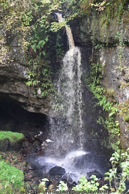
Waterfall, Pollnagollum Cave - geograph.org.uk - 7037674 — N Chadwick — CC BY-SA 2.0 (https://creativecommons.org/licenses/by-sa/2.0) — https://commons.wikimedia.org/wiki/File:Waterfall,_Pollnagollum_Cave_-_geograph.org.uk_-_7037674.jpg

N Chadwick
CC BY-SA 2.0
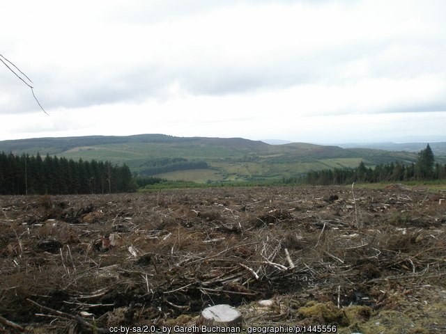
Belmore Forest - geograph.org.uk - 1445556 — Gareth Buchanan — CC BY-SA 2.0 (https://creativecommons.org/licenses/by-sa/2.0) — https://commons.wikimedia.org/wiki/File:Belmore_Forest_-_geograph.org.uk_-_1445556.jpg

Gareth Buchanan
CC BY-SA 2.0
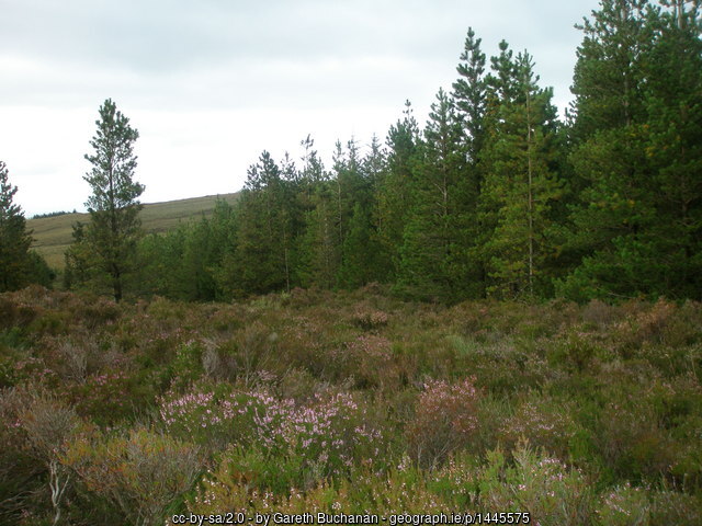
Belmore Forest - geograph.org.uk - 1445575 — Gareth Buchanan — CC BY-SA 2.0 (https://creativecommons.org/licenses/by-sa/2.0) — https://commons.wikimedia.org/wiki/File:Belmore_Forest_-_geograph.org.uk_-_1445575.jpg

Gareth Buchanan
CC BY-SA 2.0
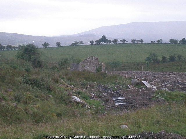
Derelict Cottage In Belmore Forest - geograph.org.uk - 1445615 — Gareth Buchanan — CC BY-SA 2.0 (https://creativecommons.org/licenses/by-sa/2.0) — https://commons.wikimedia.org/wiki/File:Derelict_Cottage_In_Belmore_Forest_-_geograph.org.uk_-_1445615.jpg

Gareth Buchanan
CC BY-SA 2.0
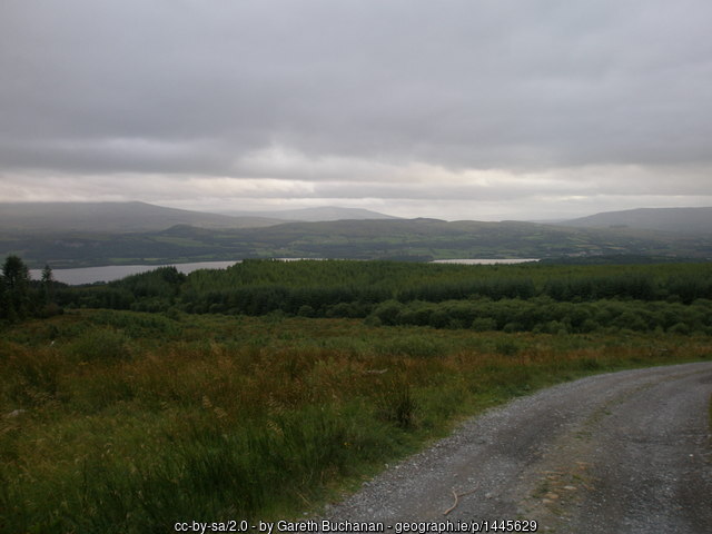
Forest Track in Belmore Forest - geograph.org.uk - 1445629 — Gareth Buchanan — CC BY-SA 2.0 (https://creativecommons.org/licenses/by-sa/2.0) — https://commons.wikimedia.org/wiki/File:Forest_Track_in_Belmore_Forest_-_geograph.org.uk_-_1445629.jpg

Gareth Buchanan
CC BY-SA 2.0
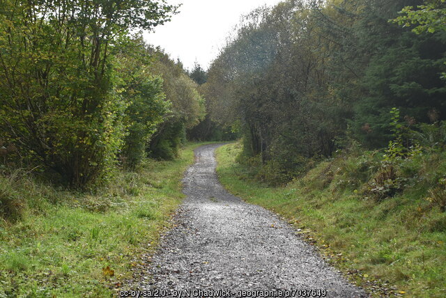
Track in Belmore Forest - geograph.org.uk - 7037649 — N Chadwick — CC BY-SA 2.0 (https://creativecommons.org/licenses/by-sa/2.0) — https://commons.wikimedia.org/wiki/File:Track_in_Belmore_Forest_-_geograph.org.uk_-_7037649.jpg

N Chadwick
CC BY-SA 2.0
View original activity in YouVisible
Weather on your route
Loading forecast…
Sources and credits
OpenStreetMap contributors; ODbL 1.0 (https://www.openstreetmap.org/copyright). Photographs credited individually.
OpenStreetMap contributors · OpenStreetMap walking route relations · ODbL 1.0
Route surroundings · Waterfall, Pollnagollum Cave - geograph.org.uk - 7037674
Waterfall, Pollnagollum Cave - geograph.org.uk - 7037674 — N Chadwick — CC BY-SA 2.0 (https://creativecommons.org/licenses/by-sa/2.0) — https://commons.wikimedia.org/wiki/File:Waterfall,_Pollnagollum_Cave_-_geograph.org.uk_-_7037674.jpg
N Chadwick · CC BY-SA 2.0 · Media source
Route surroundings · Belmore Forest - geograph.org.uk - 1445556
Belmore Forest - geograph.org.uk - 1445556 — Gareth Buchanan — CC BY-SA 2.0 (https://creativecommons.org/licenses/by-sa/2.0) — https://commons.wikimedia.org/wiki/File:Belmore_Forest_-_geograph.org.uk_-_1445556.jpg
Gareth Buchanan · CC BY-SA 2.0 · Media source
Route surroundings · Belmore Forest - geograph.org.uk - 1445575
Belmore Forest - geograph.org.uk - 1445575 — Gareth Buchanan — CC BY-SA 2.0 (https://creativecommons.org/licenses/by-sa/2.0) — https://commons.wikimedia.org/wiki/File:Belmore_Forest_-_geograph.org.uk_-_1445575.jpg
Gareth Buchanan · CC BY-SA 2.0 · Media source
Route surroundings · Derelict Cottage In Belmore Forest - geograph.org.uk - 1445615
Derelict Cottage In Belmore Forest - geograph.org.uk - 1445615 — Gareth Buchanan — CC BY-SA 2.0 (https://creativecommons.org/licenses/by-sa/2.0) — https://commons.wikimedia.org/wiki/File:Derelict_Cottage_In_Belmore_Forest_-_geograph.org.uk_-_1445615.jpg
Gareth Buchanan · CC BY-SA 2.0 · Media source
Route surroundings · Forest Track in Belmore Forest - geograph.org.uk - 1445629
Forest Track in Belmore Forest - geograph.org.uk - 1445629 — Gareth Buchanan — CC BY-SA 2.0 (https://creativecommons.org/licenses/by-sa/2.0) — https://commons.wikimedia.org/wiki/File:Forest_Track_in_Belmore_Forest_-_geograph.org.uk_-_1445629.jpg
Gareth Buchanan · CC BY-SA 2.0 · Media source
Route surroundings · Track in Belmore Forest - geograph.org.uk - 7037649
Track in Belmore Forest - geograph.org.uk - 7037649 — N Chadwick — CC BY-SA 2.0 (https://creativecommons.org/licenses/by-sa/2.0) — https://commons.wikimedia.org/wiki/File:Track_in_Belmore_Forest_-_geograph.org.uk_-_7037649.jpg
N Chadwick · CC BY-SA 2.0 · Media source