Find your next route
Explore hiking, running, trail running and cycling routes that suit your plans.

Community route
Slieve League · Bunglass and the coastal ridge loop
A recorded hill walk at Slieve League in County Donegal, from the Bunglass approach around the coastal ridge. Both original recording segments and their elevations are preserved, including an 18-minute pause with endpoints 1.28 m apart. The gallery shows named coastal landscapes, ridge and access paths in the route surroundings; it does not assign camera positions to the track.
By YouVisible Sport
Mapa del recorrido
Perfil de elevación
Activity measurements
- distance meters
- 9,178.8727925245
- elevation gain meters
- 808.45
- elevation loss meters
- 798.05
- max elevation meters
- 599.98
- min elevation meters
- 147.66
- end · latitude
- 54.641617
- end · longitude
- -8.660535
- start · latitude
- 54.641681
- start · longitude
- -8.66062
- Sport
- hiking mountaineering
- Specialty
- Hiking
From start to finish
- Country
- Ireland
- Province / region
- —
- Localities
- —
Before you go
- How to reach the start
- —
- Parking and access
- —
- Advice
- YouVisible Guide only. Garmin export is unavailable because the original has two recording segments; they have not been joined. This exposed mountain route requires suitable conditions, sure footing and navigation; check local access and weather. The recording is not a guarantee of current access.
- Recommended equipment
- —
- Terrain
- —
- Signage
- —
Characteristics and difficulty
- Estimated duration
- —
- Author perceived effort
- —
- Physical difficulty
- —
- Technical difficulty
- —
About the route
A recorded hill walk at Slieve League in County Donegal, from the Bunglass approach around the coastal ridge. Both original recording segments and their elevations are preserved, including an 18-minute pause with endpoints 1.28 m apart. The gallery shows named coastal landscapes, ridge and access paths in the route surroundings; it does not assign camera positions to the track.
- Context
- —
- Specialty
- Hiking
- Event type
- —
- Description
- Named Slieve League cliffs, ridge, upland lough, viewpoint and access path; orientation images without camera pins.
- Title
- Route surroundings
- Title
- Sesión
- Description
- A recorded hill walk at Slieve League in County Donegal, from the Bunglass approach around the coastal ridge. Both original recording segments and their elevations are preserved, including an 18-minute pause with endpoints 1.28 m apart. The gallery shows named coastal landscapes, ridge and access paths in the route surroundings; it does not assign camera positions to the track.
- Description
- Route surroundings · Slieve League sea cliffs. Orientation image of the named place or its surroundings; no on-track camera position is asserted.
- Title
- Route surroundings · Slieve League sea cliffs
- Description
- Route surroundings · One Man’s Path, Slieve League. Orientation image of the named place or its surroundings; no on-track camera position is asserted.
- Title
- Route surroundings · One Man’s Path, Slieve League
- Description
- Route surroundings · Lough above the cliffs at Bunglass. Orientation image of the named place or its surroundings; no on-track camera position is asserted.
- Title
- Route surroundings · Lough above the cliffs at Bunglass
- Description
- Route surroundings · Slieve League viewpoint. Orientation image of the named place or its surroundings; no on-track camera position is asserted.
- Title
- Route surroundings · Slieve League viewpoint
- Description
- Route surroundings · Sea stack below the Slieve League cliffs. Orientation image of the named place or its surroundings; no on-track camera position is asserted.
- Title
- Route surroundings · Sea stack below the Slieve League cliffs
- Description
- Route surroundings · Slieve League access path. Orientation image of the named place or its surroundings; no on-track camera position is asserted.
- Title
- Route surroundings · Slieve League access path
- Description
- Route surroundings · Slieve League sea cliffs. Orientation image of the named place or its surroundings; no on-track camera position is asserted.
- Title
- Route surroundings · Slieve League sea cliffs
- Description
- Route surroundings · One Man’s Path, Slieve League. Orientation image of the named place or its surroundings; no on-track camera position is asserted.
- Title
- Route surroundings · One Man’s Path, Slieve League
- Description
- Route surroundings · Lough above the cliffs at Bunglass. Orientation image of the named place or its surroundings; no on-track camera position is asserted.
- Title
- Route surroundings · Lough above the cliffs at Bunglass
- Description
- Route surroundings · Slieve League viewpoint. Orientation image of the named place or its surroundings; no on-track camera position is asserted.
- Title
- Route surroundings · Slieve League viewpoint
- Description
- Route surroundings · Sea stack below the Slieve League cliffs. Orientation image of the named place or its surroundings; no on-track camera position is asserted.
- Title
- Route surroundings · Sea stack below the Slieve League cliffs
- Description
- Route surroundings · Slieve League access path. Orientation image of the named place or its surroundings; no on-track camera position is asserted.
- Title
- Route surroundings · Slieve League access path
- Advice
- YouVisible Guide only. Garmin export is unavailable because the original has two recording segments; they have not been joined. This exposed mountain route requires suitable conditions, sure footing and navigation; check local access and weather. The recording is not a guarantee of current access.
- Title
- Slieve League · Bunglass and the coastal ridge loop
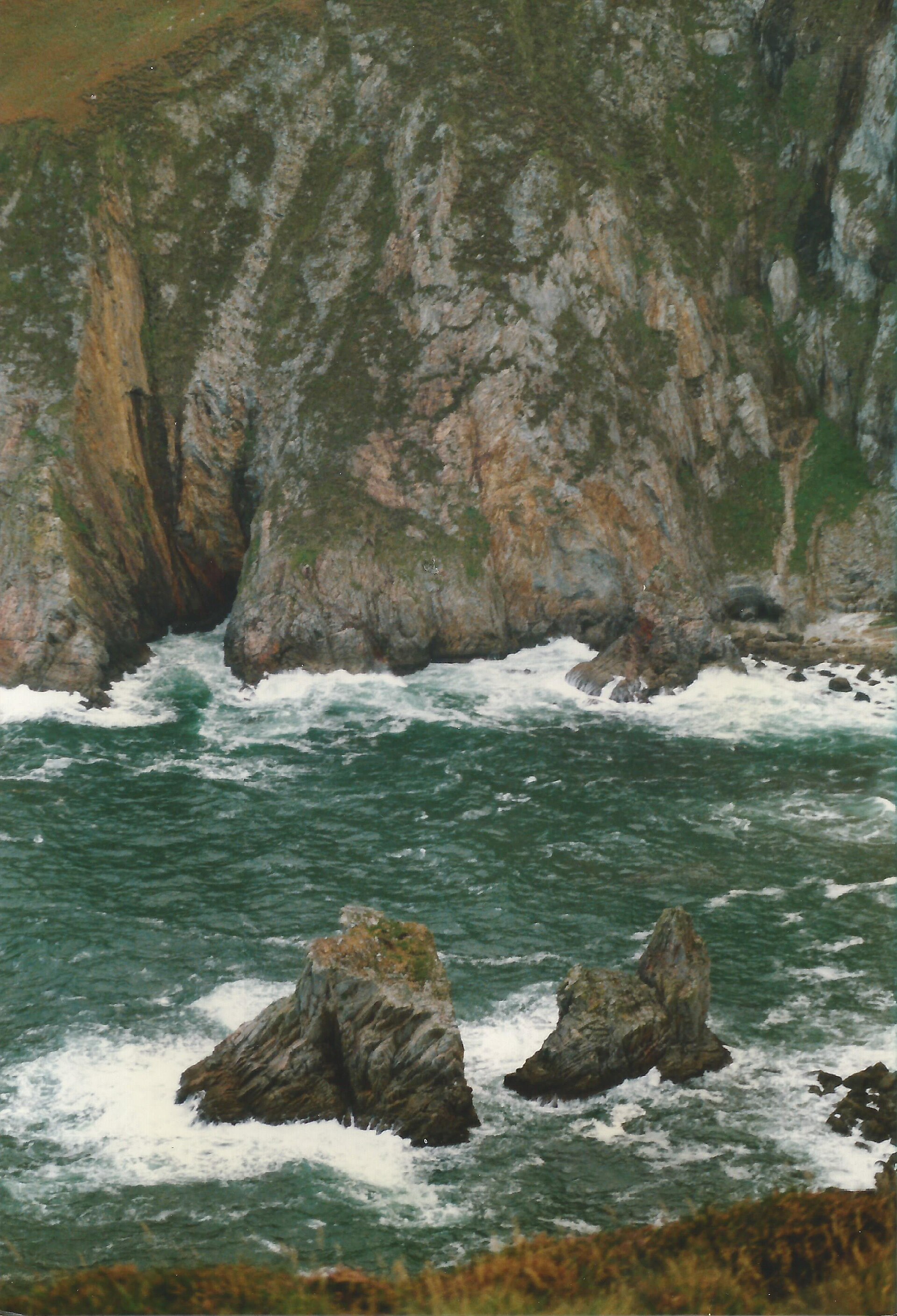
Slieve League sea cliffs — Ardfern — CC BY-SA 3.0 (https://creativecommons.org/licenses/by-sa/3.0) — https://commons.wikimedia.org/wiki/File:Slieve_League,_County_Donegal,_September_1987_(04).jpg — Provider JPEG; no local edits.

Ardfern
CC BY-SA 3.0
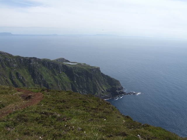
One Man’s Path, Slieve League — John M — CC BY-SA 2.0 (https://creativecommons.org/licenses/by-sa/2.0) — https://commons.wikimedia.org/wiki/File:%27One_Mans_Path%27_-_Bunglass_-_geograph.org.uk_-_1973369.jpg — Provider JPEG; no local edits.

John M
CC BY-SA 2.0
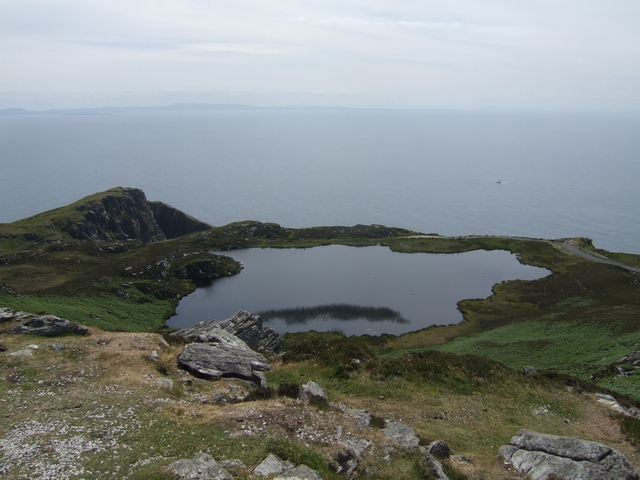
Lough above the cliffs at Bunglass — John M — CC BY-SA 2.0 (https://creativecommons.org/licenses/by-sa/2.0) — https://commons.wikimedia.org/wiki/File:Lough_above_the_cliffs_at_Bunglass_-_geograph.org.uk_-_1973349.jpg — Provider JPEG; no local edits.

John M
CC BY-SA 2.0
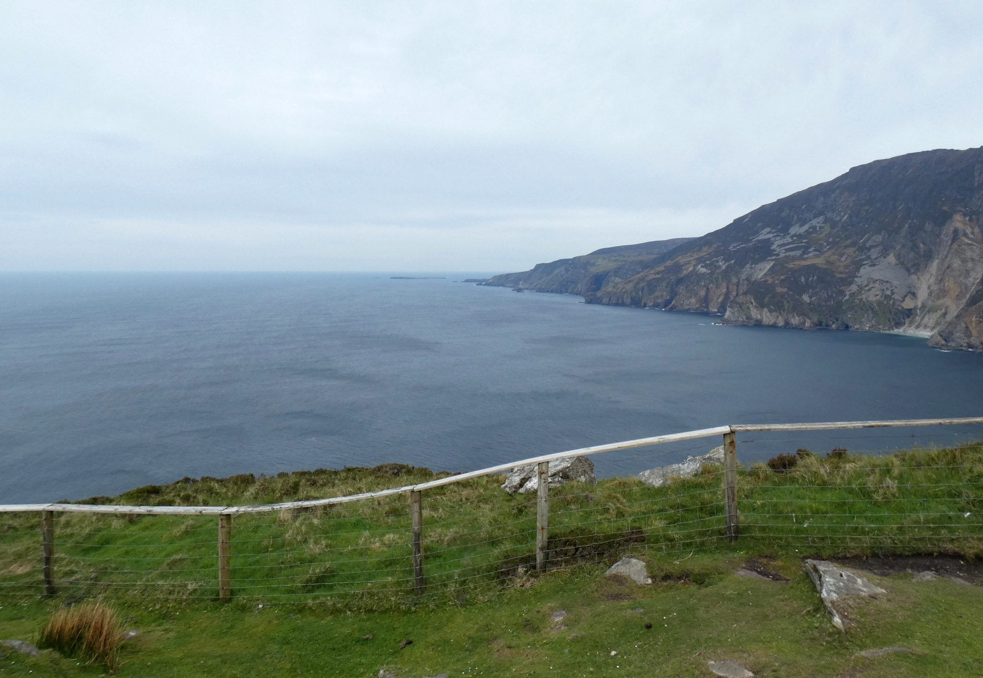
Slieve League viewpoint — Gerald England — CC BY-SA 2.0 (https://creativecommons.org/licenses/by-sa/2.0) — https://commons.wikimedia.org/wiki/File:Viewpoint_at_Slieve_League_-_geograph.org.uk_-_7528755.jpg — Provider JPEG; no local edits.

Gerald England
CC BY-SA 2.0
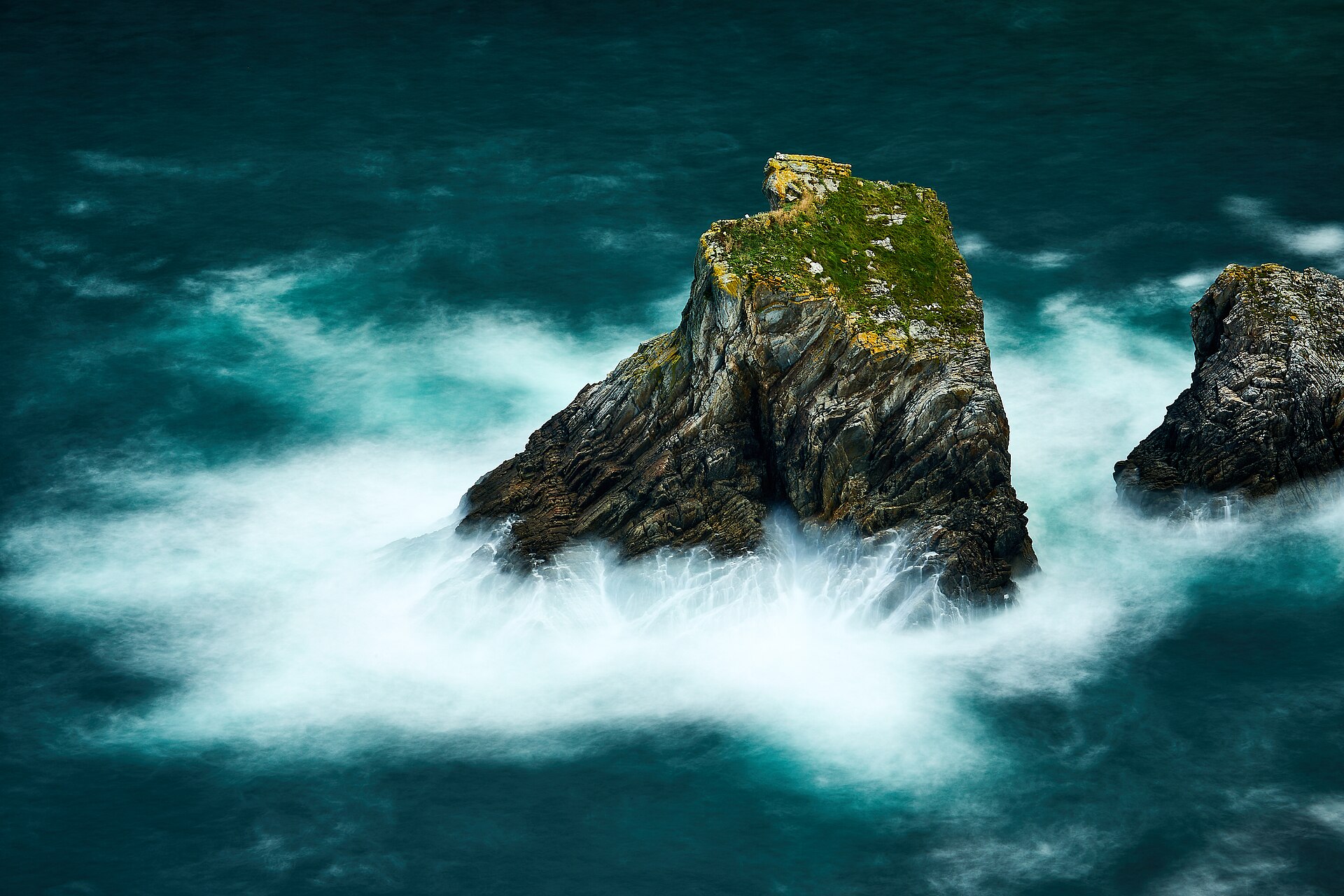
Sea stack below the Slieve League cliffs — Thomas Fuhrmann — CC BY-SA 4.0 (https://creativecommons.org/licenses/by-sa/4.0) — https://commons.wikimedia.org/wiki/File:A_sea_stack_in_the_bay_at_Slieve_League_sea_cliffs.jpg — Provider JPEG; no local edits.

Thomas Fuhrmann
CC BY-SA 4.0
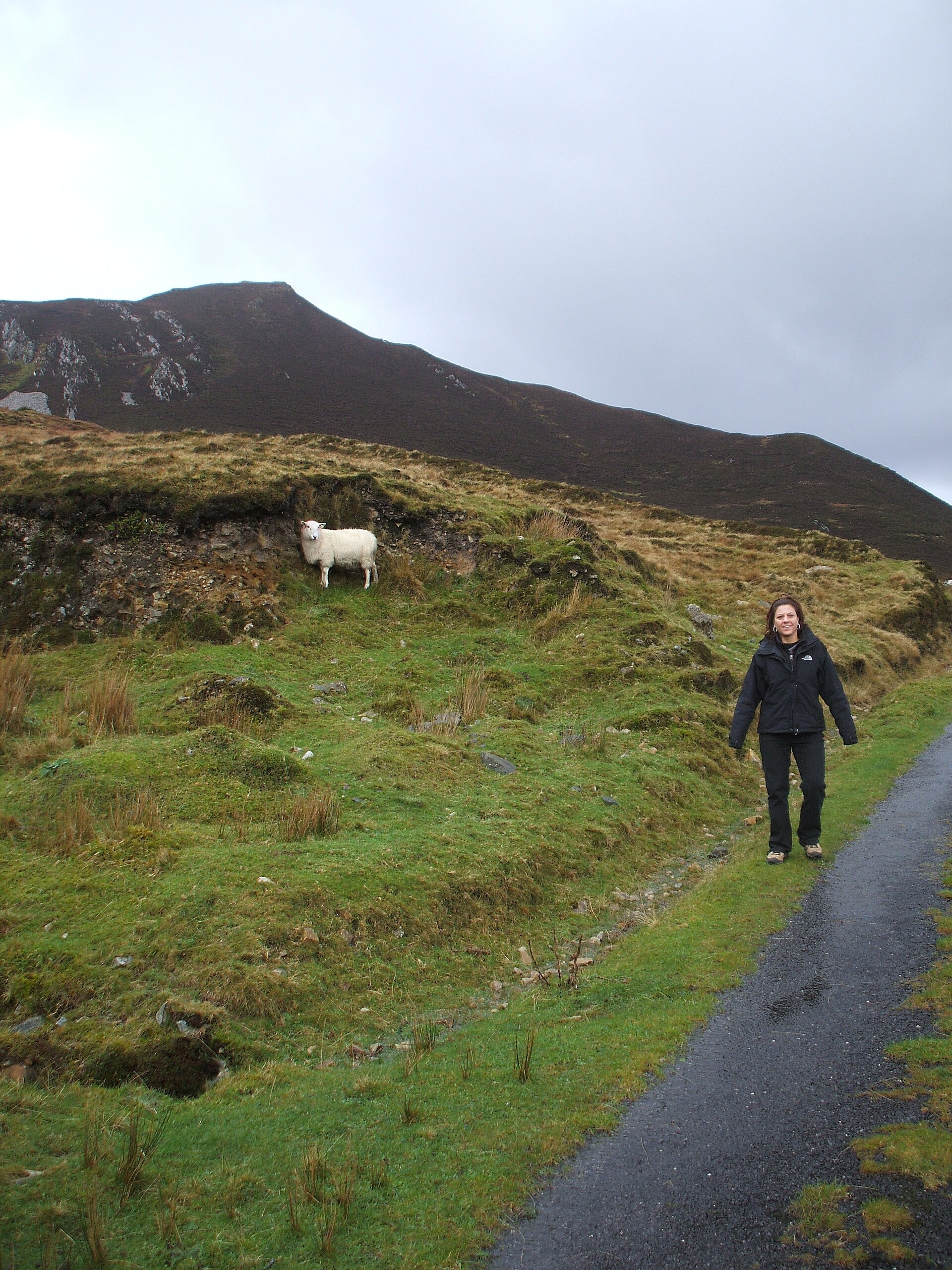
Slieve League access path — Gary Miotla — CC BY 3.0 (https://creativecommons.org/licenses/by/3.0) — https://commons.wikimedia.org/wiki/File:Slieve_League,_County_Donegal,_Ireland_-_panoramio.jpg — Provider JPEG; no local edits.

Gary Miotla
CC BY 3.0
View original activity in YouVisible
Weather on your route
Loading forecast…
Sources and credits
© OpenStreetMap contributors; original GPX by craghead. ODbL 1.0. Photographs credited individually.
OpenStreetMap contributors · Public original GPS traces · ODbL 1.0
Route surroundings · Slieve League sea cliffs
Slieve League sea cliffs — Ardfern — CC BY-SA 3.0 (https://creativecommons.org/licenses/by-sa/3.0) — https://commons.wikimedia.org/wiki/File:Slieve_League,_County_Donegal,_September_1987_(04).jpg — Provider JPEG; no local edits.
Ardfern · CC BY-SA 3.0 · Media source
Route surroundings · One Man’s Path, Slieve League
One Man’s Path, Slieve League — John M — CC BY-SA 2.0 (https://creativecommons.org/licenses/by-sa/2.0) — https://commons.wikimedia.org/wiki/File:%27One_Mans_Path%27_-_Bunglass_-_geograph.org.uk_-_1973369.jpg — Provider JPEG; no local edits.
John M · CC BY-SA 2.0 · Media source
Route surroundings · Lough above the cliffs at Bunglass
Lough above the cliffs at Bunglass — John M — CC BY-SA 2.0 (https://creativecommons.org/licenses/by-sa/2.0) — https://commons.wikimedia.org/wiki/File:Lough_above_the_cliffs_at_Bunglass_-_geograph.org.uk_-_1973349.jpg — Provider JPEG; no local edits.
John M · CC BY-SA 2.0 · Media source
Route surroundings · Slieve League viewpoint
Slieve League viewpoint — Gerald England — CC BY-SA 2.0 (https://creativecommons.org/licenses/by-sa/2.0) — https://commons.wikimedia.org/wiki/File:Viewpoint_at_Slieve_League_-_geograph.org.uk_-_7528755.jpg — Provider JPEG; no local edits.
Gerald England · CC BY-SA 2.0 · Media source
Route surroundings · Sea stack below the Slieve League cliffs
Sea stack below the Slieve League cliffs — Thomas Fuhrmann — CC BY-SA 4.0 (https://creativecommons.org/licenses/by-sa/4.0) — https://commons.wikimedia.org/wiki/File:A_sea_stack_in_the_bay_at_Slieve_League_sea_cliffs.jpg — Provider JPEG; no local edits.
Thomas Fuhrmann · CC BY-SA 4.0 · Media source
Route surroundings · Slieve League access path
Slieve League access path — Gary Miotla — CC BY 3.0 (https://creativecommons.org/licenses/by/3.0) — https://commons.wikimedia.org/wiki/File:Slieve_League,_County_Donegal,_Ireland_-_panoramio.jpg — Provider JPEG; no local edits.
Gary Miotla · CC BY 3.0 · Media source