Find your next route
Explore hiking, running, trail running and cycling routes that suit your plans.

Community route
Muckish Railway · Lough Agher and Naboll gravel ride
A recorded gravel ride beneath Muckish Mountain in County Donegal, following the former railway corridor beside Lough Agher and a local access-road loop near Lough Naboll. The complete original returns close to its starting point. Six credited photographs show the lake, access lanes, moorland and distinctive geology in the immediate route surroundings; they do not mark photograph positions on the track.
By YouVisible Sport
Mapa del recorrido
Perfil de elevación
Activity measurements
- distance meters
- 12,898.3100126463
- elevation gain meters
- 148.8
- elevation loss meters
- 145.2
- max elevation meters
- 163.6
- min elevation meters
- 75.8
- end · latitude
- 55.125818
- end · longitude
- -7.986646
- start · latitude
- 55.126022
- start · longitude
- -7.98668
- Sport
- Cycling
- Specialty
- cycling gravel
From start to finish
- Country
- Ireland
- Province / region
- —
- Localities
- —
Before you go
- How to reach the start
- —
- Parking and access
- —
- Advice
- Check current cycling access and surface conditions. Share the railway corridor carefully with walkers, follow local signs and take care on access roads; the recording is not a guarantee of present access.
- Recommended equipment
- —
- Terrain
- —
- Signage
- —
Characteristics and difficulty
- Estimated duration
- —
- Author perceived effort
- —
- Physical difficulty
- —
- Technical difficulty
- —
About the route
A recorded gravel ride beneath Muckish Mountain in County Donegal, following the former railway corridor beside Lough Agher and a local access-road loop near Lough Naboll. The complete original returns close to its starting point. Six credited photographs show the lake, access lanes, moorland and distinctive geology in the immediate route surroundings; they do not mark photograph positions on the track.
- Context
- —
- Specialty
- cycling gravel
- Event type
- —
- Description
- Lakeside bogland, access lanes, Muckish skyline and a named geological outcrop, each identified as route surroundings.
- Title
- Route highlights
- Title
- Sesión
- Description
- A recorded gravel ride beneath Muckish Mountain in County Donegal, following the former railway corridor beside Lough Agher and a local access-road loop near Lough Naboll. The complete original returns close to its starting point. Six credited photographs show the lake, access lanes, moorland and distinctive geology in the immediate route surroundings; they do not mark photograph positions on the track.
- Description
- Lough Naboll beneath Muckish Mountain, in the immediate route surroundings.
- Title
- Lough Naboll beneath Muckish Mountain · route surroundings
- Description
- Carrownamaddy access road with Muckish behind, in the immediate route surroundings.
- Title
- Carrownamaddy access road with Muckish behind · route surroundings
- Description
- Carrownamaddy moorland beside the recorded approach, in the immediate route surroundings.
- Title
- Carrownamaddy moorland beside the recorded approach · route surroundings
- Description
- Carrownamaddy lane across the bogland, in the immediate route surroundings.
- Title
- Carrownamaddy lane across the bogland · route surroundings
- Description
- Muckish Mountain viewed across the nearby bogland, in the immediate route surroundings.
- Title
- Muckish Mountain viewed across the nearby bogland · route surroundings
- Description
- Named metadolerite outcrop in the adjacent Muckish bogland, in the immediate route surroundings.
- Title
- Named metadolerite outcrop in the adjacent Muckish bogland · route surroundings
- Description
- Lough Naboll beneath Muckish Mountain, in the immediate route surroundings.
- Title
- Lough Naboll beneath Muckish Mountain · route surroundings
- Description
- Carrownamaddy access road with Muckish behind, in the immediate route surroundings.
- Title
- Carrownamaddy access road with Muckish behind · route surroundings
- Description
- Carrownamaddy moorland beside the recorded approach, in the immediate route surroundings.
- Title
- Carrownamaddy moorland beside the recorded approach · route surroundings
- Description
- Carrownamaddy lane across the bogland, in the immediate route surroundings.
- Title
- Carrownamaddy lane across the bogland · route surroundings
- Description
- Muckish Mountain viewed across the nearby bogland, in the immediate route surroundings.
- Title
- Muckish Mountain viewed across the nearby bogland · route surroundings
- Description
- Named metadolerite outcrop in the adjacent Muckish bogland, in the immediate route surroundings.
- Title
- Named metadolerite outcrop in the adjacent Muckish bogland · route surroundings
- Advice
- Check current cycling access and surface conditions. Share the railway corridor carefully with walkers, follow local signs and take care on access roads; the recording is not a guarantee of present access.
- Title
- Muckish Railway · Lough Agher and Naboll gravel ride
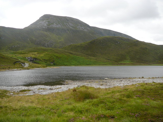
Lough Naboll beneath Muckish Mountain — Colin Park — CC BY-SA 2.0 (https://creativecommons.org/licenses/by-sa/2.0) — https://commons.wikimedia.org/wiki/File:Lough_Naboll_below_Muckish_Mountain_-_geograph.org.uk_-_1052622.jpg — Official provider JPEG; no local edits.

Colin Park
CC BY-SA 2.0
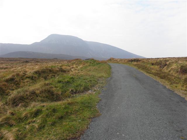
Carrownamaddy access road with Muckish behind — Kenneth Allen — CC BY-SA 2.0 (https://creativecommons.org/licenses/by-sa/2.0) — https://commons.wikimedia.org/wiki/File:Road_at_Carrownamaddy_-_geograph.org.uk_-_2370979.jpg — Official provider JPEG; no local edits.

Kenneth Allen
CC BY-SA 2.0
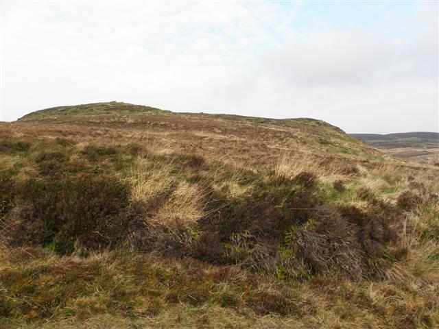
Carrownamaddy moorland beside the recorded approach — Kenneth Allen — CC BY-SA 2.0 (https://creativecommons.org/licenses/by-sa/2.0) — https://commons.wikimedia.org/wiki/File:Carrownamaddy_Townland_-_geograph.org.uk_-_2370981.jpg — Official provider JPEG; no local edits.

Kenneth Allen
CC BY-SA 2.0
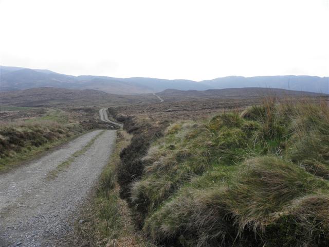
Carrownamaddy lane across the bogland — Kenneth Allen — CC BY-SA 2.0 (https://creativecommons.org/licenses/by-sa/2.0) — https://commons.wikimedia.org/wiki/File:Lane,_Carrownamaddy_-_geograph.org.uk_-_2370978.jpg — Official provider JPEG; no local edits.

Kenneth Allen
CC BY-SA 2.0
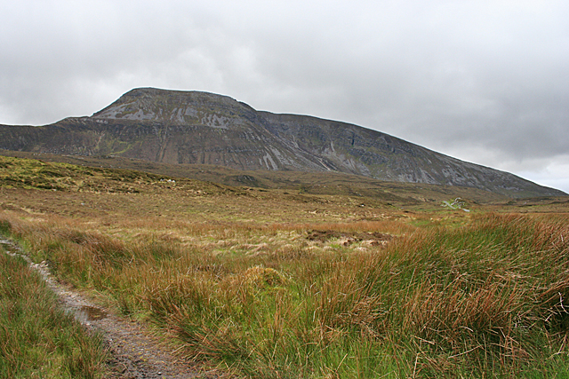
Muckish Mountain viewed across the nearby bogland — Anne Burgess — CC BY-SA 2.0 (https://creativecommons.org/licenses/by-sa/2.0) — https://commons.wikimedia.org/wiki/File:Muckish_Mountain_-_geograph.org.uk_-_3993628.jpg — Official provider JPEG; no local edits.

Anne Burgess
CC BY-SA 2.0
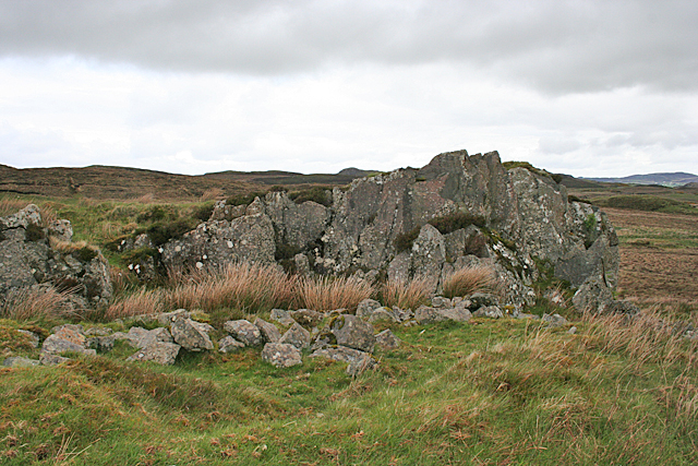
Named metadolerite outcrop in the adjacent Muckish bogland — Anne Burgess — CC BY-SA 2.0 (https://creativecommons.org/licenses/by-sa/2.0) — https://commons.wikimedia.org/wiki/File:Metadolerite_Intrusion_-_geograph.org.uk_-_3993588.jpg — Official provider JPEG; no local edits.

Anne Burgess
CC BY-SA 2.0
View original activity in YouVisible
Weather on your route
Loading forecast…
Sources and credits
© OpenStreetMap contributors; original GPX by HeikkiVesanto. ODbL 1.0. Photographs credited individually.
OpenStreetMap contributors · Public original GPS traces · ODbL 1.0
Lough Naboll beneath Muckish Mountain · route surroundings
Lough Naboll beneath Muckish Mountain — Colin Park — CC BY-SA 2.0 (https://creativecommons.org/licenses/by-sa/2.0) — https://commons.wikimedia.org/wiki/File:Lough_Naboll_below_Muckish_Mountain_-_geograph.org.uk_-_1052622.jpg — Official provider JPEG; no local edits.
Colin Park · CC BY-SA 2.0 · Media source
Carrownamaddy access road with Muckish behind · route surroundings
Carrownamaddy access road with Muckish behind — Kenneth Allen — CC BY-SA 2.0 (https://creativecommons.org/licenses/by-sa/2.0) — https://commons.wikimedia.org/wiki/File:Road_at_Carrownamaddy_-_geograph.org.uk_-_2370979.jpg — Official provider JPEG; no local edits.
Kenneth Allen · CC BY-SA 2.0 · Media source
Carrownamaddy moorland beside the recorded approach · route surroundings
Carrownamaddy moorland beside the recorded approach — Kenneth Allen — CC BY-SA 2.0 (https://creativecommons.org/licenses/by-sa/2.0) — https://commons.wikimedia.org/wiki/File:Carrownamaddy_Townland_-_geograph.org.uk_-_2370981.jpg — Official provider JPEG; no local edits.
Kenneth Allen · CC BY-SA 2.0 · Media source
Carrownamaddy lane across the bogland · route surroundings
Carrownamaddy lane across the bogland — Kenneth Allen — CC BY-SA 2.0 (https://creativecommons.org/licenses/by-sa/2.0) — https://commons.wikimedia.org/wiki/File:Lane,_Carrownamaddy_-_geograph.org.uk_-_2370978.jpg — Official provider JPEG; no local edits.
Kenneth Allen · CC BY-SA 2.0 · Media source
Muckish Mountain viewed across the nearby bogland · route surroundings
Muckish Mountain viewed across the nearby bogland — Anne Burgess — CC BY-SA 2.0 (https://creativecommons.org/licenses/by-sa/2.0) — https://commons.wikimedia.org/wiki/File:Muckish_Mountain_-_geograph.org.uk_-_3993628.jpg — Official provider JPEG; no local edits.
Anne Burgess · CC BY-SA 2.0 · Media source
Named metadolerite outcrop in the adjacent Muckish bogland · route surroundings
Named metadolerite outcrop in the adjacent Muckish bogland — Anne Burgess — CC BY-SA 2.0 (https://creativecommons.org/licenses/by-sa/2.0) — https://commons.wikimedia.org/wiki/File:Metadolerite_Intrusion_-_geograph.org.uk_-_3993588.jpg — Official provider JPEG; no local edits.
Anne Burgess · CC BY-SA 2.0 · Media source