Find your next route
Explore hiking, running, trail running and cycling routes that suit your plans.

Community route
Horn Head · Coastguard Hill and coastal paths
A recorded walk on Horn Head in County Donegal, following coastal heathland paths, the Coastguard Hill lookout and sections of the local road. The original recording starts north of Dunfanaghy and finishes near the southern approach; its endpoints are different. The gallery shows six identifiable scenes in the immediate route surroundings.
By YouVisible Sport
Mapa del recorrido
Perfil de elevación
Activity measurements
- distance meters
- 10,801.5812478766
- elevation gain meters
- 682.22
- elevation loss meters
- 705.24
- max elevation meters
- 230.02
- min elevation meters
- 6.01
- end · latitude
- 55.18542
- end · longitude
- -7.98694
- start · latitude
- 55.18823
- start · longitude
- -7.9908
- Sport
- hiking mountaineering
- Specialty
- Hiking
From start to finish
- Country
- Ireland
- Province / region
- —
- Localities
- —
Before you go
- How to reach the start
- —
- Parking and access
- —
- Advice
- Check local access and weather before setting out. Keep back from cliff edges and follow current local signs; take care where the recorded route uses a road.
- Recommended equipment
- —
- Terrain
- —
- Signage
- —
Characteristics and difficulty
- Estimated duration
- —
- Author perceived effort
- —
- Physical difficulty
- —
- Technical difficulty
- —
About the route
A recorded walk on Horn Head in County Donegal, following coastal heathland paths, the Coastguard Hill lookout and sections of the local road. The original recording starts north of Dunfanaghy and finishes near the southern approach; its endpoints are different. The gallery shows six identifiable scenes in the immediate route surroundings.
- Context
- —
- Specialty
- Hiking
- Event type
- —
- Description
- Coastal paths, lookout and local landscape scenes, each identified as route surroundings.
- Title
- Route highlights
- Title
- Sesión
- Description
- A recorded walk on Horn Head in County Donegal, following coastal heathland paths, the Coastguard Hill lookout and sections of the local road. The original recording starts north of Dunfanaghy and finishes near the southern approach; its endpoints are different. The gallery shows six identifiable scenes in the immediate route surroundings.
- Description
- Horn Head coastal cliffs viewed from Coastguard Hill, in the immediate route surroundings.
- Title
- Horn Head coastal cliffs viewed from Coastguard Hill · route surroundings
- Description
- Footpath to Coastguard Hill lookout, in the immediate route surroundings.
- Title
- Footpath to Coastguard Hill lookout · route surroundings
- Description
- Coastal view from Horn Head, in the immediate route surroundings.
- Title
- Coastal view from Horn Head · route surroundings
- Description
- Walled farm lane at Horn Head, in the immediate route surroundings.
- Title
- Walled farm lane at Horn Head · route surroundings
- Description
- Old stone cottage beside the Horn Head road, in the immediate route surroundings.
- Title
- Old stone cottage beside the Horn Head road · route surroundings
- Description
- Descending road towards Dunfanaghy, in the immediate route surroundings.
- Title
- Descending road towards Dunfanaghy · route surroundings
- Description
- Horn Head coastal cliffs viewed from Coastguard Hill, in the immediate route surroundings.
- Title
- Horn Head coastal cliffs viewed from Coastguard Hill · route surroundings
- Description
- Footpath to Coastguard Hill lookout, in the immediate route surroundings.
- Title
- Footpath to Coastguard Hill lookout · route surroundings
- Description
- Coastal view from Horn Head, in the immediate route surroundings.
- Title
- Coastal view from Horn Head · route surroundings
- Description
- Walled farm lane at Horn Head, in the immediate route surroundings.
- Title
- Walled farm lane at Horn Head · route surroundings
- Description
- Old stone cottage beside the Horn Head road, in the immediate route surroundings.
- Title
- Old stone cottage beside the Horn Head road · route surroundings
- Description
- Descending road towards Dunfanaghy, in the immediate route surroundings.
- Title
- Descending road towards Dunfanaghy · route surroundings
- Advice
- Check local access and weather before setting out. Keep back from cliff edges and follow current local signs; take care where the recorded route uses a road.
- Title
- Horn Head · Coastguard Hill and coastal paths
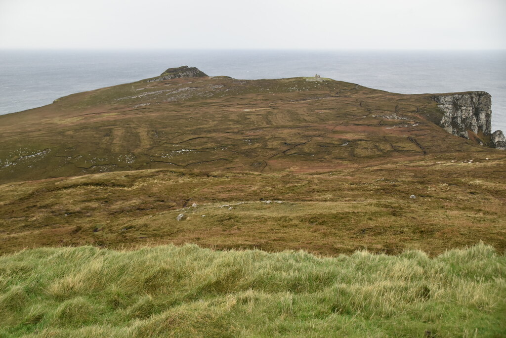
Horn Head coastal cliffs viewed from Coastguard Hill — N Chadwick — CC BY-SA 2.0 (https://creativecommons.org/licenses/by-sa/2.0) — https://commons.wikimedia.org/wiki/File:View_towards_Horn_Head_-_geograph.org.uk_-_7134057.jpg — Official provider JPEG; no local edits.

N Chadwick
CC BY-SA 2.0
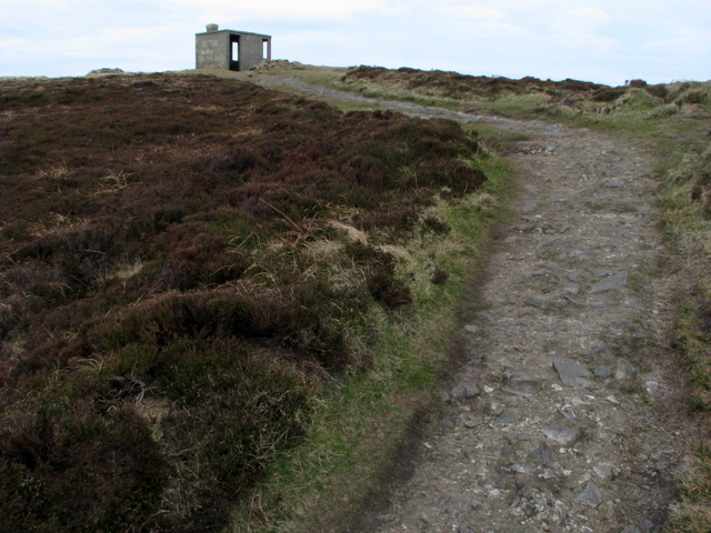
Footpath to Coastguard Hill lookout — Ross — CC BY-SA 2.0 (https://creativecommons.org/licenses/by-sa/2.0) — https://commons.wikimedia.org/wiki/File:Path_to_Coastguard_Hill_-_geograph.org.uk_-_774488.jpg — Official provider JPEG; no local edits.

Ross
CC BY-SA 2.0
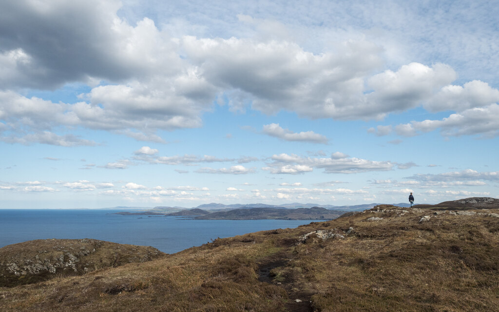
Coastal view from Horn Head — Rossographer — CC BY-SA 2.0 (https://creativecommons.org/licenses/by-sa/2.0) — https://commons.wikimedia.org/wiki/File:Horn_Head_-_geograph.org.uk_-_7156806.jpg — Official provider JPEG; no local edits.

Rossographer
CC BY-SA 2.0
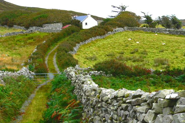
Walled farm lane at Horn Head — Joseph Mischyshyn — CC BY-SA 2.0 (https://creativecommons.org/licenses/by-sa/2.0) — https://commons.wikimedia.org/wiki/File:Horn_Head_-_Road_with_walls_to_farm_house_-_geograph.org.uk_-_1181868.jpg — Official provider JPEG; no local edits.

Joseph Mischyshyn
CC BY-SA 2.0
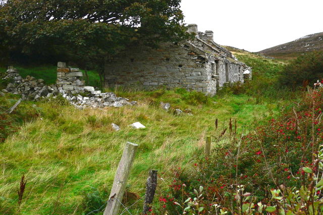
Old stone cottage beside the Horn Head road — Joseph Mischyshyn — CC BY-SA 2.0 (https://creativecommons.org/licenses/by-sa/2.0) — https://commons.wikimedia.org/wiki/File:Horn_Head_-_Derelict_cottage_-_geograph.org.uk_-_1181872.jpg — Official provider JPEG; no local edits.

Joseph Mischyshyn
CC BY-SA 2.0
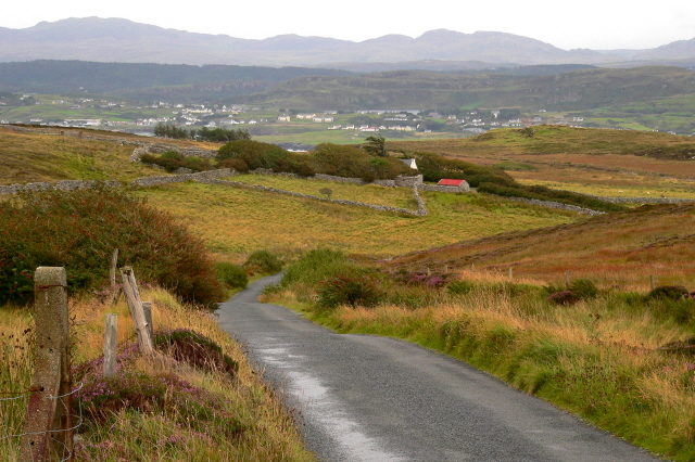
Descending road towards Dunfanaghy — Joseph Mischyshyn — CC BY-SA 2.0 (https://creativecommons.org/licenses/by-sa/2.0) — https://commons.wikimedia.org/wiki/File:Horn_Head_-_Descending_road_scene_-_geograph.org.uk_-_1181875.jpg — Official provider JPEG; no local edits.

Joseph Mischyshyn
CC BY-SA 2.0
View original activity in YouVisible
Weather on your route
Loading forecast…
Sources and credits
© OpenStreetMap contributors; original GPX by Michael Sallwasser. ODbL 1.0. Photographs credited individually.
OpenStreetMap contributors · Public original GPS traces · ODbL 1.0
Horn Head coastal cliffs viewed from Coastguard Hill · route surroundings
Horn Head coastal cliffs viewed from Coastguard Hill — N Chadwick — CC BY-SA 2.0 (https://creativecommons.org/licenses/by-sa/2.0) — https://commons.wikimedia.org/wiki/File:View_towards_Horn_Head_-_geograph.org.uk_-_7134057.jpg — Official provider JPEG; no local edits.
N Chadwick · CC BY-SA 2.0 · Media source
Footpath to Coastguard Hill lookout · route surroundings
Footpath to Coastguard Hill lookout — Ross — CC BY-SA 2.0 (https://creativecommons.org/licenses/by-sa/2.0) — https://commons.wikimedia.org/wiki/File:Path_to_Coastguard_Hill_-_geograph.org.uk_-_774488.jpg — Official provider JPEG; no local edits.
Ross · CC BY-SA 2.0 · Media source
Coastal view from Horn Head · route surroundings
Coastal view from Horn Head — Rossographer — CC BY-SA 2.0 (https://creativecommons.org/licenses/by-sa/2.0) — https://commons.wikimedia.org/wiki/File:Horn_Head_-_geograph.org.uk_-_7156806.jpg — Official provider JPEG; no local edits.
Rossographer · CC BY-SA 2.0 · Media source
Walled farm lane at Horn Head · route surroundings
Walled farm lane at Horn Head — Joseph Mischyshyn — CC BY-SA 2.0 (https://creativecommons.org/licenses/by-sa/2.0) — https://commons.wikimedia.org/wiki/File:Horn_Head_-_Road_with_walls_to_farm_house_-_geograph.org.uk_-_1181868.jpg — Official provider JPEG; no local edits.
Joseph Mischyshyn · CC BY-SA 2.0 · Media source
Old stone cottage beside the Horn Head road · route surroundings
Old stone cottage beside the Horn Head road — Joseph Mischyshyn — CC BY-SA 2.0 (https://creativecommons.org/licenses/by-sa/2.0) — https://commons.wikimedia.org/wiki/File:Horn_Head_-_Derelict_cottage_-_geograph.org.uk_-_1181872.jpg — Official provider JPEG; no local edits.
Joseph Mischyshyn · CC BY-SA 2.0 · Media source
Descending road towards Dunfanaghy · route surroundings
Descending road towards Dunfanaghy — Joseph Mischyshyn — CC BY-SA 2.0 (https://creativecommons.org/licenses/by-sa/2.0) — https://commons.wikimedia.org/wiki/File:Horn_Head_-_Descending_road_scene_-_geograph.org.uk_-_1181875.jpg — Official provider JPEG; no local edits.
Joseph Mischyshyn · CC BY-SA 2.0 · Media source