Find your next route
Explore hiking, running, trail running and cycling routes that suit your plans.

Community route
Nymph, Dream, Haiyaha and The Loch · Alberta Falls
An original recorded hike linking Nymph Lake, Dream Lake, Lake Haiyaha, The Loch and Alberta Falls in Rocky Mountain National Park. The complete source track starts in the Bear Lake area and finishes in the Glacier Gorge area. The gallery shows four different named lakes, Alberta Falls and the actual walking path towards The Loch. Historical photographs record conditions when taken.
By YouVisible Sport
Mapa del recorrido
Perfil de elevación
Activity measurements
- distance meters
- 11,327.6916782372
- elevation gain meters
- 633.03
- elevation loss meters
- 686.86
- max elevation meters
- 3,117.21
- min elevation meters
- 2,811.99
- end · latitude
- 40.3103456
- end · longitude
- -105.6403732
- start · latitude
- 40.3121223
- start · longitude
- -105.6458381
- Sport
- hiking mountaineering
- Specialty
- Hiking
From start to finish
- Country
- United States
- Province / region
- —
- Localities
- —
Before you go
- How to reach the start
- —
- Parking and access
- —
- Advice
- —
- Recommended equipment
- —
- Terrain
- —
- Signage
- —
Characteristics and difficulty
- Estimated duration
- —
- Author perceived effort
- —
- Physical difficulty
- —
- Technical difficulty
- —
About the route
An original recorded hike linking Nymph Lake, Dream Lake, Lake Haiyaha, The Loch and Alberta Falls in Rocky Mountain National Park. The complete source track starts in the Bear Lake area and finishes in the Glacier Gorge area. The gallery shows four different named lakes, Alberta Falls and the actual walking path towards The Loch. Historical photographs record conditions when taken.
- Context
- —
- Specialty
- Hiking
- Event type
- —
- Description
- Nymph Lake, Dream Lake, Lake Haiyaha, The Loch, Alberta Falls and the path towards The Loch. Named-landmark views without an accredited camera position are labelled route surroundings. Photograph camera coordinates are not placed on the recorded track.
- Title
- Route highlights
- Title
- Sesión
- Description
- An original recorded hike linking Nymph Lake, Dream Lake, Lake Haiyaha, The Loch and Alberta Falls in Rocky Mountain National Park. The complete source track starts in the Bear Lake area and finishes in the Glacier Gorge area. The gallery shows four different named lakes, Alberta Falls and the actual walking path towards The Loch. Historical photographs record conditions when taken.
- Description
- Hallett Peak reflected among the boulders of Lake Haiyaha. This historical photograph records the lake when photographed. Route surroundings. The photograph is not positioned on the recorded track.
- Title
- Lake Haiyaha and Hallett Peak · route surroundings
- Description
- Forest and mountain reflections across Nymph Lake. Route surroundings. The photograph is not positioned on the recorded track.
- Title
- Nymph Lake · route surroundings
- Description
- The rocky shore and mountain backdrop of Dream Lake. Route surroundings. The photograph is not positioned on the recorded track.
- Title
- Dream Lake · route surroundings
- Description
- Mountain reflections and shoreline scenery at The Loch. The photograph is not positioned on the recorded track.
- Title
- The Loch
- Description
- Water flowing over rock at Alberta Falls. Route surroundings. The photograph is not positioned on the recorded track.
- Title
- Alberta Falls · route surroundings
- Description
- The walking path and rocky forested slope on the approach to The Loch. The photograph is not positioned on the recorded track.
- Title
- The trail towards The Loch
- Description
- Hallett Peak reflected among the boulders of Lake Haiyaha. This historical photograph records the lake when photographed. Route surroundings. The photograph is not positioned on the recorded track.
- Title
- Lake Haiyaha and Hallett Peak · route surroundings
- Description
- Forest and mountain reflections across Nymph Lake. Route surroundings. The photograph is not positioned on the recorded track.
- Title
- Nymph Lake · route surroundings
- Description
- The rocky shore and mountain backdrop of Dream Lake. Route surroundings. The photograph is not positioned on the recorded track.
- Title
- Dream Lake · route surroundings
- Description
- Mountain reflections and shoreline scenery at The Loch. The photograph is not positioned on the recorded track.
- Title
- The Loch
- Description
- Water flowing over rock at Alberta Falls. Route surroundings. The photograph is not positioned on the recorded track.
- Title
- Alberta Falls · route surroundings
- Description
- The walking path and rocky forested slope on the approach to The Loch. The photograph is not positioned on the recorded track.
- Title
- The trail towards The Loch
- Title
- Nymph, Dream, Haiyaha and The Loch · Alberta Falls
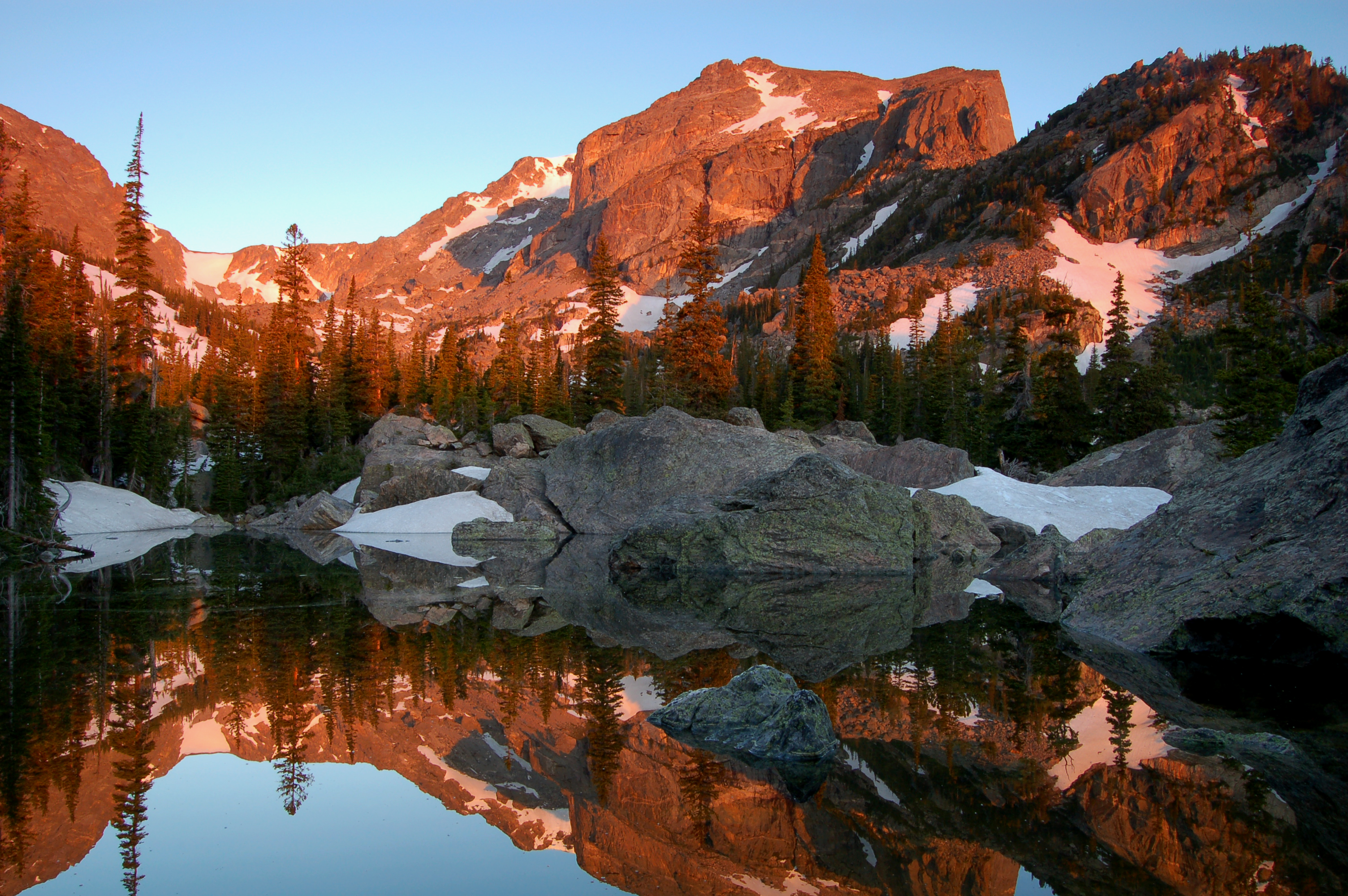
Hallet's Peak reflected in Lake Haiyaha at darn in Rocky Mountain National Park. NPS/Debra Miller — NPS / Debra Miller — CC BY 2.0 (https://creativecommons.org/licenses/by/2.0/) — https://www.flickr.com/photos/130826934@N07/18659267056/ — No local modifications; exact official Flickr original or provider variant supplied.
NPS / Debra Miller
CC BY 2.0
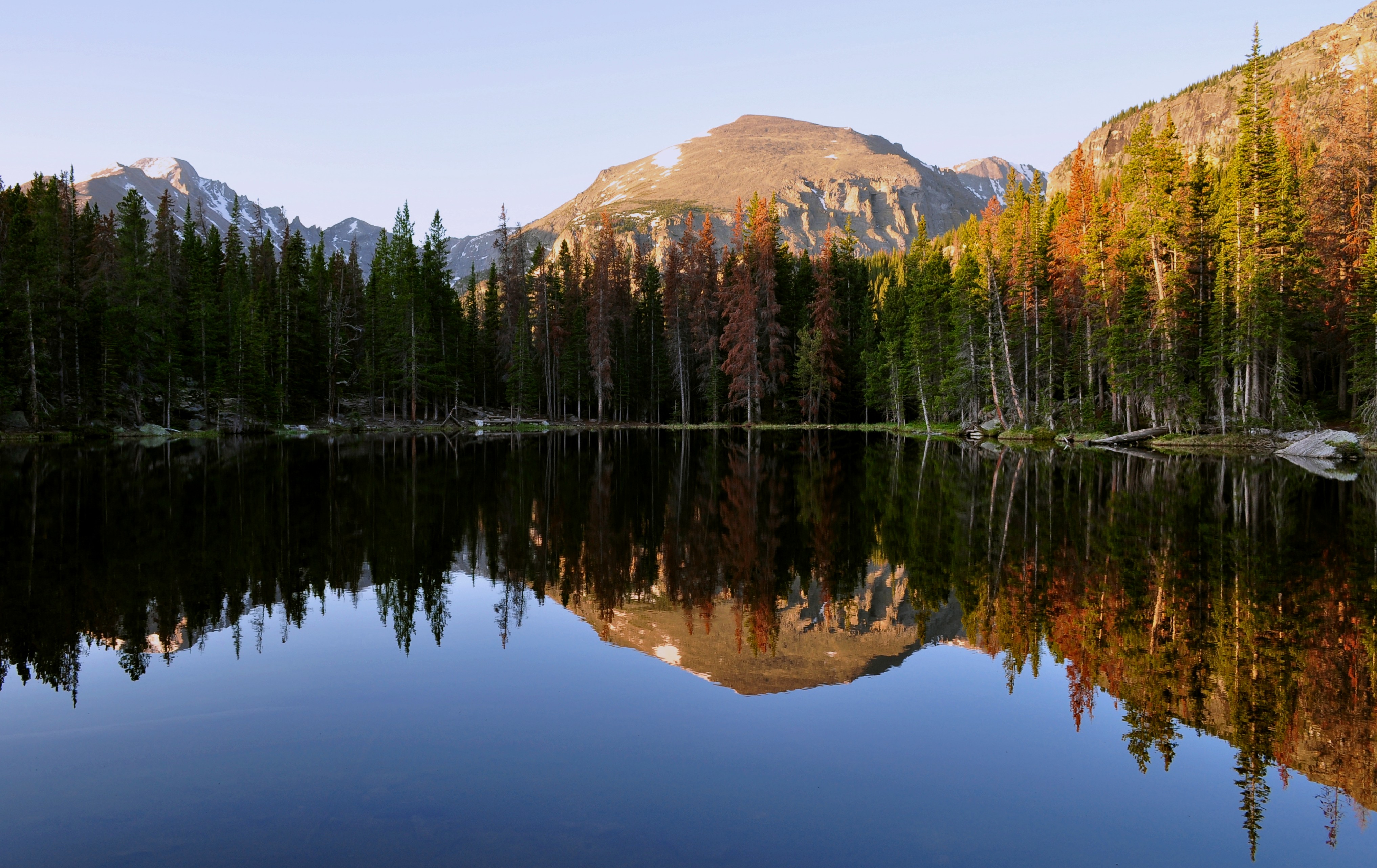
Nymph Lake — Marco Becerra — CC BY 2.0 (https://creativecommons.org/licenses/by/2.0/) — https://www.flickr.com/photos/39348621@N00/4740402266/ — No local modifications; exact official Flickr original or provider variant supplied.
Marco Becerra
CC BY 2.0
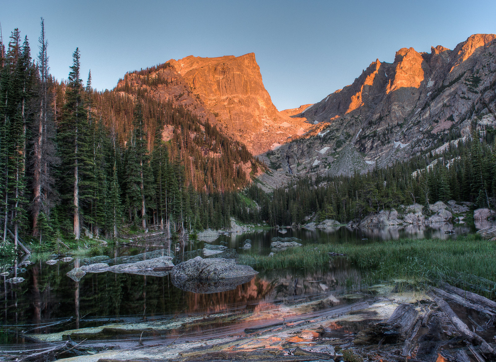
Dream Lake — Marco Becerra — CC BY 2.0 (https://creativecommons.org/licenses/by/2.0/) — https://www.flickr.com/photos/39348621@N00/9361794666/ — No local modifications; exact official Flickr original or provider variant supplied.
Marco Becerra
CC BY 2.0
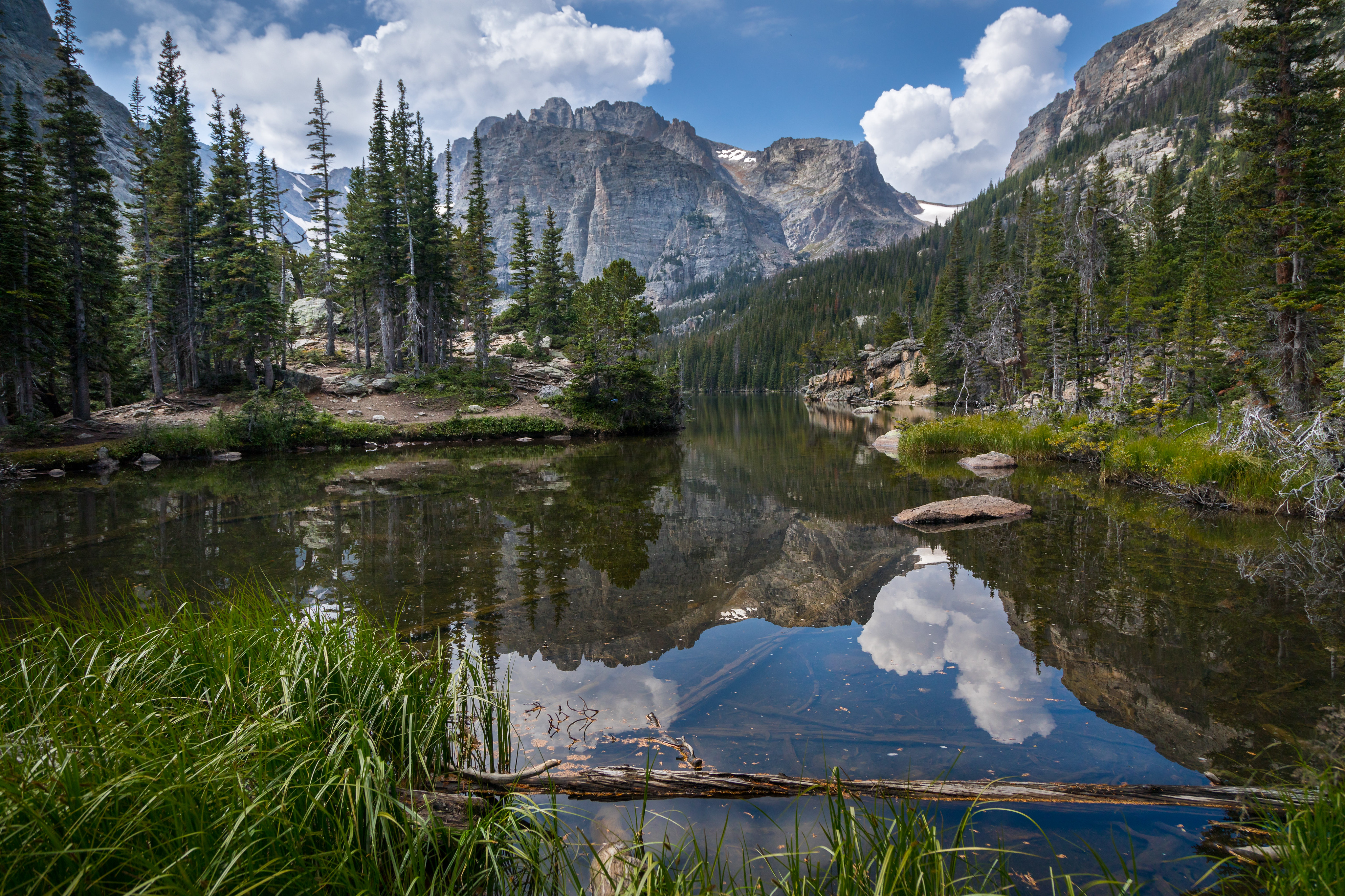
the loch — Christian Collins — CC BY-SA 2.0 (https://creativecommons.org/licenses/by-sa/2.0/) — https://www.flickr.com/photos/17094005@N00/36524220733/ — No local modifications; exact official Flickr original or provider variant supplied.
Christian Collins
CC BY-SA 2.0
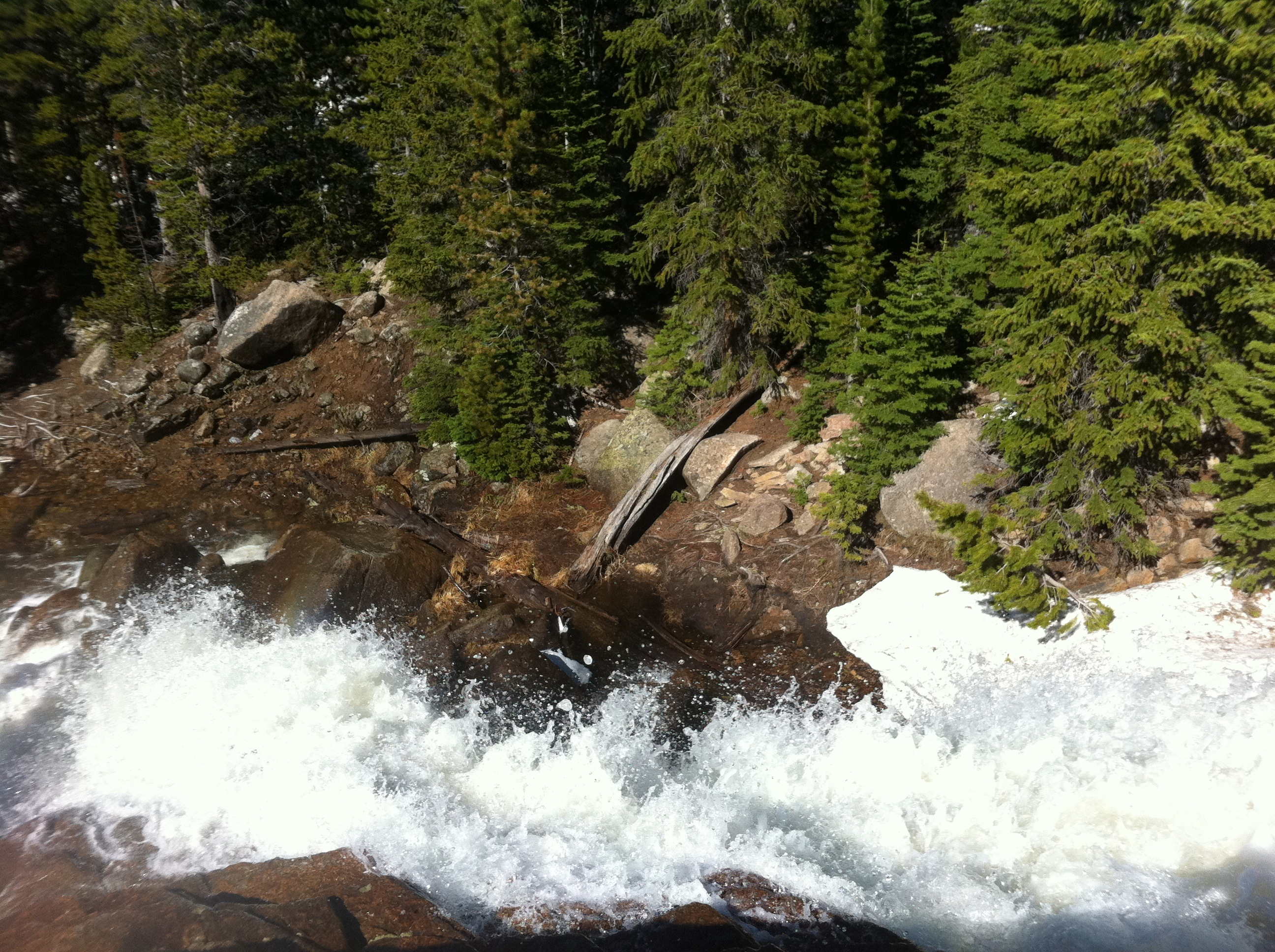
Alberta Falls — Christine Warner-Morin — CC BY 2.0 (https://creativecommons.org/licenses/by/2.0/) — https://www.flickr.com/photos/9987846@N08/5835450886/ — No local modifications; exact official Flickr original or provider variant supplied.
Christine Warner-Morin
CC BY 2.0
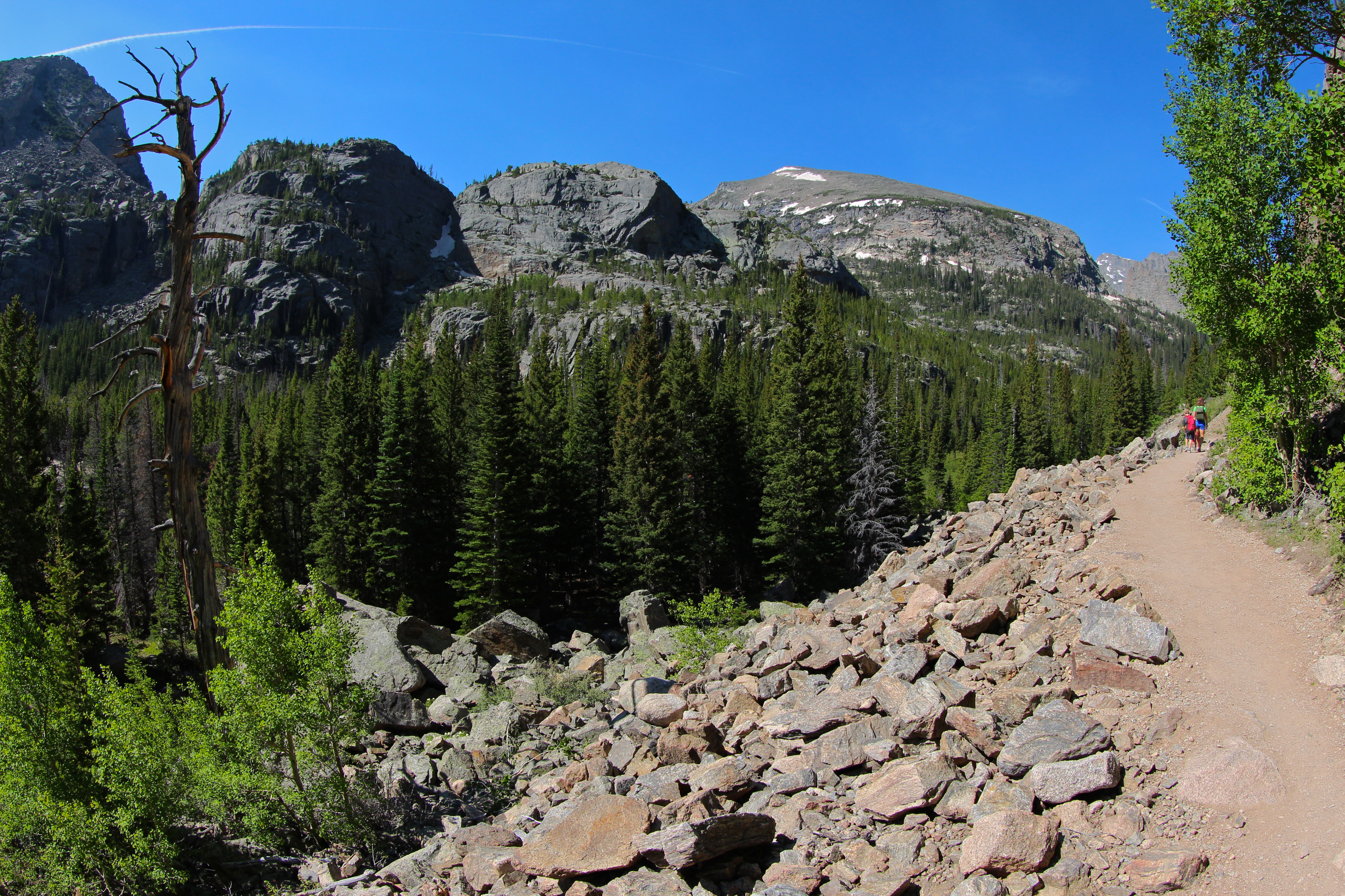
Walking uphill towards The Loch — Roy Luck — CC BY 2.0 (https://creativecommons.org/licenses/by/2.0/) — https://www.flickr.com/photos/21550937@N03/9271460363/ — No local modifications; exact official Flickr original or provider variant supplied.
Roy Luck
CC BY 2.0
View original activity in YouVisible
Weather on your route
Loading forecast…
Sources and credits
© OpenStreetMap contributors; original GPX uploaded by vagabond. ODbL 1.0. Original trace1299136, all1060 points, order, native elevations, timestamps and single segment retained. Photographs retain their individually credited CC BY2.0 or CC BY-SA2.0 rights.
OpenStreetMap contributors · Public original GPS traces · ODbL 1.0
Lake Haiyaha and Hallett Peak · route surroundings
Hallet's Peak reflected in Lake Haiyaha at darn in Rocky Mountain National Park. NPS/Debra Miller — NPS / Debra Miller — CC BY 2.0 (https://creativecommons.org/licenses/by/2.0/) — https://www.flickr.com/photos/130826934@N07/18659267056/ — No local modifications; exact official Flickr original or provider variant supplied.
NPS / Debra Miller · CC BY 2.0 · Media source
Nymph Lake · route surroundings
Nymph Lake — Marco Becerra — CC BY 2.0 (https://creativecommons.org/licenses/by/2.0/) — https://www.flickr.com/photos/39348621@N00/4740402266/ — No local modifications; exact official Flickr original or provider variant supplied.
Marco Becerra · CC BY 2.0 · Media source
Dream Lake · route surroundings
Dream Lake — Marco Becerra — CC BY 2.0 (https://creativecommons.org/licenses/by/2.0/) — https://www.flickr.com/photos/39348621@N00/9361794666/ — No local modifications; exact official Flickr original or provider variant supplied.
Marco Becerra · CC BY 2.0 · Media source
The Loch
the loch — Christian Collins — CC BY-SA 2.0 (https://creativecommons.org/licenses/by-sa/2.0/) — https://www.flickr.com/photos/17094005@N00/36524220733/ — No local modifications; exact official Flickr original or provider variant supplied.
Christian Collins · CC BY-SA 2.0 · Media source
Alberta Falls · route surroundings
Alberta Falls — Christine Warner-Morin — CC BY 2.0 (https://creativecommons.org/licenses/by/2.0/) — https://www.flickr.com/photos/9987846@N08/5835450886/ — No local modifications; exact official Flickr original or provider variant supplied.
Christine Warner-Morin · CC BY 2.0 · Media source
The trail towards The Loch
Walking uphill towards The Loch — Roy Luck — CC BY 2.0 (https://creativecommons.org/licenses/by/2.0/) — https://www.flickr.com/photos/21550937@N03/9271460363/ — No local modifications; exact official Flickr original or provider variant supplied.
Roy Luck · CC BY 2.0 · Media source