Find your next route
Explore hiking, running, trail running and cycling routes that suit your plans.

Community route
Castle and Conundrum Peaks · Montezuma Basin
An original recorded mountain hike from upper Montezuma Basin to Castle Peak and Conundrum Peak, returning to the recorded start area. The complete original track includes the approach, high basin and connecting ridge. The gallery shows views from the route and the immediately adjacent Conundrum Peak basin; the snowy photograph records conditions when it was taken.
By YouVisible Sport
Mapa del recorrido
Perfil de elevación
Activity measurements
- distance meters
- 10,950.313669735
- elevation gain meters
- 1,131.559532
- elevation loss meters
- 1,129.675141
- max elevation meters
- 4,315.362858
- min elevation meters
- 3,475.133126
- end · latitude
- 39.008779
- end · longitude
- -106.8385299
- start · latitude
- 39.0086471
- start · longitude
- -106.838567
- Sport
- hiking mountaineering
- Specialty
- Hiking
From start to finish
- Country
- United States
- Province / region
- —
- Localities
- —
Before you go
- How to reach the start
- —
- Parking and access
- —
- Advice
- —
- Recommended equipment
- —
- Terrain
- —
- Signage
- —
Characteristics and difficulty
- Estimated duration
- —
- Author perceived effort
- —
- Physical difficulty
- —
- Technical difficulty
- —
About the route
An original recorded mountain hike from upper Montezuma Basin to Castle Peak and Conundrum Peak, returning to the recorded start area. The complete original track includes the approach, high basin and connecting ridge. The gallery shows views from the route and the immediately adjacent Conundrum Peak basin; the snowy photograph records conditions when it was taken.
- Context
- —
- Specialty
- Hiking
- Event type
- —
- Description
- The Montezuma Basin approach, high mountain basin, Castle Ridge, connecting rock faces and Conundrum Peak. The alpenglow photograph shows route surroundings. Photograph camera coordinates are not placed on the recorded track.
- Title
- Route highlights
- Title
- Sesión
- Description
- An original recorded mountain hike from upper Montezuma Basin to Castle Peak and Conundrum Peak, returning to the recorded start area. The complete original track includes the approach, high basin and connecting ridge. The gallery shows views from the route and the immediately adjacent Conundrum Peak basin; the snowy photograph records conditions when it was taken.
- Description
- Rocky ground and the coloured mountain walls seen during the Castle–Conundrum hike. The photograph is not positioned on the recorded track.
- Title
- Upper Montezuma Basin approach
- Description
- A broad view into the rocky upper basin along the approach. The photograph is not positioned on the recorded track.
- Title
- The high basin below the peaks
- Description
- A snowy view of Castle Ridge. This photograph records conditions when taken. The photograph is not positioned on the recorded track.
- Title
- Castle Ridge under snow
- Description
- Layered rock faces seen from the ridge between the two peaks. The photograph is not positioned on the recorded track.
- Title
- The connecting ridge
- Description
- Conundrum Peak above its high basin, lit by alpenglow. Route surroundings. The photograph is not positioned on the recorded track.
- Title
- Alpenglow on Conundrum Peak · route surroundings
- Description
- A sunrise view from the summit identified by the photographer. The photograph is not positioned on the recorded track.
- Title
- Sunrise from Conundrum Peak Summit
- Description
- Rocky ground and the coloured mountain walls seen during the Castle–Conundrum hike. The photograph is not positioned on the recorded track.
- Title
- Upper Montezuma Basin approach
- Description
- A broad view into the rocky upper basin along the approach. The photograph is not positioned on the recorded track.
- Title
- The high basin below the peaks
- Description
- A snowy view of Castle Ridge. This photograph records conditions when taken. The photograph is not positioned on the recorded track.
- Title
- Castle Ridge under snow
- Description
- Layered rock faces seen from the ridge between the two peaks. The photograph is not positioned on the recorded track.
- Title
- The connecting ridge
- Description
- Conundrum Peak above its high basin, lit by alpenglow. Route surroundings. The photograph is not positioned on the recorded track.
- Title
- Alpenglow on Conundrum Peak · route surroundings
- Description
- A sunrise view from the summit identified by the photographer. The photograph is not positioned on the recorded track.
- Title
- Sunrise from Conundrum Peak Summit
- Title
- Castle and Conundrum Peaks · Montezuma Basin
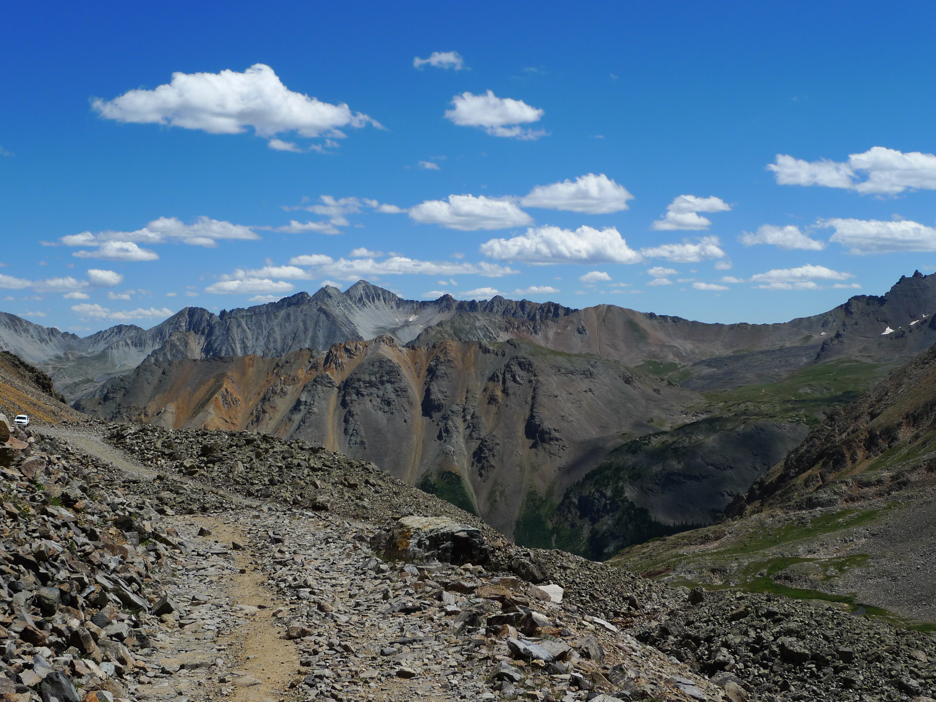
P1010869 — Jeremiah LaRocco — CC BY-SA 2.0 (https://creativecommons.org/licenses/by-sa/2.0/) — https://www.flickr.com/photos/45448242@N02/4896664424/ — No local modifications; exact original Flickr image supplied.
Jeremiah LaRocco
CC BY-SA 2.0
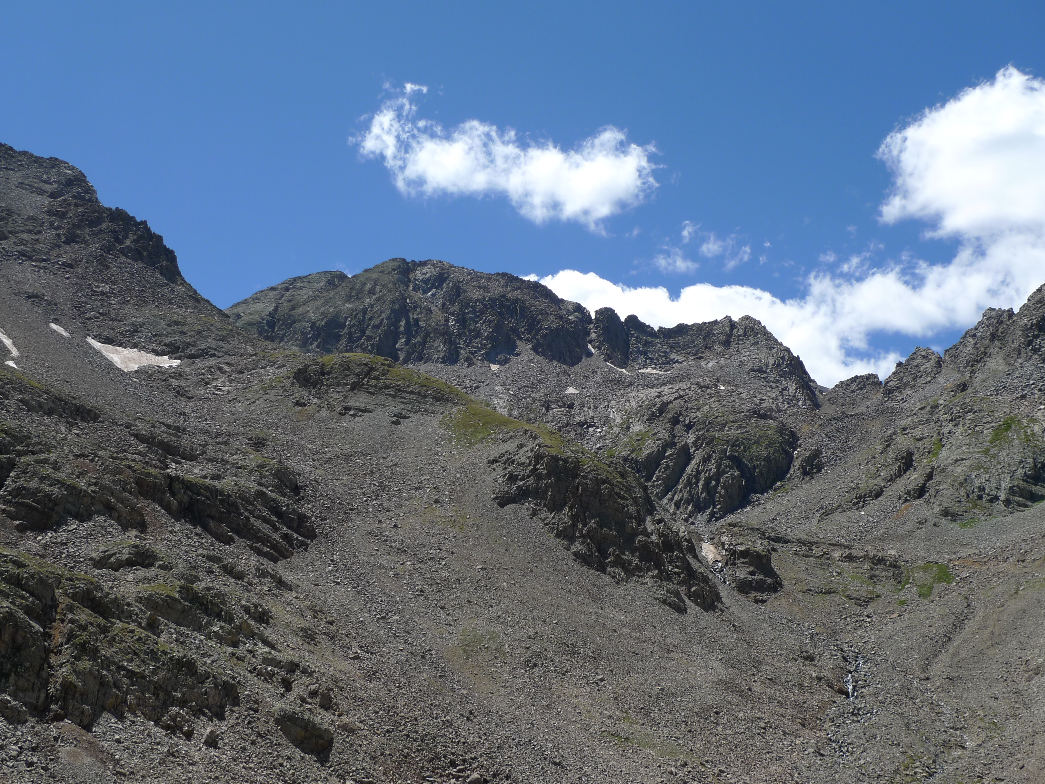
P1010871 — Jeremiah LaRocco — CC BY-SA 2.0 (https://creativecommons.org/licenses/by-sa/2.0/) — https://www.flickr.com/photos/45448242@N02/4896074817/ — No local modifications; exact original Flickr image supplied.
Jeremiah LaRocco
CC BY-SA 2.0
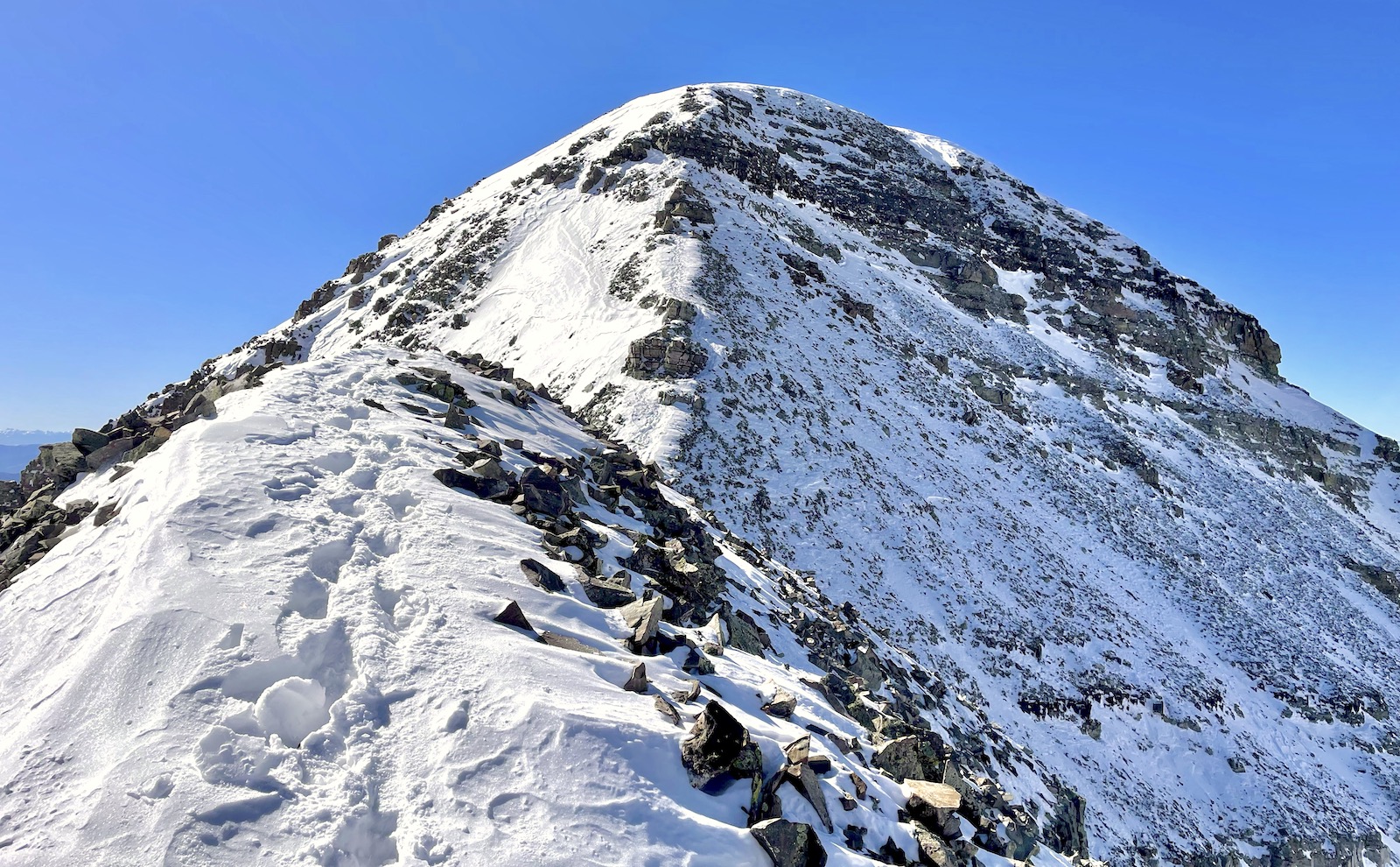
Castle Ridge — Kylie Czajkowski — CC BY 2.0 (https://creativecommons.org/licenses/by/2.0/) — https://www.flickr.com/photos/189863825@N02/51853686797/ — No local modifications; exact original Flickr image supplied.
Kylie Czajkowski
CC BY 2.0
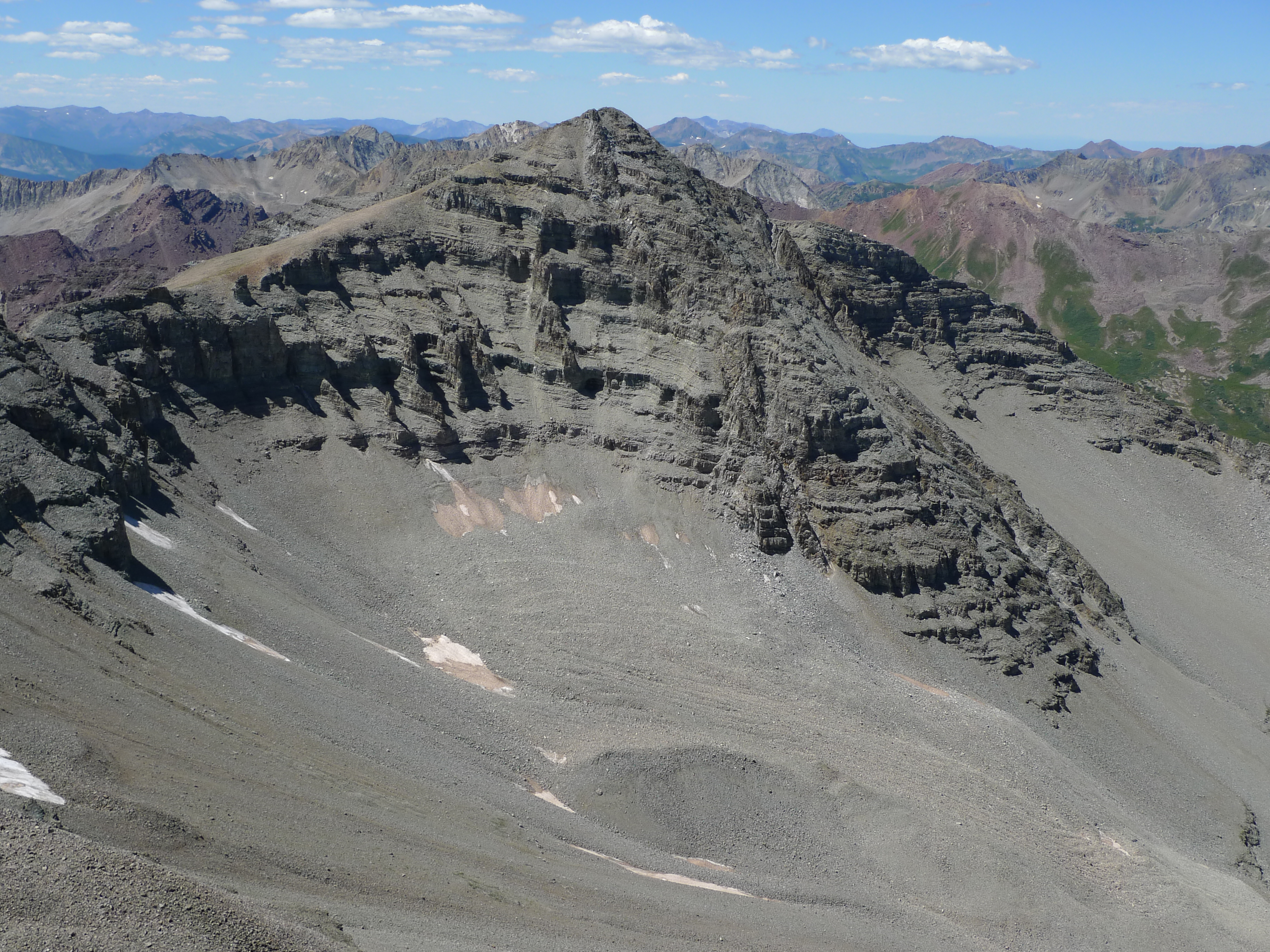
P1010857 — Jeremiah LaRocco — CC BY-SA 2.0 (https://creativecommons.org/licenses/by-sa/2.0/) — https://www.flickr.com/photos/45448242@N02/4896635866/ — No local modifications; exact original Flickr image supplied.
Jeremiah LaRocco
CC BY-SA 2.0
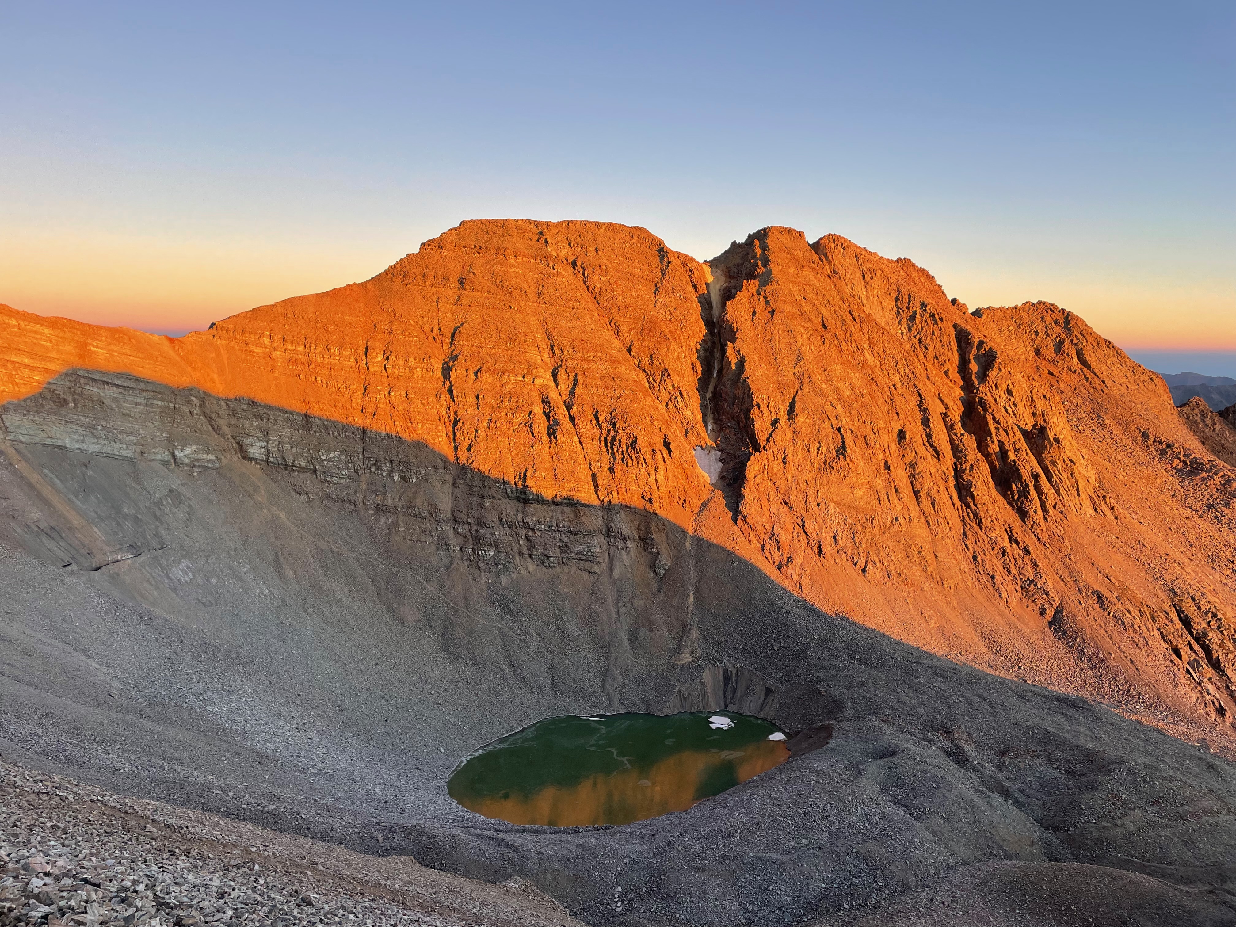
Alpenglow on Conundrum Peak — Kylie Czajkowski — CC BY 2.0 (https://creativecommons.org/licenses/by/2.0/) — https://www.flickr.com/photos/189863825@N02/52357418336/ — No local modifications; exact original Flickr image supplied.
Kylie Czajkowski
CC BY 2.0
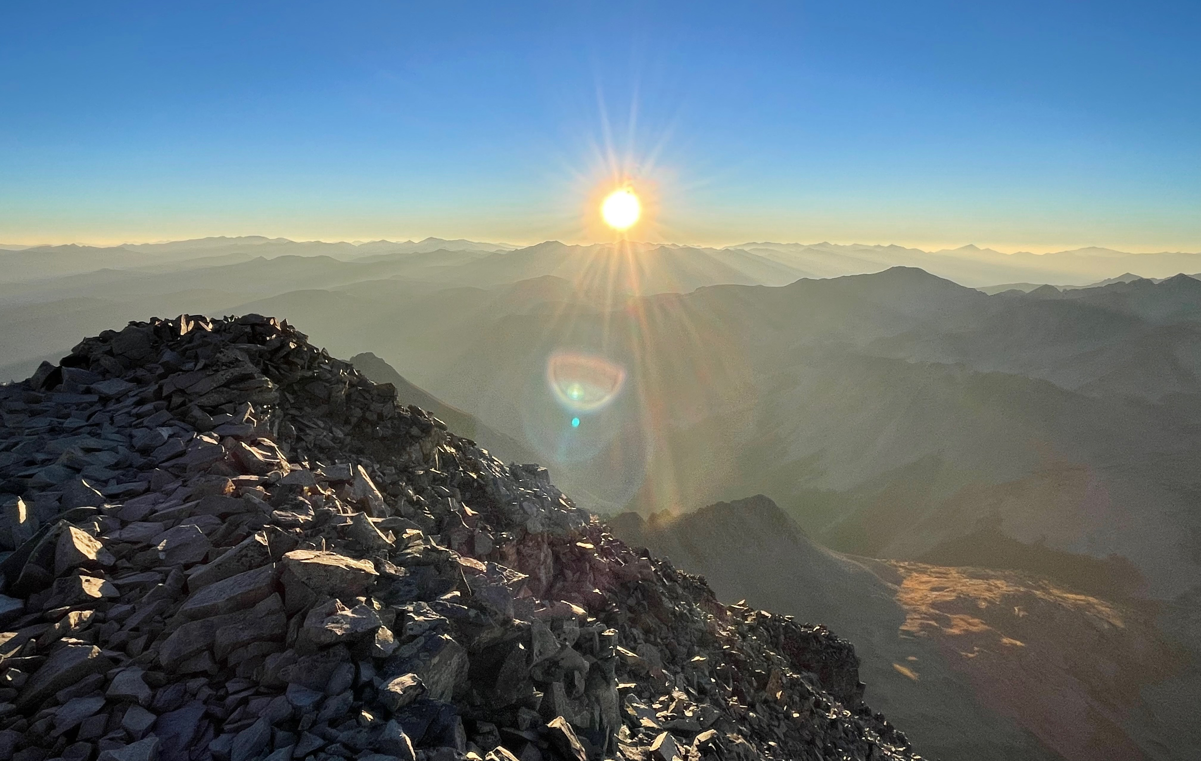
Conundrum Peak Summit — Kylie Czajkowski — CC BY 2.0 (https://creativecommons.org/licenses/by/2.0/) — https://www.flickr.com/photos/189863825@N02/52357831605/ — No local modifications; exact original Flickr image supplied.
Kylie Czajkowski
CC BY 2.0
View original activity in YouVisible
Weather on your route
Loading forecast…
Sources and credits
© OpenStreetMap contributors; original GPX uploaded by cyberhobo. ODbL 1.0. Original trace1093859, all2280 points, order, native elevations, timestamps and single segment retained. Photographs retain their individually credited CC BY2.0 or CC BY-SA2.0 rights.
OpenStreetMap contributors · Public original GPS traces · ODbL 1.0
Upper Montezuma Basin approach
P1010869 — Jeremiah LaRocco — CC BY-SA 2.0 (https://creativecommons.org/licenses/by-sa/2.0/) — https://www.flickr.com/photos/45448242@N02/4896664424/ — No local modifications; exact original Flickr image supplied.
Jeremiah LaRocco · CC BY-SA 2.0 · Media source
The high basin below the peaks
P1010871 — Jeremiah LaRocco — CC BY-SA 2.0 (https://creativecommons.org/licenses/by-sa/2.0/) — https://www.flickr.com/photos/45448242@N02/4896074817/ — No local modifications; exact original Flickr image supplied.
Jeremiah LaRocco · CC BY-SA 2.0 · Media source
Castle Ridge under snow
Castle Ridge — Kylie Czajkowski — CC BY 2.0 (https://creativecommons.org/licenses/by/2.0/) — https://www.flickr.com/photos/189863825@N02/51853686797/ — No local modifications; exact original Flickr image supplied.
Kylie Czajkowski · CC BY 2.0 · Media source
The connecting ridge
P1010857 — Jeremiah LaRocco — CC BY-SA 2.0 (https://creativecommons.org/licenses/by-sa/2.0/) — https://www.flickr.com/photos/45448242@N02/4896635866/ — No local modifications; exact original Flickr image supplied.
Jeremiah LaRocco · CC BY-SA 2.0 · Media source
Alpenglow on Conundrum Peak · route surroundings
Alpenglow on Conundrum Peak — Kylie Czajkowski — CC BY 2.0 (https://creativecommons.org/licenses/by/2.0/) — https://www.flickr.com/photos/189863825@N02/52357418336/ — No local modifications; exact original Flickr image supplied.
Kylie Czajkowski · CC BY 2.0 · Media source
Sunrise from Conundrum Peak Summit
Conundrum Peak Summit — Kylie Czajkowski — CC BY 2.0 (https://creativecommons.org/licenses/by/2.0/) — https://www.flickr.com/photos/189863825@N02/52357831605/ — No local modifications; exact original Flickr image supplied.
Kylie Czajkowski · CC BY 2.0 · Media source