Find your next route
Explore hiking, running, trail running and cycling routes that suit your plans.

Community route
Long Lake Loop · Brainard Lake connector
An original recorded hiking circuit around Long Lake, including the connector paths in the Brainard Lake area near the Indian Peaks Wilderness. The gallery shows lake and forest scenery, a creek, a wilderness trail sign and an aerial panorama of the immediate Brainard Lake surroundings. The photographs are labelled route surroundings.
By YouVisible Sport
Mapa del recorrido
Perfil de elevación
Activity measurements
- distance meters
- 7,013.5366130383
- elevation gain meters
- 197.189
- elevation loss meters
- 198.858
- max elevation meters
- 3,240.967
- min elevation meters
- 3,174.453
- end · latitude
- 40.0833565
- end · longitude
- -105.5814644
- start · latitude
- 40.0834465
- start · longitude
- -105.5814226
- Sport
- hiking mountaineering
- Specialty
- Hiking
From start to finish
- Country
- United States
- Province / region
- —
- Localities
- —
Before you go
- How to reach the start
- —
- Parking and access
- —
- Advice
- Check current trail conditions, weather and access arrangements before setting out. Take care near creeks and on uneven mountain paths.
- Recommended equipment
- —
- Terrain
- —
- Signage
- —
Characteristics and difficulty
- Estimated duration
- —
- Author perceived effort
- —
- Physical difficulty
- —
- Technical difficulty
- —
About the route
An original recorded hiking circuit around Long Lake, including the connector paths in the Brainard Lake area near the Indian Peaks Wilderness. The gallery shows lake and forest scenery, a creek, a wilderness trail sign and an aerial panorama of the immediate Brainard Lake surroundings. The photographs are labelled route surroundings.
- Context
- —
- Specialty
- Hiking
- Event type
- —
- Description
- Long Lake, forest paths, a creek and the nearby Brainard Lake access area. Each photograph is labelled route surroundings, including the aerial panorama, without a position on the track.
- Title
- Route highlights
- Title
- Sesión
- Description
- An original recorded hiking circuit around Long Lake, including the connector paths in the Brainard Lake area near the Indian Peaks Wilderness. The gallery shows lake and forest scenery, a creek, a wilderness trail sign and an aerial panorama of the immediate Brainard Lake surroundings. The photographs are labelled route surroundings.
- Description
- Route surroundings — Long Lake reflections. This photograph is not positioned on the recorded track.
- Title
- Long lake reflections · route surroundings
- Description
- Route surroundings — Long Lake and the Indian Peaks. This photograph is not positioned on the recorded track.
- Title
- Long lake and the indian peaks · route surroundings
- Description
- Route surroundings — creek and forest at the far end of Long Lake. This photograph is not positioned on the recorded track.
- Title
- Creek and forest at the far end of long lake · route surroundings
- Description
- Route surroundings — creek near Long Lake. This photograph is not positioned on the recorded track.
- Title
- Creek near long lake · route surroundings
- Description
- Route surroundings — aerial panorama of Brainard Lake and the access area. This photograph is not positioned on the recorded track.
- Title
- Aerial panorama of brainard lake and the access area · route surroundings
- Description
- Route surroundings — Indian Peaks Wilderness trail sign and forest path. This photograph is not positioned on the recorded track.
- Title
- Indian peaks wilderness trail sign and forest path · route surroundings
- Description
- Route surroundings — Long Lake reflections. This photograph is not positioned on the recorded track.
- Title
- Long lake reflections · route surroundings
- Description
- Route surroundings — Long Lake and the Indian Peaks. This photograph is not positioned on the recorded track.
- Title
- Long lake and the indian peaks · route surroundings
- Description
- Route surroundings — creek and forest at the far end of Long Lake. This photograph is not positioned on the recorded track.
- Title
- Creek and forest at the far end of long lake · route surroundings
- Description
- Route surroundings — creek near Long Lake. This photograph is not positioned on the recorded track.
- Title
- Creek near long lake · route surroundings
- Description
- Route surroundings — aerial panorama of Brainard Lake and the access area. This photograph is not positioned on the recorded track.
- Title
- Aerial panorama of brainard lake and the access area · route surroundings
- Description
- Route surroundings — Indian Peaks Wilderness trail sign and forest path. This photograph is not positioned on the recorded track.
- Title
- Indian peaks wilderness trail sign and forest path · route surroundings
- Advice
- Check current trail conditions, weather and access arrangements before setting out. Take care near creeks and on uneven mountain paths.
- Title
- Long Lake Loop · Brainard Lake connector
Long Lake Reflections — Max and Dee Bernt — CC BY 2.0 (https://creativecommons.org/licenses/by/2.0/) — https://www.flickr.com/photos/61112853@N06/15115042749/ — No local modifications; exact official Flickr version supplied.
Max and Dee Bernt
CC BY 2.0
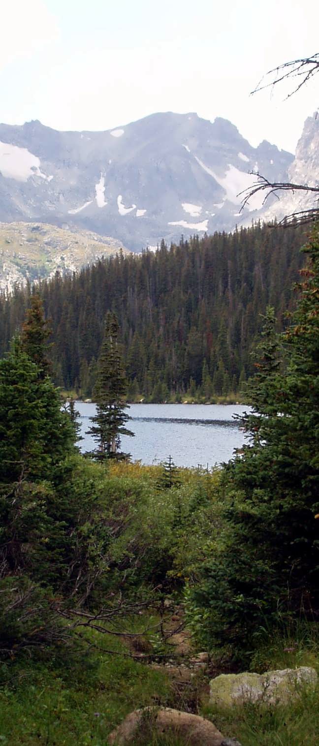
Long Lake — Aidan Grey — CC BY 2.0 (https://creativecommons.org/licenses/by/2.0/) — https://www.flickr.com/photos/55104692@N00/224898992/ — No local modifications; exact official Flickr version supplied.
Aidan Grey
CC BY 2.0
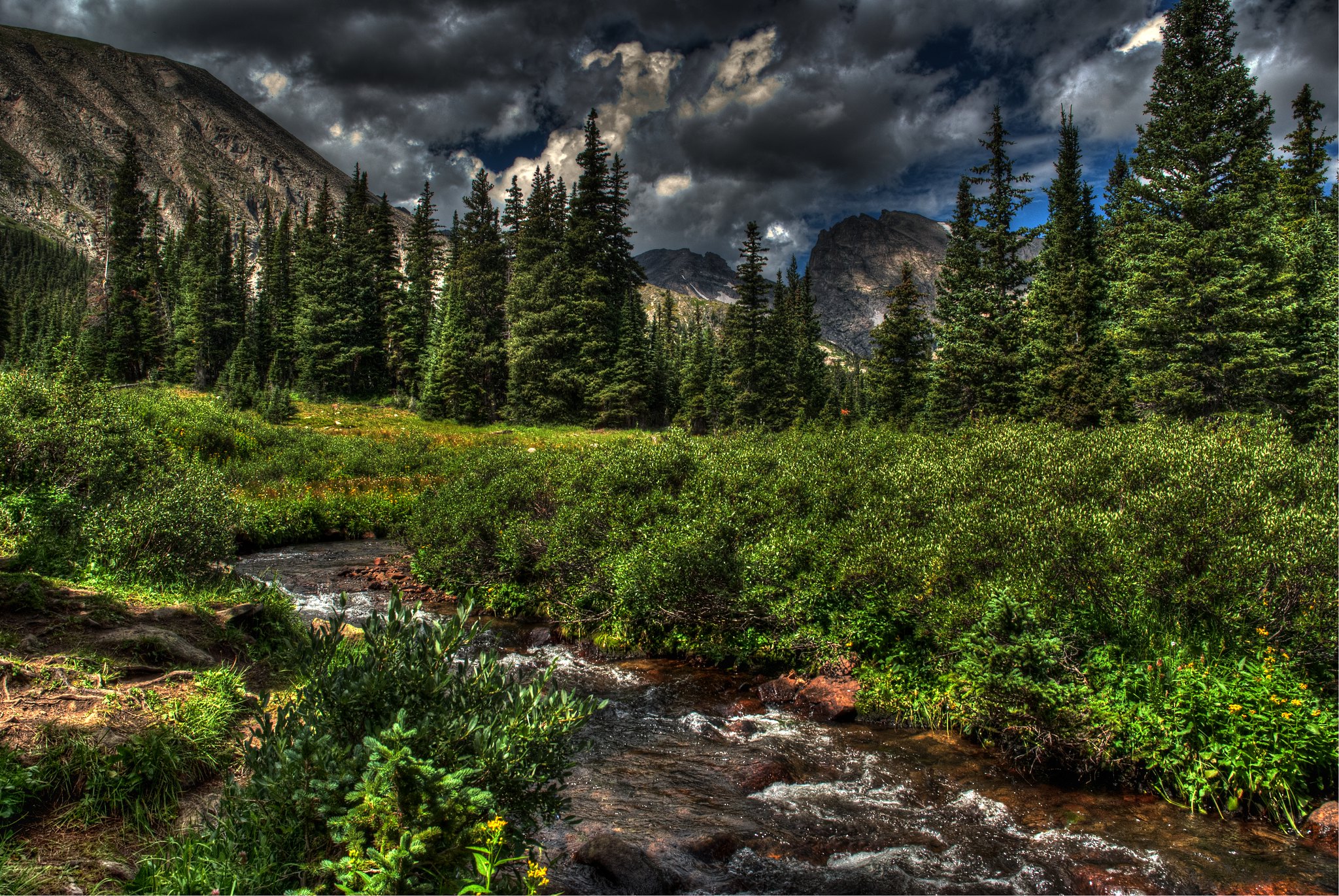
Brainard lake recreation area — Matthew Evans — Public Domain Dedication (CC0) (https://creativecommons.org/publicdomain/zero/1.0/) — https://www.flickr.com/photos/88026027@N03/8055930693/ — No local modifications; exact official Flickr version supplied.
Matthew Evans
Public Domain Dedication (CC0)
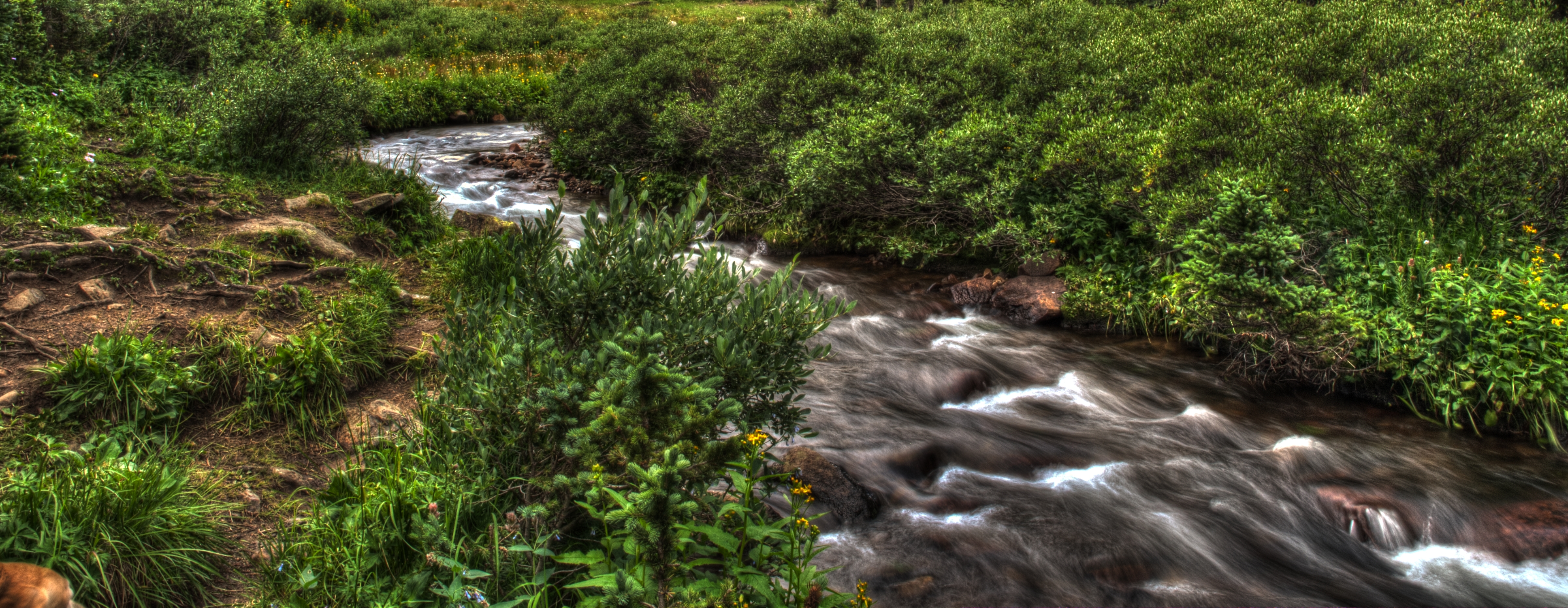
Creek near long lake · route surroundings — Matthew Evans — CC BY-SA 2.0 (https://creativecommons.org/licenses/by-sa/2.0/) — https://www.flickr.com/photos/126586678@N05/15090255862/ — No local modifications; exact official Flickr version supplied.
Matthew Evans
CC BY-SA 2.0
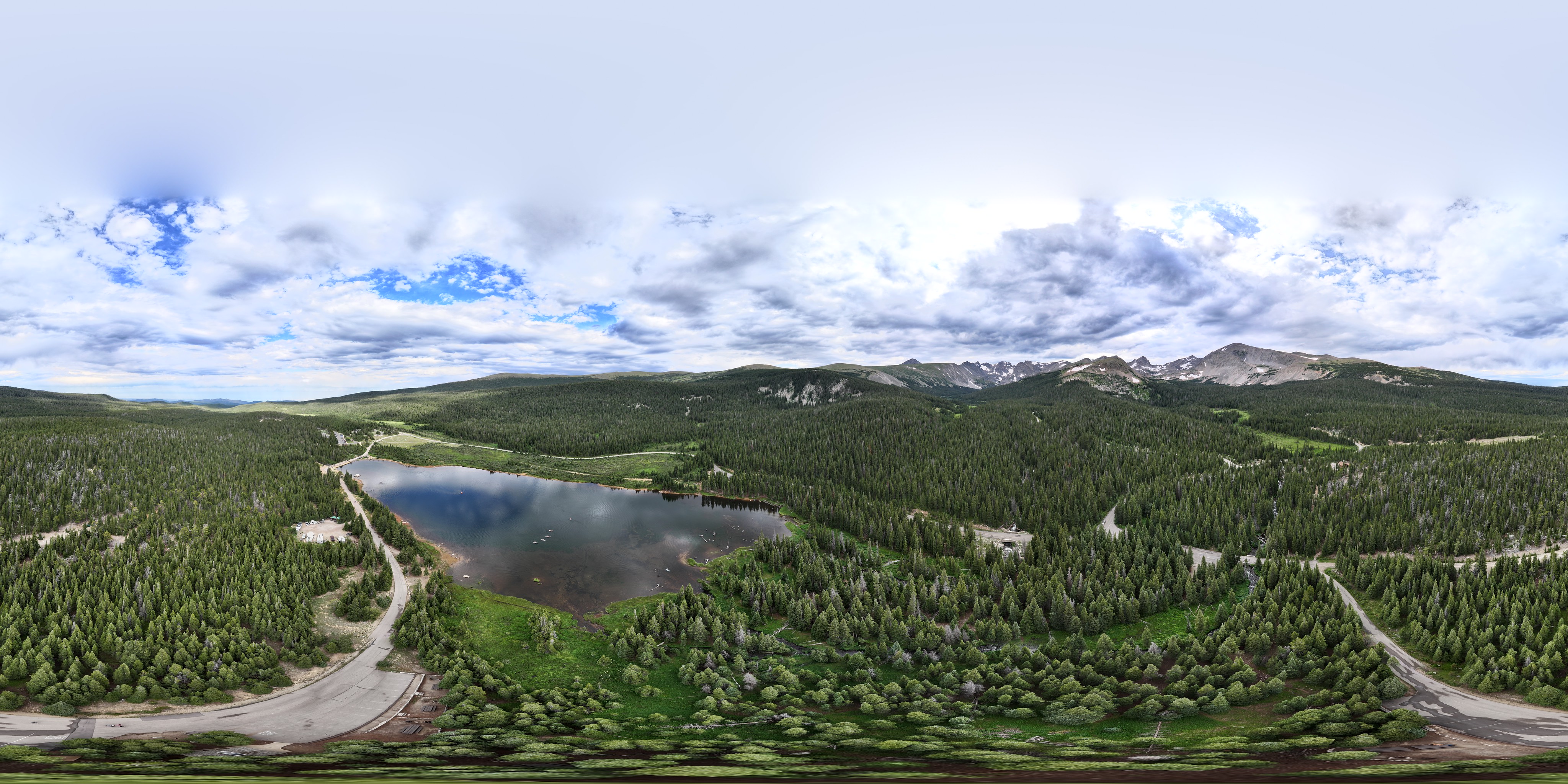
Brainard Lake, Colorado — Mike Lapidakis — CC BY-SA 2.0 (https://creativecommons.org/licenses/by-sa/2.0/) — https://www.flickr.com/photos/36374272@N03/53080295796/ — No local modifications; exact official Flickr version supplied.
Mike Lapidakis
CC BY-SA 2.0
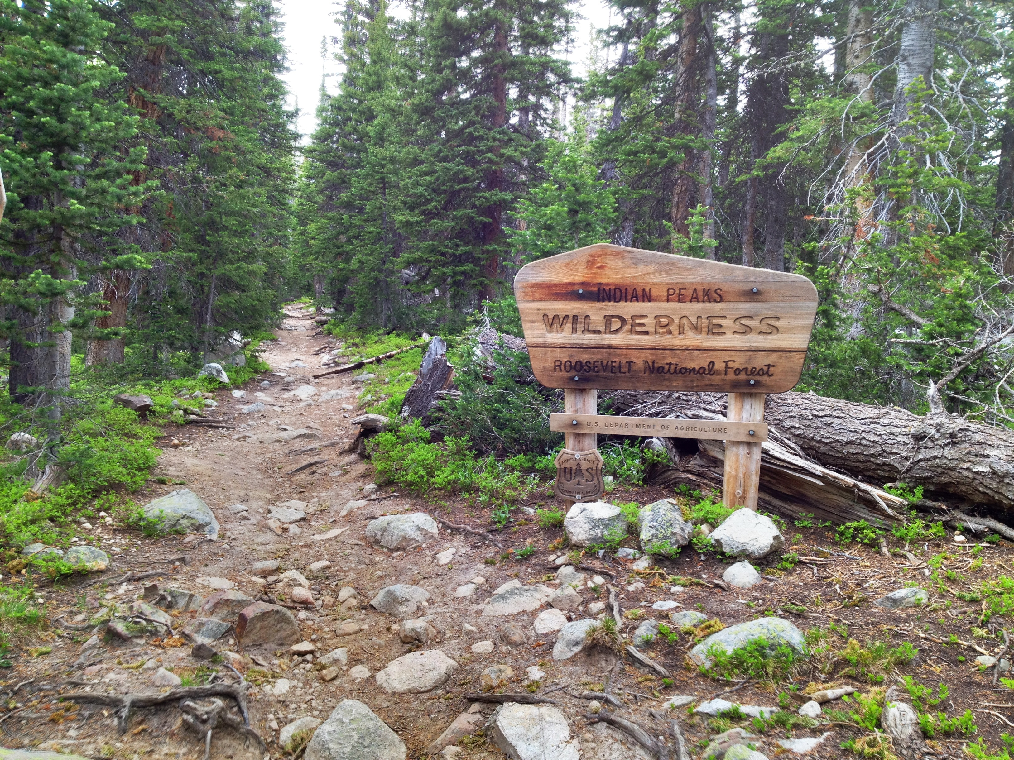
Camera Roll-9 — Patty Carlson — CC BY 2.0 (https://creativecommons.org/licenses/by/2.0/) — https://www.flickr.com/photos/32444354@N08/7416799116/ — No local modifications; exact official Flickr version supplied.
Patty Carlson
CC BY 2.0
View original activity in YouVisible
Weather on your route
Loading forecast…
Sources and credits
© OpenStreetMap contributors; original GPX uploaded by cjones_cu. ODbL 1.0. Original trace2758300, all709 points, order, elevations, timestamps and segment retained. Photographs retain their individually credited CC BY2.0, CC BY-SA2.0 or CC0 rights.
OpenStreetMap contributors · Public original GPS traces · ODbL 1.0
Long lake reflections · route surroundings
Long Lake Reflections — Max and Dee Bernt — CC BY 2.0 (https://creativecommons.org/licenses/by/2.0/) — https://www.flickr.com/photos/61112853@N06/15115042749/ — No local modifications; exact official Flickr version supplied.
Max and Dee Bernt · CC BY 2.0 · Media source
Long lake and the indian peaks · route surroundings
Long Lake — Aidan Grey — CC BY 2.0 (https://creativecommons.org/licenses/by/2.0/) — https://www.flickr.com/photos/55104692@N00/224898992/ — No local modifications; exact official Flickr version supplied.
Aidan Grey · CC BY 2.0 · Media source
Creek and forest at the far end of long lake · route surroundings
Brainard lake recreation area — Matthew Evans — Public Domain Dedication (CC0) (https://creativecommons.org/publicdomain/zero/1.0/) — https://www.flickr.com/photos/88026027@N03/8055930693/ — No local modifications; exact official Flickr version supplied.
Matthew Evans · Public Domain Dedication (CC0) · Media source
Creek near long lake · route surroundings
Creek near long lake · route surroundings — Matthew Evans — CC BY-SA 2.0 (https://creativecommons.org/licenses/by-sa/2.0/) — https://www.flickr.com/photos/126586678@N05/15090255862/ — No local modifications; exact official Flickr version supplied.
Matthew Evans · CC BY-SA 2.0 · Media source
Aerial panorama of brainard lake and the access area · route surroundings
Brainard Lake, Colorado — Mike Lapidakis — CC BY-SA 2.0 (https://creativecommons.org/licenses/by-sa/2.0/) — https://www.flickr.com/photos/36374272@N03/53080295796/ — No local modifications; exact official Flickr version supplied.
Mike Lapidakis · CC BY-SA 2.0 · Media source
Indian peaks wilderness trail sign and forest path · route surroundings
Camera Roll-9 — Patty Carlson — CC BY 2.0 (https://creativecommons.org/licenses/by/2.0/) — https://www.flickr.com/photos/32444354@N08/7416799116/ — No local modifications; exact official Flickr version supplied.
Patty Carlson · CC BY 2.0 · Media source