Find your next route
Explore hiking, running, trail running and cycling routes that suit your plans.

Community route
Birks Bridge · Harter Fell and Hardknott
A recorded hiking route from the Birks area over Harter Fell and towards Hardknott Pass. It follows the complete uploaded track to its recorded finish. The gallery distinguishes the old stone Birks Bridge in the immediate surroundings from the separate River Duddon bridge on the track.
By YouVisible Sport
Mapa del recorrido
Perfil de elevación
Activity measurements
- distance meters
- 10,960.5060478475
- elevation gain meters
- 860.2
- elevation loss meters
- 1,004.6
- max elevation meters
- 661.2
- min elevation meters
- 34.2
- end · latitude
- 54.389963
- end · longitude
- -3.173683
- start · latitude
- 54.385669
- start · longitude
- -3.179489
- Sport
- hiking mountaineering
- Specialty
- Hiking
From start to finish
- Country
- United Kingdom
- Province / region
- —
- Localities
- —
Before you go
- How to reach the start
- —
- Parking and access
- —
- Advice
- Check local access, path conditions and the weather before setting out. Photographs show conditions on their recorded dates and do not establish current conditions.
- Recommended equipment
- —
- Terrain
- —
- Signage
- —
Characteristics and difficulty
- Estimated duration
- —
- Author perceived effort
- —
- Physical difficulty
- —
- Technical difficulty
- —
About the route
A recorded hiking route from the Birks area over Harter Fell and towards Hardknott Pass. It follows the complete uploaded track to its recorded finish. The gallery distinguishes the old stone Birks Bridge in the immediate surroundings from the separate River Duddon bridge on the track.
- Context
- —
- Specialty
- Hiking
- Event type
- —
- Description
- Individually identified paths, landscapes and landmarks. Photographs outside the recorded line are labelled route surroundings; historical photographs do not establish current conditions.
- Title
- Route highlights
- Title
- Sesión
- Description
- A recorded hiking route from the Birks area over Harter Fell and towards Hardknott Pass. It follows the complete uploaded track to its recorded finish. The gallery distinguishes the old stone Birks Bridge in the immediate surroundings from the separate River Duddon bridge on the track.
- Description
- Hardknott Pass: down and up the Duddon valley. A specifically identified landmark, path or view of the recorded route.
- Title
- Hardknott Pass: down and up the Duddon valley
- Description
- Birks Bridge. Route surroundings; this photograph is not positioned on the recorded track.
- Title
- Birks Bridge · route surroundings
- Description
- Bridge over the River Duddon. A specifically identified landmark, path or view of the recorded route.
- Title
- Bridge over the River Duddon
- Description
- Summit tor of Harter Fell. A specifically identified landmark, path or view of the recorded route.
- Title
- Summit tor of Harter Fell
- Description
- Path to Harter Fell. A specifically identified landmark, path or view of the recorded route.
- Title
- Path to Harter Fell
- Description
- Hardknott Gill. A specifically identified landmark, path or view of the recorded route.
- Title
- Hardknott Gill
- Description
- Hardknott Pass: down and up the Duddon valley. A specifically identified landmark, path or view of the recorded route.
- Title
- Hardknott Pass: down and up the Duddon valley
- Description
- Birks Bridge. Route surroundings; this photograph is not positioned on the recorded track.
- Title
- Birks Bridge · route surroundings
- Description
- Bridge over the River Duddon. A specifically identified landmark, path or view of the recorded route.
- Title
- Bridge over the River Duddon
- Description
- Summit tor of Harter Fell. A specifically identified landmark, path or view of the recorded route.
- Title
- Summit tor of Harter Fell
- Description
- Path to Harter Fell. A specifically identified landmark, path or view of the recorded route.
- Title
- Path to Harter Fell
- Description
- Hardknott Gill. A specifically identified landmark, path or view of the recorded route.
- Title
- Hardknott Gill
- Advice
- Check local access, path conditions and the weather before setting out. Photographs show conditions on their recorded dates and do not establish current conditions.
- Title
- Birks Bridge · Harter Fell and Hardknott
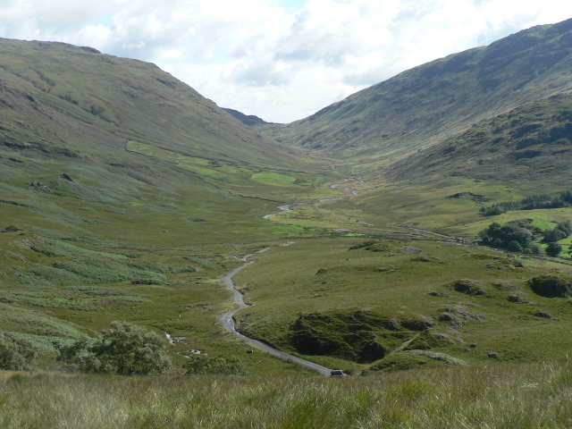
Hardknott Pass: down and up the Duddon valley — Chris Downer — CC BY-SA 2.0 (https://creativecommons.org/licenses/by-sa/2.0/) — https://www.geograph.org.uk/photo/919613 — No local modifications.
Chris Downer
CC BY-SA 2.0
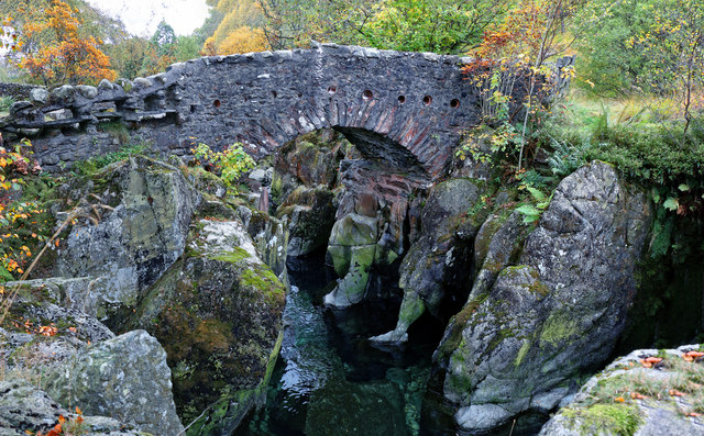
Birks Bridge — Andy Stephenson — CC BY-SA 2.0 (https://creativecommons.org/licenses/by-sa/2.0/) — https://www.geograph.org.uk/photo/4717820 — No local modifications.
Andy Stephenson
CC BY-SA 2.0
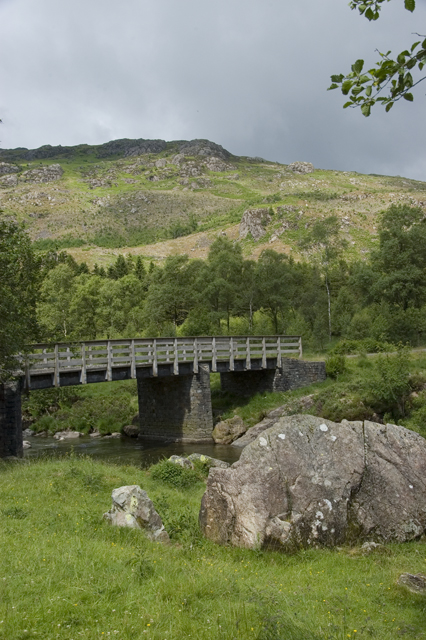
Bridge over the River Duddon — Tom Richardson — CC BY-SA 2.0 (https://creativecommons.org/licenses/by-sa/2.0/) — https://www.geograph.org.uk/photo/1943067 — No local modifications.
Tom Richardson
CC BY-SA 2.0
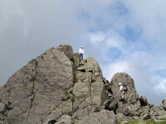
Summit tor of Harter Fell — Trevor Littlewood — CC BY-SA 2.0 (https://creativecommons.org/licenses/by-sa/2.0/) — https://www.geograph.org.uk/photo/2196199 — No local modifications.
Trevor Littlewood
CC BY-SA 2.0
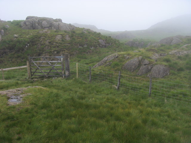
Path to Harter Fell — Shaun Ferguson — CC BY-SA 2.0 (https://creativecommons.org/licenses/by-sa/2.0/) — https://www.geograph.org.uk/photo/4725578 — No local modifications.
Shaun Ferguson
CC BY-SA 2.0
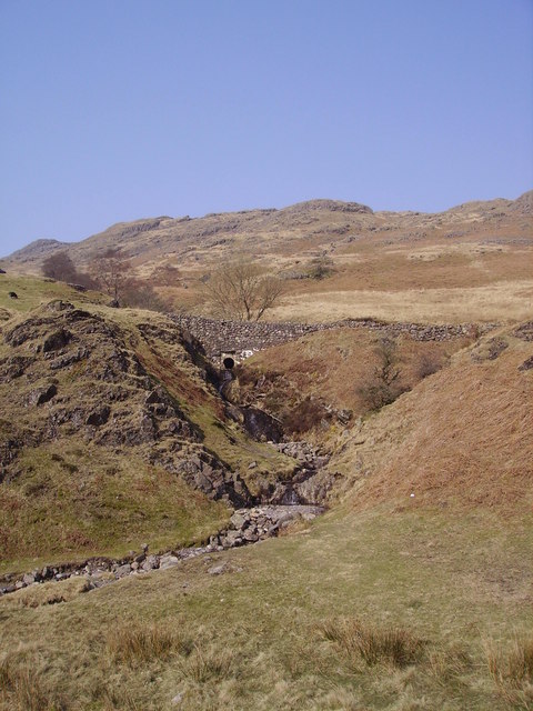
Hardknott Gill — Michael Graham — CC BY-SA 2.0 (https://creativecommons.org/licenses/by-sa/2.0/) — https://www.geograph.org.uk/photo/785424 — No local modifications.
Michael Graham
CC BY-SA 2.0
View original activity in YouVisible
Weather on your route
Loading forecast…
Sources and credits
© OpenStreetMap contributors; original attributable GPX by WalkingMAN. ODbL 1.0. All original points, segment, elevations, timestamps and order preserved. Photographs retain their individual CC BY-SA2.0 credits.
OpenStreetMap contributors · Public original GPS traces · ODbL 1.0
Hardknott Pass: down and up the Duddon valley
Hardknott Pass: down and up the Duddon valley — Chris Downer — CC BY-SA 2.0 (https://creativecommons.org/licenses/by-sa/2.0/) — https://www.geograph.org.uk/photo/919613 — No local modifications.
Chris Downer · CC BY-SA 2.0 · Media source
Birks Bridge · route surroundings
Birks Bridge — Andy Stephenson — CC BY-SA 2.0 (https://creativecommons.org/licenses/by-sa/2.0/) — https://www.geograph.org.uk/photo/4717820 — No local modifications.
Andy Stephenson · CC BY-SA 2.0 · Media source
Bridge over the River Duddon
Bridge over the River Duddon — Tom Richardson — CC BY-SA 2.0 (https://creativecommons.org/licenses/by-sa/2.0/) — https://www.geograph.org.uk/photo/1943067 — No local modifications.
Tom Richardson · CC BY-SA 2.0 · Media source
Summit tor of Harter Fell
Summit tor of Harter Fell — Trevor Littlewood — CC BY-SA 2.0 (https://creativecommons.org/licenses/by-sa/2.0/) — https://www.geograph.org.uk/photo/2196199 — No local modifications.
Trevor Littlewood · CC BY-SA 2.0 · Media source
Path to Harter Fell
Path to Harter Fell — Shaun Ferguson — CC BY-SA 2.0 (https://creativecommons.org/licenses/by-sa/2.0/) — https://www.geograph.org.uk/photo/4725578 — No local modifications.
Shaun Ferguson · CC BY-SA 2.0 · Media source
Hardknott Gill
Hardknott Gill — Michael Graham — CC BY-SA 2.0 (https://creativecommons.org/licenses/by-sa/2.0/) — https://www.geograph.org.uk/photo/785424 — No local modifications.
Michael Graham · CC BY-SA 2.0 · Media source