Find your next route
Explore hiking, running, trail running and cycling routes that suit your plans.

Community route
Kentmere Horseshoe · High Street circuit
A recorded Kentmere Horseshoe circuit over the surrounding fell ridges, including Ill Bell, Froswick, Thornthwaite Crag and High Street. It continues around the head of Kentmere via Nan Bield and Kentmere Pike. Photographs identify the places shown; the Nan Bield path photograph is labelled as route surroundings, and the historical photographs do not establish current conditions.
By YouVisible Sport
Mapa del recorrido
Perfil de elevación
Activity measurements
- distance meters
- 21,828.0999706582
- elevation gain meters
- 1,408
- elevation loss meters
- 1,456
- max elevation meters
- 850
- min elevation meters
- 109
- end · latitude
- 54.4295588
- end · longitude
- -2.8400016
- start · latitude
- 54.4296109
- start · longitude
- -2.8401281
- Sport
- hiking mountaineering
- Specialty
- Hiking
From start to finish
- Country
- United Kingdom
- Province / region
- —
- Localities
- —
Before you go
- How to reach the start
- —
- Parking and access
- —
- Advice
- Check local access, the mountain weather forecast and visibility before setting out. Carry appropriate navigation equipment for the fell ridges.
- Recommended equipment
- —
- Terrain
- —
- Signage
- —
Characteristics and difficulty
- Estimated duration
- —
- Author perceived effort
- —
- Physical difficulty
- —
- Technical difficulty
- —
About the route
A recorded Kentmere Horseshoe circuit over the surrounding fell ridges, including Ill Bell, Froswick, Thornthwaite Crag and High Street. It continues around the head of Kentmere via Nan Bield and Kentmere Pike. Photographs identify the places shown; the Nan Bield path photograph is labelled as route surroundings, and the historical photographs do not establish current conditions.
- Context
- —
- Specialty
- Hiking
- Event type
- —
- Description
- Kentmere village, Garburn Pass, the Ill Bell–Froswick ridge, Thornthwaite beacon and Kentmere Pike; the Nan Bield photograph is labelled route surroundings. Historical photographs do not establish current conditions.
- Title
- Route highlights
- Title
- Sesión
- Description
- A recorded Kentmere Horseshoe circuit over the surrounding fell ridges, including Ill Bell, Froswick, Thornthwaite Crag and High Street. It continues around the head of Kentmere via Nan Bield and Kentmere Pike. Photographs identify the places shown; the Nan Bield path photograph is labelled as route surroundings, and the historical photographs do not establish current conditions.
- Description
- Froswick seen from Ill Bell in the historical photograph of 2007-01-27. Snow in this image does not establish current conditions.
- Title
- Froswick from Ill Bell
- Description
- Kentmere village, Cumbria. A landmark or view of the recorded Kentmere Horseshoe route.
- Title
- Kentmere village, Cumbria
- Description
- Garburn Pass. A landmark or view of the recorded Kentmere Horseshoe route.
- Title
- Garburn Pass
- Description
- Beacon, Thornthwaite Crag. A landmark or view of the recorded Kentmere Horseshoe route.
- Title
- Beacon, Thornthwaite Crag
- Description
- The undulating Nan Bield Pass. Route surroundings; this photograph is not positioned on the recorded track.
- Title
- The undulating Nan Bield Pass · route surroundings
- Description
- Historical black-and-white photograph of arrival at Kentmere Pike, taken 2008-12-30. It does not show current conditions.
- Title
- Arriving at Kentmere Pike
- Description
- Froswick seen from Ill Bell in the historical photograph of 2007-01-27. Snow in this image does not establish current conditions.
- Title
- Froswick from Ill Bell
- Description
- Kentmere village, Cumbria. A landmark or view of the recorded Kentmere Horseshoe route.
- Title
- Kentmere village, Cumbria
- Description
- Garburn Pass. A landmark or view of the recorded Kentmere Horseshoe route.
- Title
- Garburn Pass
- Description
- Beacon, Thornthwaite Crag. A landmark or view of the recorded Kentmere Horseshoe route.
- Title
- Beacon, Thornthwaite Crag
- Description
- The undulating Nan Bield Pass. Route surroundings; this photograph is not positioned on the recorded track.
- Title
- The undulating Nan Bield Pass · route surroundings
- Description
- Historical black-and-white photograph of arrival at Kentmere Pike, taken 2008-12-30. It does not show current conditions.
- Title
- Arriving at Kentmere Pike
- Advice
- Check local access, the mountain weather forecast and visibility before setting out. Carry appropriate navigation equipment for the fell ridges.
- Title
- Kentmere Horseshoe · High Street circuit
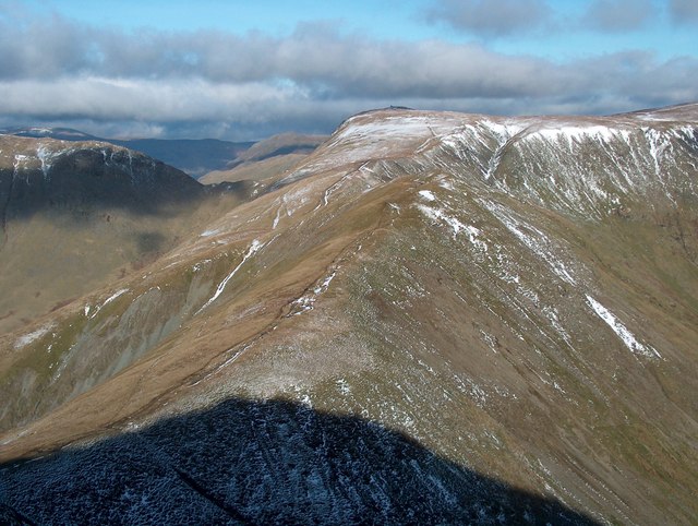
Froswick from Ill Bell — Bill Boaden — CC BY-SA 2.0 (https://creativecommons.org/licenses/by-sa/2.0/) — https://www.geograph.org.uk/photo/1723331 — No local modifications.
Bill Boaden
CC BY-SA 2.0
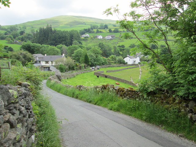
Kentmere village, Cumbria — Peter S — CC BY-SA 2.0 (https://creativecommons.org/licenses/by-sa/2.0/) — https://www.geograph.org.uk/photo/3593163 — No local modifications.
Peter S
CC BY-SA 2.0
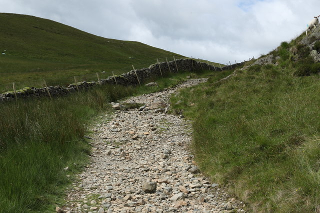
Garburn Pass — Andrew Abbott — CC BY-SA 2.0 (https://creativecommons.org/licenses/by-sa/2.0/) — https://www.geograph.org.uk/photo/5454076 — No local modifications.
Andrew Abbott
CC BY-SA 2.0
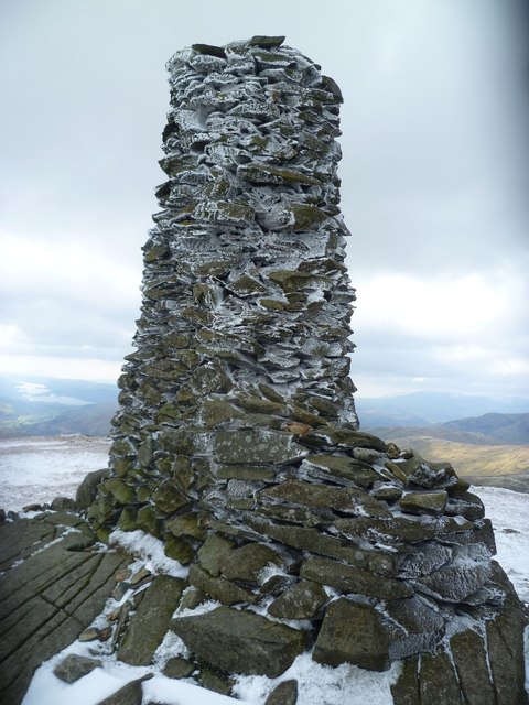
Beacon, Thornthwaite Crag — Michael Graham — CC BY-SA 2.0 (https://creativecommons.org/licenses/by-sa/2.0/) — https://www.geograph.org.uk/photo/3905824 — No local modifications.
Michael Graham
CC BY-SA 2.0
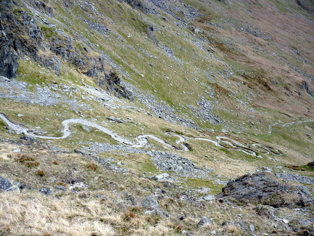
The undulating Nan Bield Pass — Phil Catterall — CC BY-SA 2.0 (https://creativecommons.org/licenses/by-sa/2.0/) — https://www.geograph.org.uk/photo/2706096 — No local modifications.
Phil Catterall
CC BY-SA 2.0
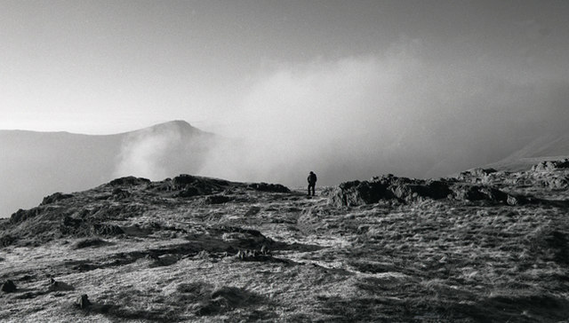
Arriving at Kentmere Pike — Tom Richardson — CC BY-SA 2.0 (https://creativecommons.org/licenses/by-sa/2.0/) — https://www.geograph.org.uk/photo/1106195 — No local modifications.
Tom Richardson
CC BY-SA 2.0
View original activity in YouVisible
Weather on your route
Loading forecast…
Sources and credits
© OpenStreetMap contributors; original GPX uploaded by WalkingMAN. ODbL 1.0. Original trace2370692, all2023 points, order, elevations, timestamps and segment retained. Individual photographs retain their credited CC BY-SA2.0 licence.
OpenStreetMap contributors · Public original GPS traces · ODbL 1.0
Froswick from Ill Bell
Froswick from Ill Bell — Bill Boaden — CC BY-SA 2.0 (https://creativecommons.org/licenses/by-sa/2.0/) — https://www.geograph.org.uk/photo/1723331 — No local modifications.
Bill Boaden · CC BY-SA 2.0 · Media source
Kentmere village, Cumbria
Kentmere village, Cumbria — Peter S — CC BY-SA 2.0 (https://creativecommons.org/licenses/by-sa/2.0/) — https://www.geograph.org.uk/photo/3593163 — No local modifications.
Peter S · CC BY-SA 2.0 · Media source
Garburn Pass
Garburn Pass — Andrew Abbott — CC BY-SA 2.0 (https://creativecommons.org/licenses/by-sa/2.0/) — https://www.geograph.org.uk/photo/5454076 — No local modifications.
Andrew Abbott · CC BY-SA 2.0 · Media source
Beacon, Thornthwaite Crag
Beacon, Thornthwaite Crag — Michael Graham — CC BY-SA 2.0 (https://creativecommons.org/licenses/by-sa/2.0/) — https://www.geograph.org.uk/photo/3905824 — No local modifications.
Michael Graham · CC BY-SA 2.0 · Media source
The undulating Nan Bield Pass · route surroundings
The undulating Nan Bield Pass — Phil Catterall — CC BY-SA 2.0 (https://creativecommons.org/licenses/by-sa/2.0/) — https://www.geograph.org.uk/photo/2706096 — No local modifications.
Phil Catterall · CC BY-SA 2.0 · Media source
Arriving at Kentmere Pike
Arriving at Kentmere Pike — Tom Richardson — CC BY-SA 2.0 (https://creativecommons.org/licenses/by-sa/2.0/) — https://www.geograph.org.uk/photo/1106195 — No local modifications.
Tom Richardson · CC BY-SA 2.0 · Media source