Find your next route
Explore hiking, running, trail running and cycling routes that suit your plans.

Community route
Nether Wasdale · Low Wood and Wast Water
A recorded walking circuit near Nether Wasdale, following the River Irt and the paths of Low Wood beside Wast Water. The gallery shows the woodland path, Forest Bridge and Wasdale Hall, with separately labelled views of the immediate lakeshore surroundings.
By YouVisible Sport
Mapa del recorrido
Perfil de elevación
Activity measurements
- distance meters
- 8,093.0616380682
- elevation gain meters
- 272.8
- elevation loss meters
- 278.8
- max elevation meters
- 125.6
- min elevation meters
- 52.8
- end · latitude
- 54.421984
- end · longitude
- -3.344054
- start · latitude
- 54.421933
- start · longitude
- -3.344043
- Sport
- hiking mountaineering
- Specialty
- Hiking
From start to finish
- Country
- United Kingdom
- Province / region
- —
- Localities
- —
Before you go
- How to reach the start
- —
- Parking and access
- —
- Advice
- Check local path conditions and the weather before setting out. Take care on lakeside paths and the minor road sections.
- Recommended equipment
- —
- Terrain
- —
- Signage
- —
Characteristics and difficulty
- Estimated duration
- —
- Author perceived effort
- —
- Physical difficulty
- —
- Technical difficulty
- —
About the route
A recorded walking circuit near Nether Wasdale, following the River Irt and the paths of Low Wood beside Wast Water. The gallery shows the woodland path, Forest Bridge and Wasdale Hall, with separately labelled views of the immediate lakeshore surroundings.
- Context
- —
- Specialty
- Hiking
- Event type
- —
- Description
- Woodland paths, Forest Bridge and Wasdale Hall; photographs beyond the recorded line are labelled route surroundings.
- Title
- Route highlights
- Title
- Sesión
- Description
- A recorded walking circuit near Nether Wasdale, following the River Irt and the paths of Low Wood beside Wast Water. The gallery shows the woodland path, Forest Bridge and Wasdale Hall, with separately labelled views of the immediate lakeshore surroundings.
- Description
- Wast Water from the shore at Low Wood. Route surroundings; this photograph is not positioned on the recorded track.
- Title
- Wast Water from the shore at Low Wood · route surroundings
- Description
- Wast Water Youth Hostel. A landmark or path of the recorded Low Wood route.
- Title
- Wast Water Youth Hostel
- Description
- Footpath through Low Wood. A landmark or path of the recorded Low Wood route.
- Title
- Footpath through Low Wood
- Description
- Forest Bridge. A landmark or path of the recorded Low Wood route.
- Title
- Forest Bridge
- Description
- Path along the shore of Wast Water. Route surroundings; this photograph is not positioned on the recorded track.
- Title
- Path along the shore of Wast Water · route surroundings
- Description
- Low crag beside road approaching Wastwater. Route surroundings; this photograph is not positioned on the recorded track.
- Title
- Low crag beside road approaching Wastwater · route surroundings
- Description
- Wast Water from the shore at Low Wood. Route surroundings; this photograph is not positioned on the recorded track.
- Title
- Wast Water from the shore at Low Wood · route surroundings
- Description
- Wast Water Youth Hostel. A landmark or path of the recorded Low Wood route.
- Title
- Wast Water Youth Hostel
- Description
- Footpath through Low Wood. A landmark or path of the recorded Low Wood route.
- Title
- Footpath through Low Wood
- Description
- Forest Bridge. A landmark or path of the recorded Low Wood route.
- Title
- Forest Bridge
- Description
- Path along the shore of Wast Water. Route surroundings; this photograph is not positioned on the recorded track.
- Title
- Path along the shore of Wast Water · route surroundings
- Description
- Low crag beside road approaching Wastwater. Route surroundings; this photograph is not positioned on the recorded track.
- Title
- Low crag beside road approaching Wastwater · route surroundings
- Advice
- Check local path conditions and the weather before setting out. Take care on lakeside paths and the minor road sections.
- Title
- Nether Wasdale · Low Wood and Wast Water
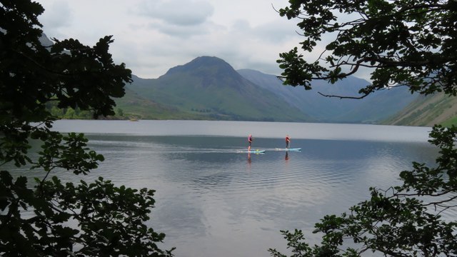
Wast Water from the shore at Low Wood — Colin Park — CC BY-SA 2.0 (https://creativecommons.org/licenses/by-sa/2.0/) — https://www.geograph.org.uk/photo/7935063 — No local modifications.
Colin Park
CC BY-SA 2.0
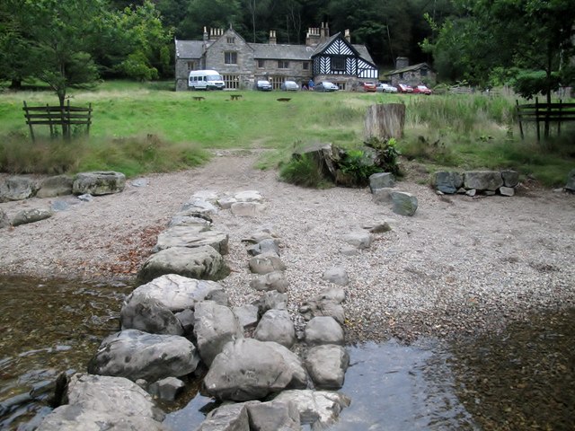
Wast Water Youth Hostel — Rude Health — CC BY-SA 2.0 (https://creativecommons.org/licenses/by-sa/2.0/) — https://www.geograph.org.uk/photo/3309639 — No local modifications.
Rude Health
CC BY-SA 2.0
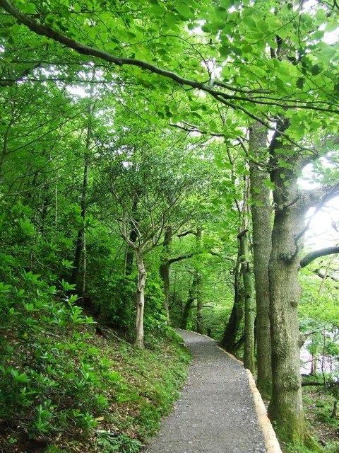
Footpath through Low Wood — Tim Glover — CC BY-SA 2.0 (https://creativecommons.org/licenses/by-sa/2.0/) — https://www.geograph.org.uk/photo/4858685 — No local modifications.
Tim Glover
CC BY-SA 2.0
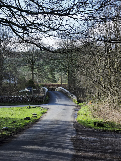
Forest Bridge — Trevor Littlewood — CC BY-SA 2.0 (https://creativecommons.org/licenses/by-sa/2.0/) — https://www.geograph.org.uk/photo/7442138 — No local modifications.
Trevor Littlewood
CC BY-SA 2.0
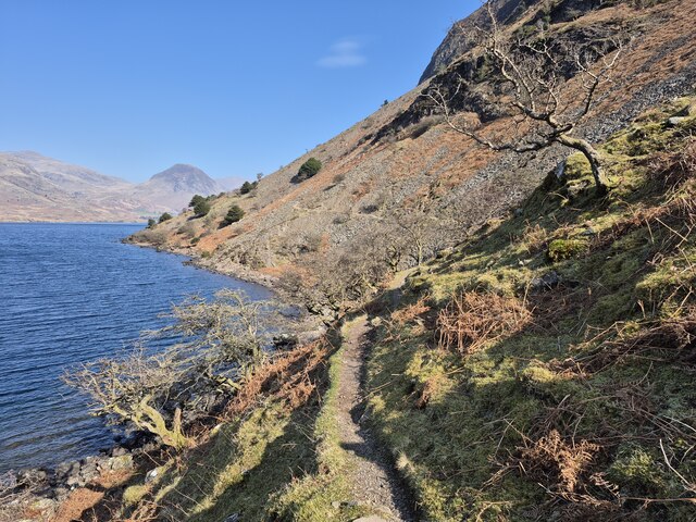
Path along the shore of Wast Water — Steven Brown — CC BY-SA 2.0 (https://creativecommons.org/licenses/by-sa/2.0/) — https://www.geograph.org.uk/photo/7992079 — No local modifications.
Steven Brown
CC BY-SA 2.0
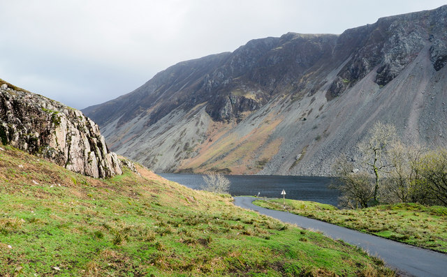
Low crag beside road approaching Wastwater — Trevor Littlewood — CC BY-SA 2.0 (https://creativecommons.org/licenses/by-sa/2.0/) — https://www.geograph.org.uk/photo/6091711 — No local modifications.
Trevor Littlewood
CC BY-SA 2.0
View original activity in YouVisible
Weather on your route
Loading forecast…
Sources and credits
© OpenStreetMap contributors; original GPX uploaded by WalkingMAN. ODbL 1.0. Original trace4152132, all950 points, order, elevations, timestamps and segment retained. Individual photographs retain their credited CC BY-SA2.0 licence.
OpenStreetMap contributors · Public original GPS traces · ODbL 1.0
Wast Water from the shore at Low Wood · route surroundings
Wast Water from the shore at Low Wood — Colin Park — CC BY-SA 2.0 (https://creativecommons.org/licenses/by-sa/2.0/) — https://www.geograph.org.uk/photo/7935063 — No local modifications.
Colin Park · CC BY-SA 2.0 · Media source
Wast Water Youth Hostel
Wast Water Youth Hostel — Rude Health — CC BY-SA 2.0 (https://creativecommons.org/licenses/by-sa/2.0/) — https://www.geograph.org.uk/photo/3309639 — No local modifications.
Rude Health · CC BY-SA 2.0 · Media source
Footpath through Low Wood
Footpath through Low Wood — Tim Glover — CC BY-SA 2.0 (https://creativecommons.org/licenses/by-sa/2.0/) — https://www.geograph.org.uk/photo/4858685 — No local modifications.
Tim Glover · CC BY-SA 2.0 · Media source
Forest Bridge
Forest Bridge — Trevor Littlewood — CC BY-SA 2.0 (https://creativecommons.org/licenses/by-sa/2.0/) — https://www.geograph.org.uk/photo/7442138 — No local modifications.
Trevor Littlewood · CC BY-SA 2.0 · Media source
Path along the shore of Wast Water · route surroundings
Path along the shore of Wast Water — Steven Brown — CC BY-SA 2.0 (https://creativecommons.org/licenses/by-sa/2.0/) — https://www.geograph.org.uk/photo/7992079 — No local modifications.
Steven Brown · CC BY-SA 2.0 · Media source
Low crag beside road approaching Wastwater · route surroundings
Low crag beside road approaching Wastwater — Trevor Littlewood — CC BY-SA 2.0 (https://creativecommons.org/licenses/by-sa/2.0/) — https://www.geograph.org.uk/photo/6091711 — No local modifications.
Trevor Littlewood · CC BY-SA 2.0 · Media source