Find your next route
Explore hiking, running, trail running and cycling routes that suit your plans.

Community route
Capital Ring · Highgate to Stoke Newington
Walk Capital Ring section 12 from Highgate to Stoke Newington through north London’s linked green spaces. The route includes the Parkland Walk corridor and continues towards Stoke Newington. It is a one-way walk, with onward travel arranged separately. The archive gallery shows local waymarks, views and natural details; follow current access notices.
By YouVisible Sport
Mapa del recorrido
Activity measurements
- distance meters
- 8,793.0039381581
- end · latitude
- 51.5641005
- end · longitude
- -0.0729611
- start · latitude
- 51.5781157
- start · longitude
- -0.1439935
- Sport
- walking
- Specialty
- walking outdoor
From start to finish
- Country
- United Kingdom
- Province / region
- —
- Localities
- Highgate
Before you go
- How to reach the start
- —
- Parking and access
- —
- Advice
- Plan access and the return journey, check current conditions and respect local restrictions.
- Recommended equipment
- —
- Terrain
- —
- Signage
- Capital Ring waymarks use Big Ben within a circle of arrows, as identified in the source route relation.
Characteristics and difficulty
- Estimated duration
- —
- Author perceived effort
- —
- Physical difficulty
- —
- Technical difficulty
- —
About the route
Walk Capital Ring section 12 from Highgate to Stoke Newington through north London’s linked green spaces. The route includes the Parkland Walk corridor and continues towards Stoke Newington. It is a one-way walk, with onward travel arranged separately. The archive gallery shows local waymarks, views and natural details; follow current access notices.
- Context
- —
- Specialty
- walking outdoor
- Event type
- —
- Description
- Places and natural details from the route and its local setting, with individual photographic credits and licences.
- Title
- Route highlights
- Title
- Sesión
- Description
- Walk Capital Ring section 12 from Highgate to Stoke Newington through north London’s linked green spaces. The route includes the Parkland Walk corridor and continues towards Stoke Newington. It is a one-way walk, with onward travel arranged separately. The archive gallery shows local waymarks, views and natural details; follow current access notices.
- Description
- Archive Capital Ring direction signs at Crouch End Hill on the Parkland Walk.
- Title
- Waymarks on the Parkland Walk
- Description
- Archive photograph of Parkland Walk in Crouch End, taken 2025-01-07. This view does not establish current path or access conditions.
- Title
- Parkland Walk in Crouch End
- Description
- Archive photograph of Former platforms at Crouch End, taken 2025-01-07. This view does not establish current path or access conditions.
- Title
- Former platforms at Crouch End
- Description
- Archive photograph of Frost on the bridge over Stanhope Road, taken 2026-01-05. This view does not establish current path or access conditions.
- Title
- Frost on the bridge over Stanhope Road
- Description
- Archive photograph of Parkland Walk at Finsbury Park, taken 2019-01-26. This view does not establish current path or access conditions.
- Title
- Parkland Walk at Finsbury Park
- Description
- Archive photograph of Path by West Lake in Clissold Park, taken 2015-03-18. This view does not establish current path or access conditions.
- Title
- Path by West Lake in Clissold Park
- Description
- Archive Capital Ring direction signs at Crouch End Hill on the Parkland Walk.
- Title
- Waymarks on the Parkland Walk
- Description
- Archive photograph of Parkland Walk in Crouch End, taken 2025-01-07. This view does not establish current path or access conditions.
- Title
- Parkland Walk in Crouch End
- Description
- Archive photograph of Former platforms at Crouch End, taken 2025-01-07. This view does not establish current path or access conditions.
- Title
- Former platforms at Crouch End
- Description
- Archive photograph of Frost on the bridge over Stanhope Road, taken 2026-01-05. This view does not establish current path or access conditions.
- Title
- Frost on the bridge over Stanhope Road
- Description
- Archive photograph of Parkland Walk at Finsbury Park, taken 2019-01-26. This view does not establish current path or access conditions.
- Title
- Parkland Walk at Finsbury Park
- Description
- Archive photograph of Path by West Lake in Clissold Park, taken 2015-03-18. This view does not establish current path or access conditions.
- Title
- Path by West Lake in Clissold Park
- Advice
- Plan access and the return journey, check current conditions and respect local restrictions.
- Signage
- Capital Ring waymarks use Big Ben within a circle of arrows, as identified in the source route relation.
- Title
- Capital Ring · Highgate to Stoke Newington
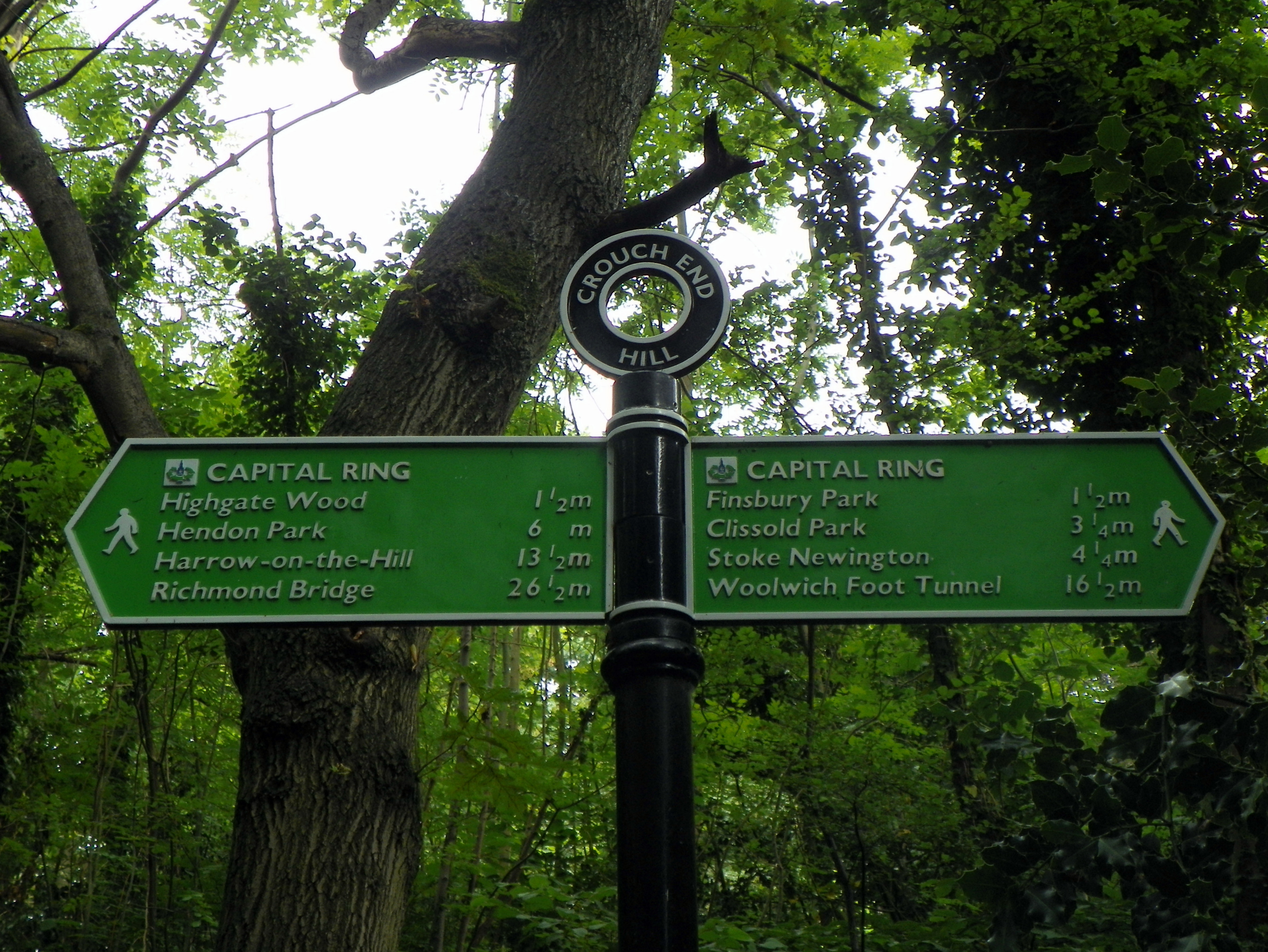
GOC Ally Pally 036: Capital Ring, Parkland Walk, Haringey — Peter O'Connor aka anemoneprojectors — CC BY-SA 2.0 (https://creativecommons.org/licenses/by-sa/2.0/) — https://www.flickr.com/photos/58414938@N00/28329882934/ — No local modifications.
Peter O'Connor aka anemoneprojectors
CC BY-SA 2.0
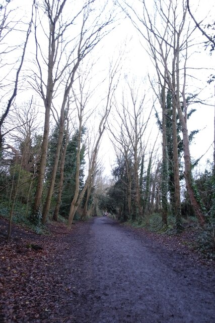
Parkland Walk in Crouch End — © DS Pugh — CC BY-SA 2.0 (https://creativecommons.org/licenses/by-sa/2.0/). https://www.geograph.org.uk/photo/7956746. Photograph dated 2025-01-07; licensor-published rendition, no local modifications.
DS Pugh
CC BY-SA 2.0
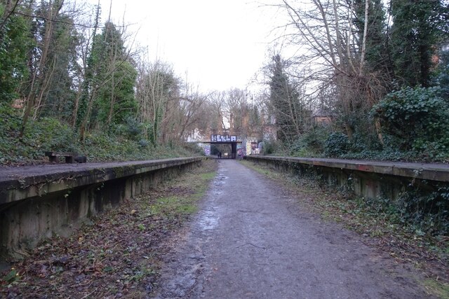
Former platforms at Crouch End — © DS Pugh — CC BY-SA 2.0 (https://creativecommons.org/licenses/by-sa/2.0/). https://www.geograph.org.uk/photo/7956741. Photograph dated 2025-01-07; licensor-published rendition, no local modifications.
DS Pugh
CC BY-SA 2.0
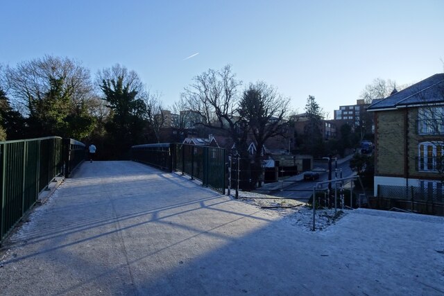
Frost on the bridge over Stanhope Road — © DS Pugh — CC BY-SA 2.0 (https://creativecommons.org/licenses/by-sa/2.0/). https://www.geograph.org.uk/photo/8233050. Photograph dated 2026-01-05; licensor-published rendition, no local modifications.
DS Pugh
CC BY-SA 2.0
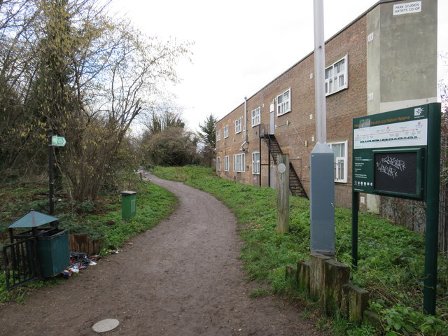
Parkland Walk at Finsbury Park — © Malc McDonald — CC BY-SA 2.0 (https://creativecommons.org/licenses/by-sa/2.0/). https://www.geograph.org.uk/photo/6033827. Photograph dated 2019-01-26; licensor-published rendition, no local modifications.
Malc McDonald
CC BY-SA 2.0
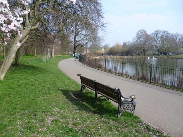
Path by West Lake in Clissold Park — © Marathon — CC BY-SA 2.0 (https://creativecommons.org/licenses/by-sa/2.0/). https://www.geograph.org.uk/photo/4390692. Photograph dated 2015-03-18; licensor-published rendition, no local modifications.
Marathon
CC BY-SA 2.0
View original activity in YouVisible
Weather on your route
Loading forecast…
Sources and credits
© OpenStreetMap contributors. Open Database License (ODbL) 1.0 — https://www.openstreetmap.org/copyright. Photographs have separate individual licences.
OpenStreetMap contributors · OpenStreetMap walking route relation · ODbL 1.0
Waymarks on the Parkland Walk
GOC Ally Pally 036: Capital Ring, Parkland Walk, Haringey — Peter O'Connor aka anemoneprojectors — CC BY-SA 2.0 (https://creativecommons.org/licenses/by-sa/2.0/) — https://www.flickr.com/photos/58414938@N00/28329882934/ — No local modifications.
Peter O'Connor aka anemoneprojectors · CC BY-SA 2.0 · Media source
Parkland Walk in Crouch End
Parkland Walk in Crouch End — © DS Pugh — CC BY-SA 2.0 (https://creativecommons.org/licenses/by-sa/2.0/). https://www.geograph.org.uk/photo/7956746. Photograph dated 2025-01-07; licensor-published rendition, no local modifications.
DS Pugh · CC BY-SA 2.0 · Media source
Former platforms at Crouch End
Former platforms at Crouch End — © DS Pugh — CC BY-SA 2.0 (https://creativecommons.org/licenses/by-sa/2.0/). https://www.geograph.org.uk/photo/7956741. Photograph dated 2025-01-07; licensor-published rendition, no local modifications.
DS Pugh · CC BY-SA 2.0 · Media source
Frost on the bridge over Stanhope Road
Frost on the bridge over Stanhope Road — © DS Pugh — CC BY-SA 2.0 (https://creativecommons.org/licenses/by-sa/2.0/). https://www.geograph.org.uk/photo/8233050. Photograph dated 2026-01-05; licensor-published rendition, no local modifications.
DS Pugh · CC BY-SA 2.0 · Media source
Parkland Walk at Finsbury Park
Parkland Walk at Finsbury Park — © Malc McDonald — CC BY-SA 2.0 (https://creativecommons.org/licenses/by-sa/2.0/). https://www.geograph.org.uk/photo/6033827. Photograph dated 2019-01-26; licensor-published rendition, no local modifications.
Malc McDonald · CC BY-SA 2.0 · Media source
Path by West Lake in Clissold Park
Path by West Lake in Clissold Park — © Marathon — CC BY-SA 2.0 (https://creativecommons.org/licenses/by-sa/2.0/). https://www.geograph.org.uk/photo/4390692. Photograph dated 2015-03-18; licensor-published rendition, no local modifications.
Marathon · CC BY-SA 2.0 · Media source