Find your next route
Explore hiking, running, trail running and cycling routes that suit your plans.

Community route
Capital Ring · Grove Park to Crystal Palace
Walk Capital Ring section 3 from Grove Park to Crystal Palace through south London’s green spaces and streets. The route links the two neighbourhoods in one direction; the return journey is separate. The gallery shows places and natural details from the route’s local setting. Follow current waymarks and check local access notices before walking.
By YouVisible Sport
Mapa del recorrido
Activity measurements
- distance meters
- 13,476.800979732
- end · latitude
- 51.4180868
- end · longitude
- -0.0730348
- start · latitude
- 51.4336993
- start · longitude
- 0.0280691
- Sport
- walking
- Specialty
- walking outdoor
From start to finish
- Country
- United Kingdom
- Province / region
- —
- Localities
- London
Before you go
- How to reach the start
- —
- Parking and access
- —
- Advice
- Plan access and the return journey, check current conditions and respect local restrictions.
- Recommended equipment
- —
- Terrain
- —
- Signage
- Capital Ring waymarks use Big Ben within a circle of arrows, as identified in the source route relation.
Characteristics and difficulty
- Estimated duration
- —
- Author perceived effort
- —
- Physical difficulty
- —
- Technical difficulty
- —
About the route
Walk Capital Ring section 3 from Grove Park to Crystal Palace through south London’s green spaces and streets. The route links the two neighbourhoods in one direction; the return journey is separate. The gallery shows places and natural details from the route’s local setting. Follow current waymarks and check local access notices before walking.
- Context
- —
- Specialty
- walking outdoor
- Event type
- —
- Description
- Places and natural details from the route and its local setting, with individual photographic credits and licences.
- Title
- Route highlights
- Title
- Sesión
- Description
- Walk Capital Ring section 3 from Grove Park to Crystal Palace through south London’s green spaces and streets. The route links the two neighbourhoods in one direction; the return journey is separate. The gallery shows places and natural details from the route’s local setting. Follow current waymarks and check local access notices before walking.
- Description
- Capital Ring direction signs photographed in Crystal Palace Park.
- Title
- Capital Ring signs at Crystal Palace
- Description
- Archive photograph from the south London area, published by Annie and Andrew.
- Title
- Crystal Palace athletics stadium
- Description
- Archive photograph of Downham Woodland Walk, taken 2011-09-18. This view does not establish current path or access conditions.
- Title
- Downham Woodland Walk
- Description
- Archive photograph of Downham Woodland Walk, taken 2013-05-09. This view does not establish current path or access conditions.
- Title
- Downham Woodland Walk
- Description
- Archive photograph of Path through Beckenham Place Park, taken 2010-05-09. This view does not establish current path or access conditions.
- Title
- Path through Beckenham Place Park
- Description
- Archive photograph of Junction of paths, Cator Park, Beckenham, taken 2015-07-30. This view does not establish current path or access conditions.
- Title
- Junction of paths, Cator Park, Beckenham
- Description
- Capital Ring direction signs photographed in Crystal Palace Park.
- Title
- Capital Ring signs at Crystal Palace
- Description
- Archive photograph from the south London area, published by Annie and Andrew.
- Title
- Crystal Palace athletics stadium
- Description
- Archive photograph of Downham Woodland Walk, taken 2011-09-18. This view does not establish current path or access conditions.
- Title
- Downham Woodland Walk
- Description
- Archive photograph of Downham Woodland Walk, taken 2013-05-09. This view does not establish current path or access conditions.
- Title
- Downham Woodland Walk
- Description
- Archive photograph of Path through Beckenham Place Park, taken 2010-05-09. This view does not establish current path or access conditions.
- Title
- Path through Beckenham Place Park
- Description
- Archive photograph of Junction of paths, Cator Park, Beckenham, taken 2015-07-30. This view does not establish current path or access conditions.
- Title
- Junction of paths, Cator Park, Beckenham
- Advice
- Plan access and the return journey, check current conditions and respect local restrictions.
- Signage
- Capital Ring waymarks use Big Ben within a circle of arrows, as identified in the source route relation.
- Title
- Capital Ring · Grove Park to Crystal Palace
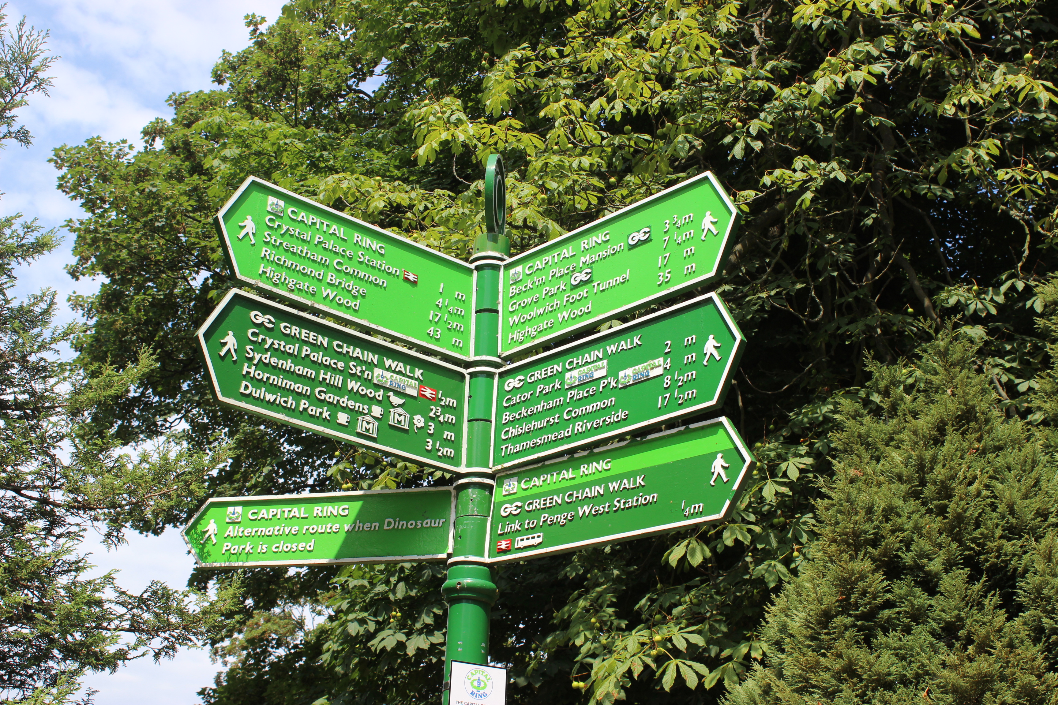
Capital Ring walking route sign in Crystal Palace Park. — Maggie Jones — Public domain (https://creativecommons.org/publicdomain/mark/1.0/) — https://www.flickr.com/photos/24329363@N00/14796622773/ — No local modifications.
Maggie Jones
Public domain
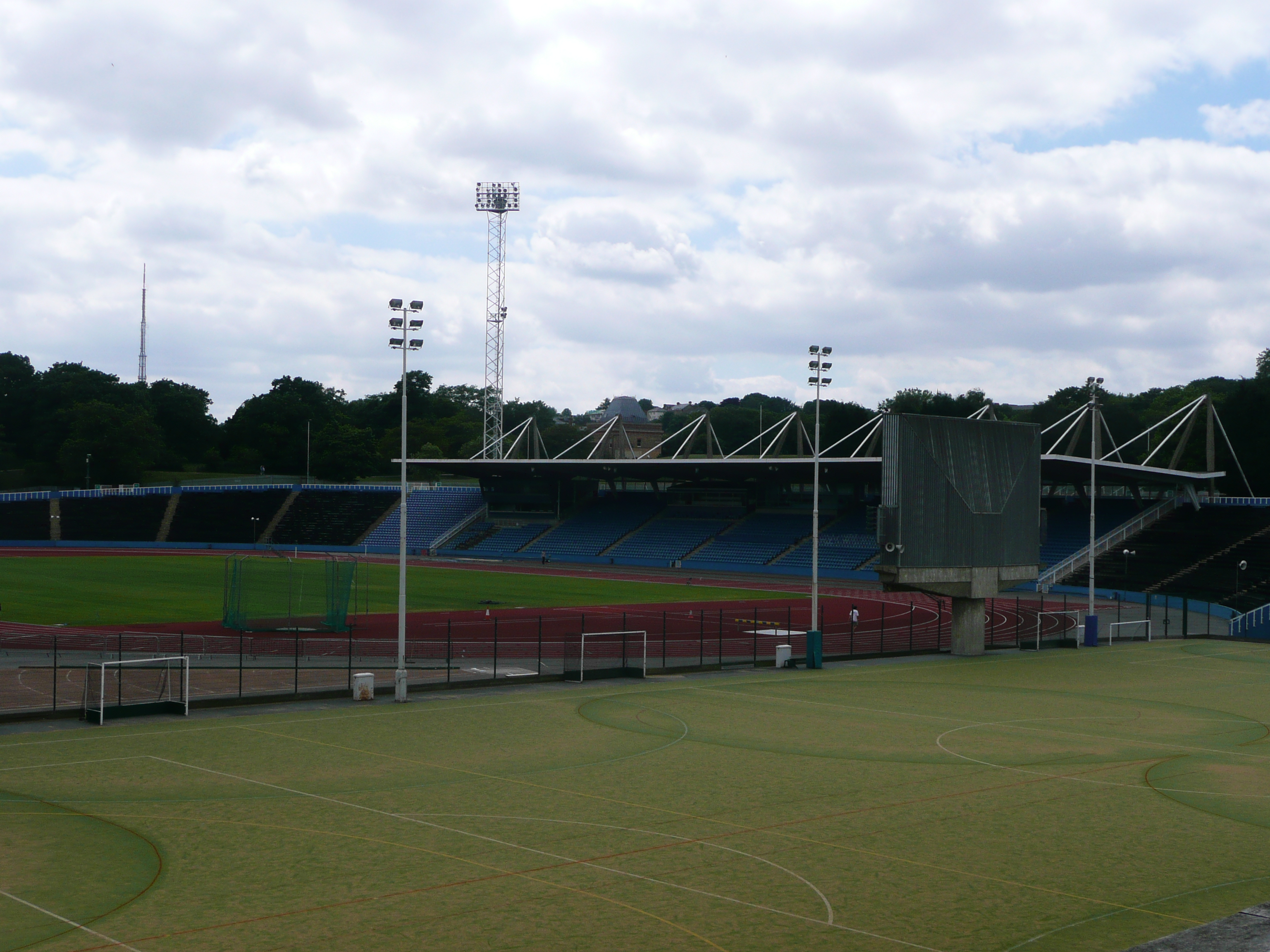
Crystal Palace Athletic Stadium — Annie and Andrew — CC BY 2.0 (https://creativecommons.org/licenses/by/2.0/) — https://www.flickr.com/photos/56175063@N07/5199647590/ — No local modifications.
Annie and Andrew
CC BY 2.0
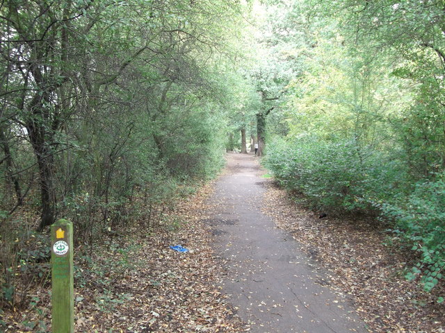
Downham Woodland Walk — © David Anstiss — CC BY-SA 2.0 (https://creativecommons.org/licenses/by-sa/2.0/). https://www.geograph.org.uk/photo/2612513. Photograph dated 2011-09-18; licensor-published rendition, no local modifications.
David Anstiss
CC BY-SA 2.0
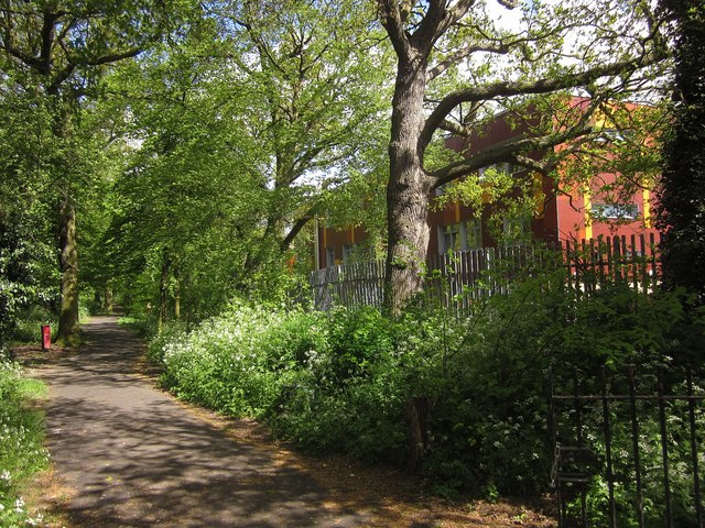
Downham Woodland Walk — © Derek Harper — CC BY-SA 2.0 (https://creativecommons.org/licenses/by-sa/2.0/). https://www.geograph.org.uk/photo/3460177. Photograph dated 2013-05-09; licensor-published rendition, no local modifications.
Derek Harper
CC BY-SA 2.0
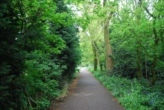
Path through Beckenham Place Park — © N Chadwick — CC BY-SA 2.0 (https://creativecommons.org/licenses/by-sa/2.0/). https://www.geograph.org.uk/photo/1946836. Photograph dated 2010-05-09; licensor-published rendition, no local modifications.
N Chadwick
CC BY-SA 2.0
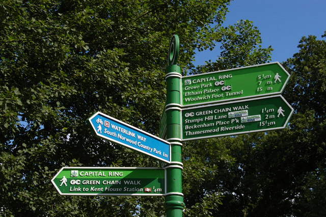
Junction of paths, Cator Park, Beckenham — © Christopher Hilton — CC BY-SA 2.0 (https://creativecommons.org/licenses/by-sa/2.0/). https://www.geograph.org.uk/photo/4925202. Photograph dated 2015-07-30; licensor-published rendition, no local modifications.
Christopher Hilton
CC BY-SA 2.0
View original activity in YouVisible
Weather on your route
Loading forecast…
Sources and credits
© OpenStreetMap contributors. Open Database License (ODbL) 1.0 — https://www.openstreetmap.org/copyright. Photographs have separate individual licences.
OpenStreetMap contributors · OpenStreetMap walking route relation · ODbL 1.0
Capital Ring signs at Crystal Palace
Capital Ring walking route sign in Crystal Palace Park. — Maggie Jones — Public domain (https://creativecommons.org/publicdomain/mark/1.0/) — https://www.flickr.com/photos/24329363@N00/14796622773/ — No local modifications.
Maggie Jones · Public domain · Media source
Crystal Palace athletics stadium
Crystal Palace Athletic Stadium — Annie and Andrew — CC BY 2.0 (https://creativecommons.org/licenses/by/2.0/) — https://www.flickr.com/photos/56175063@N07/5199647590/ — No local modifications.
Annie and Andrew · CC BY 2.0 · Media source
Downham Woodland Walk
Downham Woodland Walk — © David Anstiss — CC BY-SA 2.0 (https://creativecommons.org/licenses/by-sa/2.0/). https://www.geograph.org.uk/photo/2612513. Photograph dated 2011-09-18; licensor-published rendition, no local modifications.
David Anstiss · CC BY-SA 2.0 · Media source
Downham Woodland Walk
Downham Woodland Walk — © Derek Harper — CC BY-SA 2.0 (https://creativecommons.org/licenses/by-sa/2.0/). https://www.geograph.org.uk/photo/3460177. Photograph dated 2013-05-09; licensor-published rendition, no local modifications.
Derek Harper · CC BY-SA 2.0 · Media source
Path through Beckenham Place Park
Path through Beckenham Place Park — © N Chadwick — CC BY-SA 2.0 (https://creativecommons.org/licenses/by-sa/2.0/). https://www.geograph.org.uk/photo/1946836. Photograph dated 2010-05-09; licensor-published rendition, no local modifications.
N Chadwick · CC BY-SA 2.0 · Media source
Junction of paths, Cator Park, Beckenham
Junction of paths, Cator Park, Beckenham — © Christopher Hilton — CC BY-SA 2.0 (https://creativecommons.org/licenses/by-sa/2.0/). https://www.geograph.org.uk/photo/4925202. Photograph dated 2015-07-30; licensor-published rendition, no local modifications.
Christopher Hilton · CC BY-SA 2.0 · Media source