Find your next route
Explore hiking, running, trail running and cycling routes that suit your plans.

Community route
Carran Loop · stone fields and grassy lanes
Explore the Clab Valley, grassy lanes and limestone fields around Carran on the Carran Loop. Sport Ireland describes a route past St Fachtnan’s Holy Well, Termon Hill and a seasonal turlough. The reference starts near the village and finishes at the approach junction after the circuit; allow for the short remaining return. Corofin is the locality reference, while the photographs show the Carran countryside.
By YouVisible Sport
Mapa del recorrido
Activity measurements
- distance meters
- 9,336.0328141021
- end · latitude
- 53.0362151
- end · longitude
- -9.0765279
- start · latitude
- 53.0350862
- start · longitude
- -9.0767728
- Sport
- walking
- Specialty
- walking outdoor
From start to finish
- Country
- Ireland
- Province / region
- —
- Localities
- Corofin
Before you go
- How to reach the start
- —
- Parking and access
- Dogs are not allowed. Limestone pavement can be slippery during or after wet weather. Follow local trail notices and the permitted line of the walk.
- Advice
- Dogs are not allowed. Limestone pavement can be slippery during or after wet weather. Sport Ireland grades the full official trail Strenuous. Check current trail notices and weather before walking.
- Recommended equipment
- —
- Terrain
- Minor roads, animal tracks, grassy lanes and limestone fields.
- Signage
- Purple arrows.
Characteristics and difficulty
- Estimated duration
- —
- Author perceived effort
- —
- Physical difficulty
- —
- Technical difficulty
- —
About the route
Explore the Clab Valley, grassy lanes and limestone fields around Carran on the Carran Loop. Sport Ireland describes a route past St Fachtnan’s Holy Well, Termon Hill and a seasonal turlough. The reference starts near the village and finishes at the approach junction after the circuit; allow for the short remaining return. Corofin is the locality reference, while the photographs show the Carran countryside.
- Context
- —
- Specialty
- walking outdoor
- Event type
- —
- Description
- Places and natural details from the route and its local setting, with individual photographic credits and licences.
- Title
- Route highlights
- Title
- Sesión
- Description
- Explore the Clab Valley, grassy lanes and limestone fields around Carran on the Carran Loop. Sport Ireland describes a route past St Fachtnan’s Holy Well, Termon Hill and a seasonal turlough. The reference starts near the village and finishes at the approach junction after the circuit; allow for the short remaining return. Corofin is the locality reference, while the photographs show the Carran countryside.
- Description
- The lane from Carran to Teampall Chrónáin. Photograph by Oliver Dixon, dated 2013-07-16 in the source. Historical view of the Carran Loop landscape or track; no claim of current access or conditions.
- Title
- Lane and stone walls on the Carran Loop
- Description
- The main road through Carran, Co. Clare. Photograph by P L Chadwick, dated 2011-09-20 in the source. Historical view of the Carran Loop landscape or track; no claim of current access or conditions.
- Title
- Main-road junction at the Carran trailhead
- Description
- The Old Bog Road, Carran. Photograph by Oliver Dixon, dated 2013-07-16 in the source. Historical view of the Carran Loop landscape or track; no claim of current access or conditions.
- Title
- Old Bog Road junction and purple waymark
- Description
- Limestone path in the Teampall Chrónáin area beside the Carran Loop, identified by the photographer. Photograph by Oliver Dixon, dated 16 July 2013. This does not add a church visit or assert an exact camera position on the GPX.
- Title
- Limestone path beside the Carran Loop
- Description
- Limestone pavement in the Burren. Photograph by Oliver Dixon, dated 2013-07-16 in the source. Historical view of the Carran Loop landscape or track; no claim of current access or conditions.
- Title
- Limestone pavement and fields by the Carran Loop
- Description
- Best to heed the warning sign. Photograph by Gordon Hatton, dated 2015-09-25 in the source. Historical view of the Carran Loop landscape or track; no claim of current access or conditions.
- Title
- Footpath entrance from the Old Bog Road junction
- Description
- The lane from Carran to Teampall Chrónáin. Photograph by Oliver Dixon, dated 2013-07-16 in the source. Historical view of the Carran Loop landscape or track; no claim of current access or conditions.
- Title
- Lane and stone walls on the Carran Loop
- Description
- The main road through Carran, Co. Clare. Photograph by P L Chadwick, dated 2011-09-20 in the source. Historical view of the Carran Loop landscape or track; no claim of current access or conditions.
- Title
- Main-road junction at the Carran trailhead
- Description
- The Old Bog Road, Carran. Photograph by Oliver Dixon, dated 2013-07-16 in the source. Historical view of the Carran Loop landscape or track; no claim of current access or conditions.
- Title
- Old Bog Road junction and purple waymark
- Description
- Limestone path in the Teampall Chrónáin area beside the Carran Loop, identified by the photographer. Photograph by Oliver Dixon, dated 16 July 2013. This does not add a church visit or assert an exact camera position on the GPX.
- Title
- Limestone path beside the Carran Loop
- Description
- Limestone pavement in the Burren. Photograph by Oliver Dixon, dated 2013-07-16 in the source. Historical view of the Carran Loop landscape or track; no claim of current access or conditions.
- Title
- Limestone pavement and fields by the Carran Loop
- Description
- Best to heed the warning sign. Photograph by Gordon Hatton, dated 2015-09-25 in the source. Historical view of the Carran Loop landscape or track; no claim of current access or conditions.
- Title
- Footpath entrance from the Old Bog Road junction
- Advice
- Dogs are not allowed. Limestone pavement can be slippery during or after wet weather. Sport Ireland grades the full official trail Strenuous. Check current trail notices and weather before walking.
- Parking and access
- Dogs are not allowed. Limestone pavement can be slippery during or after wet weather. Follow local trail notices and the permitted line of the walk.
- Signage
- Purple arrows.
- Terrain
- Minor roads, animal tracks, grassy lanes and limestone fields.
- Title
- Carran Loop · stone fields and grassy lanes
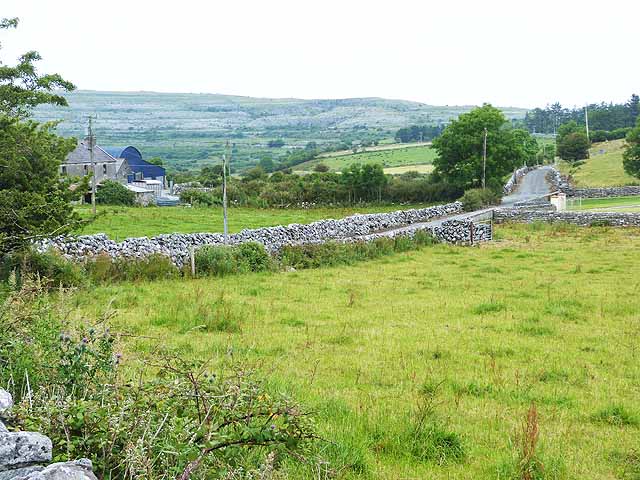
The lane from Carran to Teampall Chrónáin — Oliver Dixon — CC BY-SA 2.0 (https://creativecommons.org/licenses/by-sa/2.0/) — https://www.geograph.org.uk/photo/3567571. Photograph dated 2013-07-16. Publisher-provided 640px image; no local modifications.
Oliver Dixon
CC BY-SA 2.0
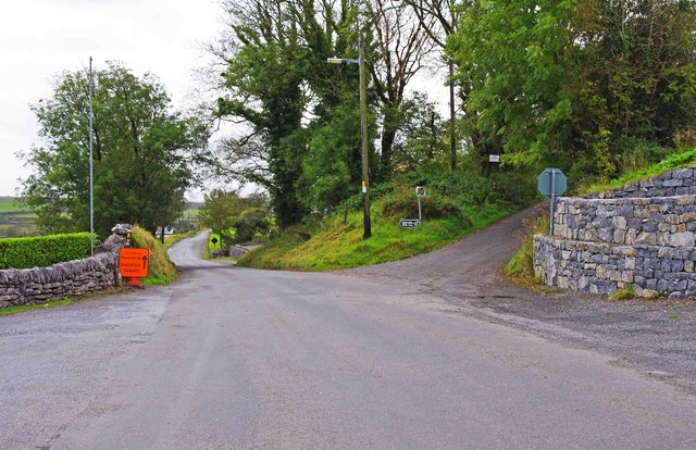
The main road through Carran, Co. Clare — P L Chadwick — CC BY-SA 2.0 (https://creativecommons.org/licenses/by-sa/2.0/) — https://www.geograph.org.uk/photo/3029351. Photograph dated 2011-09-20. Publisher-provided 640px image; no local modifications.
P L Chadwick
CC BY-SA 2.0
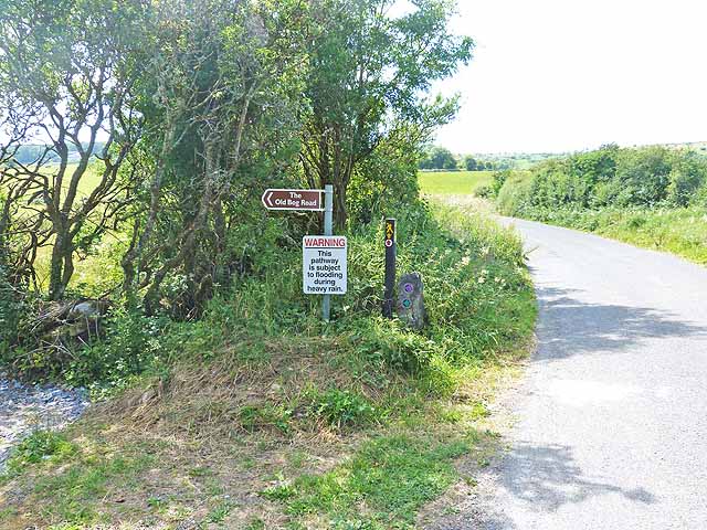
The Old Bog Road, Carran — Oliver Dixon — CC BY-SA 2.0 (https://creativecommons.org/licenses/by-sa/2.0/) — https://www.geograph.org.uk/photo/3567581. Photograph dated 2013-07-16. Publisher-provided 640px image; no local modifications.
Oliver Dixon
CC BY-SA 2.0
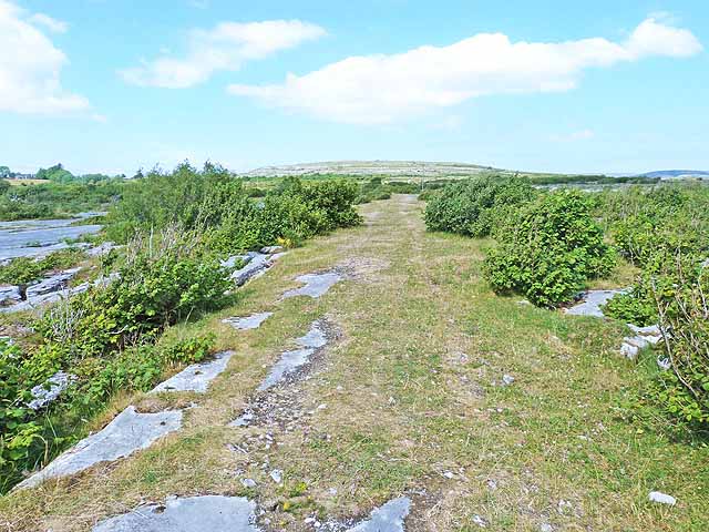
Path from Teampall Chrónáin — Oliver Dixon — CC BY-SA 2.0 (https://creativecommons.org/licenses/by-sa/2.0/) — https://www.geograph.org.uk/photo/3567593. Photograph dated 2013-07-16. Publisher-provided 640px image; no local modifications.
Oliver Dixon
CC BY-SA 2.0
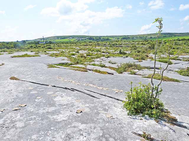
Limestone pavement in the Burren — Oliver Dixon — CC BY-SA 2.0 (https://creativecommons.org/licenses/by-sa/2.0/) — https://www.geograph.org.uk/photo/3567597. Photograph dated 2013-07-16. Publisher-provided 640px image; no local modifications.
Oliver Dixon
CC BY-SA 2.0
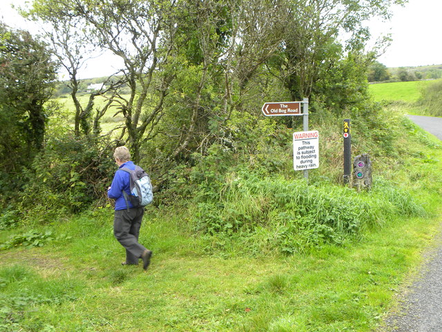
Best to heed the warning sign — Gordon Hatton — CC BY-SA 2.0 (https://creativecommons.org/licenses/by-sa/2.0/) — https://www.geograph.org.uk/photo/4695541. Photograph dated 2015-09-25. Publisher-provided 640px image; no local modifications.
Gordon Hatton
CC BY-SA 2.0
View original activity in YouVisible
Weather on your route
Loading forecast…
Sources and credits
Sport Ireland. Get Ireland Active Trail Routes. CC BY 4.0 — https://creativecommons.org/licenses/by/4.0/. Photographs have separate individual licences.
Sport Ireland · Get Ireland Active Trail Routes · CC BY 4.0
Lane and stone walls on the Carran Loop
The lane from Carran to Teampall Chrónáin — Oliver Dixon — CC BY-SA 2.0 (https://creativecommons.org/licenses/by-sa/2.0/) — https://www.geograph.org.uk/photo/3567571. Photograph dated 2013-07-16. Publisher-provided 640px image; no local modifications.
Oliver Dixon · CC BY-SA 2.0 · Media source
Main-road junction at the Carran trailhead
The main road through Carran, Co. Clare — P L Chadwick — CC BY-SA 2.0 (https://creativecommons.org/licenses/by-sa/2.0/) — https://www.geograph.org.uk/photo/3029351. Photograph dated 2011-09-20. Publisher-provided 640px image; no local modifications.
P L Chadwick · CC BY-SA 2.0 · Media source
Old Bog Road junction and purple waymark
The Old Bog Road, Carran — Oliver Dixon — CC BY-SA 2.0 (https://creativecommons.org/licenses/by-sa/2.0/) — https://www.geograph.org.uk/photo/3567581. Photograph dated 2013-07-16. Publisher-provided 640px image; no local modifications.
Oliver Dixon · CC BY-SA 2.0 · Media source
Limestone path beside the Carran Loop
Path from Teampall Chrónáin — Oliver Dixon — CC BY-SA 2.0 (https://creativecommons.org/licenses/by-sa/2.0/) — https://www.geograph.org.uk/photo/3567593. Photograph dated 2013-07-16. Publisher-provided 640px image; no local modifications.
Oliver Dixon · CC BY-SA 2.0 · Media source
Limestone pavement and fields by the Carran Loop
Limestone pavement in the Burren — Oliver Dixon — CC BY-SA 2.0 (https://creativecommons.org/licenses/by-sa/2.0/) — https://www.geograph.org.uk/photo/3567597. Photograph dated 2013-07-16. Publisher-provided 640px image; no local modifications.
Oliver Dixon · CC BY-SA 2.0 · Media source
Footpath entrance from the Old Bog Road junction
Best to heed the warning sign — Gordon Hatton — CC BY-SA 2.0 (https://creativecommons.org/licenses/by-sa/2.0/) — https://www.geograph.org.uk/photo/4695541. Photograph dated 2015-09-25. Publisher-provided 640px image; no local modifications.
Gordon Hatton · CC BY-SA 2.0 · Media source