Find your next route
Explore hiking, running, trail running and cycling routes that suit your plans.

Community route
Tony Knowles Coastal Trail · Downtown Anchorage to Kincaid
Follow the Tony Knowles Coastal Trail from Downtown Anchorage towards Kincaid, passing Cook Inlet shoreline, wetlands and wooded coastal terrain. This one-way reference preserves the complete OpenStreetMap walking-route relation, including its final shared Raspberry Multi-Use segment near Kincaid; no return or extra road link is added. Visit Anchorage describes the trail as a route for pedestrians and cyclists, with winter skiing as well. The archive photographs introduce the downtown trail entrance and nearby shore and wetland scenery. They do not show current snow, ice, wildlife or access conditions.
By YouVisible Sport
Mapa del recorrido
Activity measurements
- distance meters
- 16,564.6740976631
- end · latitude
- 61.1533374
- end · longitude
- -150.0548332
- start · latitude
- 61.2205586
- start · longitude
- -149.8975646
- Sport
- walking
- Specialty
- walking outdoor
From start to finish
Beginning of the source reference; no approach added.
Go to start · Google MapsEnd of the source reference; return not included.
Go to finish · Google Maps- Country
- United States
- Province / region
- —
- Localities
- Anchorage
Before you go
- How to reach the start
- —
- Parking and access
- The original walking relation and all thirty member ways explicitly allow or designate pedestrian use. Check Anchorage Parks and Recreation notices and winter trail conditions before visiting. Current opening, grooming, parking availability and parking coordinates are not confirmed. Plan transport separately for this one-way route.
- Advice
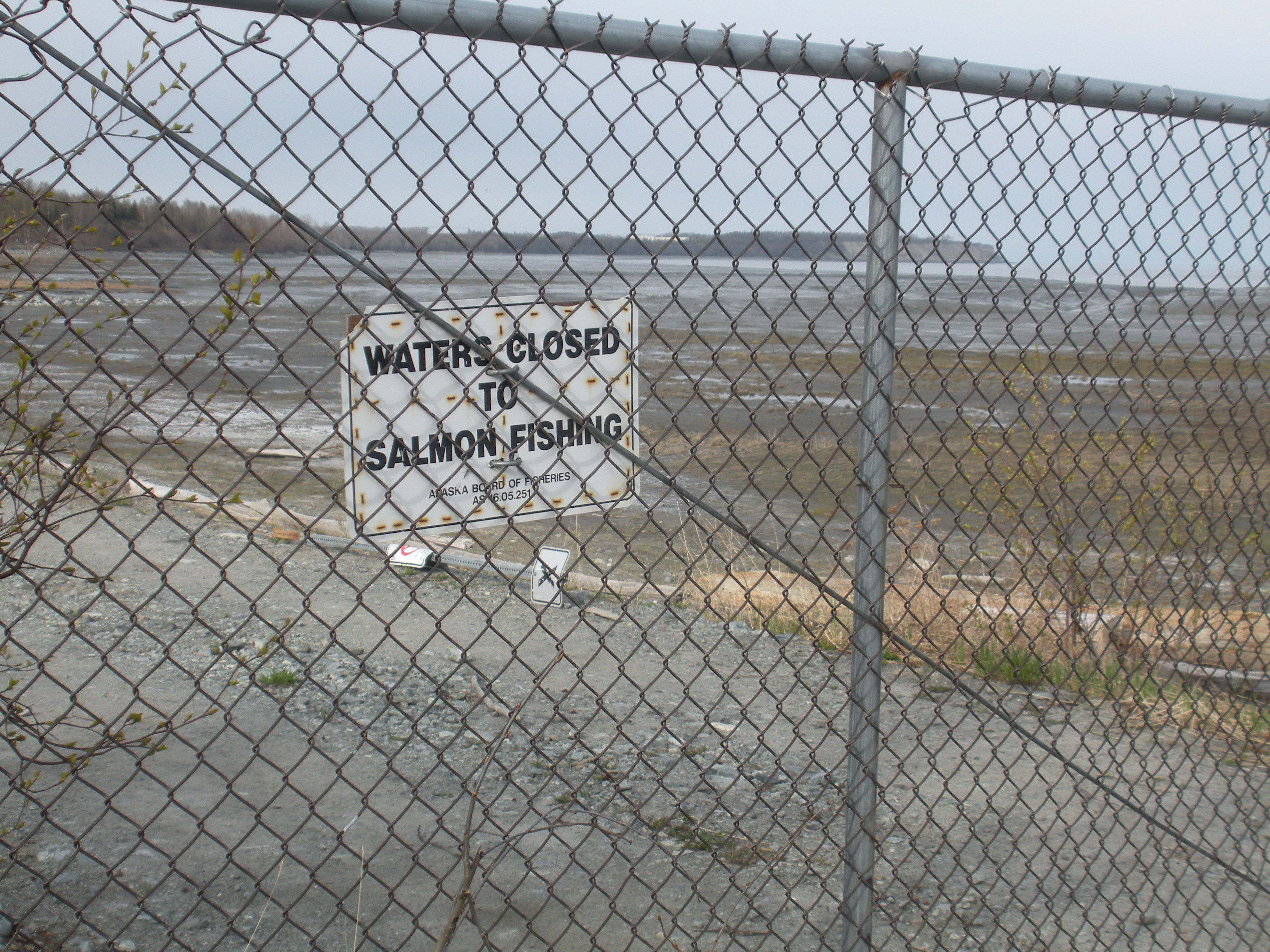
- Share the path with cyclists and winter trail users and follow current municipal guidance. Snow, ice and short winter daylight can affect travel. Keep your distance from moose and other wildlife. Stay on the trail rather than walking onto tidal mudflats or inlet ice. The archive fishing-closure sign is retained as historical context, not a statement of current fishing rules.
- Recommended equipment
- Walking shoes suitable for verified conditions, warm layers, windproof and waterproof clothing, water, an offline map and a charged phone. Assess any need for winter traction from current conditions and local guidance.
- Terrain
- Shared paved or asphalt path, with a concrete underpass and bridges recorded in the original map. Some member ways do not specify a surface; no complete current surface inspection is claimed.
- Signage
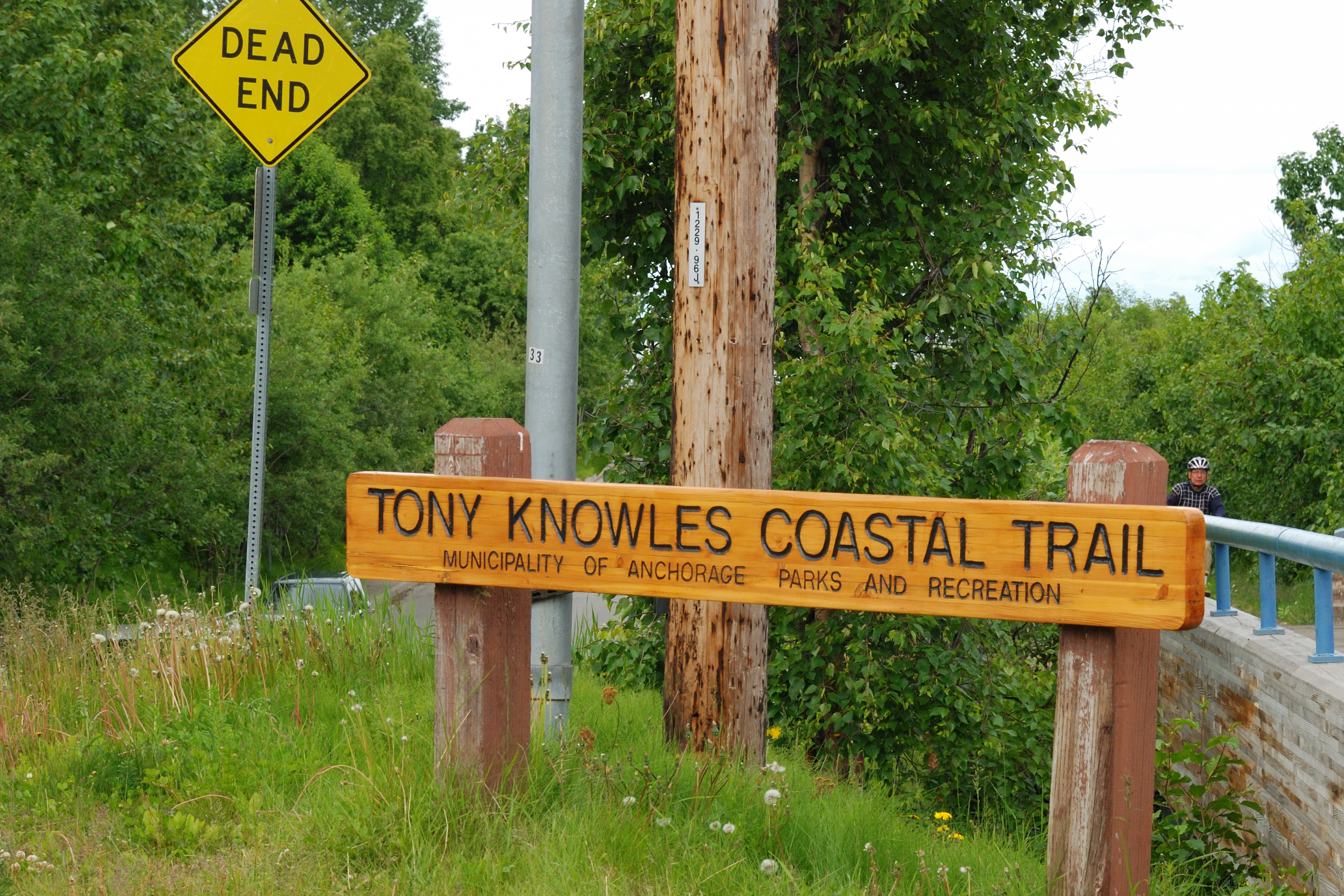
- Archive photographs show the named municipal trail signs at the downtown entrance. Current condition and the completeness of waymarking along the full trail are unknown.
Characteristics and difficulty
- Estimated duration
- —
- Author perceived effort
- —
- Physical difficulty
- —
- Technical difficulty
- —
About the route
Follow the Tony Knowles Coastal Trail from Downtown Anchorage towards Kincaid, passing Cook Inlet shoreline, wetlands and wooded coastal terrain. This one-way reference preserves the complete OpenStreetMap walking-route relation, including its final shared Raspberry Multi-Use segment near Kincaid; no return or extra road link is added. Visit Anchorage describes the trail as a route for pedestrians and cyclists, with winter skiing as well. The archive photographs introduce the downtown trail entrance and nearby shore and wetland scenery. They do not show current snow, ice, wildlife or access conditions.
- Context
- —
- Specialty
- walking outdoor
- Event type
- —
- Description
- Archive photographs of the route and its local setting. Context images outside the track are identified in their captions; none establishes current access or conditions.
- Title
- Route highlights
- Title
- Sesión
- Description
- Follow the Tony Knowles Coastal Trail from Downtown Anchorage towards Kincaid, passing Cook Inlet shoreline, wetlands and wooded coastal terrain. This one-way reference preserves the complete OpenStreetMap walking-route relation, including its final shared Raspberry Multi-Use segment near Kincaid; no return or extra road link is added. Visit Anchorage describes the trail as a route for pedestrians and cyclists, with winter skiing as well. The archive photographs introduce the downtown trail entrance and nearby shore and wetland scenery. They do not show current snow, ice, wildlife or access conditions.
- Description
- Archive view of the municipal Tony Knowles Coastal Trail sign at the downtown entrance.
- Title
- The coastal trail entrance
- Description
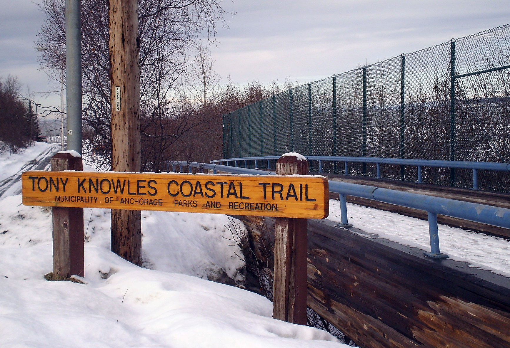
- A separate archive winter view of the named trail entrance. It does not show present snow or access conditions.
- Title
- The entrance in winter
- Description
- An archive fishing-closure sign near the trail. Consult current rules; this image does not establish today’s restrictions.
- Title
- A historical waterside notice
- Description
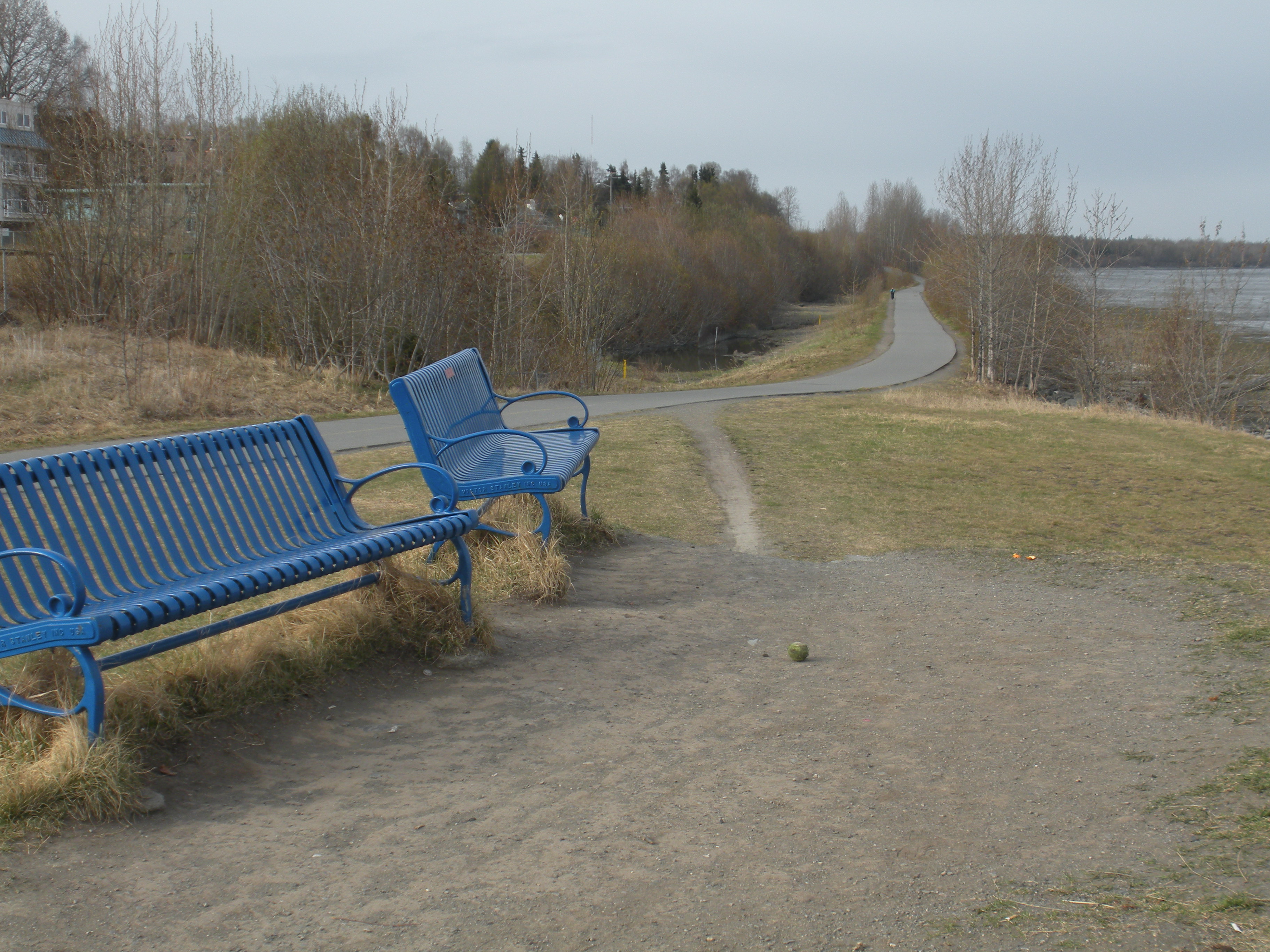
- Archive view of a bench and the path near the coastal trail’s downtown end.
- Title
- A bench beside the path
- Description
- A vertical archive view of the shoreline and wetland setting near the trail. Remain on permitted paths rather than entering tidal mudflats.
- Title
- Shoreline and driftwood
- Description
- Archive view across the wetland landscape near the trail, with mountains beyond.
- Title
- Mountains beyond the wetland
- Description
- Archive view of the municipal Tony Knowles Coastal Trail sign at the downtown entrance.
- Title
- The coastal trail entrance
- Description
- A separate archive winter view of the named trail entrance. It does not show present snow or access conditions.
- Title
- The entrance in winter
- Description
- An archive fishing-closure sign near the trail. Consult current rules; this image does not establish today’s restrictions.
- Title
- A historical waterside notice
- Description
- Archive view of a bench and the path near the coastal trail’s downtown end.
- Title
- A bench beside the path
- Description
- A vertical archive view of the shoreline and wetland setting near the trail. Remain on permitted paths rather than entering tidal mudflats.
- Title
- Shoreline and driftwood
- Description
- Archive view across the wetland landscape near the trail, with mountains beyond.
- Title
- Mountains beyond the wetland
- Advice
- Share the path with cyclists and winter trail users and follow current municipal guidance. Snow, ice and short winter daylight can affect travel. Keep your distance from moose and other wildlife. Stay on the trail rather than walking onto tidal mudflats or inlet ice. The archive fishing-closure sign is retained as historical context, not a statement of current fishing rules.
- Description
- End of the source reference; return not included.
- Parking and access
- The original walking relation and all thirty member ways explicitly allow or designate pedestrian use. Check Anchorage Parks and Recreation notices and winter trail conditions before visiting. Current opening, grooming, parking availability and parking coordinates are not confirmed. Plan transport separately for this one-way route.
- Recommended equipment
- Walking shoes suitable for verified conditions, warm layers, windproof and waterproof clothing, water, an offline map and a charged phone. Assess any need for winter traction from current conditions and local guidance.
- Signage
- Archive photographs show the named municipal trail signs at the downtown entrance. Current condition and the completeness of waymarking along the full trail are unknown.
- Description
- Beginning of the source reference; no approach added.
- Terrain
- Shared paved or asphalt path, with a concrete underpass and bridges recorded in the original map. Some member ways do not specify a surface; no complete current surface inspection is claimed.
- Title
- Tony Knowles Coastal Trail · Downtown Anchorage to Kincaid
Tony Knowles Coastal Trail — Andrei Taranchenko — CC BY 2.0 — https://www.flickr.com/photos/9702212@N03/2644212780/
Andrei Taranchenko
CC BY 2.0
Tony Knowles Coastal Trail — James Brooks — CC BY 2.0 — https://www.flickr.com/photos/68679992@N00/5588287442/
James Brooks
CC BY 2.0
Tony Knowles Coastal Trail — Jason Riedy — CC BY 2.0 — https://www.flickr.com/photos/66142667@N00/5725321805/
Jason Riedy
CC BY 2.0
Tony Knowles Coastal Trail — Jason Riedy — CC BY 2.0 — https://www.flickr.com/photos/66142667@N00/5725859428/
Jason Riedy
CC BY 2.0
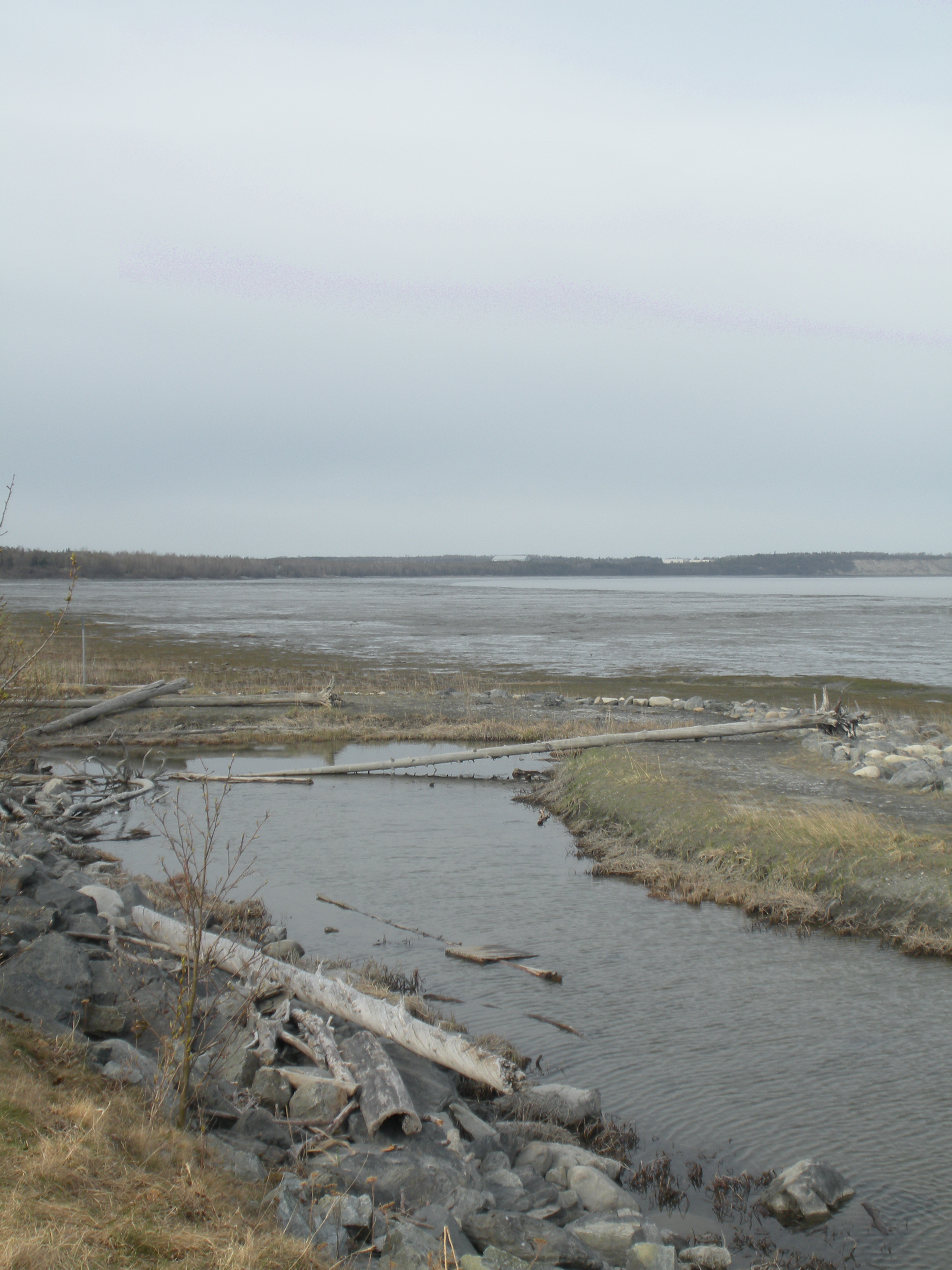
Tony Knowles Coastal Trail — Jason Riedy — CC BY 2.0 — https://www.flickr.com/photos/66142667@N00/5725862208/
Jason Riedy
CC BY 2.0
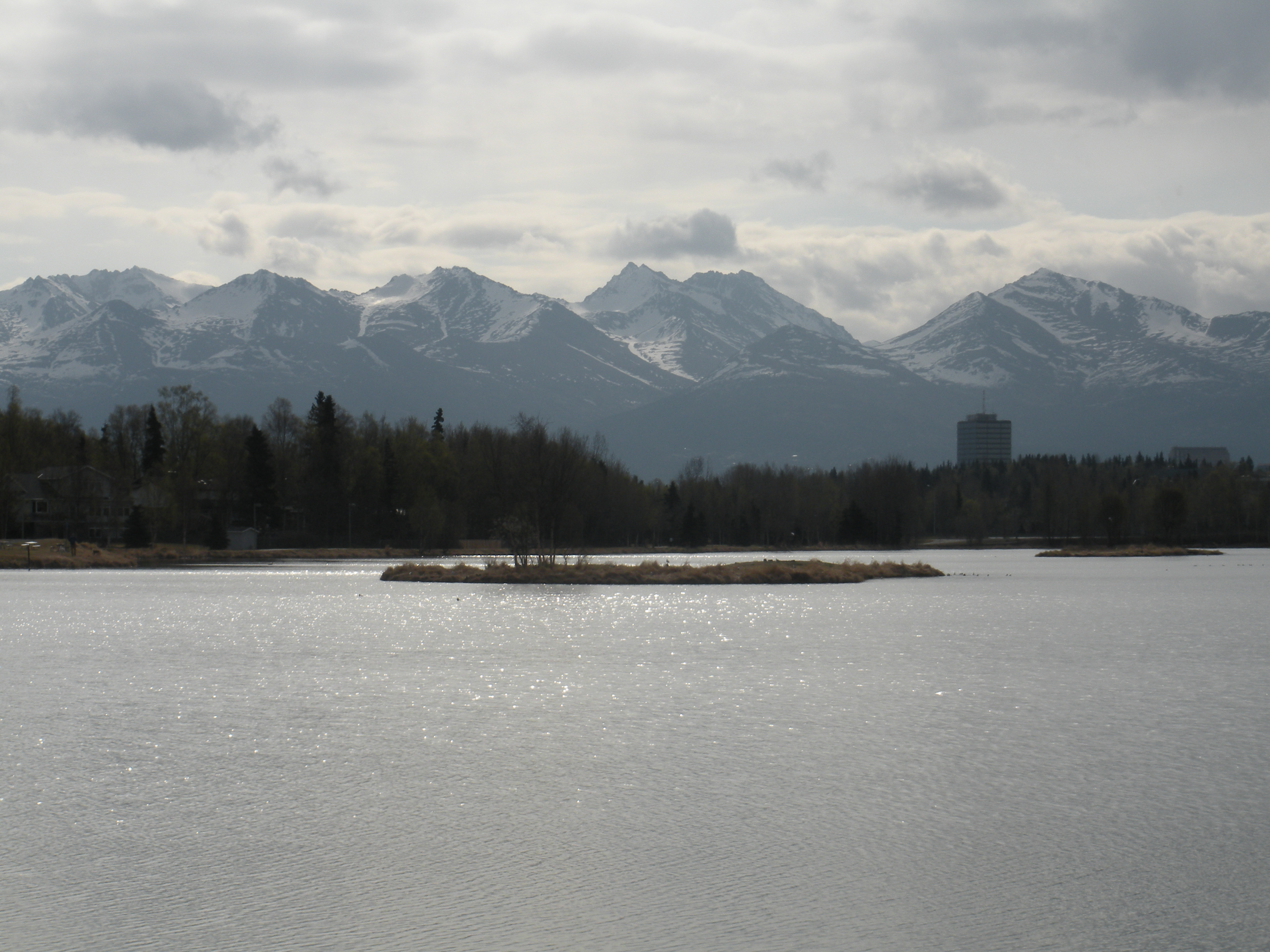
Tony Knowles Coastal Trail — Jason Riedy — CC BY 2.0 — https://www.flickr.com/photos/66142667@N00/5725900566/
Jason Riedy
CC BY 2.0
View original activity in YouVisible
Weather on your route
Loading forecast…
Sources and credits
© OpenStreetMap contributors — https://www.openstreetmap.org/copyright — ODbL 1.0. Faithful GPX conversion of walking relation 16693695; original database and member versions retained. Photographs have separate individual licences.
OpenStreetMap contributors · OpenStreetMap walking route relation · ODbL 1.0
The coastal trail entrance
Tony Knowles Coastal Trail — Andrei Taranchenko — CC BY 2.0 — https://www.flickr.com/photos/9702212@N03/2644212780/
Andrei Taranchenko · CC BY 2.0 · Media source
The entrance in winter
Tony Knowles Coastal Trail — James Brooks — CC BY 2.0 — https://www.flickr.com/photos/68679992@N00/5588287442/
James Brooks · CC BY 2.0 · Media source
A historical waterside notice
Tony Knowles Coastal Trail — Jason Riedy — CC BY 2.0 — https://www.flickr.com/photos/66142667@N00/5725321805/
Jason Riedy · CC BY 2.0 · Media source
A bench beside the path
Tony Knowles Coastal Trail — Jason Riedy — CC BY 2.0 — https://www.flickr.com/photos/66142667@N00/5725859428/
Jason Riedy · CC BY 2.0 · Media source
Shoreline and driftwood
Tony Knowles Coastal Trail — Jason Riedy — CC BY 2.0 — https://www.flickr.com/photos/66142667@N00/5725862208/
Jason Riedy · CC BY 2.0 · Media source
Mountains beyond the wetland
Tony Knowles Coastal Trail — Jason Riedy — CC BY 2.0 — https://www.flickr.com/photos/66142667@N00/5725900566/
Jason Riedy · CC BY 2.0 · Media source