Find your next route
Explore hiking, running, trail running and cycling routes that suit your plans.

Community route
Savage Alpine Trail · campground to the river area
Cross the open slopes above the Savage River area on this mapped one-way reference for the Savage Alpine Trail in Denali National Park. The NPS alignment starts near Savage River Campground and ends by the river-area trailhead; no return or park-road connection is added. Forest gives way to exposed mountain terrain and broad valley views. The photographs combine the Alpine Trail’s start with clearly identified views of the surrounding Savage River valley and the separate riverside loop. Healy is the nearby catalogue town, not the start of the walk. The NPS source flags a winter seasonal closure, and current opening has not been confirmed.
By YouVisible Sport
Mapa del recorrido
Activity measurements
- distance meters
- 6,820.8806696691
- end · latitude
- 63.7400386
- end · longitude
- -149.2915202
- start · latitude
- 63.7157983
- start · longitude
- -149.2547003
- Sport
- hiking mountaineering
- Specialty
- Hiking
From start to finish
Beginning of the source reference; no approach added.
Go to start · Google MapsEnd of the source reference; return not included.
Go to finish · Google Maps- Country
- United States
- Province / region
- —
- Localities
- Healy
Before you go
- How to reach the start
- —
- Parking and access
- Check current Denali National Park notices, trail restrictions and park-road access. The mapped trail has a winter seasonal closure flag. The start is near Savage River Campground and the end near the river area; present parking availability and road opening are unknown.
- Advice
- This is an archive route reference, not confirmation that the trail is open or suitable now. Exposed terrain, snow, ice, wind, cold and short winter daylight require separate assessment. Respect closure notices, keep away from wildlife and plan return transport. The riverside loop shown in context photographs is a separate route and is not added to this track.
- Recommended equipment
- Suitable footwear, warm layers, waterproof and windproof clothing, water, food, offline navigation and a charged phone. Winter equipment and skills depend on verified conditions and park guidance.
- Terrain
- Native-surface mountain footpath through forest and exposed alpine slopes. Uneven and rocky sections; the source has no valid measured elevation series.
- Signage
- —
Characteristics and difficulty
- Estimated duration
- —
- Author perceived effort
- —
- Physical difficulty
- —
- Technical difficulty
- —
About the route
Cross the open slopes above the Savage River area on this mapped one-way reference for the Savage Alpine Trail in Denali National Park. The NPS alignment starts near Savage River Campground and ends by the river-area trailhead; no return or park-road connection is added. Forest gives way to exposed mountain terrain and broad valley views. The photographs combine the Alpine Trail’s start with clearly identified views of the surrounding Savage River valley and the separate riverside loop. Healy is the nearby catalogue town, not the start of the walk. The NPS source flags a winter seasonal closure, and current opening has not been confirmed.
- Context
- —
- Specialty
- Hiking
- Event type
- —
- Description
- Archive photographs of the route and its local setting. Context images outside the track are identified in their captions; none establishes current access or conditions.
- Title
- Route highlights
- Title
- Sesión
- Description
- Cross the open slopes above the Savage River area on this mapped one-way reference for the Savage Alpine Trail in Denali National Park. The NPS alignment starts near Savage River Campground and ends by the river-area trailhead; no return or park-road connection is added. Forest gives way to exposed mountain terrain and broad valley views. The photographs combine the Alpine Trail’s start with clearly identified views of the surrounding Savage River valley and the separate riverside loop. Healy is the nearby catalogue town, not the start of the walk. The NPS source flags a winter seasonal closure, and current opening has not been confirmed.
- Description
- A vertical archive view of the separate Savage River trail and its bridge, as local landscape context. That riverside loop is not included in this Alpine Trail reference.
- Title
- The Savage River valley
- Description
- The source photographer identifies this archive view as the start of the Savage Alpine Trail.
- Title
- The Alpine Trail starts here
- Description
- Archive view of the Savage River’s braided channels, as valley context for the higher trail.
- Title
- The river flats
- Description
- A view of the separate Savage River Trail. This photograph does not add that path to the imported alpine route.
- Title
- Rocks beside the river
- Description
- Archive view towards the mountains of the Savage River area. The photographer’s original credit remains visible.
- Title
- Mountains beyond the river
- Description
- Archive local context beside the Savage River. Follow the Alpine Trail reference and current park notices rather than inferring a connection from this photograph.
- Title
- The riverside path
- Description
- A vertical archive view of the separate Savage River trail and its bridge, as local landscape context. That riverside loop is not included in this Alpine Trail reference.
- Title
- The Savage River valley
- Description
- The source photographer identifies this archive view as the start of the Savage Alpine Trail.
- Title
- The Alpine Trail starts here
- Description
- Archive view of the Savage River’s braided channels, as valley context for the higher trail.
- Title
- The river flats
- Description
- A view of the separate Savage River Trail. This photograph does not add that path to the imported alpine route.
- Title
- Rocks beside the river
- Description
- Archive view towards the mountains of the Savage River area. The photographer’s original credit remains visible.
- Title
- Mountains beyond the river
- Description
- Archive local context beside the Savage River. Follow the Alpine Trail reference and current park notices rather than inferring a connection from this photograph.
- Title
- The riverside path
- Advice
- This is an archive route reference, not confirmation that the trail is open or suitable now. Exposed terrain, snow, ice, wind, cold and short winter daylight require separate assessment. Respect closure notices, keep away from wildlife and plan return transport. The riverside loop shown in context photographs is a separate route and is not added to this track.
- Description
- End of the source reference; return not included.
- Parking and access
- Check current Denali National Park notices, trail restrictions and park-road access. The mapped trail has a winter seasonal closure flag. The start is near Savage River Campground and the end near the river area; present parking availability and road opening are unknown.
- Recommended equipment
- Suitable footwear, warm layers, waterproof and windproof clothing, water, food, offline navigation and a charged phone. Winter equipment and skills depend on verified conditions and park guidance.
- Description
- Beginning of the source reference; no approach added.
- Terrain
- Native-surface mountain footpath through forest and exposed alpine slopes. Uneven and rocky sections; the source has no valid measured elevation series.
- Title
- Savage Alpine Trail · campground to the river area
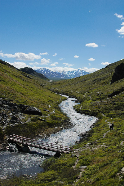
Savage River Trail, Denali — Vince Smith — CC BY 2.0 — https://www.flickr.com/photos/74733773@N00/23655623/
Vince Smith
CC BY 2.0
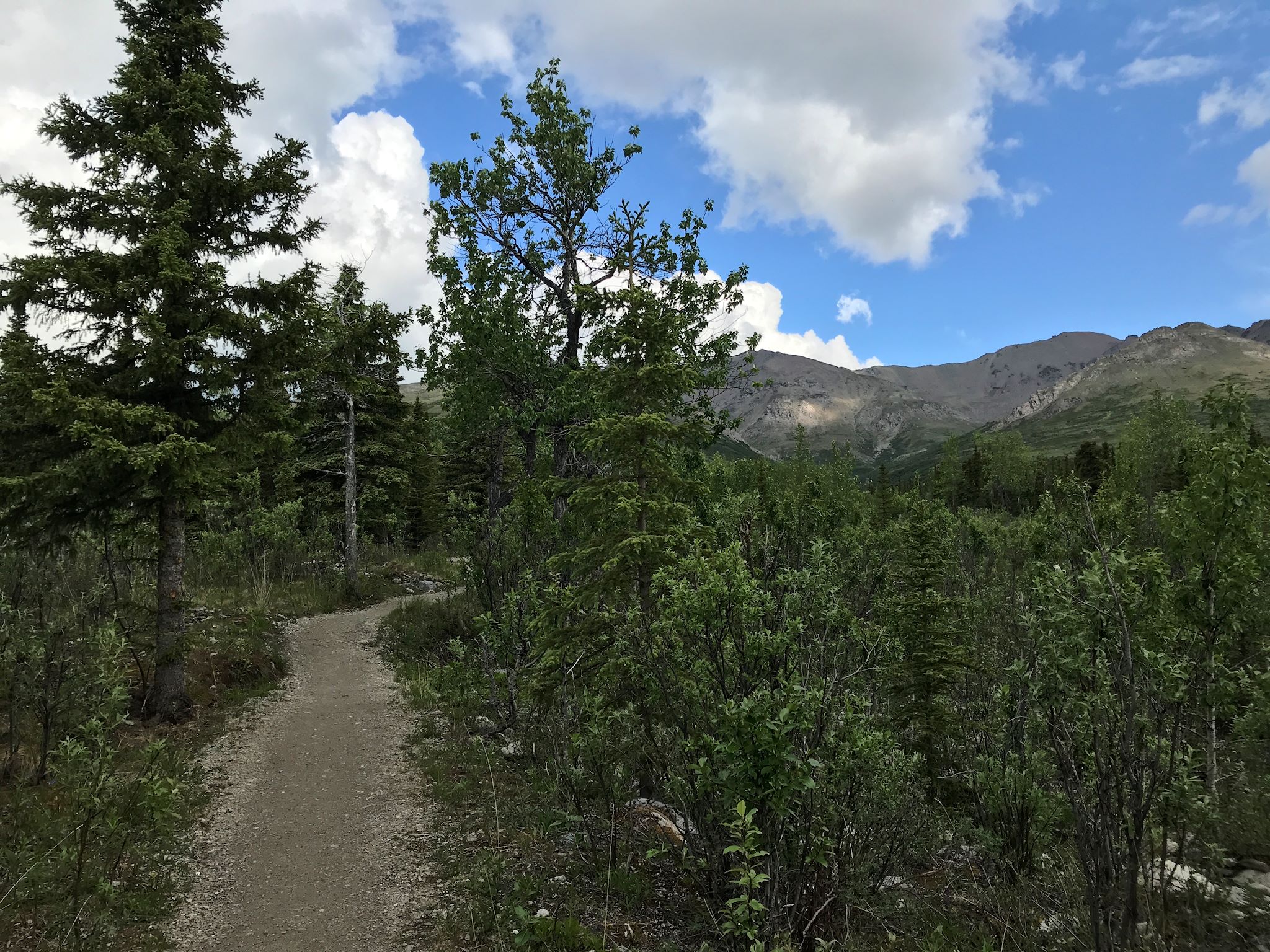
The start of the Savage Alpine trail — sf-dvs — CC BY 2.0 — https://www.flickr.com/photos/46207792@N00/48059689057/
sf-dvs
CC BY 2.0
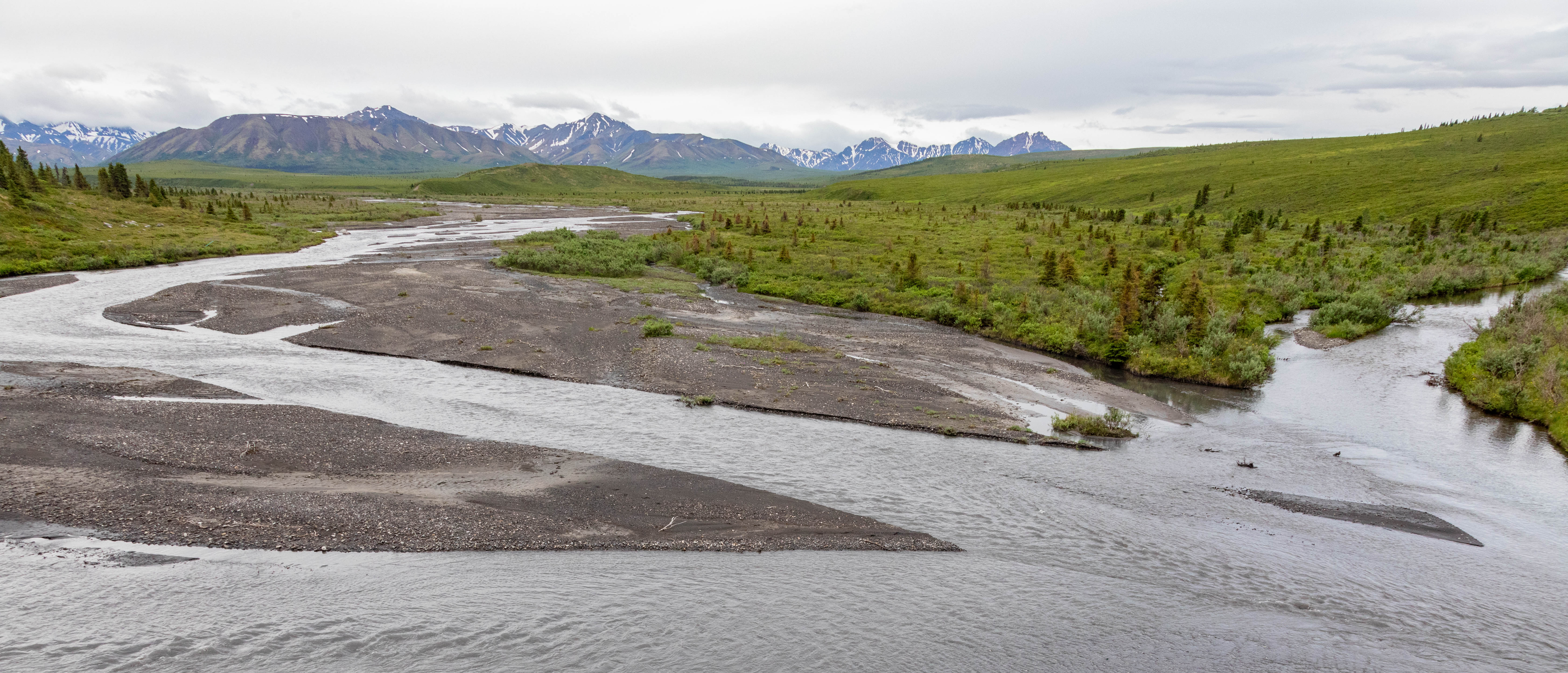
Savage River — David Brossard — CC BY-SA 2.0 — https://www.flickr.com/photos/16069488@N00/53148065812/
David Brossard
CC BY-SA 2.0
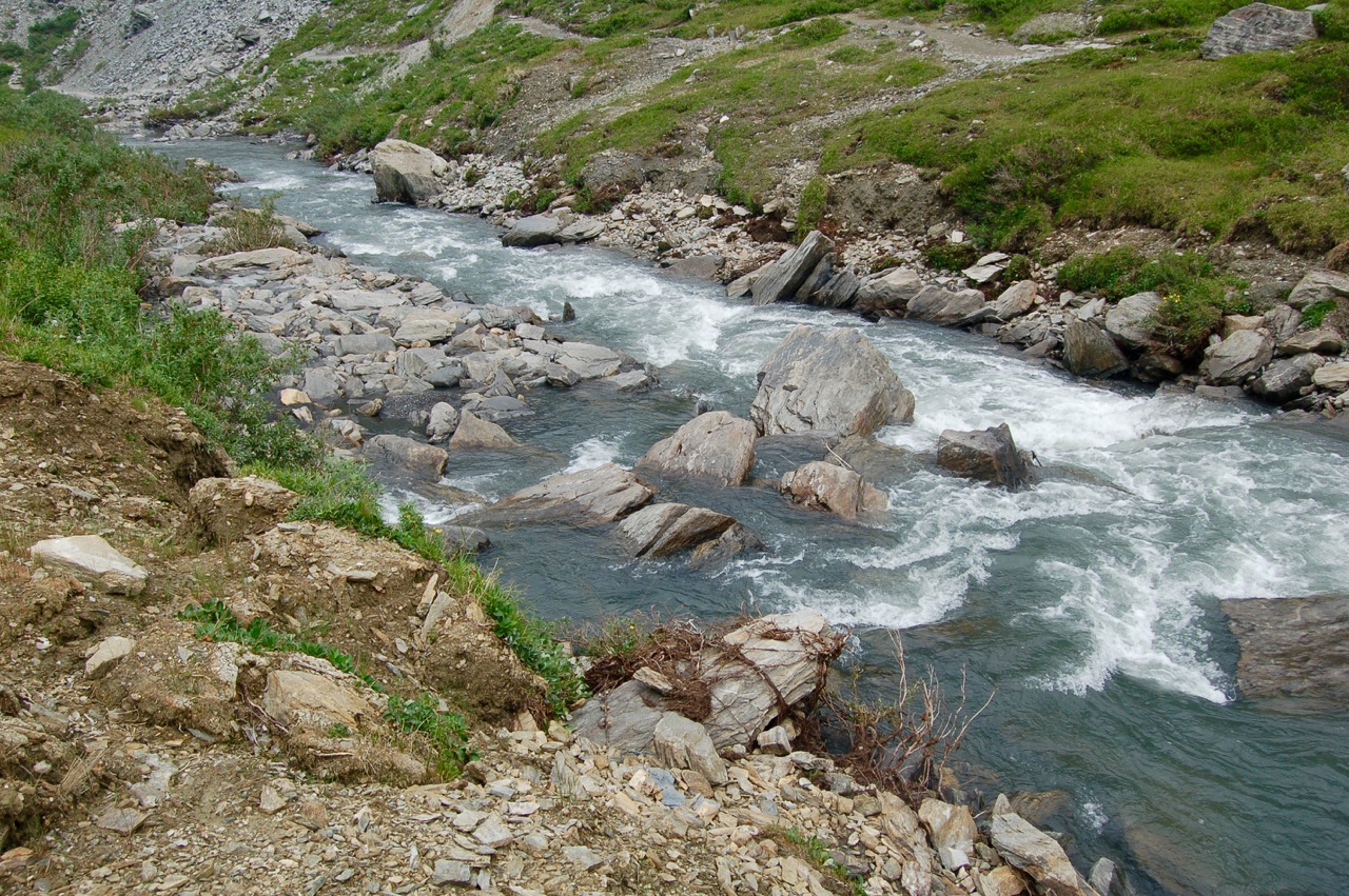
Savage River Trail — Brian — CC BY 2.0 — https://www.flickr.com/photos/23728403@N00/22346593830/
Brian
CC BY 2.0
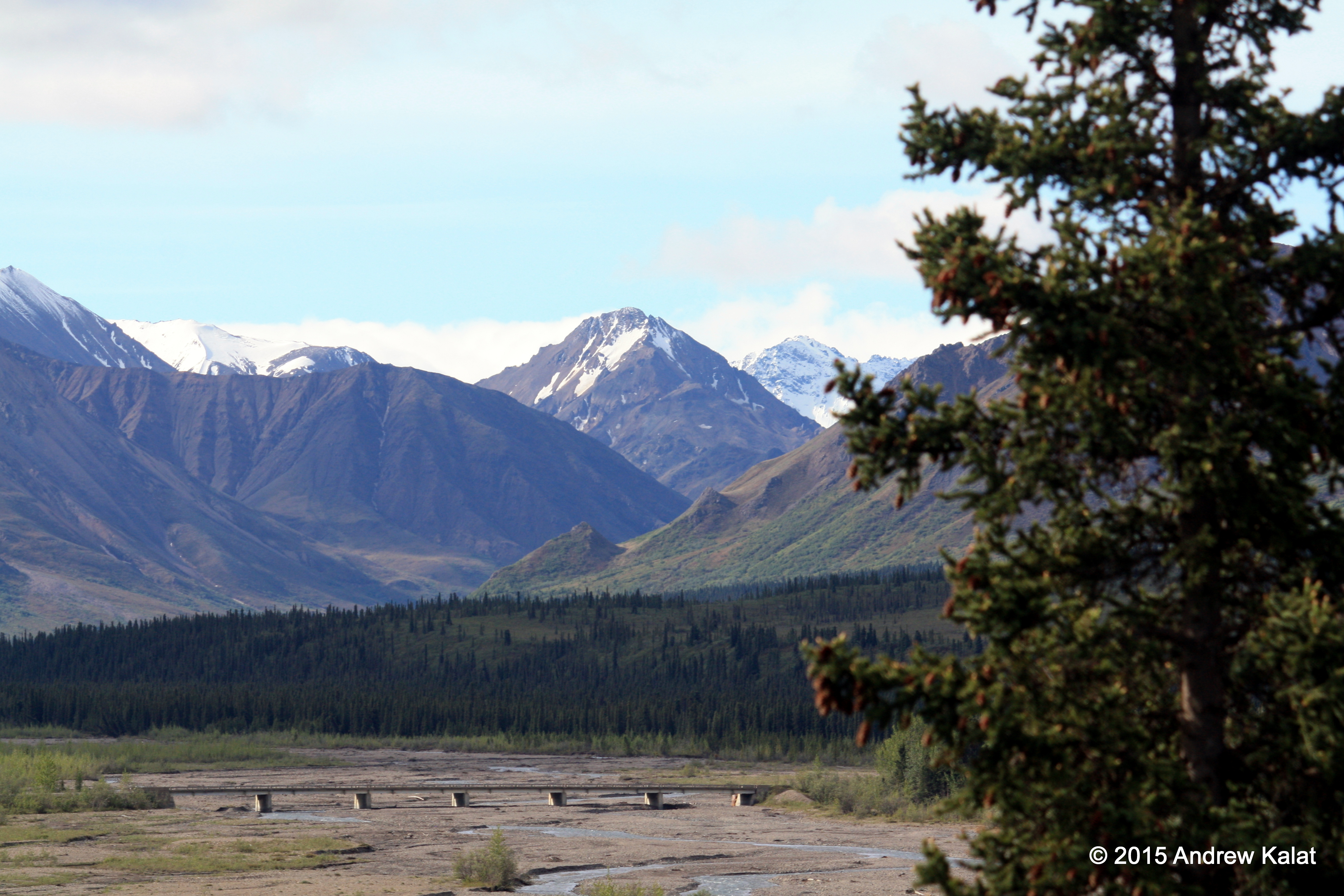
Savage River in Denali National Park — Andrew Kalat — CC BY-ND 2.0 — https://www.flickr.com/photos/90811165@N00/19444591825/
Andrew Kalat
CC BY-ND 2.0
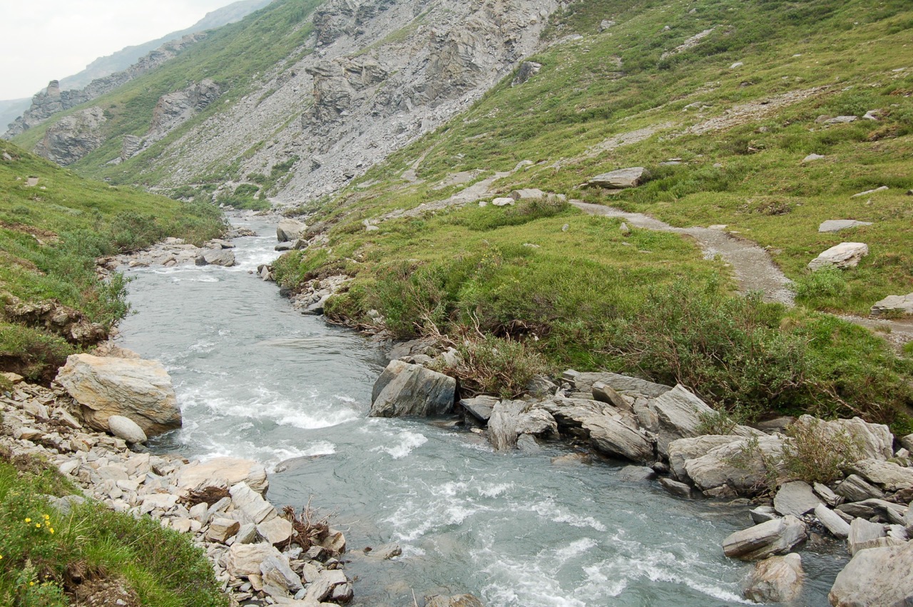
Savage River Trail — Brian — CC BY 2.0 — https://www.flickr.com/photos/23728403@N00/21913342553/
Brian
CC BY 2.0
View original activity in YouVisible
Weather on your route
Loading forecast…
Sources and credits
National Park Service. Public domain · U.S. Government work — https://www.nps.gov/aboutus/disclaimer.htm. No protection is claimed in original U.S. Government works. Photographs have separate individual licences.
National Park Service · NPS Public Trails · Public domain · U.S. Government work
The Savage River valley
Savage River Trail, Denali — Vince Smith — CC BY 2.0 — https://www.flickr.com/photos/74733773@N00/23655623/
Vince Smith · CC BY 2.0 · Media source
The Alpine Trail starts here
The start of the Savage Alpine trail — sf-dvs — CC BY 2.0 — https://www.flickr.com/photos/46207792@N00/48059689057/
sf-dvs · CC BY 2.0 · Media source
The river flats
Savage River — David Brossard — CC BY-SA 2.0 — https://www.flickr.com/photos/16069488@N00/53148065812/
David Brossard · CC BY-SA 2.0 · Media source
Rocks beside the river
Savage River Trail — Brian — CC BY 2.0 — https://www.flickr.com/photos/23728403@N00/22346593830/
Brian · CC BY 2.0 · Media source
Mountains beyond the river
Savage River in Denali National Park — Andrew Kalat — CC BY-ND 2.0 — https://www.flickr.com/photos/90811165@N00/19444591825/
Andrew Kalat · CC BY-ND 2.0 · Media source
The riverside path
Savage River Trail — Brian — CC BY 2.0 — https://www.flickr.com/photos/23728403@N00/21913342553/
Brian · CC BY 2.0 · Media source