Find your next route
Explore hiking, running, trail running and cycling routes that suit your plans.

Community route
Triple Lakes · southern trailhead to the Riley Creek woods
An archive one-way reference through the forest and lake landscape of the Triple Lakes Trail in Denali National Park. This mapped variant runs north from the southern Highway 3 trailhead towards the woods above Riley Creek. It follows the continuous main trail in the NPS dataset and ends at its northern mapped endpoint before the separate Hines Creek sections: the missing connection and the visitor-centre approach are not added. Secondary trails are excluded where the NPS records identify them. Healy is the nearby catalogue town, not the trailhead. The source flags a winter seasonal closure; current opening is not confirmed. Archive photographs of the lakes, forest floor and northern creek setting do not establish present access or conditions.
By YouVisible Sport
Mapa del recorrido
Activity measurements
- distance meters
- 13,772.7666871936
- end · latitude
- 63.72189
- end · longitude
- -148.9173761
- start · latitude
- 63.6574268
- start · longitude
- -148.8372784
- Sport
- hiking mountaineering
- Specialty
- Hiking
From start to finish
Beginning of the source reference; no approach added.
Go to start · Google MapsEnd of the source reference; return not included.
Go to finish · Google Maps- Country
- United States
- Province / region
- —
- Localities
- Healy
Before you go
- How to reach the start
- —
- Parking and access
- Check Denali National Park access notices before planning this route. The source flags a winter seasonal closure. The southern mapped endpoint is near the Tsenesdghaas Na’ trailhead on Highway 3; current parking availability is unknown. The northern reference ends before the disconnected Hines Creek sections, so do not treat it as a complete connection to the visitor centre.
- Advice
- Treat this as an archive reference and respect winter closures. Snow, ice, cold and short daylight can make travel hazardous. The NPS warns there is no park shuttle between the two ends of the full trail; arrange transport separately. The selected mapped variant stops short of the northern trailhead. Check park guidance on wildlife and group limits before visiting.
- Recommended equipment
- Suitable footwear, warm layers, waterproof and windproof clothing, water, food, offline navigation and a charged phone. Winter equipment and skills depend on verified conditions and park guidance.
- Terrain
- Native-surface forest and mountain footpath, with climbs and descents. The map preserves the main alignment around the lakes; no valid measured elevation series is supplied.
- Signage
- —
Characteristics and difficulty
- Estimated duration
- —
- Author perceived effort
- —
- Physical difficulty
- —
- Technical difficulty
- —
About the route
An archive one-way reference through the forest and lake landscape of the Triple Lakes Trail in Denali National Park. This mapped variant runs north from the southern Highway 3 trailhead towards the woods above Riley Creek. It follows the continuous main trail in the NPS dataset and ends at its northern mapped endpoint before the separate Hines Creek sections: the missing connection and the visitor-centre approach are not added. Secondary trails are excluded where the NPS records identify them. Healy is the nearby catalogue town, not the trailhead. The source flags a winter seasonal closure; current opening is not confirmed. Archive photographs of the lakes, forest floor and northern creek setting do not establish present access or conditions.
- Context
- —
- Specialty
- Hiking
- Event type
- —
- Description
- Archive photographs of the route and its local setting. Context images outside the track are identified in their captions; none establishes current access or conditions.
- Title
- Route highlights
- Title
- Sesión
- Description
- An archive one-way reference through the forest and lake landscape of the Triple Lakes Trail in Denali National Park. This mapped variant runs north from the southern Highway 3 trailhead towards the woods above Riley Creek. It follows the continuous main trail in the NPS dataset and ends at its northern mapped endpoint before the separate Hines Creek sections: the missing connection and the visitor-centre approach are not added. Secondary trails are excluded where the NPS records identify them. Healy is the nearby catalogue town, not the trailhead. The source flags a winter seasonal closure; current opening is not confirmed. Archive photographs of the lakes, forest floor and northern creek setting do not establish present access or conditions.
- Description
- NPS archive view from the Triple Lakes Trail. It does not show current conditions.
- Title
- A lake along the trail
- Description
- A separate NPS archive view of the lake landscape beside the Triple Lakes Trail.
- Title
- Lake and forested slopes
- Description
- Moss photographed for the NPS Triple Lakes Trail collection. The individual asset is explicitly public domain; the photographer is not named.
- Title
- The forest floor
- Description
- NPS archive photograph of Hines Creek in the northern trail setting. This creek section lies beyond the selected continuous mapped variant; no connection is added.
- Title
- Hines Creek setting
- Description
- An archive NPS view of the Hines Creek bridge. It provides context for the wider trail and is not included as a new segment in this reference.
- Title
- The northern footbridge
- Description
- NPS Photo / Tim Rains: creek scenery on the neighbouring McKinley Station Trail. This is context outside the selected track, not an added approach.
- Title
- The surrounding creek landscape
- Description
- NPS archive view from the Triple Lakes Trail. It does not show current conditions.
- Title
- A lake along the trail
- Description
- A separate NPS archive view of the lake landscape beside the Triple Lakes Trail.
- Title
- Lake and forested slopes
- Description
- Moss photographed for the NPS Triple Lakes Trail collection. The individual asset is explicitly public domain; the photographer is not named.
- Title
- The forest floor
- Description
- NPS archive photograph of Hines Creek in the northern trail setting. This creek section lies beyond the selected continuous mapped variant; no connection is added.
- Title
- Hines Creek setting
- Description
- An archive NPS view of the Hines Creek bridge. It provides context for the wider trail and is not included as a new segment in this reference.
- Title
- The northern footbridge
- Description
- NPS Photo / Tim Rains: creek scenery on the neighbouring McKinley Station Trail. This is context outside the selected track, not an added approach.
- Title
- The surrounding creek landscape
- Advice
- Treat this as an archive reference and respect winter closures. Snow, ice, cold and short daylight can make travel hazardous. The NPS warns there is no park shuttle between the two ends of the full trail; arrange transport separately. The selected mapped variant stops short of the northern trailhead. Check park guidance on wildlife and group limits before visiting.
- Description
- End of the source reference; return not included.
- Parking and access
- Check Denali National Park access notices before planning this route. The source flags a winter seasonal closure. The southern mapped endpoint is near the Tsenesdghaas Na’ trailhead on Highway 3; current parking availability is unknown. The northern reference ends before the disconnected Hines Creek sections, so do not treat it as a complete connection to the visitor centre.
- Recommended equipment
- Suitable footwear, warm layers, waterproof and windproof clothing, water, food, offline navigation and a charged phone. Winter equipment and skills depend on verified conditions and park guidance.
- Description
- Beginning of the source reference; no approach added.
- Terrain
- Native-surface forest and mountain footpath, with climbs and descents. The map preserves the main alignment around the lakes; no valid measured elevation series is supplied.
- Title
- Triple Lakes · southern trailhead to the Riley Creek woods
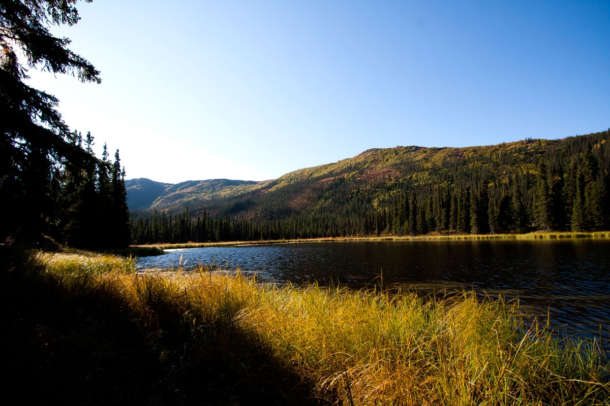
View of Triple Lakes Trail — NPS Photo — Public domain · U.S. Government work — https://npgallery.nps.gov/AssetDetail/3b2223d4-1dd8-b71c-071b-0ae519969acd
NPS Photo
Public domain · U.S. Government work
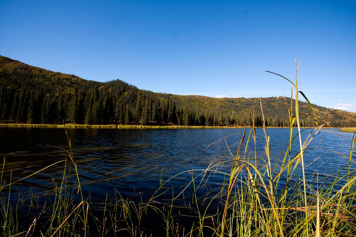
Another View of Triple Lakes Trail — NPS Photo — Public domain · U.S. Government work — https://npgallery.nps.gov/AssetDetail/3b24df30-1dd8-b71c-07c6-be51f6f28de4
NPS Photo
Public domain · U.S. Government work
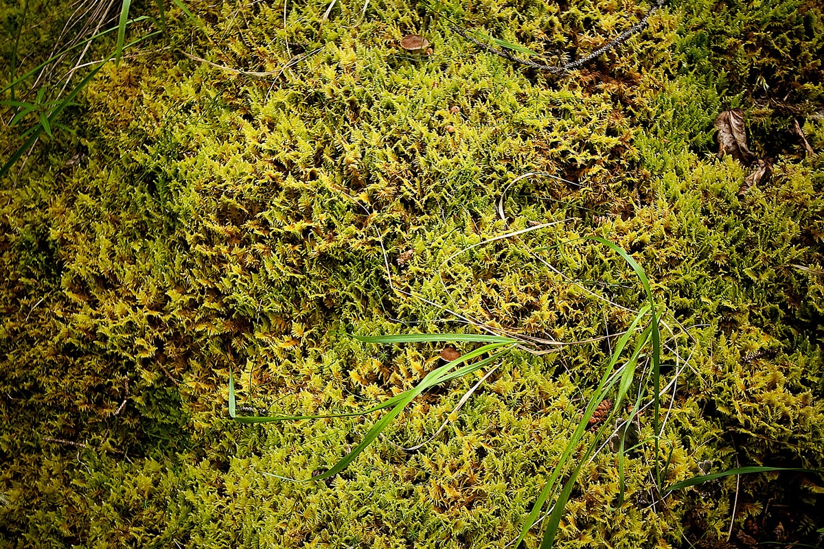
Moss — U.S. National Park Service (publisher; photographer not identified) — Public domain · U.S. Government work — https://npgallery.nps.gov/AssetDetail/3b1c4570-1dd8-b71c-0749-41aaa74384fa
U.S. National Park Service (publisher; photographer not identified)
Public domain · U.S. Government work
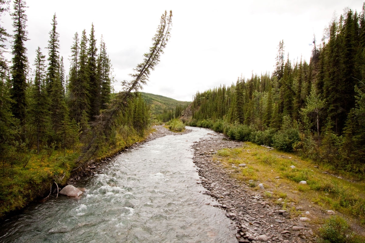
Hines Creek — NPS Photo — Public domain · U.S. Government work — https://npgallery.nps.gov/AssetDetail/3b0e42cf-1dd8-b71c-07bc-2a2cd282b5d0
NPS Photo
Public domain · U.S. Government work
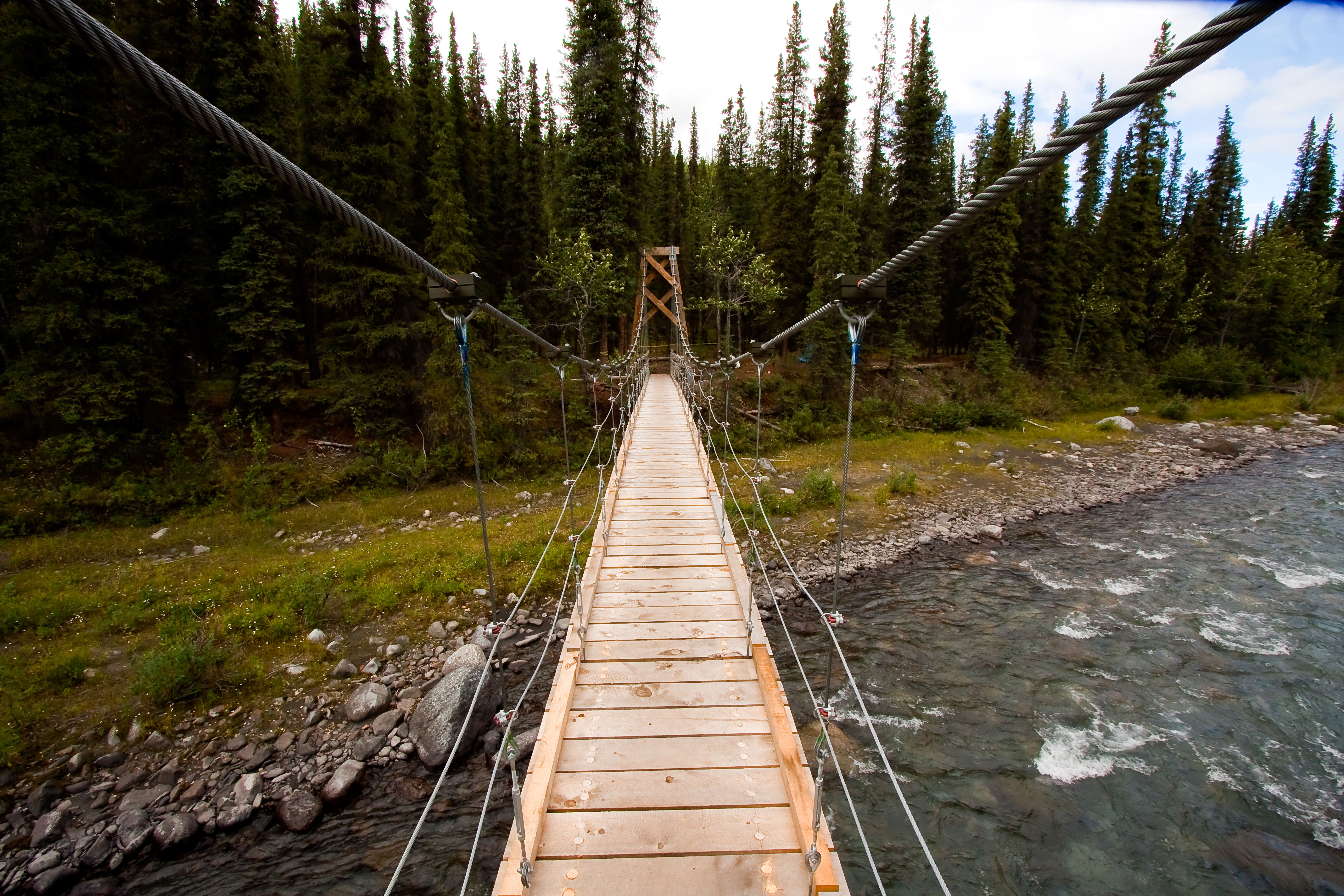
Bridge over Hines Creek — NPS Photo — Public domain · U.S. Government work — https://npgallery.nps.gov/AssetDetail/3b0ffaed-1dd8-b71c-070a-f69d7135469f
NPS Photo
Public domain · U.S. Government work
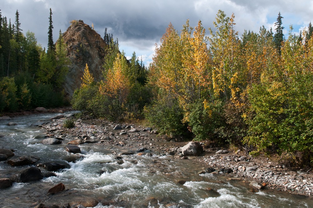
McKinley Station Trail- Stormy river — NPS Photo / Tim Rains — Public domain · U.S. Government work — https://npgallery.nps.gov/AssetDetail/2998c07c-1dd8-b71c-0737-7c7cb9a5439e
NPS Photo / Tim Rains
Public domain · U.S. Government work
View original activity in YouVisible
Weather on your route
Loading forecast…
Sources and credits
National Park Service. Public domain · U.S. Government work — https://www.nps.gov/aboutus/disclaimer.htm. No protection is claimed in original U.S. Government works. Photographs have separate individual licences.
National Park Service · NPS Public Trails · Public domain · U.S. Government work
A lake along the trail
View of Triple Lakes Trail — NPS Photo — Public domain · U.S. Government work — https://npgallery.nps.gov/AssetDetail/3b2223d4-1dd8-b71c-071b-0ae519969acd
NPS Photo · Public domain · U.S. Government work · Media source
Lake and forested slopes
Another View of Triple Lakes Trail — NPS Photo — Public domain · U.S. Government work — https://npgallery.nps.gov/AssetDetail/3b24df30-1dd8-b71c-07c6-be51f6f28de4
NPS Photo · Public domain · U.S. Government work · Media source
The forest floor
Moss — U.S. National Park Service (publisher; photographer not identified) — Public domain · U.S. Government work — https://npgallery.nps.gov/AssetDetail/3b1c4570-1dd8-b71c-0749-41aaa74384fa
U.S. National Park Service (publisher; photographer not identified) · Public domain · U.S. Government work · Media source
Hines Creek setting
Hines Creek — NPS Photo — Public domain · U.S. Government work — https://npgallery.nps.gov/AssetDetail/3b0e42cf-1dd8-b71c-07bc-2a2cd282b5d0
NPS Photo · Public domain · U.S. Government work · Media source
The northern footbridge
Bridge over Hines Creek — NPS Photo — Public domain · U.S. Government work — https://npgallery.nps.gov/AssetDetail/3b0ffaed-1dd8-b71c-070a-f69d7135469f
NPS Photo · Public domain · U.S. Government work · Media source
The surrounding creek landscape
McKinley Station Trail- Stormy river — NPS Photo / Tim Rains — Public domain · U.S. Government work — https://npgallery.nps.gov/AssetDetail/2998c07c-1dd8-b71c-0737-7c7cb9a5439e
NPS Photo / Tim Rains · Public domain · U.S. Government work · Media source