Find your next route
Explore hiking, running, trail running and cycling routes that suit your plans.

Community route
Oakwood Forest Trail · Ballyhaise woodland loop
Explore the official Oakwood Forest Trail from Ballyhaise Amenity Park. The mapped loop passes through the local wooded landscape and preserves the Sport Ireland reference without added road connections. Sport Ireland grades this walk Moderate. The archive photographs introduce the Annalee, the amenity park and the surrounding village; the village square, community centre and nearby lane provide local context rather than a promise that every photographed place lies on the track. Check current access and weather before setting out. No performed activity time is recorded.
By YouVisible Sport
Mapa del recorrido
Activity measurements
- distance meters
- 5,330.8380276942
- end · latitude
- 54.0437176
- end · longitude
- -7.3262797
- start · latitude
- 54.0437176
- start · longitude
- -7.3262797
- Sport
- walking
- Specialty
- walking outdoor
From start to finish
Beginning of the source reference; no approach added.
Go to start · Google MapsEnd of the complete loop at the start coordinate.
Go to finish · Google Maps- Country
- Ireland
- Province / region
- —
- Localities
- Ballyhaise
Before you go
- How to reach the start
- —
- Parking and access
- The official start and finish is Ballyhaise Amenity Park. Confirm parking availability and local access notices. Dogs must be on a lead according to Sport Ireland.
- Advice
- Keep to permitted paths and respect gates, livestock and private land. Check local closures and weather; paths may be wet or muddy. The reference is not confirmation of current opening. The published duration is not stored because the same mapped direction has not been established.
- Recommended equipment
- Walking shoes with good grip, waterproof clothing, drinking water and an offline map.
- Terrain
- Mapped woodland paths and local road sections; the official listing does not provide a complete surface inventory.
- Signage
- Green arrows. Waymarking is reported by Sport Ireland; current on-site condition is not confirmed.
Characteristics and difficulty
- Estimated duration
- —
- Author perceived effort
- —
- Physical difficulty
- —
- Technical difficulty
- —
About the route
Explore the official Oakwood Forest Trail from Ballyhaise Amenity Park. The mapped loop passes through the local wooded landscape and preserves the Sport Ireland reference without added road connections. Sport Ireland grades this walk Moderate. The archive photographs introduce the Annalee, the amenity park and the surrounding village; the village square, community centre and nearby lane provide local context rather than a promise that every photographed place lies on the track. Check current access and weather before setting out. No performed activity time is recorded.
- Context
- —
- Specialty
- walking outdoor
- Event type
- —
- Description
- Archive photographs of the route and its local setting. Context images outside the track are identified in their captions; none establishes current access or conditions.
- Title
- Route highlights
- Title
- Sesión
- Description
- Explore the official Oakwood Forest Trail from Ballyhaise Amenity Park. The mapped loop passes through the local wooded landscape and preserves the Sport Ireland reference without added road connections. Sport Ireland grades this walk Moderate. The archive photographs introduce the Annalee, the amenity park and the surrounding village; the village square, community centre and nearby lane provide local context rather than a promise that every photographed place lies on the track. Check current access and weather before setting out. No performed activity time is recorded.
- Description
- Archive view of the River Annalee at Ballyhaise, as landscape context for the woodland walk.
- Title
- The Annalee at Ballyhaise
- Description
- The amenity park named as the trail’s official start and finish.
- Title
- Ballyhaise Amenity Park
- Description
- A separate archive view of Ballyhaise Amenity Park.
- Title
- The village park
- Description
- A nearby lane at Curraghanoe, included as local context; this image does not add a connection or establish a right of access.
- Title
- A lane at Curraghanoe
- Description
- Ballyhaise Community Centre, shown as village context beyond the woodland setting.
- Title
- The community centre
- Description
- The village square at Ballyhaise. Follow the imported route and local waymarks rather than inferring a connection from the photograph.
- Title
- Ballyhaise village square
- Description
- Archive view of the River Annalee at Ballyhaise, as landscape context for the woodland walk.
- Title
- The Annalee at Ballyhaise
- Description
- The amenity park named as the trail’s official start and finish.
- Title
- Ballyhaise Amenity Park
- Description
- A separate archive view of Ballyhaise Amenity Park.
- Title
- The village park
- Description
- A nearby lane at Curraghanoe, included as local context; this image does not add a connection or establish a right of access.
- Title
- A lane at Curraghanoe
- Description
- Ballyhaise Community Centre, shown as village context beyond the woodland setting.
- Title
- The community centre
- Description
- The village square at Ballyhaise. Follow the imported route and local waymarks rather than inferring a connection from the photograph.
- Title
- Ballyhaise village square
- Advice
- Keep to permitted paths and respect gates, livestock and private land. Check local closures and weather; paths may be wet or muddy. The reference is not confirmation of current opening. The published duration is not stored because the same mapped direction has not been established.
- Description
- End of the complete loop at the start coordinate.
- Parking and access
- The official start and finish is Ballyhaise Amenity Park. Confirm parking availability and local access notices. Dogs must be on a lead according to Sport Ireland.
- Recommended equipment
- Walking shoes with good grip, waterproof clothing, drinking water and an offline map.
- Signage
- Green arrows. Waymarking is reported by Sport Ireland; current on-site condition is not confirmed.
- Description
- Beginning of the source reference; no approach added.
- Terrain
- Mapped woodland paths and local road sections; the official listing does not provide a complete surface inventory.
- Title
- Oakwood Forest Trail · Ballyhaise woodland loop
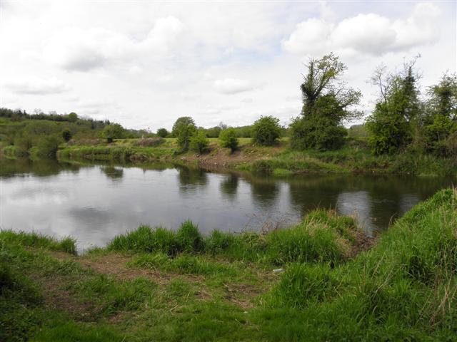
Annalee River — Kenneth Allen — CC BY-SA 2.0 — https://www.geograph.org.uk/photo/2937007
Kenneth Allen
CC BY-SA 2.0
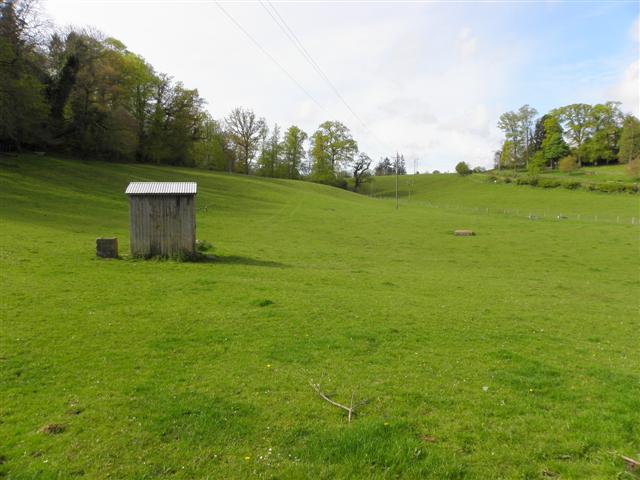
At Ballyhaise — Kenneth Allen — CC BY-SA 2.0 — https://www.geograph.org.uk/photo/2936886
Kenneth Allen
CC BY-SA 2.0
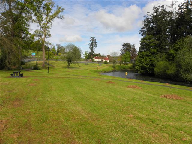
Near Ballyhaise — Kenneth Allen — CC BY-SA 2.0 — https://www.geograph.org.uk/photo/2936885
Kenneth Allen
CC BY-SA 2.0
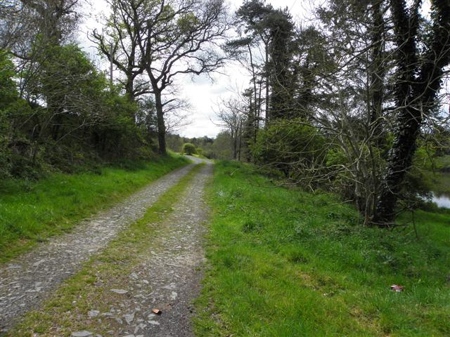
Lane, Curraghanoe — Kenneth Allen — CC BY-SA 2.0 — https://www.geograph.org.uk/photo/2937005
Kenneth Allen
CC BY-SA 2.0
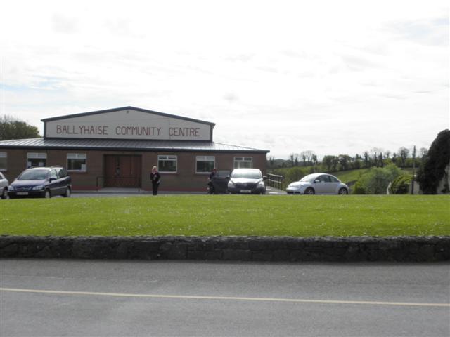
Ballyhaise Community Centre — Kenneth Allen — CC BY-SA 2.0 — https://www.geograph.org.uk/photo/2936879
Kenneth Allen
CC BY-SA 2.0
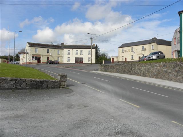
The Square, Ballyhaise — Kenneth Allen — CC BY-SA 2.0 — https://www.geograph.org.uk/photo/2936884
Kenneth Allen
CC BY-SA 2.0
View original activity in YouVisible
Weather on your route
Loading forecast…
Sources and credits
Sport Ireland. CC BY 4.0 — https://creativecommons.org/licenses/by/4.0/. Photographs have separate individual licences.
Sport Ireland · Get Ireland Active Trail Routes · CC BY 4.0
The Annalee at Ballyhaise
Annalee River — Kenneth Allen — CC BY-SA 2.0 — https://www.geograph.org.uk/photo/2937007
Kenneth Allen · CC BY-SA 2.0 · Media source
Ballyhaise Amenity Park
At Ballyhaise — Kenneth Allen — CC BY-SA 2.0 — https://www.geograph.org.uk/photo/2936886
Kenneth Allen · CC BY-SA 2.0 · Media source
The village park
Near Ballyhaise — Kenneth Allen — CC BY-SA 2.0 — https://www.geograph.org.uk/photo/2936885
Kenneth Allen · CC BY-SA 2.0 · Media source
A lane at Curraghanoe
Lane, Curraghanoe — Kenneth Allen — CC BY-SA 2.0 — https://www.geograph.org.uk/photo/2937005
Kenneth Allen · CC BY-SA 2.0 · Media source
The community centre
Ballyhaise Community Centre — Kenneth Allen — CC BY-SA 2.0 — https://www.geograph.org.uk/photo/2936879
Kenneth Allen · CC BY-SA 2.0 · Media source
Ballyhaise village square
The Square, Ballyhaise — Kenneth Allen — CC BY-SA 2.0 — https://www.geograph.org.uk/photo/2936884
Kenneth Allen · CC BY-SA 2.0 · Media source