Find your next route
Explore hiking, running, trail running and cycling routes that suit your plans.

Community route
Castle Lake Loop · PJ’s Way at Bailieborough
Follow the mapped loop through Castle Lake Forest, where forest roads pass lake views and gentle climbs. Sport Ireland identifies this as Bailieborough Castle Lake Loop, also known as PJ’s Way, and grades it Easy. The reference retains the original mapped loop without adding an approach from the town. The archive photographs show the lake, the demesne entrance and one of the Brothers’ Graves; the fishing stages are context images and do not add spurs to the track. Check current access and weather before setting out. No performed activity time is recorded.
By YouVisible Sport
Mapa del recorrido
Activity measurements
- distance meters
- 3,698.3435437431
- end · latitude
- 53.9275661
- end · longitude
- -6.9876487
- start · latitude
- 53.9275661
- start · longitude
- -6.9876487
- Sport
- walking
- Specialty
- walking outdoor
From start to finish
Beginning of the source reference; no approach added.
Go to start · Google MapsEnd of the complete loop at the start coordinate.
Go to finish · Google Maps- Country
- Ireland
- Province / region
- —
- Localities
- Bailieborough
Before you go
- How to reach the start
- —
- Parking and access
- Castle Lake car park is the official start and finish. Parking availability and current restrictions have not been confirmed. Dogs must be on a lead according to the official listing.
- Advice
- Keep to permitted paths and respect gates, livestock and private land. Check local closures and weather; paths may be wet or muddy. The reference is not confirmation of current opening. The published duration is not stored because the same mapped direction has not been established.
- Recommended equipment
- Walking shoes with good grip, waterproof clothing, drinking water and an offline map.
- Terrain
- Forest roads, reasonably level with gentle climbs, according to Sport Ireland.
- Signage
- Blue arrows. Waymarking is reported by Sport Ireland; current on-site condition is not confirmed.
Characteristics and difficulty
- Estimated duration
- —
- Author perceived effort
- —
- Physical difficulty
- —
- Technical difficulty
- —
About the route
Follow the mapped loop through Castle Lake Forest, where forest roads pass lake views and gentle climbs. Sport Ireland identifies this as Bailieborough Castle Lake Loop, also known as PJ’s Way, and grades it Easy. The reference retains the original mapped loop without adding an approach from the town. The archive photographs show the lake, the demesne entrance and one of the Brothers’ Graves; the fishing stages are context images and do not add spurs to the track. Check current access and weather before setting out. No performed activity time is recorded.
- Context
- —
- Specialty
- walking outdoor
- Event type
- —
- Description
- Archive photographs of the route and its local setting. Context images outside the track are identified in their captions; none establishes current access or conditions.
- Title
- Route highlights
- Title
- Sesión
- Description
- Follow the mapped loop through Castle Lake Forest, where forest roads pass lake views and gentle climbs. Sport Ireland identifies this as Bailieborough Castle Lake Loop, also known as PJ’s Way, and grades it Easy. The reference retains the original mapped loop without adding an approach from the town. The archive photographs show the lake, the demesne entrance and one of the Brothers’ Graves; the fishing stages are context images and do not add spurs to the track. Check current access and weather before setting out. No performed activity time is recorded.
- Description
- One of the Brothers’ Graves in the Castle Lake setting, photographed by Oliver Dixon. This archive context image does not add a detour to the mapped loop.
- Title
- A memorial in the demesne
- Description
- Archive view across Castle Lake from the jetty at Bailieborough.
- Title
- The lake jetty
- Description
- A narrow fishing stage at Castle Lough, with reed beds and woodland beyond. This contextual image does not establish access to the stage.
- Title
- A fishing stage among reeds
- Description
- A separate view of a fishing stage on Castle Lough. Follow the mapped forest loop and current local notices.
- Title
- The waterside boardwalk
- Description
- Archive view of the northern end of Castle Lough, with woodland and reeds.
- Title
- The northern lake shore
- Description
- The entrance to Bailieborough Demesne. Parking availability and current opening are not established by this archive photograph.
- Title
- Entering the demesne
- Description
- One of the Brothers’ Graves in the Castle Lake setting, photographed by Oliver Dixon. This archive context image does not add a detour to the mapped loop.
- Title
- A memorial in the demesne
- Description
- Archive view across Castle Lake from the jetty at Bailieborough.
- Title
- The lake jetty
- Description
- A narrow fishing stage at Castle Lough, with reed beds and woodland beyond. This contextual image does not establish access to the stage.
- Title
- A fishing stage among reeds
- Description
- A separate view of a fishing stage on Castle Lough. Follow the mapped forest loop and current local notices.
- Title
- The waterside boardwalk
- Description
- Archive view of the northern end of Castle Lough, with woodland and reeds.
- Title
- The northern lake shore
- Description
- The entrance to Bailieborough Demesne. Parking availability and current opening are not established by this archive photograph.
- Title
- Entering the demesne
- Advice
- Keep to permitted paths and respect gates, livestock and private land. Check local closures and weather; paths may be wet or muddy. The reference is not confirmation of current opening. The published duration is not stored because the same mapped direction has not been established.
- Description
- End of the complete loop at the start coordinate.
- Parking and access
- Castle Lake car park is the official start and finish. Parking availability and current restrictions have not been confirmed. Dogs must be on a lead according to the official listing.
- Recommended equipment
- Walking shoes with good grip, waterproof clothing, drinking water and an offline map.
- Signage
- Blue arrows. Waymarking is reported by Sport Ireland; current on-site condition is not confirmed.
- Description
- Beginning of the source reference; no approach added.
- Terrain
- Forest roads, reasonably level with gentle climbs, according to Sport Ireland.
- Title
- Castle Lake Loop · PJ’s Way at Bailieborough
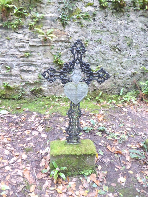
One of the Brothers' Graves — Oliver Dixon — CC BY-SA 2.0 — https://www.geograph.org.uk/photo/5560435
Oliver Dixon
CC BY-SA 2.0
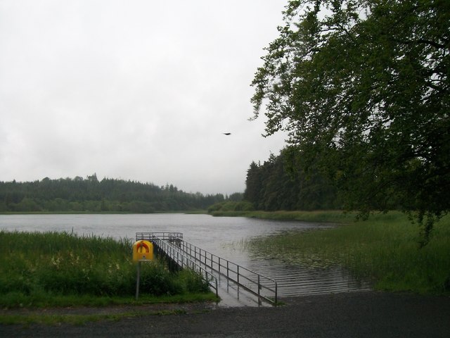
Jetty at Castle Lake Bailieboro', Co Cavan — Eric Jones — CC BY-SA 2.0 — https://www.geograph.org.uk/photo/2492362
Eric Jones
CC BY-SA 2.0
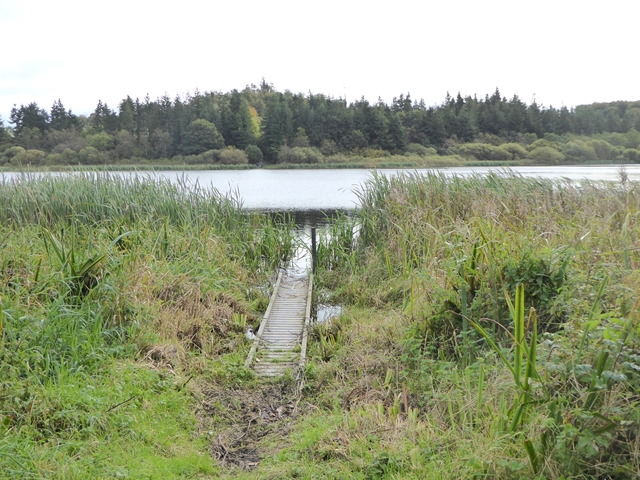
Fishing stage on Castle Lough — Oliver Dixon — CC BY-SA 2.0 — https://www.geograph.org.uk/photo/5560443
Oliver Dixon
CC BY-SA 2.0
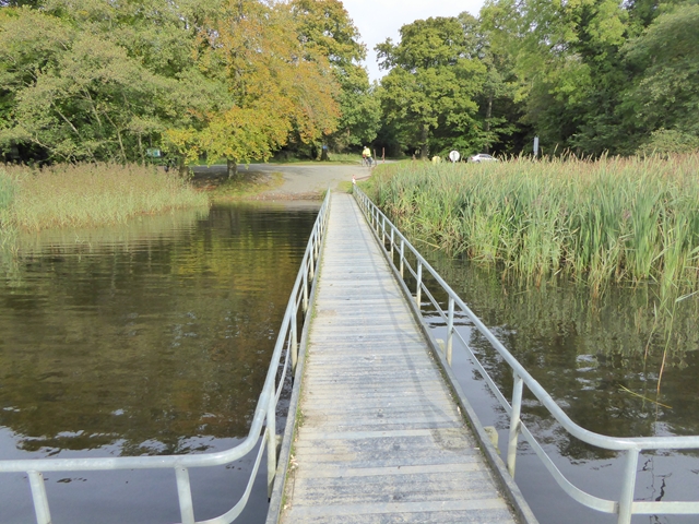
Fishing stage on Castle Lough — Oliver Dixon — CC BY-SA 2.0 — https://www.geograph.org.uk/photo/5560795
Oliver Dixon
CC BY-SA 2.0
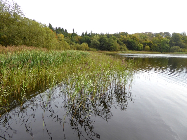
Northern end of Castle Lough — Oliver Dixon — CC BY-SA 2.0 — https://www.geograph.org.uk/photo/5560797
Oliver Dixon
CC BY-SA 2.0
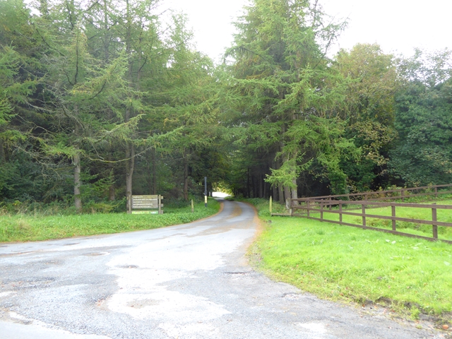
Entrance to Bailieborough Demesne — Oliver Dixon — CC BY-SA 2.0 — https://www.geograph.org.uk/photo/5572208
Oliver Dixon
CC BY-SA 2.0
View original activity in YouVisible
Weather on your route
Loading forecast…
Sources and credits
Sport Ireland. CC BY 4.0 — https://creativecommons.org/licenses/by/4.0/. Photographs have separate individual licences.
Sport Ireland · Get Ireland Active Trail Routes · CC BY 4.0
A memorial in the demesne
One of the Brothers' Graves — Oliver Dixon — CC BY-SA 2.0 — https://www.geograph.org.uk/photo/5560435
Oliver Dixon · CC BY-SA 2.0 · Media source
The lake jetty
Jetty at Castle Lake Bailieboro', Co Cavan — Eric Jones — CC BY-SA 2.0 — https://www.geograph.org.uk/photo/2492362
Eric Jones · CC BY-SA 2.0 · Media source
A fishing stage among reeds
Fishing stage on Castle Lough — Oliver Dixon — CC BY-SA 2.0 — https://www.geograph.org.uk/photo/5560443
Oliver Dixon · CC BY-SA 2.0 · Media source
The waterside boardwalk
Fishing stage on Castle Lough — Oliver Dixon — CC BY-SA 2.0 — https://www.geograph.org.uk/photo/5560795
Oliver Dixon · CC BY-SA 2.0 · Media source
The northern lake shore
Northern end of Castle Lough — Oliver Dixon — CC BY-SA 2.0 — https://www.geograph.org.uk/photo/5560797
Oliver Dixon · CC BY-SA 2.0 · Media source
Entering the demesne
Entrance to Bailieborough Demesne — Oliver Dixon — CC BY-SA 2.0 — https://www.geograph.org.uk/photo/5572208
Oliver Dixon · CC BY-SA 2.0 · Media source