Find your next route
Explore hiking, running, trail running and cycling routes that suit your plans.

Community route
Mt. Healy Overlook · the mapped uphill trail
Climb through the mountain landscape above the entrance area of Denali National Park on this one-way reference for the mapped Mt. Healy Overlook Trail. It preserves the NPS trail alignment to the overlook; an approach from the visitor centre and the return journey are not added. The upper trail reaches exposed ground, with broad views over the surrounding ridges. The NPS mapping flags a winter seasonal closure, and current opening has not been confirmed. These archive photographs do not show today’s snow, ice or access conditions. Healy is the nearby town used for the location reference; the walk is in the national park.
By YouVisible Sport
Mapa del recorrido
Activity measurements
- distance meters
- 3,444.8050223628
- end · latitude
- 63.7425529
- end · longitude
- -148.9536565
- start · latitude
- 63.7334624
- start · longitude
- -148.9258571
- Sport
- hiking mountaineering
- Specialty
- Hiking
From start to finish
Beginning of the source reference; no approach added.
Go to start · Google MapsEnd of the source reference; return not included.
Go to finish · Google Maps- Country
- United States
- Province / region
- —
- Localities
- Healy
Before you go
- How to reach the start
- —
- Parking and access
- Confirm access and trail restrictions with Denali National Park before planning a visit. The mapped trail has a winter seasonal closure flag. Denali’s winter visitor centre operates at the Murie Science and Learning Center; weather, daylight and road access require separate planning. Parking coordinates and availability are unknown.
- Advice
- Treat this as an archive route reference, not confirmation that the trail is currently open or suitable. Snow, ice, cold, wind and short winter daylight can make travel hazardous. Respect barriers and closure notices and contact the park for current conditions. Plan access to the lower mapped endpoint and the return separately.
- Recommended equipment
- Suitable mountain footwear, warm layers, waterproof and windproof clothing, water, food, offline navigation and a charged phone. Any winter equipment depends on verified conditions, access rules and the walker’s skills.
- Terrain
- Native-surface mountain footpath, with uneven ground, rocky sections and exposed higher terrain. NPS trail class: Class 2, Moderately Developed.
- Signage
- —
Characteristics and difficulty
- Estimated duration
- —
- Author perceived effort
- —
- Physical difficulty
- —
- Technical difficulty
- —
About the route
Climb through the mountain landscape above the entrance area of Denali National Park on this one-way reference for the mapped Mt. Healy Overlook Trail. It preserves the NPS trail alignment to the overlook; an approach from the visitor centre and the return journey are not added. The upper trail reaches exposed ground, with broad views over the surrounding ridges. The NPS mapping flags a winter seasonal closure, and current opening has not been confirmed. These archive photographs do not show today’s snow, ice or access conditions. Healy is the nearby town used for the location reference; the walk is in the national park.
- Context
- —
- Specialty
- Hiking
- Event type
- —
- Description
- Archive photographs of the route and its local setting. Context images outside the track are identified in their captions; none establishes current access or conditions.
- Title
- Route highlights
- Title
- Sesión
- Description
- Climb through the mountain landscape above the entrance area of Denali National Park on this one-way reference for the mapped Mt. Healy Overlook Trail. It preserves the NPS trail alignment to the overlook; an approach from the visitor centre and the return journey are not added. The upper trail reaches exposed ground, with broad views over the surrounding ridges. The NPS mapping flags a winter seasonal closure, and current opening has not been confirmed. These archive photographs do not show today’s snow, ice or access conditions. Healy is the nearby town used for the location reference; the walk is in the national park.
- Description
- Archive view of the Mt. Healy route winding over open ground. It does not establish present access or weather conditions.
- Title
- The trail above the valley
- Description
- Archive photograph of walkers on the Mt. Healy trail, retained unchanged under the photographer’s CC BY-ND licence.
- Title
- Walkers on the mountain path
- Description
- Fireweed and mountain scenery photographed during the Mt. Healy outing. The image does not imply that these conditions apply in winter.
- Title
- Fireweed beside the trail
- Description
- A ground squirrel beside the Mt. Healy route. Observe wildlife from a distance and do not feed it.
- Title
- Ground squirrel on rocky terrain
- Description
- Archive view of the mountain path and surrounding ridges.
- Title
- The ridge path
- Description
- Archive walkers at the Mt. Healy viewpoint. This is the source photographer’s image, not a record of an activity by the importing account.
- Title
- Walkers at the viewpoint
- Description
- Archive view of the Mt. Healy route winding over open ground. It does not establish present access or weather conditions.
- Title
- The trail above the valley
- Description
- Archive photograph of walkers on the Mt. Healy trail, retained unchanged under the photographer’s CC BY-ND licence.
- Title
- Walkers on the mountain path
- Description
- Fireweed and mountain scenery photographed during the Mt. Healy outing. The image does not imply that these conditions apply in winter.
- Title
- Fireweed beside the trail
- Description
- A ground squirrel beside the Mt. Healy route. Observe wildlife from a distance and do not feed it.
- Title
- Ground squirrel on rocky terrain
- Description
- Archive view of the mountain path and surrounding ridges.
- Title
- The ridge path
- Description
- Archive walkers at the Mt. Healy viewpoint. This is the source photographer’s image, not a record of an activity by the importing account.
- Title
- Walkers at the viewpoint
- Advice
- Treat this as an archive route reference, not confirmation that the trail is currently open or suitable. Snow, ice, cold, wind and short winter daylight can make travel hazardous. Respect barriers and closure notices and contact the park for current conditions. Plan access to the lower mapped endpoint and the return separately.
- Description
- End of the source reference; return not included.
- Parking and access
- Confirm access and trail restrictions with Denali National Park before planning a visit. The mapped trail has a winter seasonal closure flag. Denali’s winter visitor centre operates at the Murie Science and Learning Center; weather, daylight and road access require separate planning. Parking coordinates and availability are unknown.
- Recommended equipment
- Suitable mountain footwear, warm layers, waterproof and windproof clothing, water, food, offline navigation and a charged phone. Any winter equipment depends on verified conditions, access rules and the walker’s skills.
- Description
- Beginning of the source reference; no approach added.
- Terrain
- Native-surface mountain footpath, with uneven ground, rocky sections and exposed higher terrain. NPS trail class: Class 2, Moderately Developed.
- Title
- Mt. Healy Overlook · the mapped uphill trail
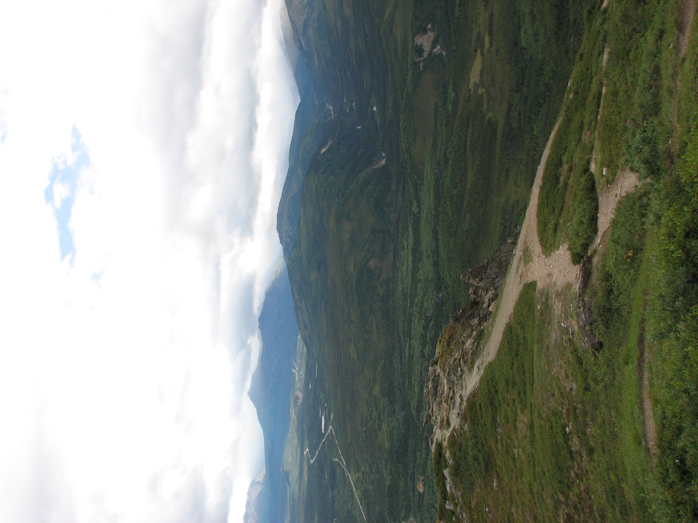
Denali: Mt Healy Overlook Hike — booizzy — CC BY-ND 2.0 — https://www.flickr.com/photos/43875868@N00/1098215562/
booizzy
CC BY-ND 2.0
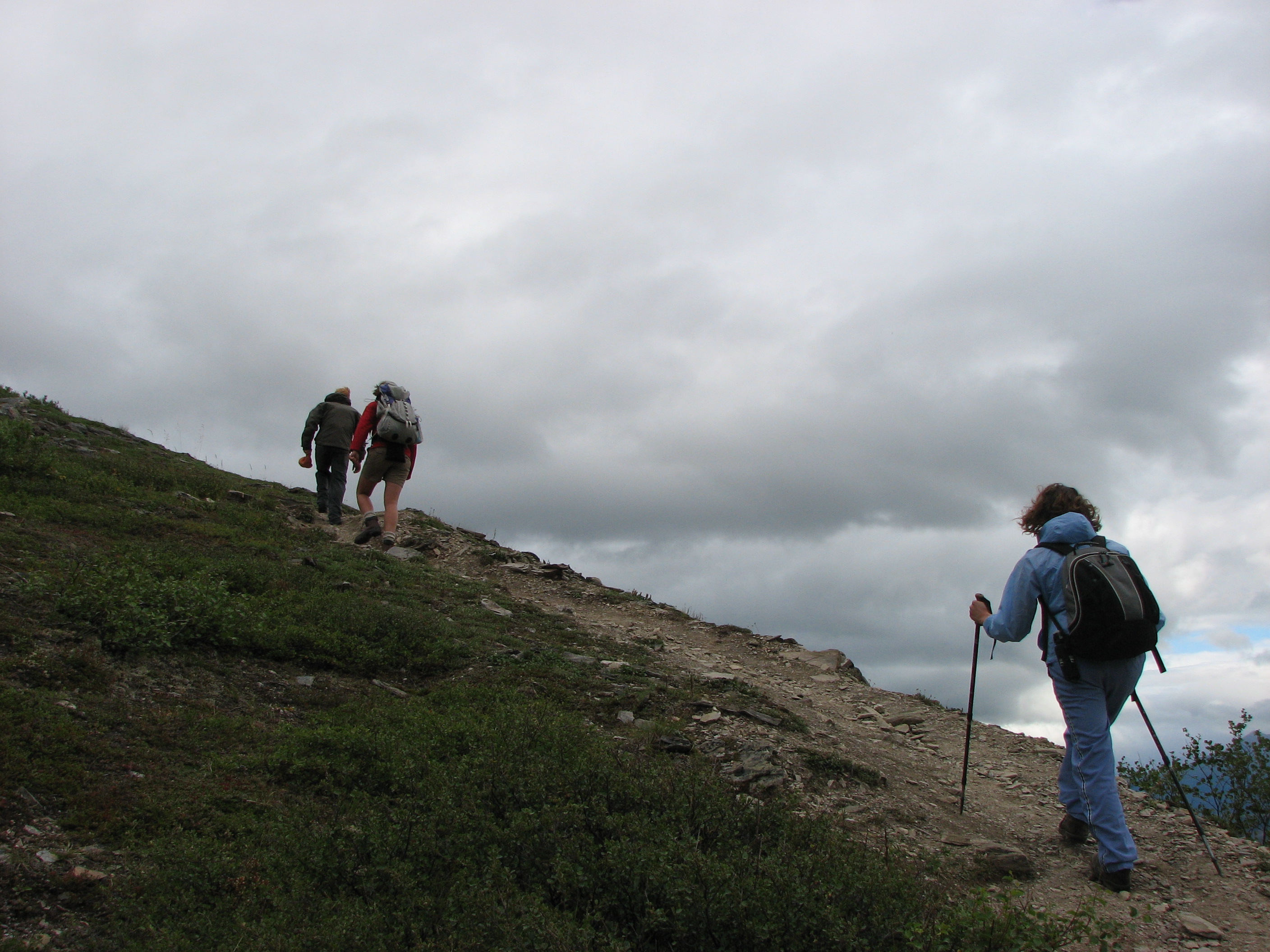
Denali: Mt Healy Overlook Hike — booizzy — CC BY-ND 2.0 — https://www.flickr.com/photos/43875868@N00/1098204534/
booizzy
CC BY-ND 2.0
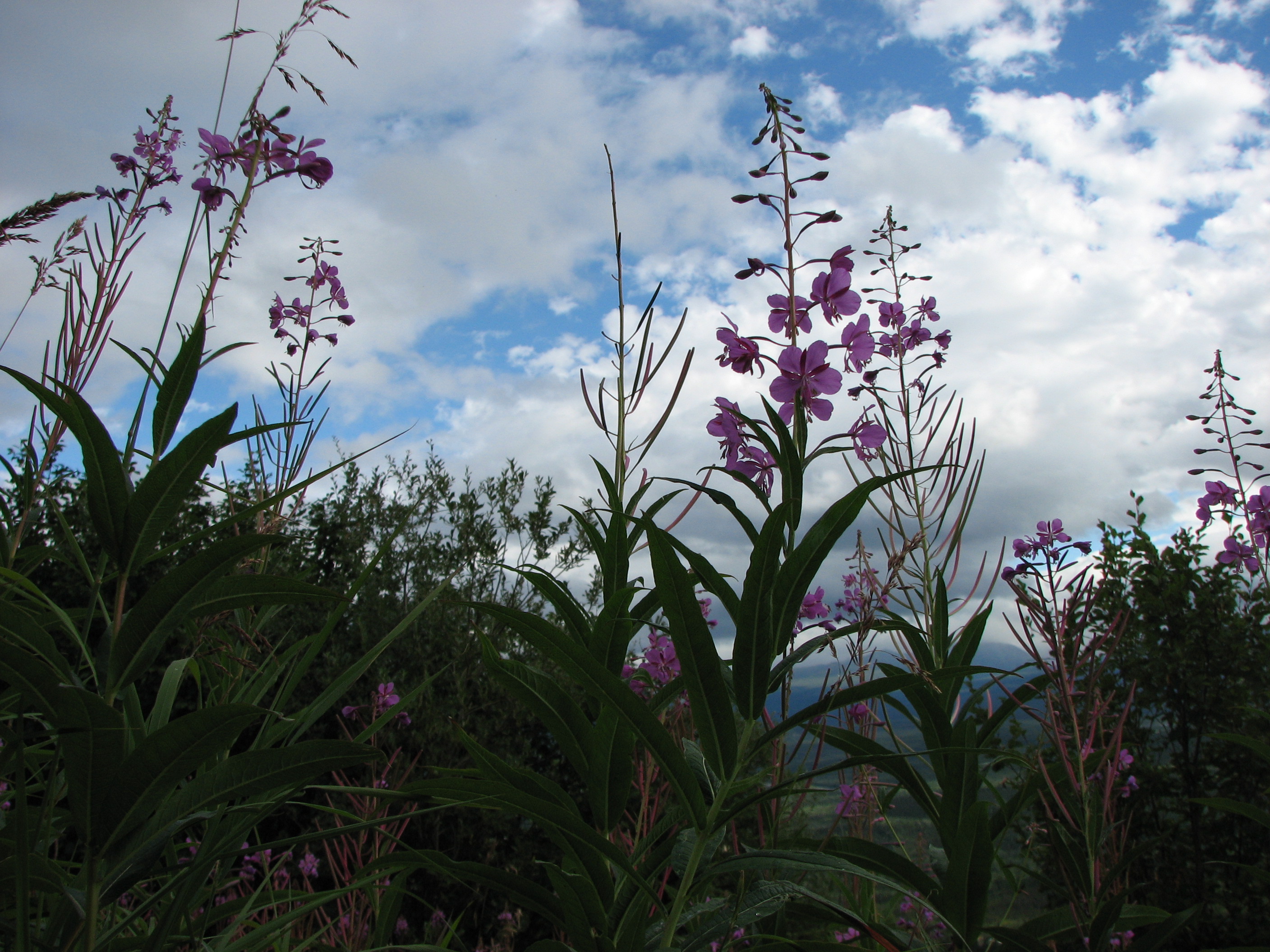
Denali: Mt Healy Overlook Hike — booizzy — CC BY-ND 2.0 — https://www.flickr.com/photos/43875868@N00/1098200754/
booizzy
CC BY-ND 2.0
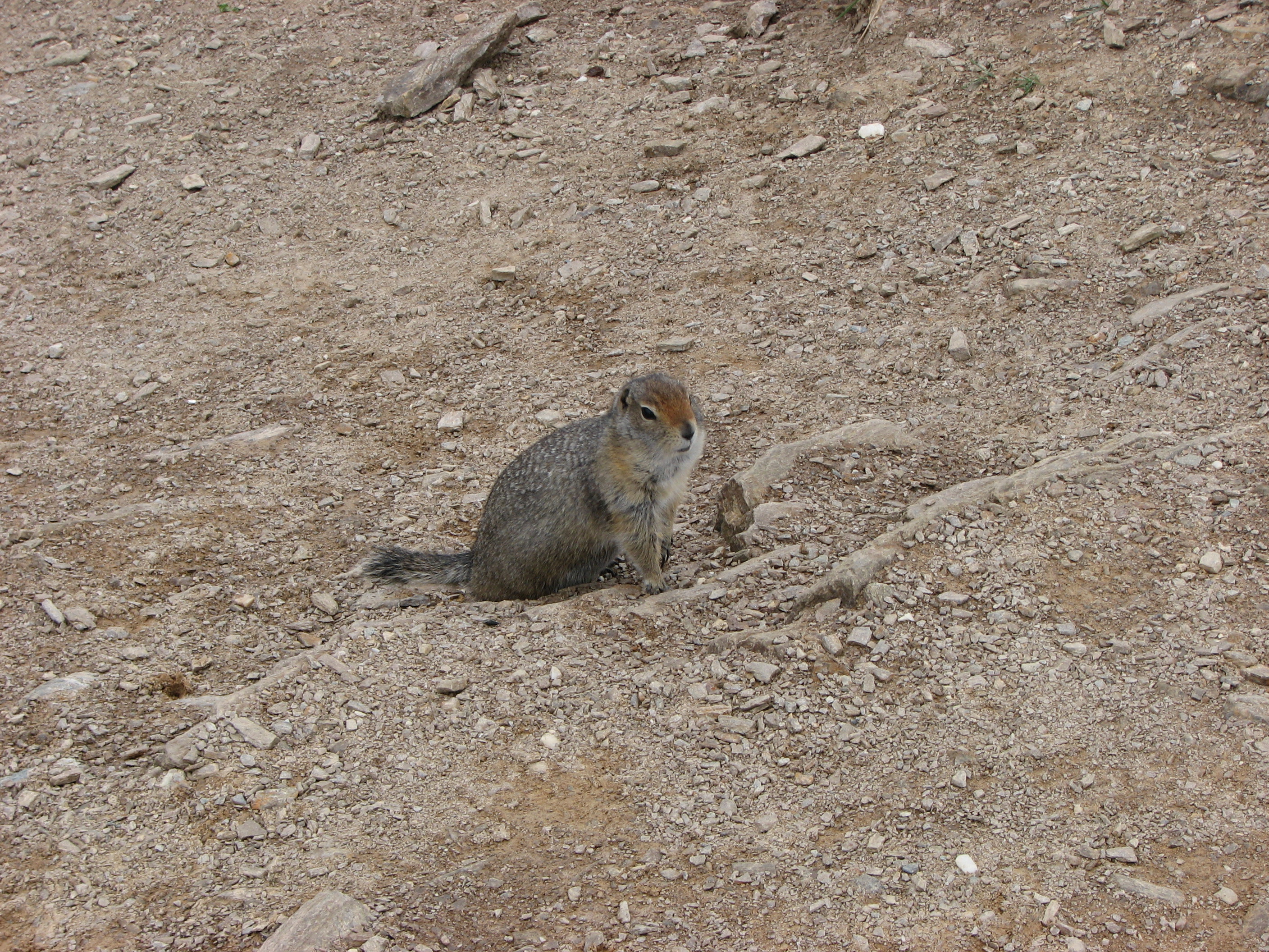
Denali: Mt Healy Overlook Hike — booizzy — CC BY-ND 2.0 — https://www.flickr.com/photos/43875868@N00/1097375349/
booizzy
CC BY-ND 2.0
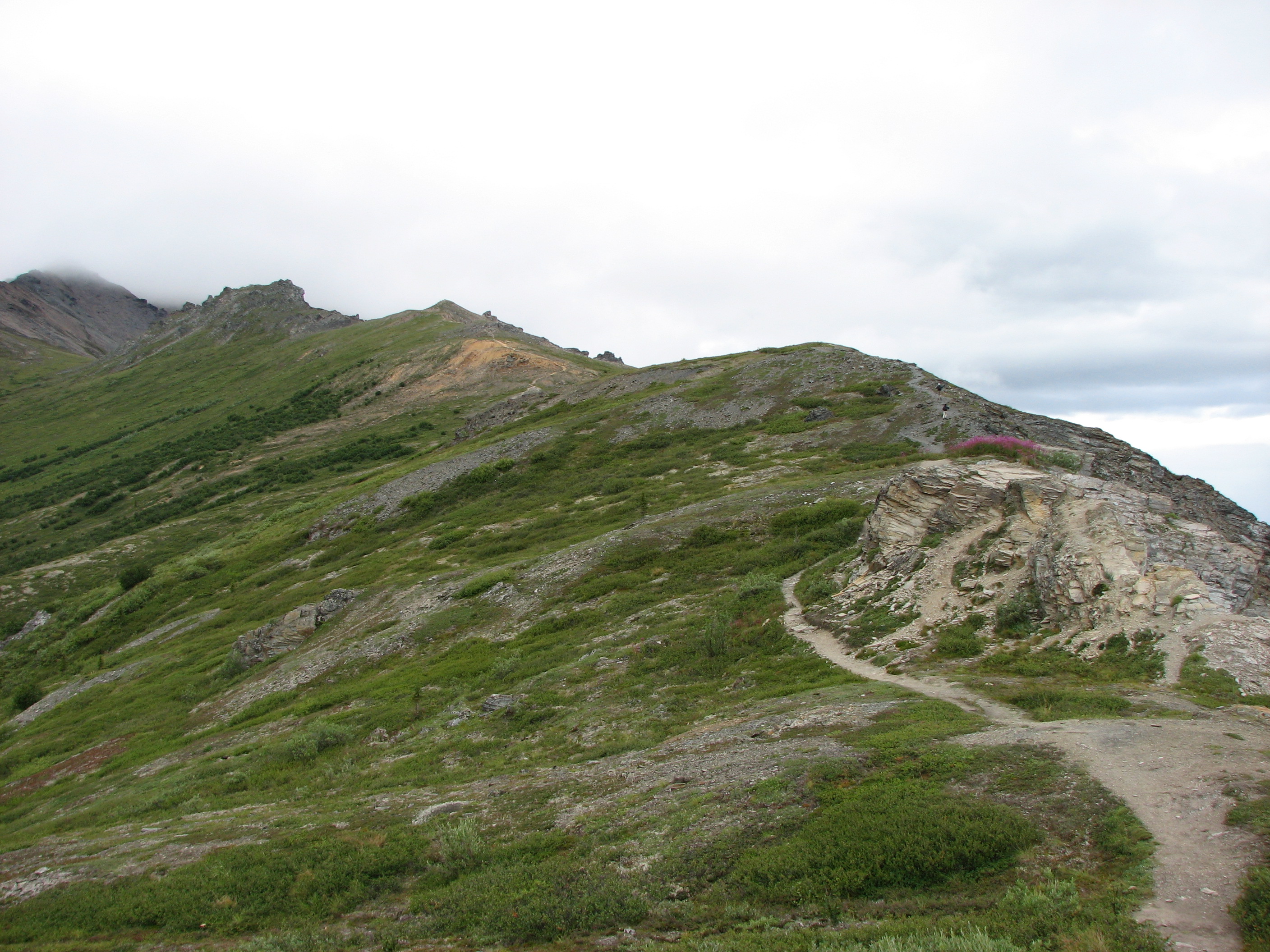
Denali: Mt Healy Overlook Hike — booizzy — CC BY-ND 2.0 — https://www.flickr.com/photos/43875868@N00/1097351813/
booizzy
CC BY-ND 2.0
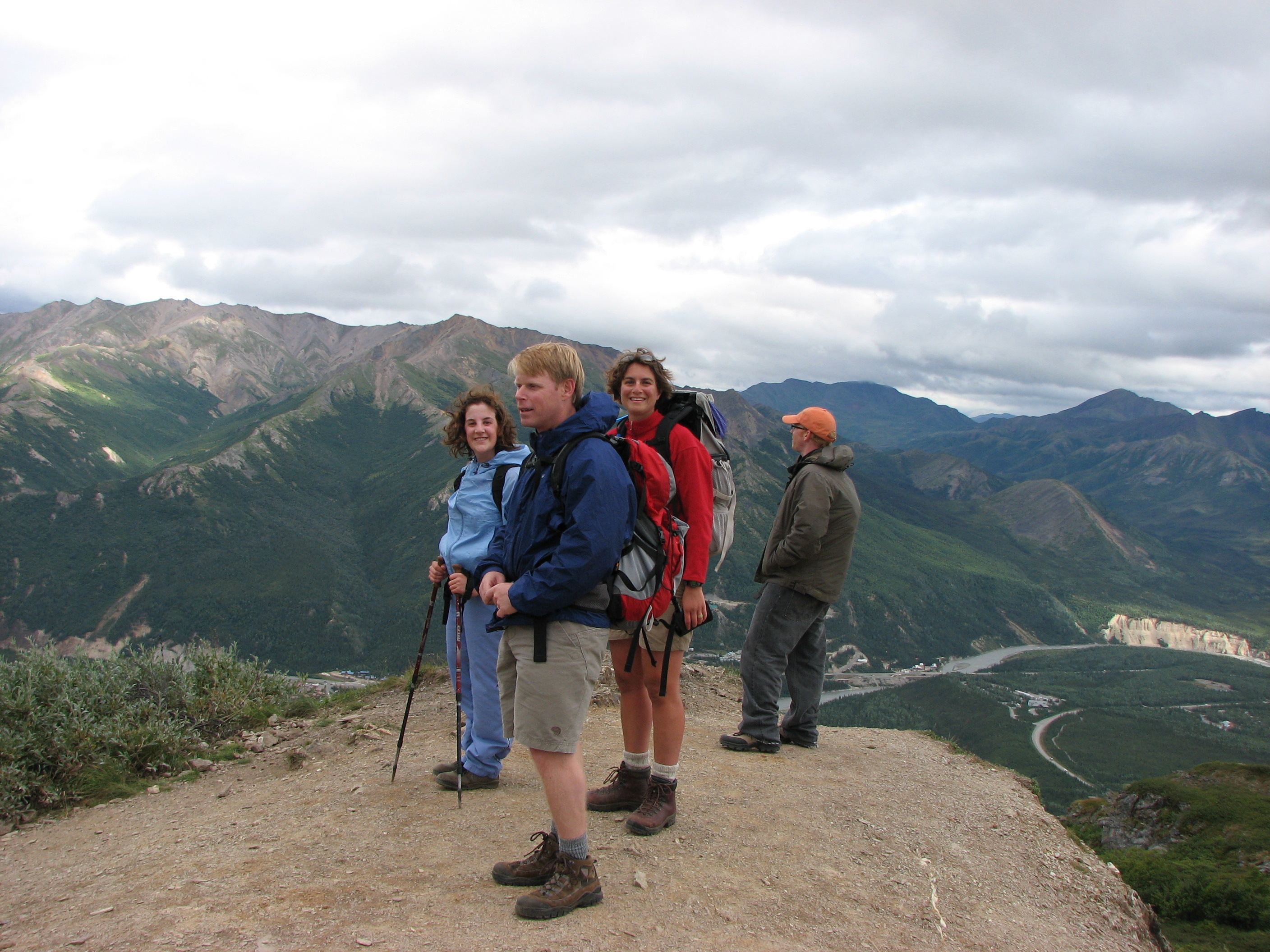
Denali: Mt Healy Overlook Hike — booizzy — CC BY-ND 2.0 — https://www.flickr.com/photos/43875868@N00/1097355385/
booizzy
CC BY-ND 2.0
View original activity in YouVisible
Weather on your route
Loading forecast…
Sources and credits
National Park Service. Public domain · U.S. Government work — https://www.nps.gov/aboutus/disclaimer.htm. No protection is claimed in original U.S. Government works. Photographs have separate individual licences.
National Park Service · NPS Public Trails · Public domain · U.S. Government work
The trail above the valley
Denali: Mt Healy Overlook Hike — booizzy — CC BY-ND 2.0 — https://www.flickr.com/photos/43875868@N00/1098215562/
booizzy · CC BY-ND 2.0 · Media source
Walkers on the mountain path
Denali: Mt Healy Overlook Hike — booizzy — CC BY-ND 2.0 — https://www.flickr.com/photos/43875868@N00/1098204534/
booizzy · CC BY-ND 2.0 · Media source
Fireweed beside the trail
Denali: Mt Healy Overlook Hike — booizzy — CC BY-ND 2.0 — https://www.flickr.com/photos/43875868@N00/1098200754/
booizzy · CC BY-ND 2.0 · Media source
Ground squirrel on rocky terrain
Denali: Mt Healy Overlook Hike — booizzy — CC BY-ND 2.0 — https://www.flickr.com/photos/43875868@N00/1097375349/
booizzy · CC BY-ND 2.0 · Media source
The ridge path
Denali: Mt Healy Overlook Hike — booizzy — CC BY-ND 2.0 — https://www.flickr.com/photos/43875868@N00/1097351813/
booizzy · CC BY-ND 2.0 · Media source
Walkers at the viewpoint
Denali: Mt Healy Overlook Hike — booizzy — CC BY-ND 2.0 — https://www.flickr.com/photos/43875868@N00/1097355385/
booizzy · CC BY-ND 2.0 · Media source