Find your next route
Explore hiking, running, trail running and cycling routes that suit your plans.

Community route
Russell Cave boardwalk · from the cave towards the visitor area
Walk the mapped Russell Cave boardwalk from the cave-viewing end towards the visitor area. The shelter, woodland and elevated walkway introduce the archaeological landscape of Russell Cave National Monument. This is the complete mapped boardwalk way in its original north-to-south direction; it does not include independent exploration inside the cave or the separate nature trail. Photographs show the cave setting and park wildlife in archive views, without promising sightings.
By YouVisible Sport
Mapa del recorrido
Activity measurements
- distance meters
- 194.3405667177
- end · latitude
- 34.9769284
- end · longitude
- -85.810007
- start · latitude
- 34.9782718
- start · longitude
- -85.8098745
- Sport
- walking
- Specialty
- walking outdoor
From start to finish
- Country
- United States
- Province / region
- —
- Localities
- Bridgeport
Before you go
- How to reach the start
- —
- Parking and access
- Use the designated public Cave Trail and observe NPS visitor-area hours and restrictions. The Bridgeport locality is the park’s published town/address reference, not a claim that the cave is in the town centre. Published visitor information is general guidance, rather than confirmation that the entire route is open today. Check current park notices and on-site barriers; parking availability is unverified.
- Advice
- Remain on the visitor boardwalk, respect archaeological-site barriers and do not enter the cave independently. Keep wildlife undisturbed and check surfaces after rain.
- Recommended equipment
- Comfortable footwear with grip, weather-appropriate clothing and water.
- Terrain
- Constructed cave-viewing boardwalk.
- Signage
- —
Characteristics and difficulty
- Estimated duration
- —
- Author perceived effort
- —
- Physical difficulty
- —
- Technical difficulty
- —
About the route
Walk the mapped Russell Cave boardwalk from the cave-viewing end towards the visitor area. The shelter, woodland and elevated walkway introduce the archaeological landscape of Russell Cave National Monument. This is the complete mapped boardwalk way in its original north-to-south direction; it does not include independent exploration inside the cave or the separate nature trail. Photographs show the cave setting and park wildlife in archive views, without promising sightings.
- Context
- —
- Specialty
- walking outdoor
- Event type
- —
- Description
- Views of the route and the places that give it character. These are archive photographs and do not establish current path conditions.
- Title
- Route highlights
- Title
- Sesión
- Description
- Walk the mapped Russell Cave boardwalk from the cave-viewing end towards the visitor area. The shelter, woodland and elevated walkway introduce the archaeological landscape of Russell Cave National Monument. This is the complete mapped boardwalk way in its original north-to-south direction; it does not include independent exploration inside the cave or the separate nature trail. Photographs show the cave setting and park wildlife in archive views, without promising sightings.
- Description
- An archive view of visitors and a ranger on the Russell Cave boardwalk. It illustrates the walking surface, without implying an accompanied visit or association with this route.
- Title
- The woodland boardwalk
- Description
- NPS photograph of the cave entrance and surrounding woodland. Remain within the public visitor area.
- Title
- Russell Cave entrance
- Description
- NPS photograph looking out from the shelter. Independent cave entry is not included in this walking reference.
- Title
- The cave shelter
- Description
- NPS photograph of the public boardwalk and the cave setting.
- Title
- The view from the boardwalk
- Description
- A purple coneflower photographed in Russell Cave National Monument; a park nature photograph, without an asserted capture position or guaranteed seasonal sighting.
- Title
- Purple coneflower in the park
- Description
- A pickerel frog photographed near the Russell Cave picnic entrance. This archive wildlife photograph does not promise a sighting on the boardwalk.
- Title
- A frog near the picnic entrance
- Description
- An archive view of visitors and a ranger on the Russell Cave boardwalk. It illustrates the walking surface, without implying an accompanied visit or association with this route.
- Title
- The woodland boardwalk
- Description
- NPS photograph of the cave entrance and surrounding woodland. Remain within the public visitor area.
- Title
- Russell Cave entrance
- Description
- NPS photograph looking out from the shelter. Independent cave entry is not included in this walking reference.
- Title
- The cave shelter
- Description
- NPS photograph of the public boardwalk and the cave setting.
- Title
- The view from the boardwalk
- Description
- A purple coneflower photographed in Russell Cave National Monument; a park nature photograph, without an asserted capture position or guaranteed seasonal sighting.
- Title
- Purple coneflower in the park
- Description
- A pickerel frog photographed near the Russell Cave picnic entrance. This archive wildlife photograph does not promise a sighting on the boardwalk.
- Title
- A frog near the picnic entrance
- Advice
- Remain on the visitor boardwalk, respect archaeological-site barriers and do not enter the cave independently. Keep wildlife undisturbed and check surfaces after rain.
- Parking and access
- Use the designated public Cave Trail and observe NPS visitor-area hours and restrictions. The Bridgeport locality is the park’s published town/address reference, not a claim that the cave is in the town centre. Published visitor information is general guidance, rather than confirmation that the entire route is open today. Check current park notices and on-site barriers; parking availability is unverified.
- Recommended equipment
- Comfortable footwear with grip, weather-appropriate clothing and water.
- Terrain
- Constructed cave-viewing boardwalk.
- Title
- Russell Cave boardwalk · from the cave towards the visitor area
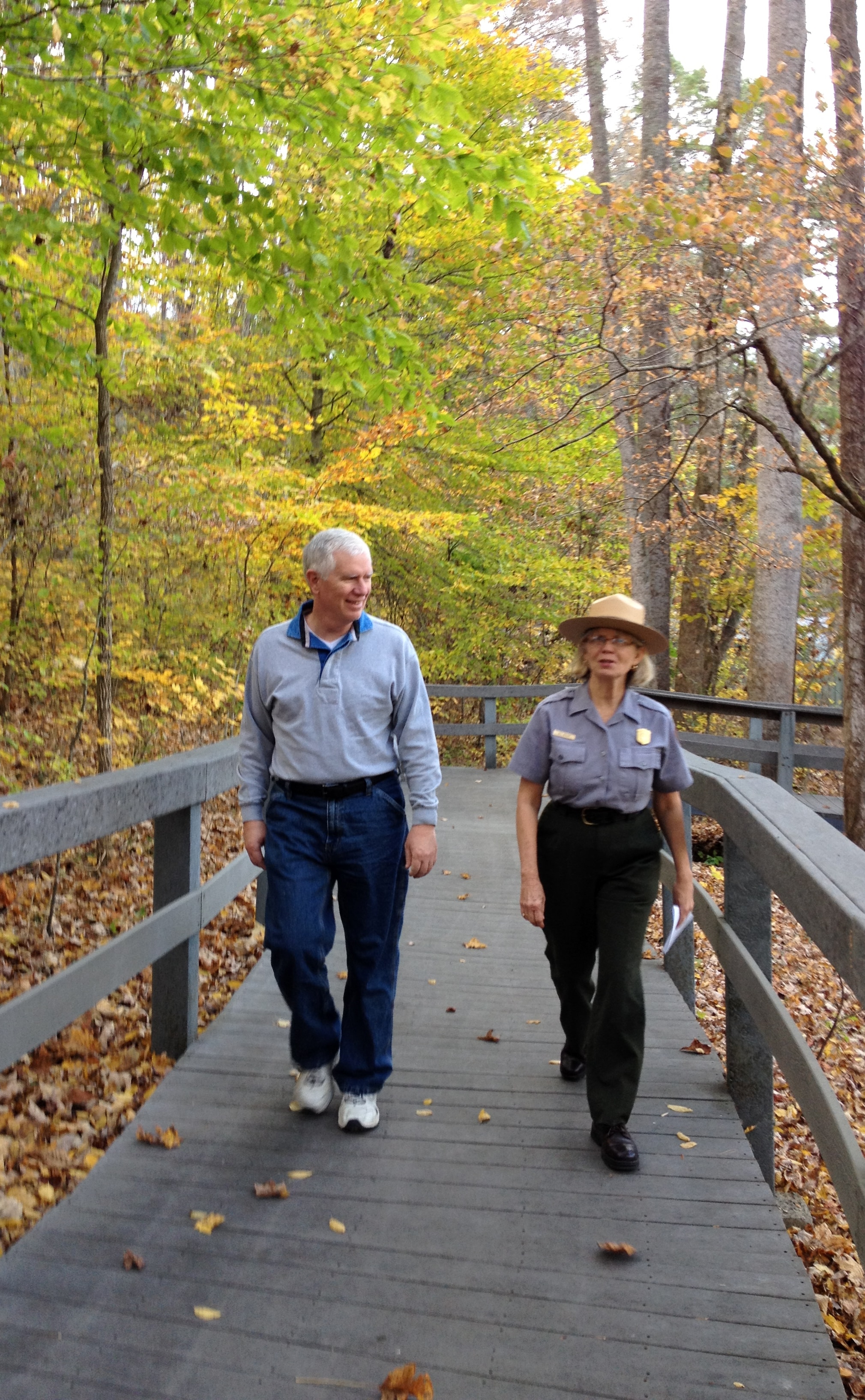
Russell Cave National Monument — repmobrooks — CC BY-SA 2.0 — https://www.flickr.com/photos/58533574@N04/10727926133/ · JPEG re-encoded for web delivery without changing dimensions or orientation.
repmobrooks
CC BY-SA 2.0
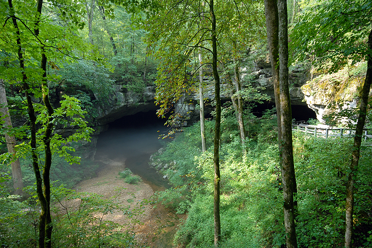
Entrance of Russell Cave. — NPS Photo — Public domain — https://npgallery.nps.gov/AssetDetail/3488fa6c-1dd8-b71c-076b-c2427b31535c
NPS Photo
Public domain
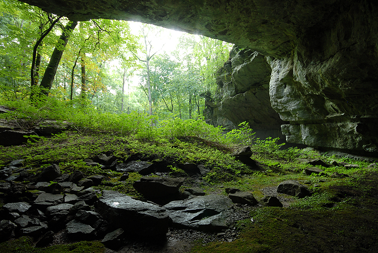
Inside the cave shelter. — NPS photo — Public domain — https://npgallery.nps.gov/AssetDetail/3564c2c0-1dd8-b71c-077f-116e899773fe
NPS photo
Public domain
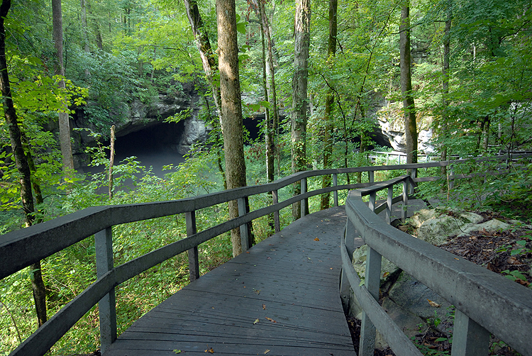
View of the cave from the boardwalk. — NPS photo — Public domain — https://npgallery.nps.gov/AssetDetail/3605d369-1dd8-b71c-07a4-0e6557902f7f
NPS photo
Public domain
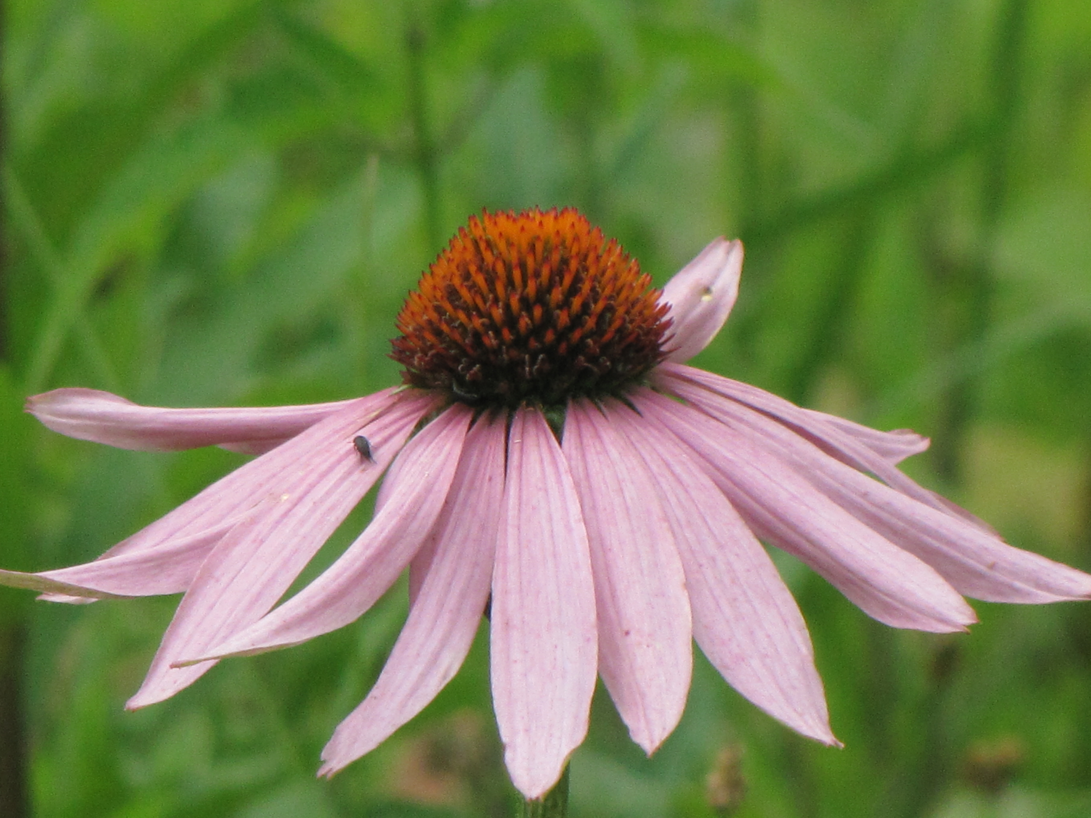
Purple Coneflower in Russell Cave National Monument, Alabama — U.S. Department of the Interior — CC BY-SA 2.0 — https://www.flickr.com/photos/42687493@N06/9125109469/
U.S. Department of the Interior
CC BY-SA 2.0
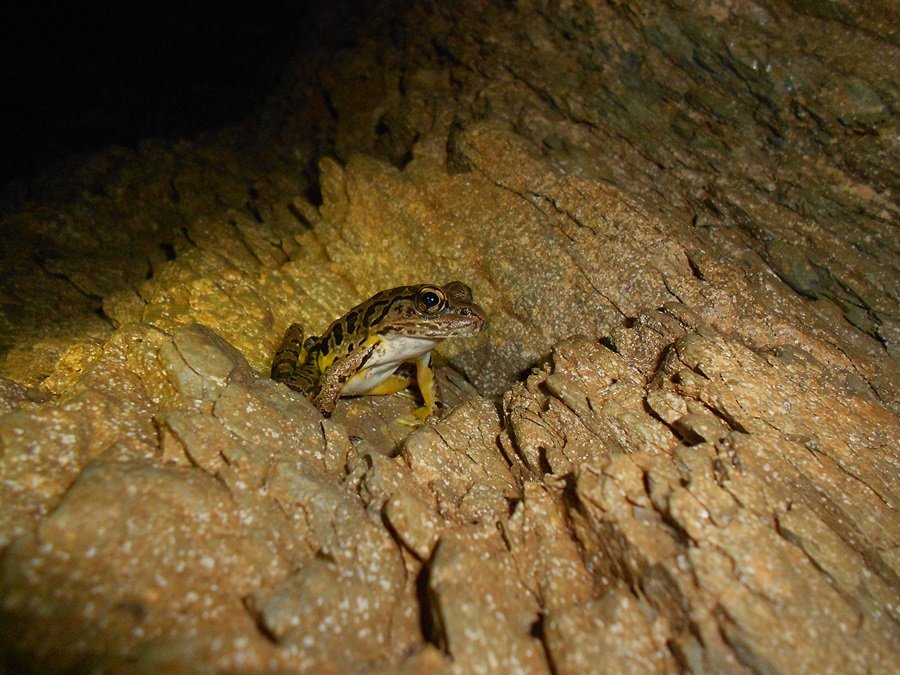
pickerel frog found in the picnic entrance to Russell Cave. — U.S. Department of the Interior — CC BY-SA 2.0 — https://www.flickr.com/photos/42687493@N06/9125145057/
U.S. Department of the Interior
CC BY-SA 2.0
View original activity in YouVisible
Weather on your route
Loading forecast…
Sources and credits
© OpenStreetMap contributors. Open Database License (ODbL) 1.0 — https://www.openstreetmap.org/copyright — https://opendatacommons.org/licenses/odbl/1-0/. Complete selected ways converted faithfully to GPX; geometry remains under ODbL 1.0. Photographs have separate individual licences.
OpenStreetMap contributors · OpenStreetMap ways · ODbL 1.0
The woodland boardwalk
Russell Cave National Monument — repmobrooks — CC BY-SA 2.0 — https://www.flickr.com/photos/58533574@N04/10727926133/ · JPEG re-encoded for web delivery without changing dimensions or orientation.
repmobrooks · CC BY-SA 2.0 · Media source
Russell Cave entrance
Entrance of Russell Cave. — NPS Photo — Public domain — https://npgallery.nps.gov/AssetDetail/3488fa6c-1dd8-b71c-076b-c2427b31535c
NPS Photo · Public domain · Media source
The cave shelter
Inside the cave shelter. — NPS photo — Public domain — https://npgallery.nps.gov/AssetDetail/3564c2c0-1dd8-b71c-077f-116e899773fe
NPS photo · Public domain · Media source
The view from the boardwalk
View of the cave from the boardwalk. — NPS photo — Public domain — https://npgallery.nps.gov/AssetDetail/3605d369-1dd8-b71c-07a4-0e6557902f7f
NPS photo · Public domain · Media source
Purple coneflower in the park
Purple Coneflower in Russell Cave National Monument, Alabama — U.S. Department of the Interior — CC BY-SA 2.0 — https://www.flickr.com/photos/42687493@N06/9125109469/
U.S. Department of the Interior · CC BY-SA 2.0 · Media source
A frog near the picnic entrance
pickerel frog found in the picnic entrance to Russell Cave. — U.S. Department of the Interior — CC BY-SA 2.0 — https://www.flickr.com/photos/42687493@N06/9125145057/
U.S. Department of the Interior · CC BY-SA 2.0 · Media source