Find your next route
Explore hiking, running, trail running and cycling routes that suit your plans.

Community route
Leighlinbridge to Rathvinden · the Barrow towpath
Set out beside the Barrow at Leighlinbridge and follow the towpath north towards Rathvinden Lock. The bridge and Black Castle mark the historic village setting, while the navigation channel, riverbank trees and lock provide the quieter part of the walk. The reference follows one complete mapped section of the Barrow Way and ends at its northern source endpoint; it does not add a return journey or access inside the castle.
By YouVisible Sport
Mapa del recorrido
Activity measurements
- distance meters
- 1,529.7197982484
- end · latitude
- 52.7487514
- end · longitude
- -6.9681711
- start · latitude
- 52.736739
- start · longitude
- -6.9786591
- Sport
- hiking mountaineering
- Specialty
- Hiking
From start to finish
- Country
- Ireland
- Province / region
- —
- Localities
- Leighlinbridge
Before you go
- How to reach the start
- —
- Parking and access
- Use the public towpath from Leighlinbridge and consult current Waterways Ireland and local notices. Remain on the designated path and respect adjoining private land. Tourism information does not confirm same-day opening or towpath condition. Parking availability and building admission are unverified.
- Advice
- Keep back from the water, lock chambers and weirs. Expect muddy or slippery ground after rain, keep dogs under control and give other path users room. This is a one-way reference; arrange the return separately.
- Recommended equipment
- Footwear with grip suitable for wet grass, waterproof clothing, water and an offline map.
- Terrain
- Grassy and unpaved river-navigation towpath beside the Barrow.
- Signage
- —
Characteristics and difficulty
- Estimated duration
- —
- Author perceived effort
- —
- Physical difficulty
- —
- Technical difficulty
- —
About the route
Set out beside the Barrow at Leighlinbridge and follow the towpath north towards Rathvinden Lock. The bridge and Black Castle mark the historic village setting, while the navigation channel, riverbank trees and lock provide the quieter part of the walk. The reference follows one complete mapped section of the Barrow Way and ends at its northern source endpoint; it does not add a return journey or access inside the castle.
- Context
- —
- Specialty
- Hiking
- Event type
- —
- Description
- Views of the route and the places that give it character. These are archive photographs and do not establish current path conditions.
- Title
- Route highlights
- Title
- Sesión
- Description
- Set out beside the Barrow at Leighlinbridge and follow the towpath north towards Rathvinden Lock. The bridge and Black Castle mark the historic village setting, while the navigation channel, riverbank trees and lock provide the quieter part of the walk. The reference follows one complete mapped section of the Barrow Way and ends at its northern source endpoint; it does not add a return journey or access inside the castle.
- Description
- The exterior of Black Castle at Leighlinbridge, a landmark by the southern end of the walk. No access inside the ruin is included.
- Title
- Black Castle
- Description
- The historic bridge and castle beside the Barrow.
- Title
- Bridge and castle
- Description
- The grassy towpath alongside the navigation channel north of Leighlinbridge.
- Title
- Towpath beside the canal
- Description
- Lock gates and the towpath at Rathvinden, near the northern end of the reference.
- Title
- Rathvinden Lock
- Description
- The Barrow and moorings north of Leighlinbridge.
- Title
- North along the Barrow
- Description
- Water, riverbank vegetation and the weir in the Leighlinbridge landscape.
- Title
- River and weir
- Description
- The exterior of Black Castle at Leighlinbridge, a landmark by the southern end of the walk. No access inside the ruin is included.
- Title
- Black Castle
- Description
- The historic bridge and castle beside the Barrow.
- Title
- Bridge and castle
- Description
- The grassy towpath alongside the navigation channel north of Leighlinbridge.
- Title
- Towpath beside the canal
- Description
- Lock gates and the towpath at Rathvinden, near the northern end of the reference.
- Title
- Rathvinden Lock
- Description
- The Barrow and moorings north of Leighlinbridge.
- Title
- North along the Barrow
- Description
- Water, riverbank vegetation and the weir in the Leighlinbridge landscape.
- Title
- River and weir
- Advice
- Keep back from the water, lock chambers and weirs. Expect muddy or slippery ground after rain, keep dogs under control and give other path users room. This is a one-way reference; arrange the return separately.
- Parking and access
- Use the public towpath from Leighlinbridge and consult current Waterways Ireland and local notices. Remain on the designated path and respect adjoining private land. Tourism information does not confirm same-day opening or towpath condition. Parking availability and building admission are unverified.
- Recommended equipment
- Footwear with grip suitable for wet grass, waterproof clothing, water and an offline map.
- Terrain
- Grassy and unpaved river-navigation towpath beside the Barrow.
- Title
- Leighlinbridge to Rathvinden · the Barrow towpath
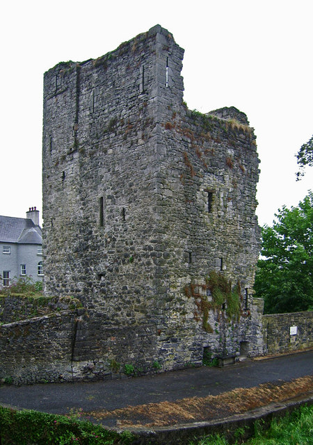
Castles of Leinster: Black Castle, Leighlinbridge, Carlow (1) — Garry Dickinson — CC BY-SA 2.0 — https://www.geograph.org.uk/photo/6589923
Garry Dickinson
CC BY-SA 2.0
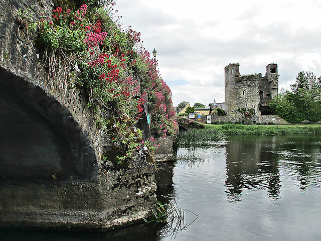
Bridge and Castle — kevin higgins — CC BY-SA 2.0 — https://www.geograph.org.uk/photo/6865884
kevin higgins
CC BY-SA 2.0
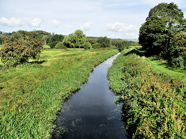
Canal and Towpath — kevin higgins — CC BY-SA 2.0 — https://www.geograph.org.uk/photo/6265584
kevin higgins
CC BY-SA 2.0
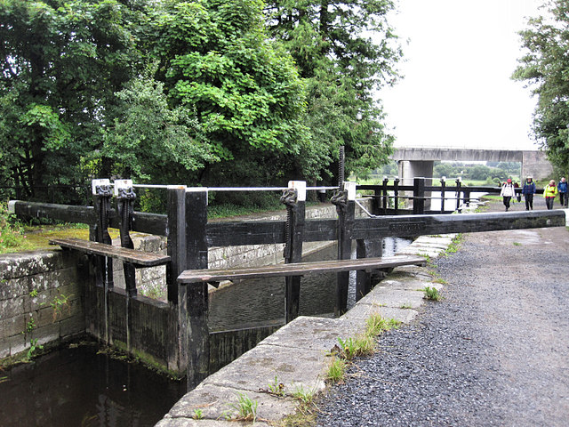
Rathvinden Lock — kevin higgins — CC BY-SA 2.0 — https://www.geograph.org.uk/photo/5501343
kevin higgins
CC BY-SA 2.0
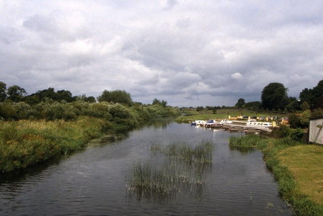
The River Barrow north of Leighlinbridge — Colin Park — CC BY-SA 2.0 — https://www.geograph.org.uk/photo/6502568
Colin Park
CC BY-SA 2.0
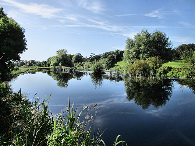
River and Weir — kevin higgins — CC BY-SA 2.0 — https://www.geograph.org.uk/photo/6265587
kevin higgins
CC BY-SA 2.0
View original activity in YouVisible
Weather on your route
Loading forecast…
Sources and credits
© OpenStreetMap contributors. Open Database License (ODbL) 1.0 — https://www.openstreetmap.org/copyright — https://opendatacommons.org/licenses/odbl/1-0/. Complete selected ways converted faithfully to GPX; geometry remains under ODbL 1.0. Photographs have separate individual licences.
OpenStreetMap contributors · OpenStreetMap ways · ODbL 1.0
Black Castle
Castles of Leinster: Black Castle, Leighlinbridge, Carlow (1) — Garry Dickinson — CC BY-SA 2.0 — https://www.geograph.org.uk/photo/6589923
Garry Dickinson · CC BY-SA 2.0 · Media source
Bridge and castle
Bridge and Castle — kevin higgins — CC BY-SA 2.0 — https://www.geograph.org.uk/photo/6865884
kevin higgins · CC BY-SA 2.0 · Media source
Towpath beside the canal
Canal and Towpath — kevin higgins — CC BY-SA 2.0 — https://www.geograph.org.uk/photo/6265584
kevin higgins · CC BY-SA 2.0 · Media source
Rathvinden Lock
Rathvinden Lock — kevin higgins — CC BY-SA 2.0 — https://www.geograph.org.uk/photo/5501343
kevin higgins · CC BY-SA 2.0 · Media source
North along the Barrow
The River Barrow north of Leighlinbridge — Colin Park — CC BY-SA 2.0 — https://www.geograph.org.uk/photo/6502568
Colin Park · CC BY-SA 2.0 · Media source
River and weir
River and Weir — kevin higgins — CC BY-SA 2.0 — https://www.geograph.org.uk/photo/6265587
kevin higgins · CC BY-SA 2.0 · Media source