Find your next route
Explore hiking, running, trail running and cycling routes that suit your plans.

Community route
Borris Viaduct · a walk above the old railway arches
Walk along the grassed top of Borris Viaduct, above the repeated stone arches of the former railway. This short, straight reference follows the complete mapped viaduct walkway from its southern to its northern endpoint. Views of the structure from below complement the walk’s railway heritage, but no extra descent, private-field access or return leg has been added to the reference.
By YouVisible Sport
Mapa del recorrido
Activity measurements
- distance meters
- 217.540192569
- end · latitude
- 52.5970526
- end · longitude
- -6.9164117
- start · latitude
- 52.5955065
- start · longitude
- -6.9144382
- Sport
- walking
- Specialty
- walking outdoor
From start to finish
- Country
- Ireland
- Province / region
- —
- Localities
- Borris
Before you go
- How to reach the start
- —
- Parking and access
- Use the signed public viaduct walk in Borris and respect gates and adjoining private land. Check local notices before visiting. Published tourism information is general access guidance and does not establish the structure’s condition or opening today. No parking position or availability is asserted.
- Advice
- Stay within the designated walkway, keep away from parapet edges and supervise children. Grass may be slippery when wet. The reference is one way; plan the return separately.
- Recommended equipment
- Walking footwear with grip and weather-appropriate clothing.
- Terrain
- A grassed former railway viaduct walkway.
- Signage
- —
Characteristics and difficulty
- Estimated duration
- —
- Author perceived effort
- —
- Physical difficulty
- —
- Technical difficulty
- —
About the route
Walk along the grassed top of Borris Viaduct, above the repeated stone arches of the former railway. This short, straight reference follows the complete mapped viaduct walkway from its southern to its northern endpoint. Views of the structure from below complement the walk’s railway heritage, but no extra descent, private-field access or return leg has been added to the reference.
- Context
- —
- Specialty
- walking outdoor
- Event type
- —
- Description
- Views of the route and the places that give it character. These are archive photographs and do not establish current path conditions.
- Title
- Route highlights
- Title
- Sesión
- Description
- Walk along the grassed top of Borris Viaduct, above the repeated stone arches of the former railway. This short, straight reference follows the complete mapped viaduct walkway from its southern to its northern endpoint. Views of the structure from below complement the walk’s railway heritage, but no extra descent, private-field access or return leg has been added to the reference.
- Description
- An archive view through one of the railway viaduct’s stone arches.
- Title
- A viaduct arch
- Description
- The grassed walking surface above the old railway arches.
- Title
- The viaduct walkway
- Description
- The side of Borris Viaduct, seen from the adjoining public area.
- Title
- Stonework from below
- Description
- The repeated stone arches of Borris Viaduct.
- Title
- The old railway structure
- Description
- A wider archive view of the viaduct and the landscape beneath it.
- Title
- The span across the landscape
- Description
- The signed public approach to Borris Viaduct.
- Title
- Approach to the viaduct
- Description
- An archive view through one of the railway viaduct’s stone arches.
- Title
- A viaduct arch
- Description
- The grassed walking surface above the old railway arches.
- Title
- The viaduct walkway
- Description
- The side of Borris Viaduct, seen from the adjoining public area.
- Title
- Stonework from below
- Description
- The repeated stone arches of Borris Viaduct.
- Title
- The old railway structure
- Description
- A wider archive view of the viaduct and the landscape beneath it.
- Title
- The span across the landscape
- Description
- The signed public approach to Borris Viaduct.
- Title
- Approach to the viaduct
- Advice
- Stay within the designated walkway, keep away from parapet edges and supervise children. Grass may be slippery when wet. The reference is one way; plan the return separately.
- Parking and access
- Use the signed public viaduct walk in Borris and respect gates and adjoining private land. Check local notices before visiting. Published tourism information is general access guidance and does not establish the structure’s condition or opening today. No parking position or availability is asserted.
- Recommended equipment
- Walking footwear with grip and weather-appropriate clothing.
- Terrain
- A grassed former railway viaduct walkway.
- Title
- Borris Viaduct · a walk above the old railway arches
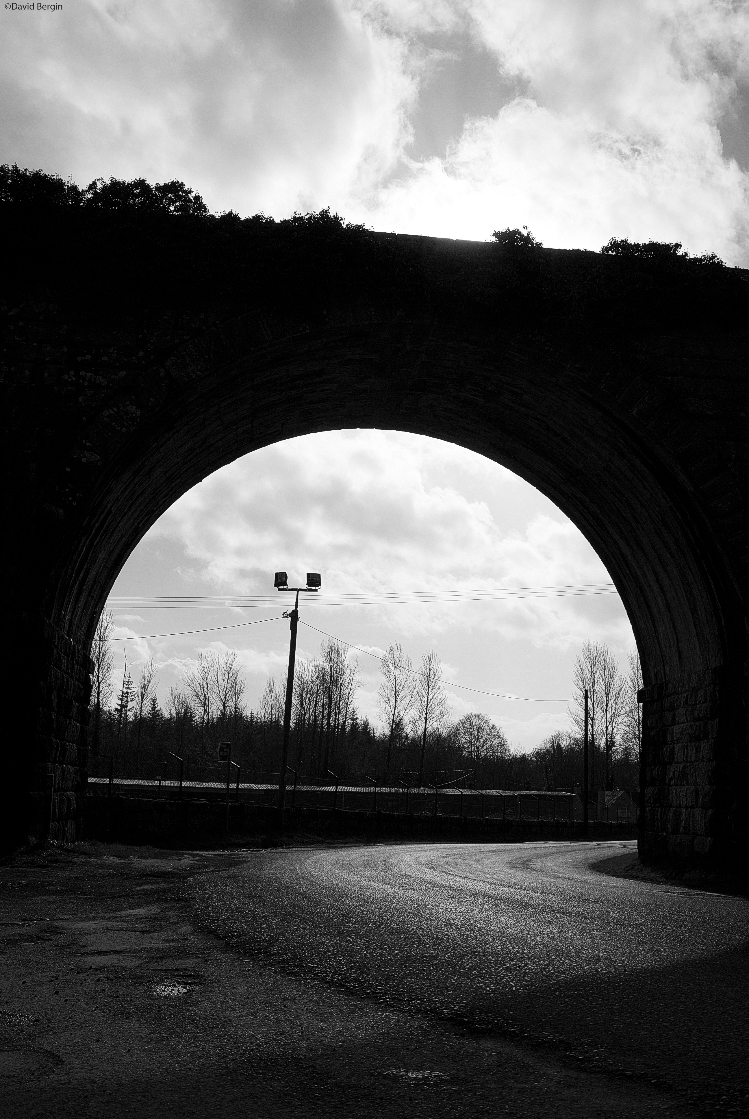
Borris Viaduct, Borris, County Carlow — David Bergin — CC BY 2.0 — https://www.flickr.com/photos/44290184@N08/16784763317/
David Bergin
CC BY 2.0
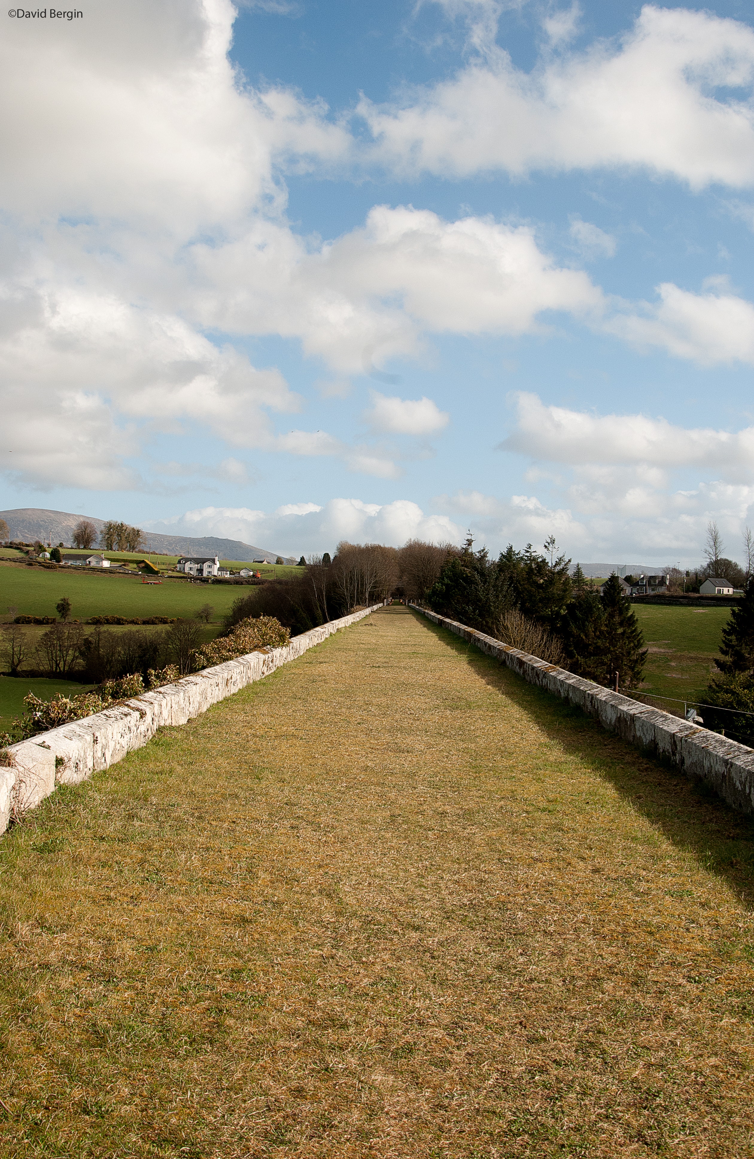
Borris Viaduct, Borris, County Carlow — David Bergin — CC BY 2.0 — https://www.flickr.com/photos/44290184@N08/16784790427/ · JPEG re-encoded for web delivery without changing dimensions or orientation.
David Bergin
CC BY 2.0
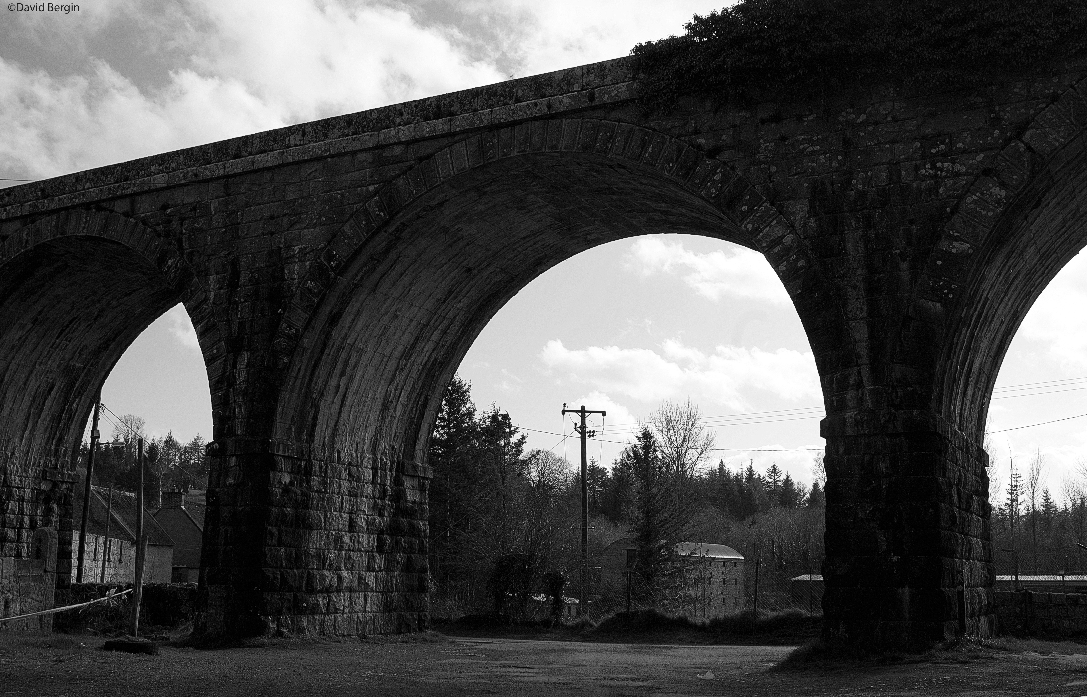
Borris Viaduct, Borris, County Carlow — David Bergin — CC BY 2.0 — https://www.flickr.com/photos/44290184@N08/16784793107/
David Bergin
CC BY 2.0
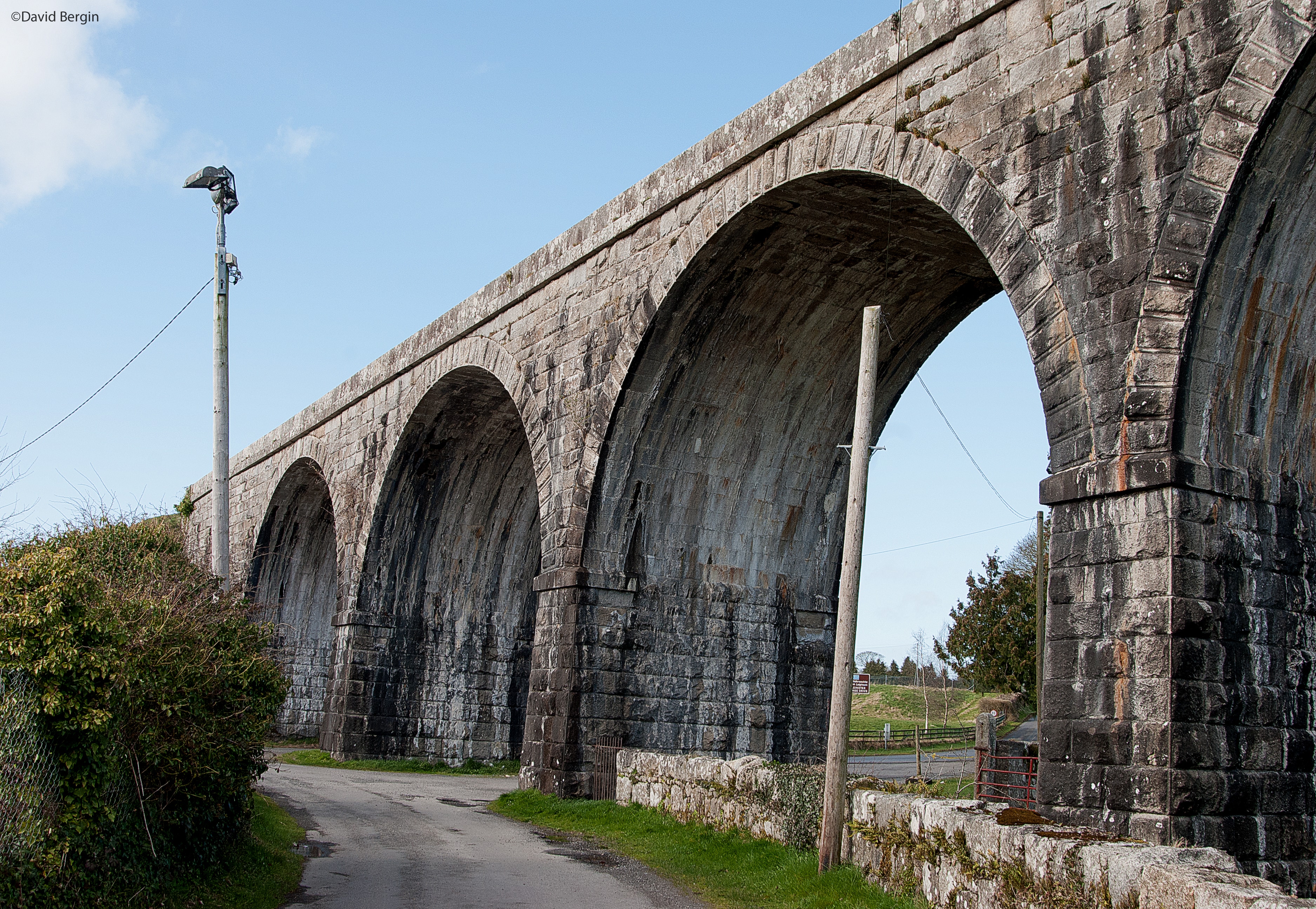
Borris Viaduct, Borris, County Carlow — David Bergin — CC BY 2.0 — https://www.flickr.com/photos/44290184@N08/16805952919/ · JPEG re-encoded for web delivery without changing dimensions or orientation.
David Bergin
CC BY 2.0
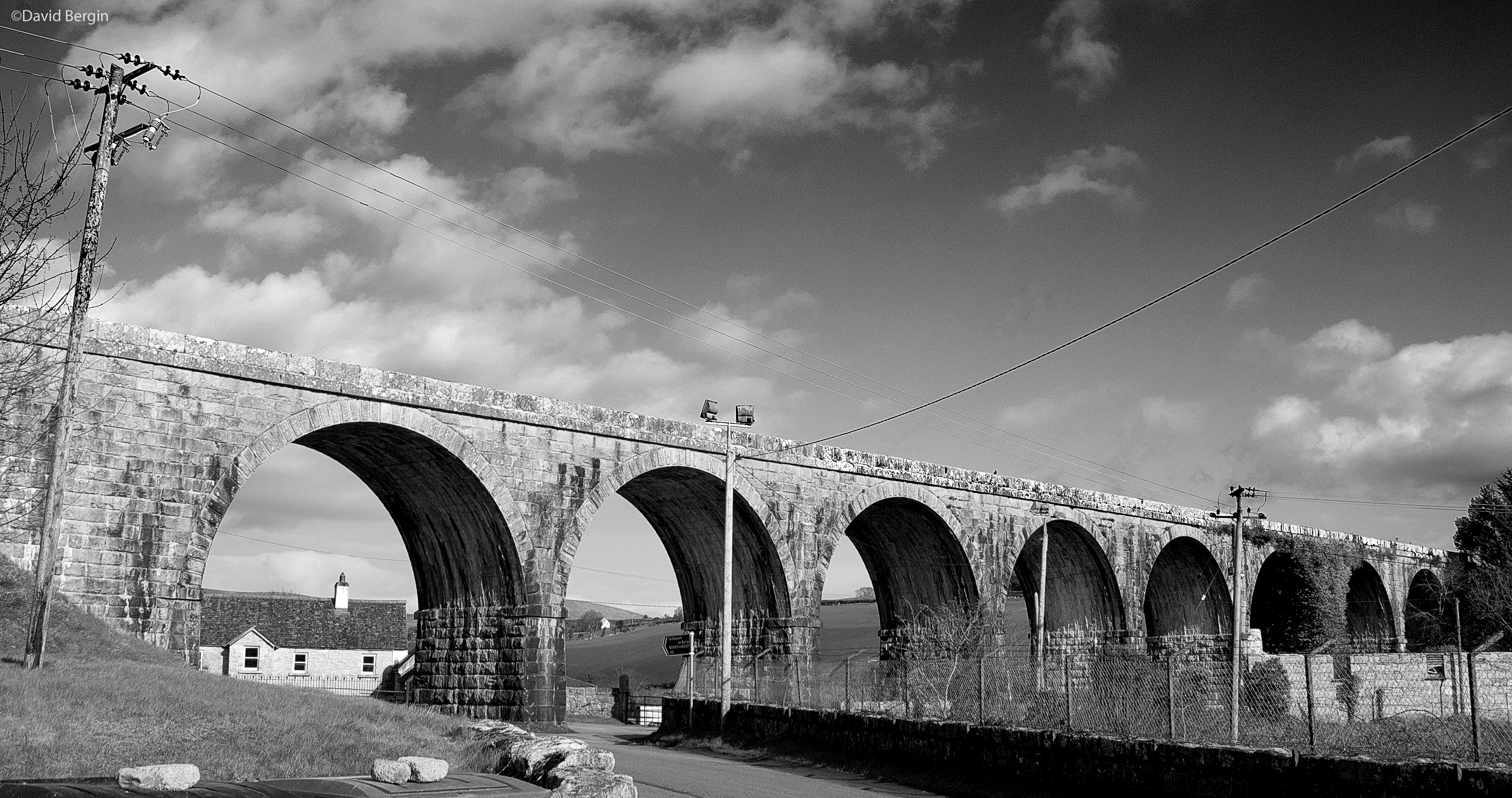
Borris Viaduct, Borris, County Carlow — David Bergin — CC BY 2.0 — https://www.flickr.com/photos/44290184@N08/16992100515/
David Bergin
CC BY 2.0
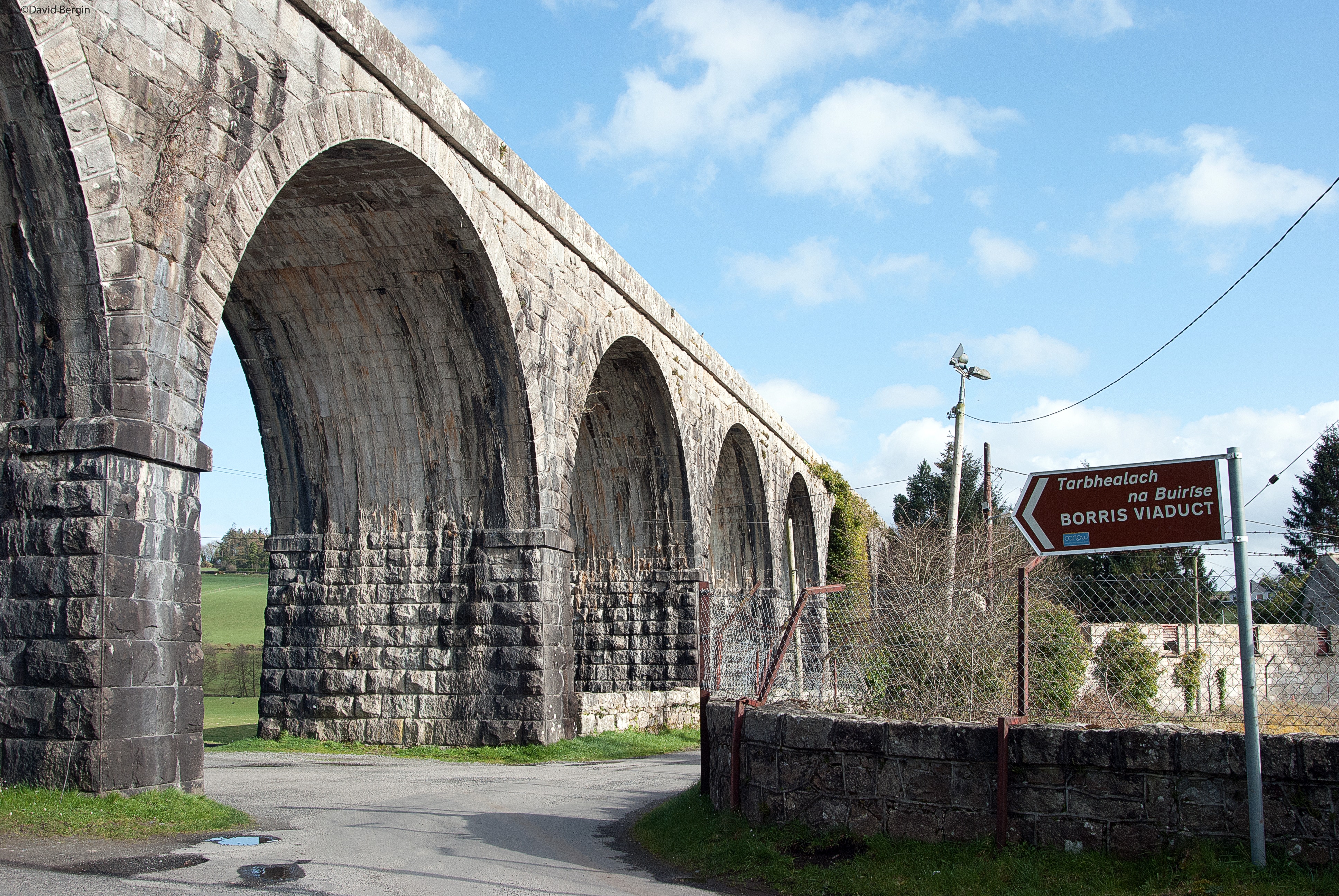
Borris Viaduct, Borris, County Carlow — David Bergin — CC BY 2.0 — https://www.flickr.com/photos/44290184@N08/16992148545/ · JPEG re-encoded for web delivery without changing dimensions or orientation.
David Bergin
CC BY 2.0
View original activity in YouVisible
Weather on your route
Loading forecast…
Sources and credits
© OpenStreetMap contributors. Open Database License (ODbL) 1.0 — https://www.openstreetmap.org/copyright — https://opendatacommons.org/licenses/odbl/1-0/. Complete selected ways converted faithfully to GPX; geometry remains under ODbL 1.0. Photographs have separate individual licences.
OpenStreetMap contributors · OpenStreetMap ways · ODbL 1.0
A viaduct arch
Borris Viaduct, Borris, County Carlow — David Bergin — CC BY 2.0 — https://www.flickr.com/photos/44290184@N08/16784763317/
David Bergin · CC BY 2.0 · Media source
The viaduct walkway
Borris Viaduct, Borris, County Carlow — David Bergin — CC BY 2.0 — https://www.flickr.com/photos/44290184@N08/16784790427/ · JPEG re-encoded for web delivery without changing dimensions or orientation.
David Bergin · CC BY 2.0 · Media source
Stonework from below
Borris Viaduct, Borris, County Carlow — David Bergin — CC BY 2.0 — https://www.flickr.com/photos/44290184@N08/16784793107/
David Bergin · CC BY 2.0 · Media source
The old railway structure
Borris Viaduct, Borris, County Carlow — David Bergin — CC BY 2.0 — https://www.flickr.com/photos/44290184@N08/16805952919/ · JPEG re-encoded for web delivery without changing dimensions or orientation.
David Bergin · CC BY 2.0 · Media source
The span across the landscape
Borris Viaduct, Borris, County Carlow — David Bergin — CC BY 2.0 — https://www.flickr.com/photos/44290184@N08/16992100515/
David Bergin · CC BY 2.0 · Media source
Approach to the viaduct
Borris Viaduct, Borris, County Carlow — David Bergin — CC BY 2.0 — https://www.flickr.com/photos/44290184@N08/16992148545/ · JPEG re-encoded for web delivery without changing dimensions or orientation.
David Bergin · CC BY 2.0 · Media source