Find your next route
Explore hiking, running, trail running and cycling routes that suit your plans.

Community route
Kilbrannish Hill and Croaghaun · approach and forest loop
Follow the mapped approach from the Kilbrannish Woods car-park area to the forest junction, then take the Kilbrannish Hill and Croaghaun loop. Forestry roads, open hill and views across the Carlow countryside give the route its character. This reference ends at the junction after the loop: the short return spur to the car park is not present a second time in the source and has not been invented. Arrange that final return on the ground using current signs.
By YouVisible Sport
Mapa del recorrido
Activity measurements
- distance meters
- 5,118.5844188451
- end · latitude
- 52.6567497
- end · longitude
- -6.7543304
- start · latitude
- 52.6563235
- start · longitude
- -6.754907
- Sport
- hiking mountaineering
- Specialty
- Hiking
From start to finish
- Country
- Ireland
- Province / region
- —
- Localities
- Bunclody
Before you go
- How to reach the start
- —
- Parking and access
- The trail is in County Carlow. Bunclody is the nearest town named by the trail publisher, rather than a claim that the track lies in County Wexford. Use the designated forest access and check current Coillte and trail-management notices. The source has one approach spur and a loop; it does not contain the final return along the spur. Car-park availability is not confirmed.
- Advice
- Follow current waymarks and forest-operation notices. The hill is exposed to wind and changing visibility. Keep dogs on a lead, avoid forestry work areas and plan the short return from the final junction separately.
- Recommended equipment
- Walking boots or shoes with grip, waterproof and windproof layers, water and an offline map.
- Terrain
- Forestry roads, woodland tracks and exposed hill sections. Sport Ireland describes the published full loop as Strenuous / Challenging; no separate normalized physical or technical score is asserted for this reference variant.
- Signage
- Sport Ireland: purple arrow on yellow background.
Characteristics and difficulty
- Estimated duration
- —
- Author perceived effort
- —
- Physical difficulty
- —
- Technical difficulty
- —
About the route
Follow the mapped approach from the Kilbrannish Woods car-park area to the forest junction, then take the Kilbrannish Hill and Croaghaun loop. Forestry roads, open hill and views across the Carlow countryside give the route its character. This reference ends at the junction after the loop: the short return spur to the car park is not present a second time in the source and has not been invented. Arrange that final return on the ground using current signs.
- Context
- —
- Specialty
- Hiking
- Event type
- —
- Description
- Views of the route and the places that give it character. These are archive photographs and do not establish current path conditions.
- Title
- Route highlights
- Title
- Sesión
- Description
- Follow the mapped approach from the Kilbrannish Woods car-park area to the forest junction, then take the Kilbrannish Hill and Croaghaun loop. Forestry roads, open hill and views across the Carlow countryside give the route its character. This reference ends at the junction after the loop: the short return spur to the car park is not present a second time in the source and has not been invented. Arrange that final return on the ground using current signs.
- Description
- Forest and heath on the Kilbrannish–Croaghaun hillside; no camera position is assigned to the route.
- Title
- Forest and heath
- Description
- A forestry track in the same Kilbrannish hill landscape.
- Title
- A forest track
- Description
- The meeting of planted woodland and open hillside.
- Title
- Forest boundary
- Description
- A view out from the forest to the surrounding heath and countryside.
- Title
- Open heathland
- Description
- A track junction in the woodland around Kilbrannish and Croaghaun.
- Title
- A forestry junction
- Description
- The open approach towards Croaghaun and the surrounding forest.
- Title
- Towards Croaghaun
- Description
- Forest and heath on the Kilbrannish–Croaghaun hillside; no camera position is assigned to the route.
- Title
- Forest and heath
- Description
- A forestry track in the same Kilbrannish hill landscape.
- Title
- A forest track
- Description
- The meeting of planted woodland and open hillside.
- Title
- Forest boundary
- Description
- A view out from the forest to the surrounding heath and countryside.
- Title
- Open heathland
- Description
- A track junction in the woodland around Kilbrannish and Croaghaun.
- Title
- A forestry junction
- Description
- The open approach towards Croaghaun and the surrounding forest.
- Title
- Towards Croaghaun
- Advice
- Follow current waymarks and forest-operation notices. The hill is exposed to wind and changing visibility. Keep dogs on a lead, avoid forestry work areas and plan the short return from the final junction separately.
- Parking and access
- The trail is in County Carlow. Bunclody is the nearest town named by the trail publisher, rather than a claim that the track lies in County Wexford. Use the designated forest access and check current Coillte and trail-management notices. The source has one approach spur and a loop; it does not contain the final return along the spur. Car-park availability is not confirmed.
- Recommended equipment
- Walking boots or shoes with grip, waterproof and windproof layers, water and an offline map.
- Signage
- Sport Ireland: purple arrow on yellow background.
- Terrain
- Forestry roads, woodland tracks and exposed hill sections. Sport Ireland describes the published full loop as Strenuous / Challenging; no separate normalized physical or technical score is asserted for this reference variant.
- Title
- Kilbrannish Hill and Croaghaun · approach and forest loop
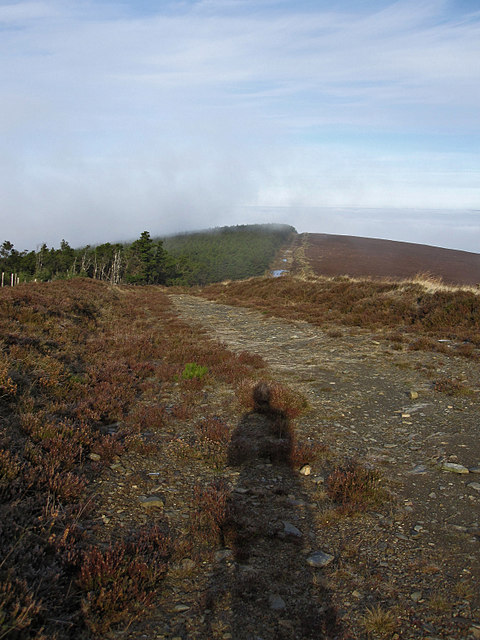
Forest and Heath — kevin higgins — CC BY-SA 2.0 — https://www.geograph.org.uk/photo/5201059
kevin higgins
CC BY-SA 2.0
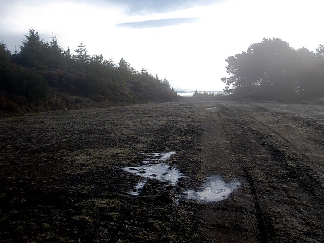
Forest Track — kevin higgins — CC BY-SA 2.0 — https://www.geograph.org.uk/photo/5201045
kevin higgins
CC BY-SA 2.0
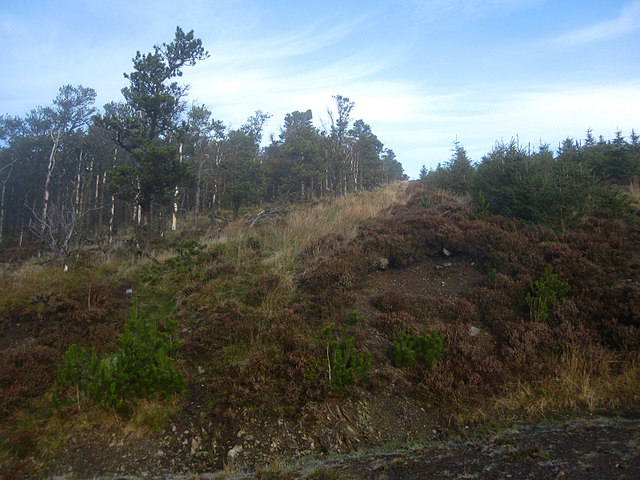
Forest Boundary — kevin higgins — CC BY-SA 2.0 — https://www.geograph.org.uk/photo/5201035
kevin higgins
CC BY-SA 2.0
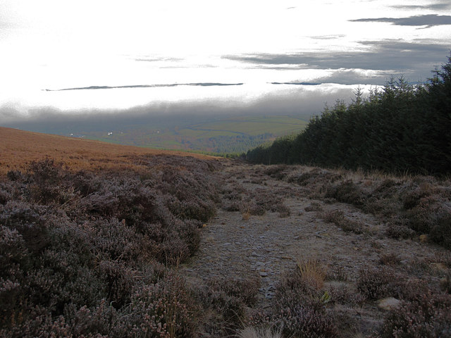
Forest and Heathland — kevin higgins — CC BY-SA 2.0 — https://www.geograph.org.uk/photo/5201065
kevin higgins
CC BY-SA 2.0
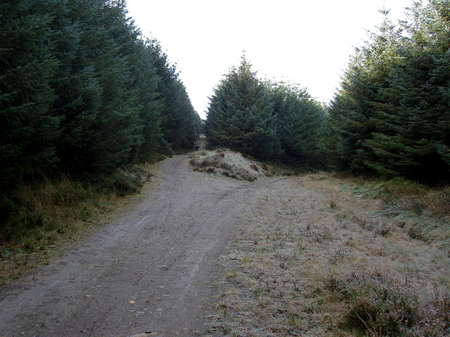
Track Junction — kevin higgins — CC BY-SA 2.0 — https://www.geograph.org.uk/photo/5201071
kevin higgins
CC BY-SA 2.0
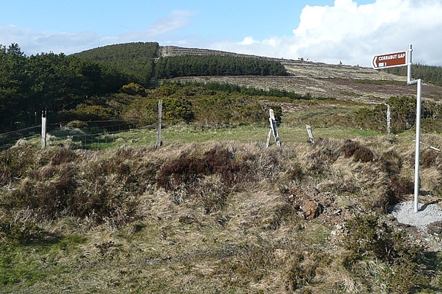
Towards Croaghaun — Graham Horn — CC BY-SA 2.0 — https://www.geograph.org.uk/photo/1254353
Graham Horn
CC BY-SA 2.0
View original activity in YouVisible
Weather on your route
Loading forecast…
Sources and credits
© Sport Ireland. Creative Commons Attribution 4.0 — https://creativecommons.org/licenses/by/4.0/. Complete source geometry converted faithfully to GPX. Photographs have separate individual licences.
Sport Ireland · Get Ireland Active Trail Routes · CC BY 4.0
Forest and heath
Forest and Heath — kevin higgins — CC BY-SA 2.0 — https://www.geograph.org.uk/photo/5201059
kevin higgins · CC BY-SA 2.0 · Media source
A forest track
Forest Track — kevin higgins — CC BY-SA 2.0 — https://www.geograph.org.uk/photo/5201045
kevin higgins · CC BY-SA 2.0 · Media source
Forest boundary
Forest Boundary — kevin higgins — CC BY-SA 2.0 — https://www.geograph.org.uk/photo/5201035
kevin higgins · CC BY-SA 2.0 · Media source
Open heathland
Forest and Heathland — kevin higgins — CC BY-SA 2.0 — https://www.geograph.org.uk/photo/5201065
kevin higgins · CC BY-SA 2.0 · Media source
A forestry junction
Track Junction — kevin higgins — CC BY-SA 2.0 — https://www.geograph.org.uk/photo/5201071
kevin higgins · CC BY-SA 2.0 · Media source
Towards Croaghaun
Towards Croaghaun — Graham Horn — CC BY-SA 2.0 — https://www.geograph.org.uk/photo/1254353
Graham Horn · CC BY-SA 2.0 · Media source