Find your next route
Explore hiking, running, trail running and cycling routes that suit your plans.

Community route
Clashganny Lock Loop · woodland and Barrow towpath
Explore the woodland and River Barrow landscape of the Clashganny Lock Loop near Borris. The mapped circuit combines forest roads with grassy towpath and views of locks, weirs and the wooded valley. Its starting vertex is on the southern part of the source circuit, rather than an asserted car-park position. The source’s slightly different first and last coordinates are retained; they describe the same loop area without inventing an extra closing section.
By YouVisible Sport
Mapa del recorrido
Activity measurements
- distance meters
- 3,606.7728805343
- end · latitude
- 52.5516652
- end · longitude
- -6.9328715
- start · latitude
- 52.5516656
- start · longitude
- -6.9328695
- Sport
- hiking mountaineering
- Specialty
- Hiking
From start to finish
- Country
- Ireland
- Province / region
- —
- Localities
- Borris
Before you go
- How to reach the start
- —
- Parking and access
- Clashganny is near Borris, the trail publisher’s nearest town. Use designated forest and lock access and consult current Coillte, council and Waterways Ireland notices. Published visitor information does not confirm that the whole route is open today. Parking coordinates and current availability are unverified.
- Advice
- Keep back from lock chambers, weirs and unguarded riverbanks. Towpath can be wet or muddy. Keep dogs on a lead and follow current signs and forest-operation restrictions.
- Recommended equipment
- Walking footwear with grip, waterproof clothing, drinking water and an offline route map.
- Terrain
- Woodland forest roads and grassy riverside towpath. Sport Ireland grades the full trail Easy, while current Coillte visitor information calls it Moderate. These source grades differ; no normalized physical or technical score is asserted.
- Signage
- Sport Ireland: green arrow on white background.
Characteristics and difficulty
- Estimated duration
- —
- Author perceived effort
- —
- Physical difficulty
- —
- Technical difficulty
- —
About the route
Explore the woodland and River Barrow landscape of the Clashganny Lock Loop near Borris. The mapped circuit combines forest roads with grassy towpath and views of locks, weirs and the wooded valley. Its starting vertex is on the southern part of the source circuit, rather than an asserted car-park position. The source’s slightly different first and last coordinates are retained; they describe the same loop area without inventing an extra closing section.
- Context
- —
- Specialty
- Hiking
- Event type
- —
- Description
- Views of the route and the places that give it character. These are archive photographs and do not establish current path conditions.
- Title
- Route highlights
- Title
- Sesión
- Description
- Explore the woodland and River Barrow landscape of the Clashganny Lock Loop near Borris. The mapped circuit combines forest roads with grassy towpath and views of locks, weirs and the wooded valley. Its starting vertex is on the southern part of the source circuit, rather than an asserted car-park position. The source’s slightly different first and last coordinates are retained; they describe the same loop area without inventing an extra closing section.
- Description
- The Barrow and lock at Clashganny, seen in an archive landscape photograph.
- Title
- Clashganny from above
- Description
- The River Barrow in the wooded Clashganny landscape.
- Title
- Wooded river valley
- Description
- The lock and river seen from the wooded hillside.
- Title
- Clashganny viewpoint
- Description
- The lock gates and towpath at Clashganny.
- Title
- Clashganny Lock
- Description
- A grassy riverside towpath beside the Barrow in the Clashganny area.
- Title
- The Barrow towpath
- Description
- The weir and adjoining towpath in the landscape followed by the loop.
- Title
- Weir and towpath
- Description
- The Barrow and lock at Clashganny, seen in an archive landscape photograph.
- Title
- Clashganny from above
- Description
- The River Barrow in the wooded Clashganny landscape.
- Title
- Wooded river valley
- Description
- The lock and river seen from the wooded hillside.
- Title
- Clashganny viewpoint
- Description
- The lock gates and towpath at Clashganny.
- Title
- Clashganny Lock
- Description
- A grassy riverside towpath beside the Barrow in the Clashganny area.
- Title
- The Barrow towpath
- Description
- The weir and adjoining towpath in the landscape followed by the loop.
- Title
- Weir and towpath
- Advice
- Keep back from lock chambers, weirs and unguarded riverbanks. Towpath can be wet or muddy. Keep dogs on a lead and follow current signs and forest-operation restrictions.
- Parking and access
- Clashganny is near Borris, the trail publisher’s nearest town. Use designated forest and lock access and consult current Coillte, council and Waterways Ireland notices. Published visitor information does not confirm that the whole route is open today. Parking coordinates and current availability are unverified.
- Recommended equipment
- Walking footwear with grip, waterproof clothing, drinking water and an offline route map.
- Signage
- Sport Ireland: green arrow on white background.
- Terrain
- Woodland forest roads and grassy riverside towpath. Sport Ireland grades the full trail Easy, while current Coillte visitor information calls it Moderate. These source grades differ; no normalized physical or technical score is asserted.
- Title
- Clashganny Lock Loop · woodland and Barrow towpath
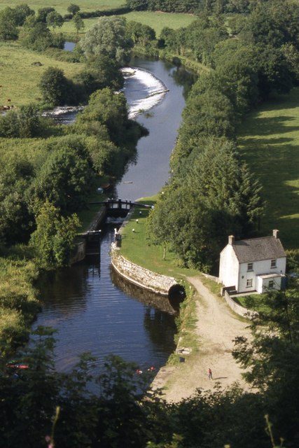
The River Barrow at Clashganny — Colin Park — CC BY-SA 2.0 — https://www.geograph.org.uk/photo/6502592
Colin Park
CC BY-SA 2.0
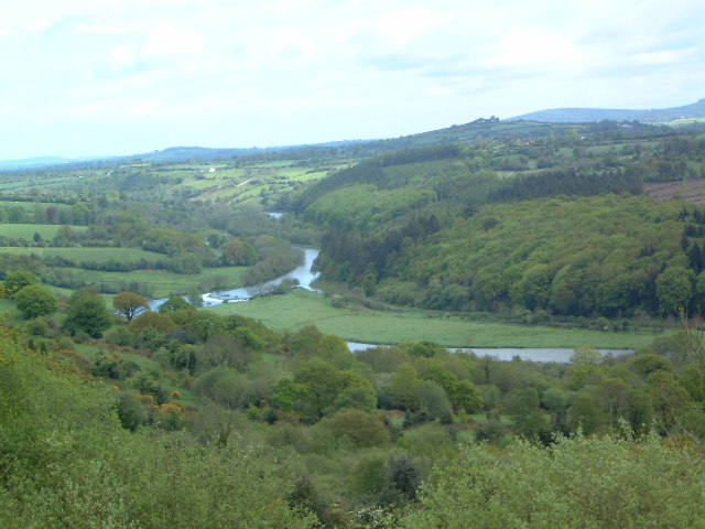
The River Barrow — Brian Shaw — CC BY-SA 2.0 — https://www.geograph.org.uk/photo/54433
Brian Shaw
CC BY-SA 2.0
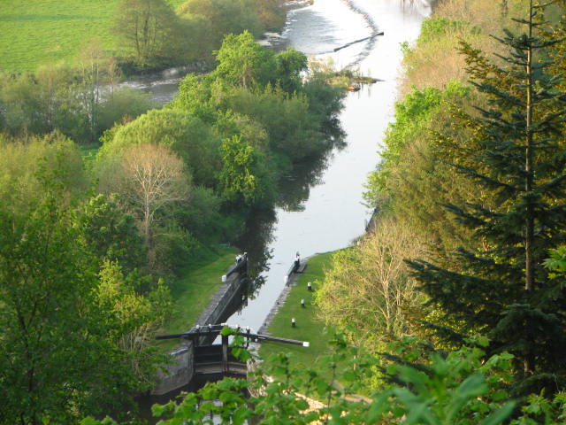
Clashganny view — liam murphy — CC BY-SA 2.0 — https://www.geograph.org.uk/photo/422868
liam murphy
CC BY-SA 2.0
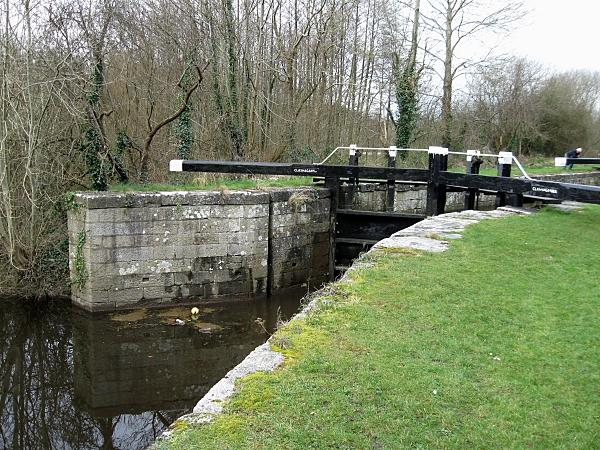
Clashganny Lock — kevin higgins — CC BY-SA 2.0 — https://www.geograph.org.uk/photo/1201199
kevin higgins
CC BY-SA 2.0
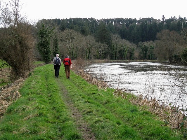
Barrow Towpath — kevin higgins — CC BY-SA 2.0 — https://www.geograph.org.uk/photo/1201124
kevin higgins
CC BY-SA 2.0
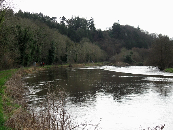
Weir and Towpath — kevin higgins — CC BY-SA 2.0 — https://www.geograph.org.uk/photo/1201132
kevin higgins
CC BY-SA 2.0
View original activity in YouVisible
Weather on your route
Loading forecast…
Sources and credits
© Sport Ireland. Creative Commons Attribution 4.0 — https://creativecommons.org/licenses/by/4.0/. Complete source geometry converted faithfully to GPX. Photographs have separate individual licences.
Sport Ireland · Get Ireland Active Trail Routes · CC BY 4.0
Clashganny from above
The River Barrow at Clashganny — Colin Park — CC BY-SA 2.0 — https://www.geograph.org.uk/photo/6502592
Colin Park · CC BY-SA 2.0 · Media source
Wooded river valley
The River Barrow — Brian Shaw — CC BY-SA 2.0 — https://www.geograph.org.uk/photo/54433
Brian Shaw · CC BY-SA 2.0 · Media source
Clashganny viewpoint
Clashganny view — liam murphy — CC BY-SA 2.0 — https://www.geograph.org.uk/photo/422868
liam murphy · CC BY-SA 2.0 · Media source
Clashganny Lock
Clashganny Lock — kevin higgins — CC BY-SA 2.0 — https://www.geograph.org.uk/photo/1201199
kevin higgins · CC BY-SA 2.0 · Media source
The Barrow towpath
Barrow Towpath — kevin higgins — CC BY-SA 2.0 — https://www.geograph.org.uk/photo/1201124
kevin higgins · CC BY-SA 2.0 · Media source
Weir and towpath
Weir and Towpath — kevin higgins — CC BY-SA 2.0 — https://www.geograph.org.uk/photo/1201132
kevin higgins · CC BY-SA 2.0 · Media source