Find your next route
Explore hiking, running, trail running and cycling routes that suit your plans.

Community route
Mablethorpe North End to Saltfleet Haven · dunes and marsh
Leave Mablethorpe North End for the dunes and marsh landscape of Saltfleetby–Theddlethorpe and continue to the southern side of Saltfleet Haven. This quieter coastal walk contrasts with the resort promenade. The reference preserves every section of Natural England’s Mablethorpe–Humber Bridge chapter 1 in a continuous northbound order. It ends at the source chapter endpoint by the haven, rather than adding a crossing or a walk into Saltfleet village.
By YouVisible Sport
Mapa del recorrido
Activity measurements
- distance meters
- 9,611.6298110948
- end · latitude
- 53.4180211
- end · longitude
- 0.2017595
- start · latitude
- 53.3587482
- start · longitude
- 0.249081
- Sport
- hiking mountaineering
- Specialty
- Hiking
From start to finish
- Country
- United Kingdom
- Province / region
- —
- Localities
- Mablethorpe
Before you go
- How to reach the start
- —
- Parking and access
- Follow the signed coast path from Mablethorpe North End and check the current National Trails map and reserve notices. General published access does not establish same-day opening. The coastal margin includes unsafe or restricted saltmarsh and mudflat areas; this reference does not authorize entry to them. Parking availability is not verified.
- Advice
- Stay on the designated route, follow wildlife and dog-control notices, and avoid disturbing birds. Check tides, weather and diversions. Arrange a separate return and do not improvise a crossing of the haven.
- Recommended equipment
- Walking footwear suitable for muddy ground, waterproof and windproof layers, drinking water and an offline map.
- Terrain
- Coastal paths, public footpaths, bridleway and short pavement sections beside dunes and marsh.
- Signage
- —
Characteristics and difficulty
- Estimated duration
- —
- Author perceived effort
- —
- Physical difficulty
- —
- Technical difficulty
- —
About the route
Leave Mablethorpe North End for the dunes and marsh landscape of Saltfleetby–Theddlethorpe and continue to the southern side of Saltfleet Haven. This quieter coastal walk contrasts with the resort promenade. The reference preserves every section of Natural England’s Mablethorpe–Humber Bridge chapter 1 in a continuous northbound order. It ends at the source chapter endpoint by the haven, rather than adding a crossing or a walk into Saltfleet village.
- Context
- —
- Specialty
- Hiking
- Event type
- —
- Description
- Views of the route and the places that give it character. These are archive photographs and do not establish current path conditions.
- Title
- Route highlights
- Title
- Sesión
- Description
- Leave Mablethorpe North End for the dunes and marsh landscape of Saltfleetby–Theddlethorpe and continue to the southern side of Saltfleet Haven. This quieter coastal walk contrasts with the resort promenade. The reference preserves every section of Natural England’s Mablethorpe–Humber Bridge chapter 1 in a continuous northbound order. It ends at the source chapter endpoint by the haven, rather than adding a crossing or a walk into Saltfleet village.
- Description
- Dunes and the wider landscape of Saltfleetby National Nature Reserve.
- Title
- Saltfleetby reserve
- Description
- Dune grassland at Saltfleetby, within the reserve landscape crossed by this coastal section.
- Title
- Dune landscape
- Description
- The tidal channel and adjacent bank at the southern side of Saltfleet Haven.
- Title
- Saltfleet Haven
- Description
- Reeds and open coastal marsh at Saltfleetby.
- Title
- Coastal marsh
- Description
- An archive view along Saltfleet Haven towards the open coast.
- Title
- Haven towards the coast
- Description
- A tidal creek in Saltfleetby–Theddlethorpe Dunes National Nature Reserve; keep to permitted paths.
- Title
- A creek in the reserve
- Description
- Dunes and the wider landscape of Saltfleetby National Nature Reserve.
- Title
- Saltfleetby reserve
- Description
- Dune grassland at Saltfleetby, within the reserve landscape crossed by this coastal section.
- Title
- Dune landscape
- Description
- The tidal channel and adjacent bank at the southern side of Saltfleet Haven.
- Title
- Saltfleet Haven
- Description
- Reeds and open coastal marsh at Saltfleetby.
- Title
- Coastal marsh
- Description
- An archive view along Saltfleet Haven towards the open coast.
- Title
- Haven towards the coast
- Description
- A tidal creek in Saltfleetby–Theddlethorpe Dunes National Nature Reserve; keep to permitted paths.
- Title
- A creek in the reserve
- Advice
- Stay on the designated route, follow wildlife and dog-control notices, and avoid disturbing birds. Check tides, weather and diversions. Arrange a separate return and do not improvise a crossing of the haven.
- Parking and access
- Follow the signed coast path from Mablethorpe North End and check the current National Trails map and reserve notices. General published access does not establish same-day opening. The coastal margin includes unsafe or restricted saltmarsh and mudflat areas; this reference does not authorize entry to them. Parking availability is not verified.
- Recommended equipment
- Walking footwear suitable for muddy ground, waterproof and windproof layers, drinking water and an offline map.
- Terrain
- Coastal paths, public footpaths, bridleway and short pavement sections beside dunes and marsh.
- Title
- Mablethorpe North End to Saltfleet Haven · dunes and marsh
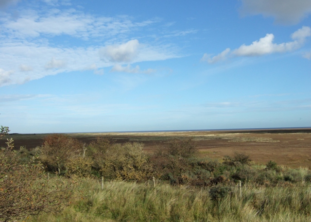
Saltfleetby National Nature Reserve — Simon Huguet — CC BY-SA 2.0 — https://www.geograph.org.uk/photo/1038298
Simon Huguet
CC BY-SA 2.0
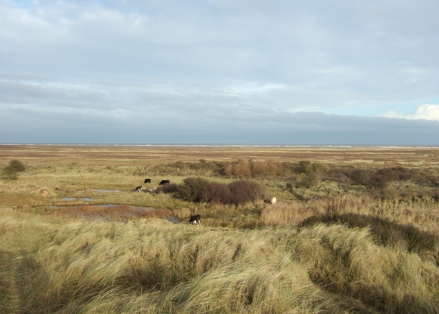
Dunes at Saltfleetby — Simon Huguet — CC BY-SA 2.0 — https://www.geograph.org.uk/photo/1077438
Simon Huguet
CC BY-SA 2.0
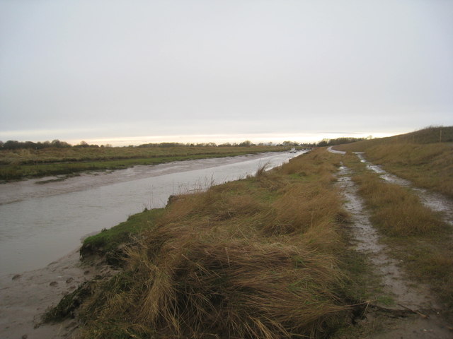
Saltfleet Haven — Jonathan Thacker — CC BY-SA 2.0 — https://www.geograph.org.uk/photo/3798165
Jonathan Thacker
CC BY-SA 2.0
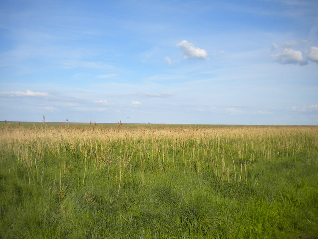
Coastal marshes, Saltfleetby (1) — Richard Vince — CC BY-SA 2.0 — https://www.geograph.org.uk/photo/4145910
Richard Vince
CC BY-SA 2.0
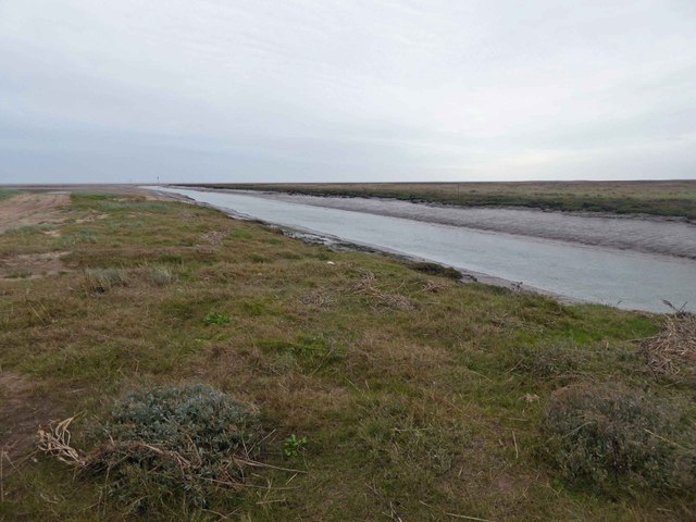
Saltfleet Haven — Steve Fareham — CC BY-SA 2.0 — https://www.geograph.org.uk/photo/4305558
Steve Fareham
CC BY-SA 2.0
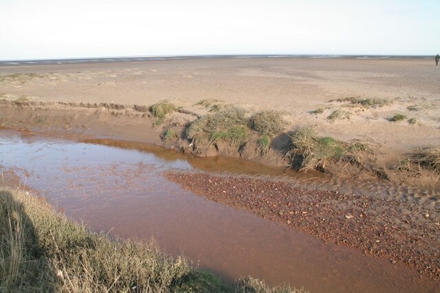
Creek on Saltfleetby-Theddlethorpe Dunes Nature Reserve — Chris — CC BY-SA 2.0 — https://www.geograph.org.uk/photo/6763390
Chris
CC BY-SA 2.0
View original activity in YouVisible
Weather on your route
Loading forecast…
Sources and credits
© Natural England copyright. Contains Ordnance Survey data © Crown copyright and database right 2024. Open Government Licence v3.0 — https://www.nationalarchives.gov.uk/doc/open-government-licence/version/3/. Complete main chapter geometry converted faithfully to GPX; whole source sections ordered in the declared walking direction. Photographs have separate individual licences.
Natural England · King Charles III England Coast Path Route · OGL 3.0
Saltfleetby reserve
Saltfleetby National Nature Reserve — Simon Huguet — CC BY-SA 2.0 — https://www.geograph.org.uk/photo/1038298
Simon Huguet · CC BY-SA 2.0 · Media source
Dune landscape
Dunes at Saltfleetby — Simon Huguet — CC BY-SA 2.0 — https://www.geograph.org.uk/photo/1077438
Simon Huguet · CC BY-SA 2.0 · Media source
Saltfleet Haven
Saltfleet Haven — Jonathan Thacker — CC BY-SA 2.0 — https://www.geograph.org.uk/photo/3798165
Jonathan Thacker · CC BY-SA 2.0 · Media source
Coastal marsh
Coastal marshes, Saltfleetby (1) — Richard Vince — CC BY-SA 2.0 — https://www.geograph.org.uk/photo/4145910
Richard Vince · CC BY-SA 2.0 · Media source
Haven towards the coast
Saltfleet Haven — Steve Fareham — CC BY-SA 2.0 — https://www.geograph.org.uk/photo/4305558
Steve Fareham · CC BY-SA 2.0 · Media source
A creek in the reserve
Creek on Saltfleetby-Theddlethorpe Dunes Nature Reserve — Chris — CC BY-SA 2.0 — https://www.geograph.org.uk/photo/6763390
Chris · CC BY-SA 2.0 · Media source