Find your next route
Explore hiking, running, trail running and cycling routes that suit your plans.

Community route
Mablethorpe North End to Sutton-on-Sea · coastal promenade
Set out from Mablethorpe North End and follow the coast south through the resort’s seafront towards Sutton-on-Sea. Beach huts, broad sand and promenade views give this walk its seaside character. The geometry is Natural England’s complete Skegness–Mablethorpe chapter 4, with whole source sections ordered in the southbound walking direction. No return leg or beach detour has been added.
By YouVisible Sport
Mapa del recorrido
Activity measurements
- distance meters
- 5,476.1810218669
- end · latitude
- 53.3166285
- end · longitude
- 0.2822873
- start · latitude
- 53.3587482
- start · longitude
- 0.249081
- Sport
- hiking mountaineering
- Specialty
- Hiking
From start to finish
- Country
- United Kingdom
- Province / region
- —
- Localities
- Mablethorpe
Before you go
- How to reach the start
- —
- Parking and access
- Use public access to Mablethorpe North End and follow the signed coastal route south. Check current National Trails notices and local signs. Published accessibility guidance does not confirm the condition of every section today, and uninterrupted wheelchair access has not been established for this complete reference. Parking details are unverified.
- Advice
- Check weather and tides and keep clear of rough seas. This is a one-way route; arrange a return from Sutton-on-Sea and obey any temporary diversions.
- Recommended equipment
- Comfortable walking footwear, a waterproof windproof layer, water, sun protection and an offline map.
- Terrain
- Seafront promenade, public pavement and coastal paths; sand may accumulate on concrete surfaces.
- Signage
- —
Characteristics and difficulty
- Estimated duration
- —
- Author perceived effort
- —
- Physical difficulty
- —
- Technical difficulty
- —
About the route
Set out from Mablethorpe North End and follow the coast south through the resort’s seafront towards Sutton-on-Sea. Beach huts, broad sand and promenade views give this walk its seaside character. The geometry is Natural England’s complete Skegness–Mablethorpe chapter 4, with whole source sections ordered in the southbound walking direction. No return leg or beach detour has been added.
- Context
- —
- Specialty
- Hiking
- Event type
- —
- Description
- Views of the route and the places that give it character. These are archive photographs and do not establish current path conditions.
- Title
- Route highlights
- Title
- Sesión
- Description
- Set out from Mablethorpe North End and follow the coast south through the resort’s seafront towards Sutton-on-Sea. Beach huts, broad sand and promenade views give this walk its seaside character. The geometry is Natural England’s complete Skegness–Mablethorpe chapter 4, with whole source sections ordered in the southbound walking direction. No return leg or beach detour has been added.
- Description
- Colourful chalets beside Mablethorpe’s seafront.
- Title
- Beachside chalets
- Description
- Dunes and the broad beach beside Mablethorpe promenade.
- Title
- Beach and dunes
- Description
- An open beach view towards Mablethorpe’s promenade.
- Title
- Promenade and sand
- Description
- The central beach and seafront in evening light.
- Title
- Seafront at dusk
- Description
- The Spanish City seafront building, viewed from outside.
- Title
- Spanish City
- Description
- Benches and an open view across the beach from the promenade.
- Title
- A pause on the promenade
- Description
- Colourful chalets beside Mablethorpe’s seafront.
- Title
- Beachside chalets
- Description
- Dunes and the broad beach beside Mablethorpe promenade.
- Title
- Beach and dunes
- Description
- An open beach view towards Mablethorpe’s promenade.
- Title
- Promenade and sand
- Description
- The central beach and seafront in evening light.
- Title
- Seafront at dusk
- Description
- The Spanish City seafront building, viewed from outside.
- Title
- Spanish City
- Description
- Benches and an open view across the beach from the promenade.
- Title
- A pause on the promenade
- Advice
- Check weather and tides and keep clear of rough seas. This is a one-way route; arrange a return from Sutton-on-Sea and obey any temporary diversions.
- Parking and access
- Use public access to Mablethorpe North End and follow the signed coastal route south. Check current National Trails notices and local signs. Published accessibility guidance does not confirm the condition of every section today, and uninterrupted wheelchair access has not been established for this complete reference. Parking details are unverified.
- Recommended equipment
- Comfortable walking footwear, a waterproof windproof layer, water, sun protection and an offline map.
- Terrain
- Seafront promenade, public pavement and coastal paths; sand may accumulate on concrete surfaces.
- Title
- Mablethorpe North End to Sutton-on-Sea · coastal promenade
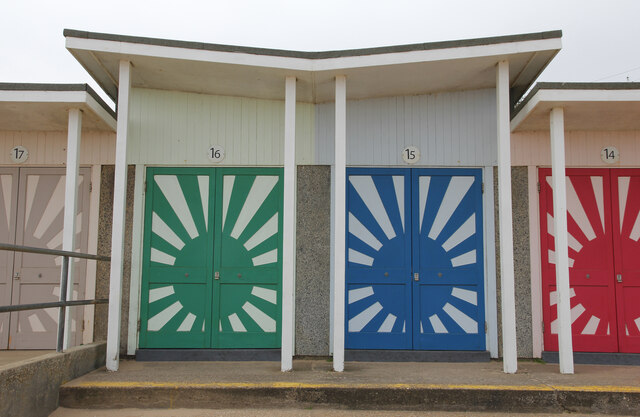
Beachside chalets — Richard Croft — CC BY-SA 2.0 — https://www.geograph.org.uk/photo/7679857
Richard Croft
CC BY-SA 2.0
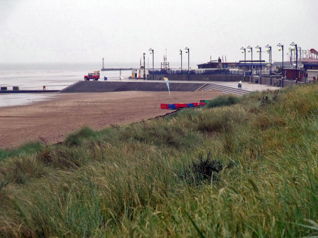
Mablethorpe beach and dunes — J.Hannan-Briggs — CC BY-SA 2.0 — https://www.geograph.org.uk/photo/2517327
J.Hannan-Briggs
CC BY-SA 2.0
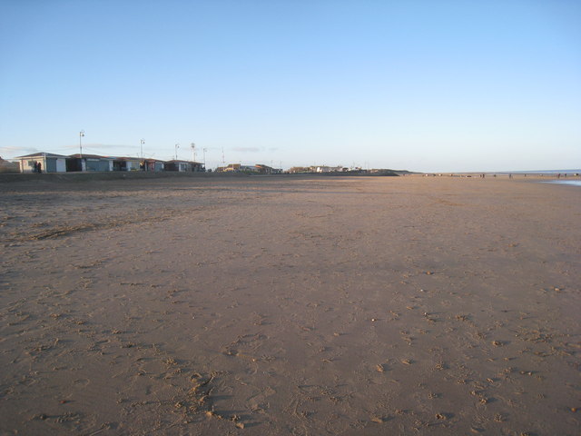
Beach and Promenade, Mablethorpe — Jonathan Thacker — CC BY-SA 2.0 — https://www.geograph.org.uk/photo/3280720
Jonathan Thacker
CC BY-SA 2.0
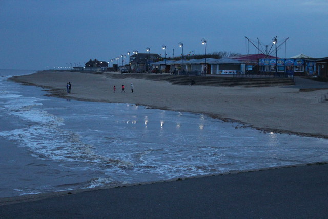
Central beach and seafront, Mablethorpe — M J Roscoe — CC BY-SA 2.0 — https://www.geograph.org.uk/photo/6104735
M J Roscoe
CC BY-SA 2.0
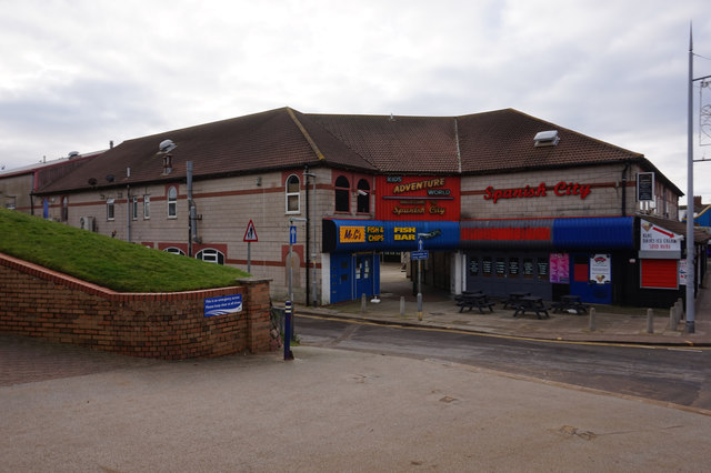
Spanish City, Mablethorpe — Ian S — CC BY-SA 2.0 — https://www.geograph.org.uk/photo/6338934
Ian S
CC BY-SA 2.0
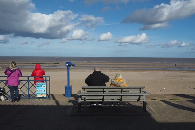
On the Prom — David Lally — CC BY-SA 2.0 — https://www.geograph.org.uk/photo/6629849
David Lally
CC BY-SA 2.0
View original activity in YouVisible
Weather on your route
Loading forecast…
Sources and credits
© Natural England copyright. Contains Ordnance Survey data © Crown copyright and database right 2024. Open Government Licence v3.0 — https://www.nationalarchives.gov.uk/doc/open-government-licence/version/3/. Complete main chapter geometry converted faithfully to GPX; whole source sections ordered in the declared walking direction. Photographs have separate individual licences.
Natural England · King Charles III England Coast Path Route · OGL 3.0
Beachside chalets
Beachside chalets — Richard Croft — CC BY-SA 2.0 — https://www.geograph.org.uk/photo/7679857
Richard Croft · CC BY-SA 2.0 · Media source
Beach and dunes
Mablethorpe beach and dunes — J.Hannan-Briggs — CC BY-SA 2.0 — https://www.geograph.org.uk/photo/2517327
J.Hannan-Briggs · CC BY-SA 2.0 · Media source
Promenade and sand
Beach and Promenade, Mablethorpe — Jonathan Thacker — CC BY-SA 2.0 — https://www.geograph.org.uk/photo/3280720
Jonathan Thacker · CC BY-SA 2.0 · Media source
Seafront at dusk
Central beach and seafront, Mablethorpe — M J Roscoe — CC BY-SA 2.0 — https://www.geograph.org.uk/photo/6104735
M J Roscoe · CC BY-SA 2.0 · Media source
Spanish City
Spanish City, Mablethorpe — Ian S — CC BY-SA 2.0 — https://www.geograph.org.uk/photo/6338934
Ian S · CC BY-SA 2.0 · Media source
A pause on the promenade
On the Prom — David Lally — CC BY-SA 2.0 — https://www.geograph.org.uk/photo/6629849
David Lally · CC BY-SA 2.0 · Media source