Find your next route
Explore hiking, running, trail running and cycling routes that suit your plans.

Community route
Ingoldmells Point to Anderby Creek · Chapel Point coast
Walk north from Ingoldmells Point through the coast at Chapel St Leonards and Chapel Point to Anderby Creek. The North Sea Observatory, seafront and dunes offer contrasting views along this exposed stretch. The reference preserves the whole main alignment of Natural England’s Skegness–Mablethorpe chapter 2. Anderby Creek is the endpoint; it does not stop at Chapel Point. Arrange the return separately.
By YouVisible Sport
Mapa del recorrido
Activity measurements
- distance meters
- 8,136.2563914199
- end · latitude
- 53.2596095
- end · longitude
- 0.3248579
- start · latitude
- 53.1921028
- start · longitude
- 0.3553676
- Sport
- hiking mountaineering
- Specialty
- Hiking
From start to finish
- Country
- United Kingdom
- Province / region
- —
- Localities
- Ingoldmells
Before you go
- How to reach the start
- —
- Parking and access
- Join the signed coastal route at Ingoldmells Point. Follow the current National Trails map and local diversion notices. The regional account is general access information, not a same-day inspection. Opening hours of the observatory, cafés and other buildings are separate from access to the outdoor walk; no interior visit is included. Parking availability is not verified.
- Advice
- Check wind, weather and tides; follow the boardwalk and signed trail rather than making shortcuts through dunes. Keep dogs under control and respect wildlife restrictions. Plan transport from Anderby Creek.
- Recommended equipment
- Walking shoes with grip, windproof waterproof clothing, water and an offline map.
- Terrain
- Promenade, coastal paths and boardwalk sections, with possible sand on paved surfaces.
- Signage
- —
Characteristics and difficulty
- Estimated duration
- —
- Author perceived effort
- —
- Physical difficulty
- —
- Technical difficulty
- —
About the route
Walk north from Ingoldmells Point through the coast at Chapel St Leonards and Chapel Point to Anderby Creek. The North Sea Observatory, seafront and dunes offer contrasting views along this exposed stretch. The reference preserves the whole main alignment of Natural England’s Skegness–Mablethorpe chapter 2. Anderby Creek is the endpoint; it does not stop at Chapel Point. Arrange the return separately.
- Context
- —
- Specialty
- Hiking
- Event type
- —
- Description
- Views of the route and the places that give it character. These are archive photographs and do not establish current path conditions.
- Title
- Route highlights
- Title
- Sesión
- Description
- Walk north from Ingoldmells Point through the coast at Chapel St Leonards and Chapel Point to Anderby Creek. The North Sea Observatory, seafront and dunes offer contrasting views along this exposed stretch. The reference preserves the whole main alignment of Natural England’s Skegness–Mablethorpe chapter 2. Anderby Creek is the endpoint; it does not stop at Chapel Point. Arrange the return separately.
- Description
- A coastal trig point near Anderby Creek. This is a survey marker, not a trail waymark.
- Title
- Anderby Creek survey marker
- Description
- The exterior of the North Sea Observatory at Chapel Point beside the coast.
- Title
- North Sea Observatory
- Description
- Marram-covered dunes by the beach at Anderby Creek.
- Title
- Anderby Creek dunes
- Description
- An open view across the sandy beach at Anderby Creek.
- Title
- Anderby Creek beach
- Description
- A view inland along Anderby Drain in the coastal landscape.
- Title
- Anderby Drain
- Description
- An aerial archive view of Anderby Creek and its coast; no camera position is assigned to the walking route.
- Title
- Coast from above
- Description
- A coastal trig point near Anderby Creek. This is a survey marker, not a trail waymark.
- Title
- Anderby Creek survey marker
- Description
- The exterior of the North Sea Observatory at Chapel Point beside the coast.
- Title
- North Sea Observatory
- Description
- Marram-covered dunes by the beach at Anderby Creek.
- Title
- Anderby Creek dunes
- Description
- An open view across the sandy beach at Anderby Creek.
- Title
- Anderby Creek beach
- Description
- A view inland along Anderby Drain in the coastal landscape.
- Title
- Anderby Drain
- Description
- An aerial archive view of Anderby Creek and its coast; no camera position is assigned to the walking route.
- Title
- Coast from above
- Advice
- Check wind, weather and tides; follow the boardwalk and signed trail rather than making shortcuts through dunes. Keep dogs under control and respect wildlife restrictions. Plan transport from Anderby Creek.
- Parking and access
- Join the signed coastal route at Ingoldmells Point. Follow the current National Trails map and local diversion notices. The regional account is general access information, not a same-day inspection. Opening hours of the observatory, cafés and other buildings are separate from access to the outdoor walk; no interior visit is included. Parking availability is not verified.
- Recommended equipment
- Walking shoes with grip, windproof waterproof clothing, water and an offline map.
- Terrain
- Promenade, coastal paths and boardwalk sections, with possible sand on paved surfaces.
- Title
- Ingoldmells Point to Anderby Creek · Chapel Point coast
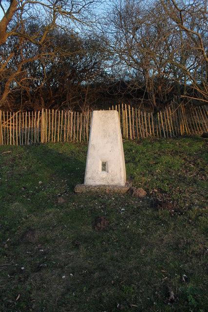
Trig point at Anderby Creek — J.Hannan-Briggs — CC BY-SA 2.0 — https://www.geograph.org.uk/photo/3258368
J.Hannan-Briggs
CC BY-SA 2.0
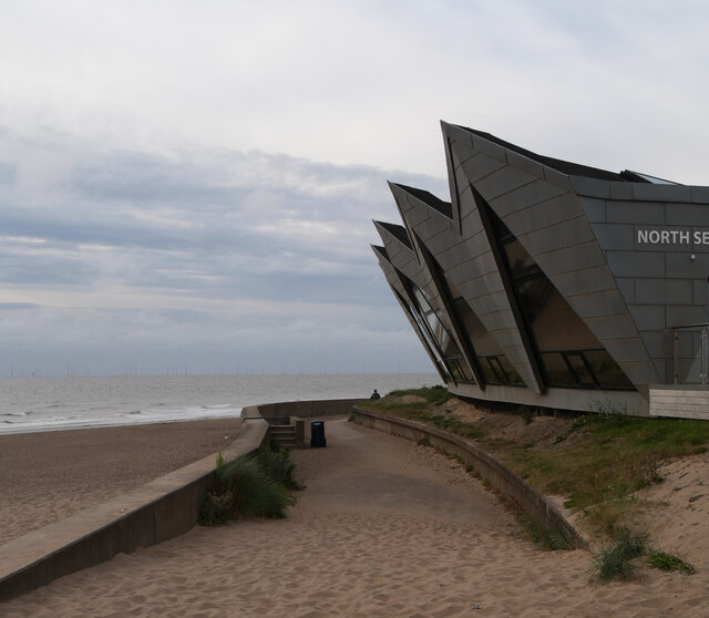
The North Sea Observatory, Chapel Point, Chapel St. Leonard's — habiloid — CC BY-SA 2.0 — https://www.geograph.org.uk/photo/7855640
habiloid
CC BY-SA 2.0
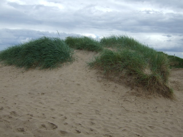
Dunes, Anderby Creek — JThomas — CC BY-SA 2.0 — https://www.geograph.org.uk/photo/3525259
JThomas
CC BY-SA 2.0
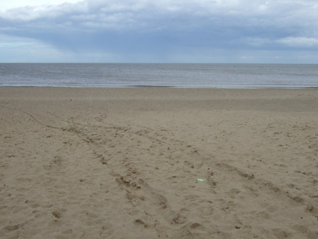
Beach at Anderby Creek — JThomas — CC BY-SA 2.0 — https://www.geograph.org.uk/photo/3525260
JThomas
CC BY-SA 2.0
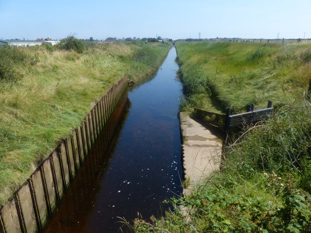
Anderby Drain at Anderby Creek — Mat Fascione — CC BY-SA 2.0 — https://www.geograph.org.uk/photo/4769601
Mat Fascione
CC BY-SA 2.0
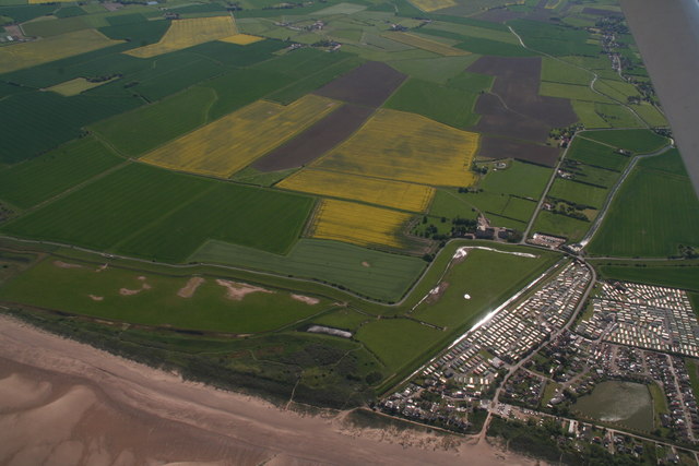
Anderby Creek: aerial 2018 — Chris — CC BY-SA 2.0 — https://www.geograph.org.uk/photo/5783341
Chris
CC BY-SA 2.0
View original activity in YouVisible
Weather on your route
Loading forecast…
Sources and credits
© Natural England copyright. Contains Ordnance Survey data © Crown copyright and database right 2024. Open Government Licence v3.0 — https://www.nationalarchives.gov.uk/doc/open-government-licence/version/3/. Complete main chapter geometry converted faithfully to GPX; whole source sections ordered in the declared walking direction. Photographs have separate individual licences.
Natural England · King Charles III England Coast Path Route · OGL 3.0
Anderby Creek survey marker
Trig point at Anderby Creek — J.Hannan-Briggs — CC BY-SA 2.0 — https://www.geograph.org.uk/photo/3258368
J.Hannan-Briggs · CC BY-SA 2.0 · Media source
North Sea Observatory
The North Sea Observatory, Chapel Point, Chapel St. Leonard's — habiloid — CC BY-SA 2.0 — https://www.geograph.org.uk/photo/7855640
habiloid · CC BY-SA 2.0 · Media source
Anderby Creek dunes
Dunes, Anderby Creek — JThomas — CC BY-SA 2.0 — https://www.geograph.org.uk/photo/3525259
JThomas · CC BY-SA 2.0 · Media source
Anderby Creek beach
Beach at Anderby Creek — JThomas — CC BY-SA 2.0 — https://www.geograph.org.uk/photo/3525260
JThomas · CC BY-SA 2.0 · Media source
Anderby Drain
Anderby Drain at Anderby Creek — Mat Fascione — CC BY-SA 2.0 — https://www.geograph.org.uk/photo/4769601
Mat Fascione · CC BY-SA 2.0 · Media source
Coast from above
Anderby Creek: aerial 2018 — Chris — CC BY-SA 2.0 — https://www.geograph.org.uk/photo/5783341
Chris · CC BY-SA 2.0 · Media source