Find your next route
Explore hiking, running, trail running and cycling routes that suit your plans.

Community route
Camino Natural del Guadiana · Villarta de San Juan–Villarrubia de los Ojos
Etapa entre Villarta de San Juan y Villarrubia de los Ojos por la llanura de cultivos, el entorno del Cigüela y los humedales de La Mancha. El Puente Viejo y el patrimonio de ambos municipios sitúan la salida y la llegada. Las fotos no acreditan caudales actuales ni añaden visitas urbanas al archivo. Geometría oficial CNIG de 20.128 km, conservada en su orden original. Horario orientativo de fuente: 3 h 55 min, sujeto a condiciones y paradas.
By YouVisible Sport
Mapa del recorrido
Perfil de elevación
Activity measurements
- distance meters
- 20,128.1632499935
- elevation gain meters
- 54.6166
- elevation loss meters
- 57.1063
- max elevation meters
- 625.1302
- min elevation meters
- 610.8006
- end · latitude
- 39.2167829
- end · longitude
- -3.6062447
- estimated duration seconds
- 14,100
- start · latitude
- 39.242361
- start · longitude
- -3.4162855
- Sport
- hiking mountaineering
- Specialty
- Hiking
From start to finish
- Country
- Spain
- Province / region
- Ciudad Real
- Localities
- Villarta de San Juan
Before you go
- How to reach the start
- —
- Parking and access
- MAPA identifica el Puente Viejo de Villarta y un tramo final asfaltado con tráfico, además del cruce de la rotonda CM-4120. Respetar cierres y no atravesar zonas inundadas del Cigüela. El observatorio de Las Charcas se cita en la ficha, sin garantizar acceso o funcionamiento actual. Sin plazas, tarifas ni coordenadas de aparcamiento acreditadas; organizar regreso.
- Advice
- Recomendación editorial: consultar previsión, avisos oficiales de los espacios y estado de caminos el día de salida; respetar cierres, ganado y propiedades. Llevar agua propia, mapa sin conexión y margen de luz. En estas rutas lineales, organizar el regreso; no se garantiza abastecimiento por aparecer una fuente en una ficha.
- Recommended equipment
- Recomendación editorial: calzado de senderismo, agua suficiente, protección solar, abrigo y protección de lluvia, teléfono con cartografía sin conexión y batería de reserva.
- Terrain
- Caminos agrícolas y tramos asfaltados de acceso urbano. MIDE 1/2/1/3 según el perfil oficial MAPA.
- Signage
- Camino Natural del Guadiana, con cruces de caminos agrícolas. Usar el track y atender a las señales temporales; orientación MIDE 2.
Characteristics and difficulty
- Estimated duration
- 3 h 55 min
- Author perceived effort
- —
- Physical difficulty
- —
- Technical difficulty
- —
About the route
Etapa entre Villarta de San Juan y Villarrubia de los Ojos por la llanura de cultivos, el entorno del Cigüela y los humedales de La Mancha. El Puente Viejo y el patrimonio de ambos municipios sitúan la salida y la llegada. Las fotos no acreditan caudales actuales ni añaden visitas urbanas al archivo. Geometría oficial CNIG de 20.128 km, conservada en su orden original. Horario orientativo de fuente: 3 h 55 min, sujeto a condiciones y paradas.
- Context
- —
- Specialty
- Hiking
- Event type
- —
- Description
- Seis fotografías reales documentadas del corredor y sus municipios. El contexto patrimonial/natural se identifica en cada descripción; no añade visitas interiores, ramales ni posiciones de cámara al track.
- Title
- Lugares destacados
- Title
- Sesión
- Description
- Etapa entre Villarta de San Juan y Villarrubia de los Ojos por la llanura de cultivos, el entorno del Cigüela y los humedales de La Mancha. El Puente Viejo y el patrimonio de ambos municipios sitúan la salida y la llegada. Las fotos no acreditan caudales actuales ni añaden visitas urbanas al archivo. Geometría oficial CNIG de 20.128 km, conservada en su orden original. Horario orientativo de fuente: 3 h 55 min, sujeto a condiciones y paradas.
- Description
- Vista del patrimonio urbano del municipio de llegada. Original con orientación EXIF, sin recorte.
- Title
- Torre del Reloj de Villarrubia
- Description
- Entrada al puente de Villarta de San Juan, hito descrito por MAPA en la etapa.
- Title
- Acceso al Puente Viejo
- Description
- Vista lateral del puente histórico sobre el Cigüela en Villarta. No acredita el nivel actual del agua.
- Title
- Arcos del Puente Viejo
- Description
- Toma distinta de los arcos del Puente Viejo de Villarta, según su ficha individual.
- Title
- Otra perspectiva del puente
- Description
- Vista del municipio desde el entorno del puente, identificada por el autor.
- Title
- Villarta desde el puente
- Description
- Plaza y ayuntamiento de Villarta de San Juan, contexto urbano de partida.
- Title
- Plaza de la Paz de Villarta
- Description
- Vista del patrimonio urbano del municipio de llegada. Original con orientación EXIF, sin recorte.
- Title
- Torre del Reloj de Villarrubia
- Description
- Entrada al puente de Villarta de San Juan, hito descrito por MAPA en la etapa.
- Title
- Acceso al Puente Viejo
- Description
- Vista lateral del puente histórico sobre el Cigüela en Villarta. No acredita el nivel actual del agua.
- Title
- Arcos del Puente Viejo
- Description
- Toma distinta de los arcos del Puente Viejo de Villarta, según su ficha individual.
- Title
- Otra perspectiva del puente
- Description
- Vista del municipio desde el entorno del puente, identificada por el autor.
- Title
- Villarta desde el puente
- Description
- Plaza y ayuntamiento de Villarta de San Juan, contexto urbano de partida.
- Title
- Plaza de la Paz de Villarta
- Advice
- Recomendación editorial: consultar previsión, avisos oficiales de los espacios y estado de caminos el día de salida; respetar cierres, ganado y propiedades. Llevar agua propia, mapa sin conexión y margen de luz. En estas rutas lineales, organizar el regreso; no se garantiza abastecimiento por aparecer una fuente en una ficha.
- Parking and access
- MAPA identifica el Puente Viejo de Villarta y un tramo final asfaltado con tráfico, además del cruce de la rotonda CM-4120. Respetar cierres y no atravesar zonas inundadas del Cigüela. El observatorio de Las Charcas se cita en la ficha, sin garantizar acceso o funcionamiento actual. Sin plazas, tarifas ni coordenadas de aparcamiento acreditadas; organizar regreso.
- Recommended equipment
- Recomendación editorial: calzado de senderismo, agua suficiente, protección solar, abrigo y protección de lluvia, teléfono con cartografía sin conexión y batería de reserva.
- Signage
- Camino Natural del Guadiana, con cruces de caminos agrícolas. Usar el track y atender a las señales temporales; orientación MIDE 2.
- Terrain
- Caminos agrícolas y tramos asfaltados de acceso urbano. MIDE 1/2/1/3 según el perfil oficial MAPA.
- Title
- Camino Natural del Guadiana · Villarta de San Juan–Villarrubia de los Ojos
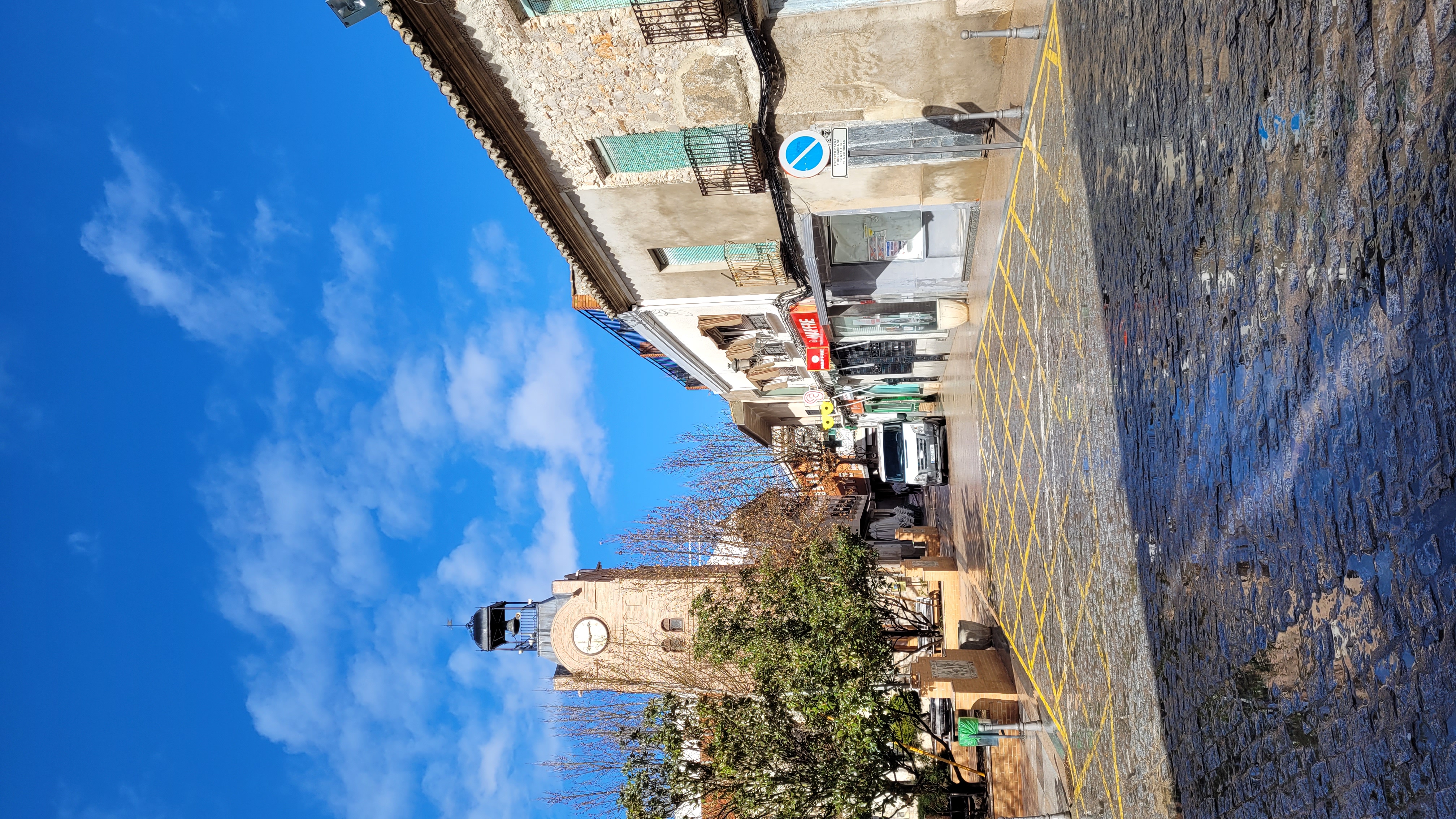
Torre del Reloj, Villarrubia de los Ojos.jpg — Albertocsc — CC BY-SA 4.0 — https://commons.wikimedia.org/wiki/File:Torre_del_Reloj,_Villarrubia_de_los_Ojos.jpg

Albertocsc
CC BY-SA 4.0
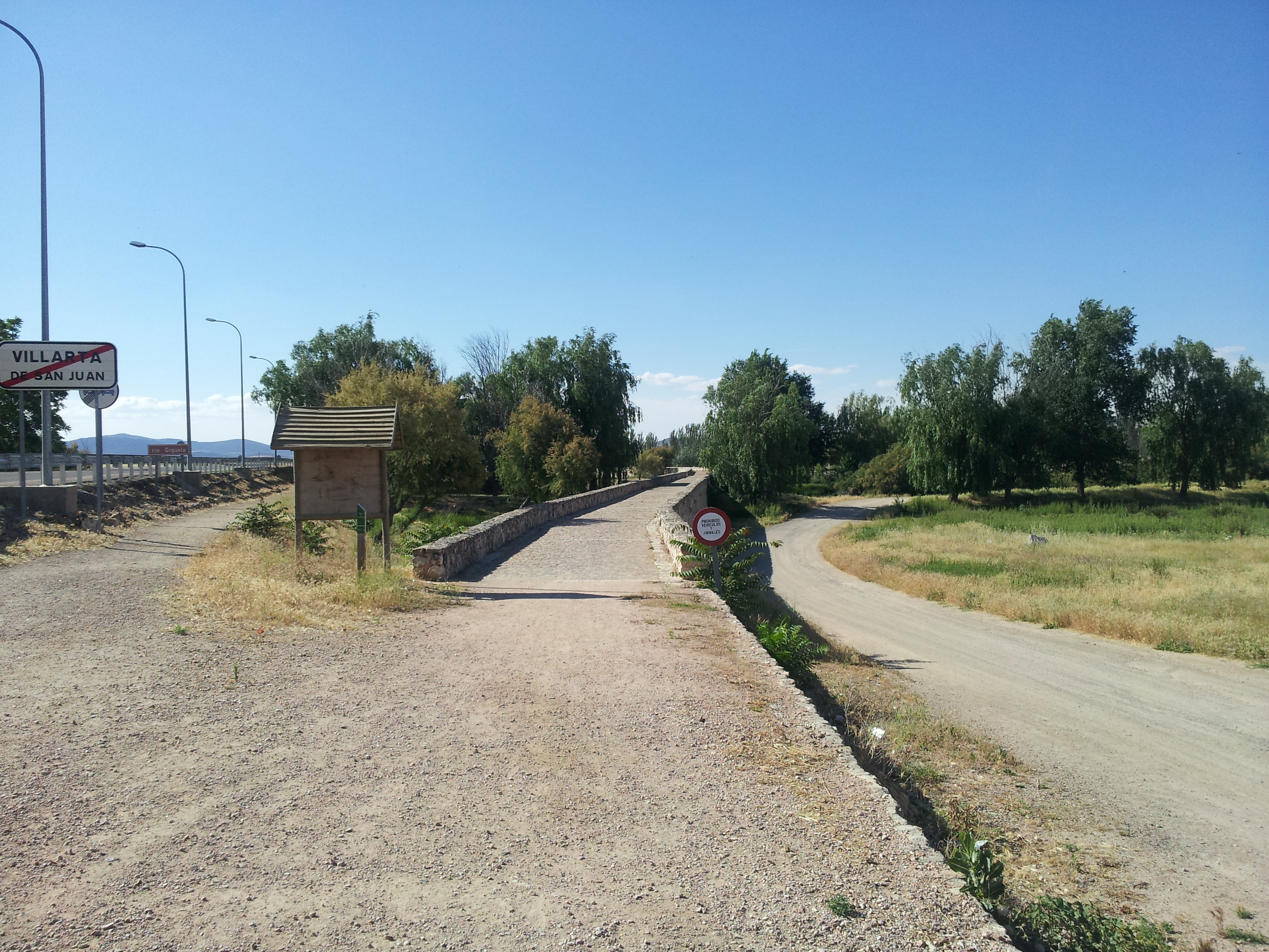
Puente Romano 1 Villarta de San Juan.jpg — This file is a work by Takashi kurita . Please, credit this: Álvaro C.E. I would appreciate being notified (acantos30 hotmail.com) if you use my work outside Wikimedia More of my work can be found in my personal gallery — CC BY-SA 3.0 — https://commons.wikimedia.org/wiki/File:Puente_Romano_1_Villarta_de_San_Juan.jpg

This file is a work by Takashi kurita . Please, credit this: Álvaro C.E. I would appreciate being notified (acantos30 hotmail.com) if you use my work outside Wikimedia More of my work can be found in my personal gallery
CC BY-SA 3.0
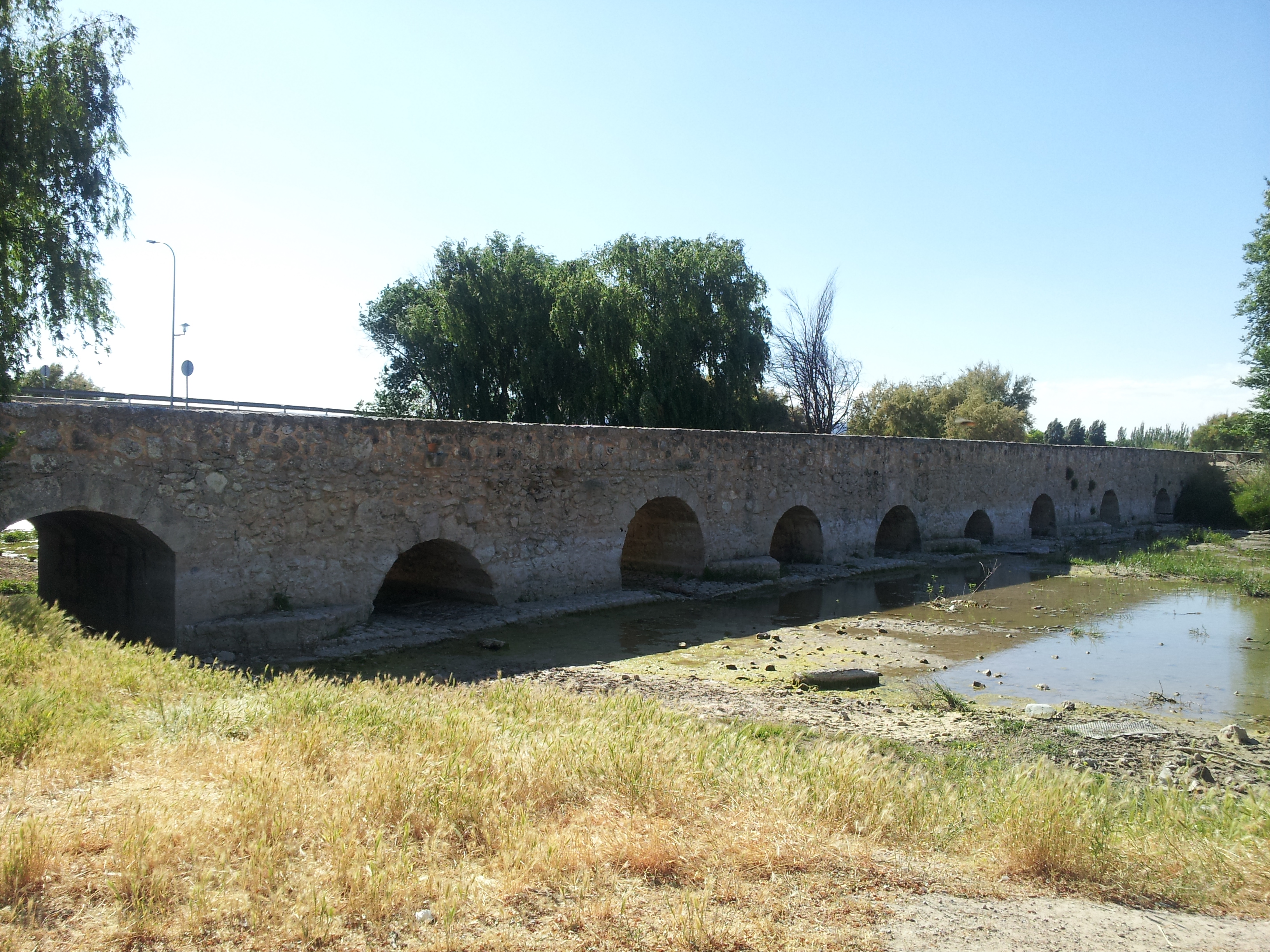
Puente Romano 2 Villarta de San Juan.jpg — This file is a work by Takashi kurita . Please, credit this: Álvaro C.E. I would appreciate being notified (acantos30 hotmail.com) if you use my work outside Wikimedia More of my work can be found in my personal gallery — CC BY-SA 3.0 — https://commons.wikimedia.org/wiki/File:Puente_Romano_2_Villarta_de_San_Juan.jpg

This file is a work by Takashi kurita . Please, credit this: Álvaro C.E. I would appreciate being notified (acantos30 hotmail.com) if you use my work outside Wikimedia More of my work can be found in my personal gallery
CC BY-SA 3.0
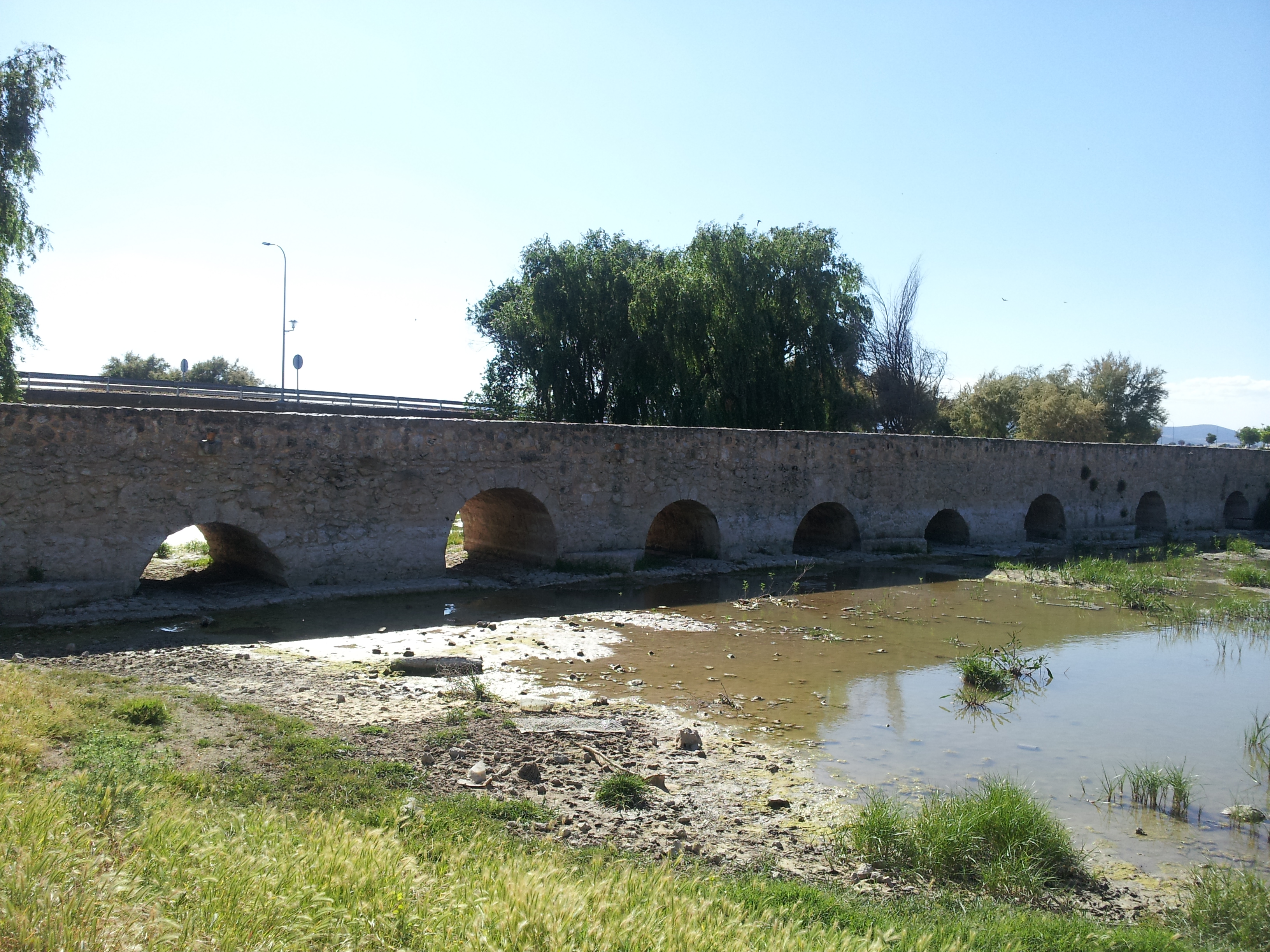
Puente Romano 3 Villarta de San Juan.jpg — This file is a work by Takashi kurita . Please, credit this: Álvaro C.E. I would appreciate being notified (acantos30 hotmail.com) if you use my work outside Wikimedia More of my work can be found in my personal gallery — CC BY-SA 3.0 — https://commons.wikimedia.org/wiki/File:Puente_Romano_3_Villarta_de_San_Juan.jpg

This file is a work by Takashi kurita . Please, credit this: Álvaro C.E. I would appreciate being notified (acantos30 hotmail.com) if you use my work outside Wikimedia More of my work can be found in my personal gallery
CC BY-SA 3.0
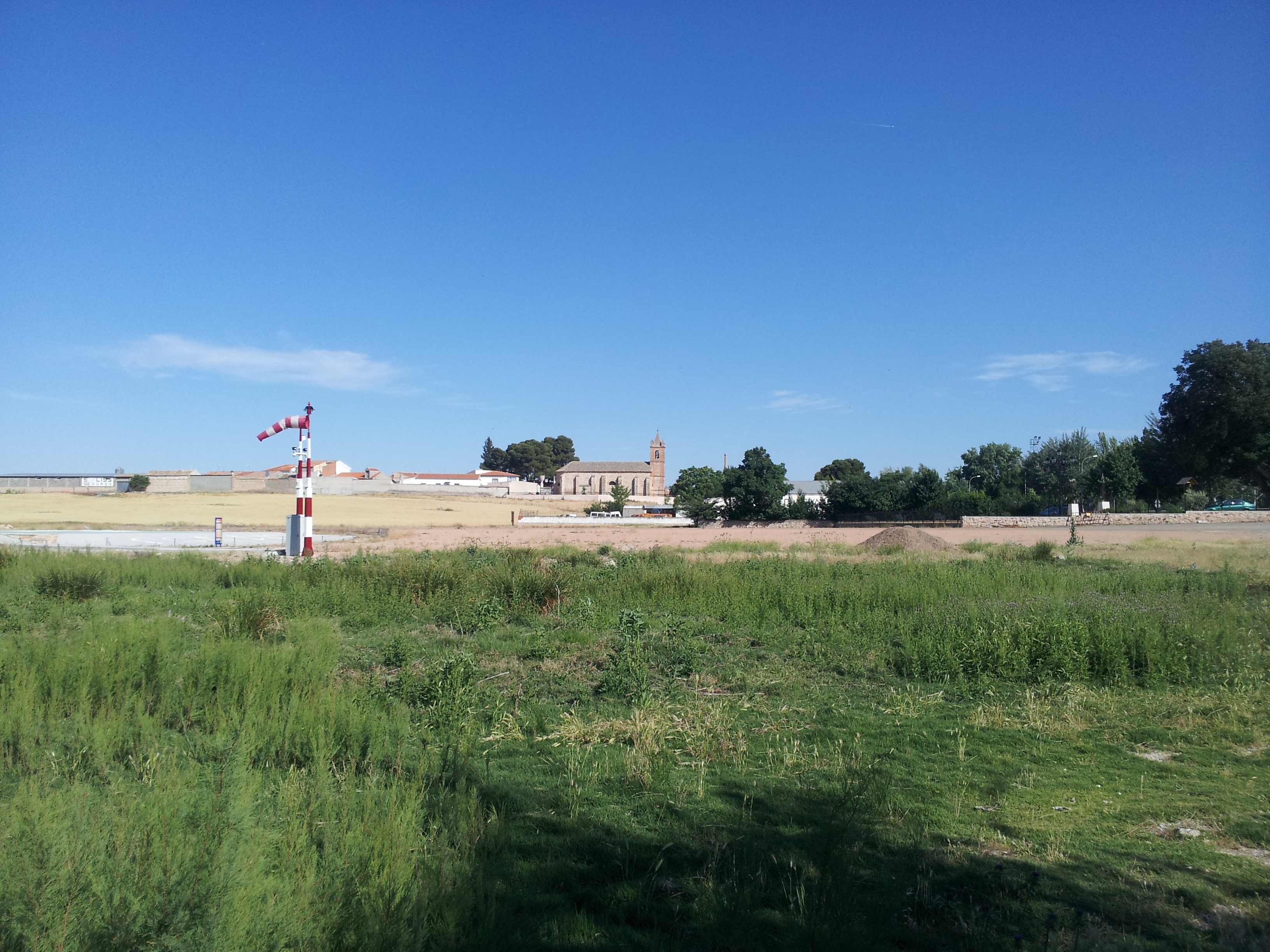
Villarta de San Juan, Vista general desde puente Romano.jpg — This file is a work by Takashi kurita . Please, credit this: Álvaro C.E. I would appreciate being notified (acantos30 hotmail.com) if you use my work outside Wikimedia More of my work can be found in my personal gallery — CC BY-SA 3.0 — https://commons.wikimedia.org/wiki/File:Villarta_de_San_Juan,_Vista_general_desde_puente_Romano.jpg

This file is a work by Takashi kurita . Please, credit this: Álvaro C.E. I would appreciate being notified (acantos30 hotmail.com) if you use my work outside Wikimedia More of my work can be found in my personal gallery
CC BY-SA 3.0
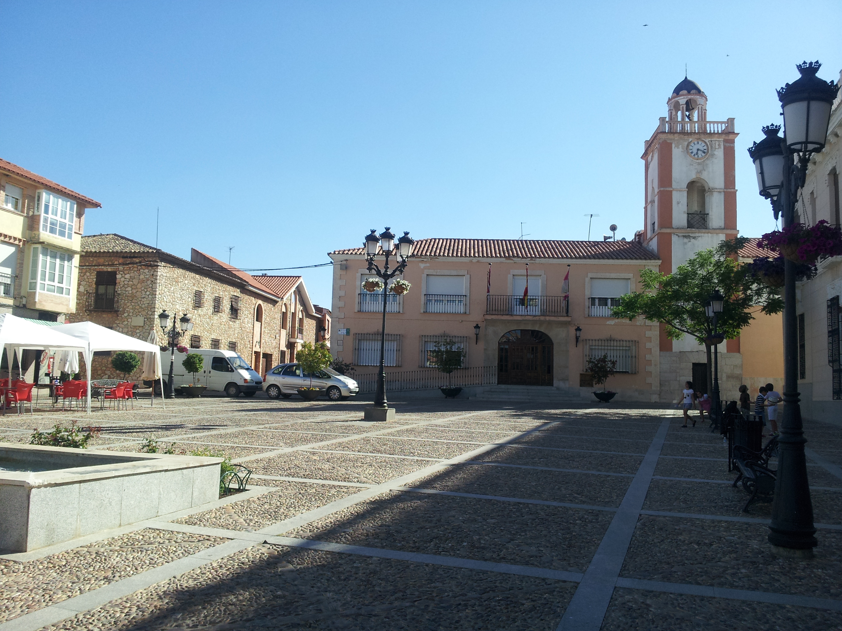
Plaza de la Paz y Ayuntamiento Villarta de San Juan.jpg — This file is a work by Takashi kurita . Please, credit this: Álvaro C.E. I would appreciate being notified (acantos30 hotmail.com) if you use my work outside Wikimedia More of my work can be found in my personal gallery — CC BY-SA 3.0 — https://commons.wikimedia.org/wiki/File:Plaza_de_la_Paz_y_Ayuntamiento_Villarta_de_San_Juan.jpg

This file is a work by Takashi kurita . Please, credit this: Álvaro C.E. I would appreciate being notified (acantos30 hotmail.com) if you use my work outside Wikimedia More of my work can be found in my personal gallery
CC BY-SA 3.0
View original activity in YouVisible
Weather on your route
Loading forecast…
Sources and credits
Obra derivada de CNT 2024 CC-BY 4.0 MAPA. CNT614-0050-etapa-5-villarta-de-san-juan-villarrubia-de-los-ojos.kml. Conversión fiel a GPX, sin añadir coordenadas ni tiempos. Créditos fotográficos separados.
MAPA · CNIG CNT 2024 · CC BY 4.0
Torre del Reloj de Villarrubia
Torre del Reloj, Villarrubia de los Ojos.jpg — Albertocsc — CC BY-SA 4.0 — https://commons.wikimedia.org/wiki/File:Torre_del_Reloj,_Villarrubia_de_los_Ojos.jpg
Albertocsc · CC BY-SA 4.0 · Media source
Acceso al Puente Viejo
Puente Romano 1 Villarta de San Juan.jpg — This file is a work by Takashi kurita . Please, credit this: Álvaro C.E. I would appreciate being notified (acantos30 hotmail.com) if you use my work outside Wikimedia More of my work can be found in my personal gallery — CC BY-SA 3.0 — https://commons.wikimedia.org/wiki/File:Puente_Romano_1_Villarta_de_San_Juan.jpg
This file is a work by Takashi kurita . Please, credit this: Álvaro C.E. I would appreciate being notified (acantos30 hotmail.com) if you use my work outside Wikimedia More of my work can be found in my personal gallery · CC BY-SA 3.0 · Media source
Arcos del Puente Viejo
Puente Romano 2 Villarta de San Juan.jpg — This file is a work by Takashi kurita . Please, credit this: Álvaro C.E. I would appreciate being notified (acantos30 hotmail.com) if you use my work outside Wikimedia More of my work can be found in my personal gallery — CC BY-SA 3.0 — https://commons.wikimedia.org/wiki/File:Puente_Romano_2_Villarta_de_San_Juan.jpg
This file is a work by Takashi kurita . Please, credit this: Álvaro C.E. I would appreciate being notified (acantos30 hotmail.com) if you use my work outside Wikimedia More of my work can be found in my personal gallery · CC BY-SA 3.0 · Media source
Otra perspectiva del puente
Puente Romano 3 Villarta de San Juan.jpg — This file is a work by Takashi kurita . Please, credit this: Álvaro C.E. I would appreciate being notified (acantos30 hotmail.com) if you use my work outside Wikimedia More of my work can be found in my personal gallery — CC BY-SA 3.0 — https://commons.wikimedia.org/wiki/File:Puente_Romano_3_Villarta_de_San_Juan.jpg
This file is a work by Takashi kurita . Please, credit this: Álvaro C.E. I would appreciate being notified (acantos30 hotmail.com) if you use my work outside Wikimedia More of my work can be found in my personal gallery · CC BY-SA 3.0 · Media source
Villarta desde el puente
Villarta de San Juan, Vista general desde puente Romano.jpg — This file is a work by Takashi kurita . Please, credit this: Álvaro C.E. I would appreciate being notified (acantos30 hotmail.com) if you use my work outside Wikimedia More of my work can be found in my personal gallery — CC BY-SA 3.0 — https://commons.wikimedia.org/wiki/File:Villarta_de_San_Juan,_Vista_general_desde_puente_Romano.jpg
This file is a work by Takashi kurita . Please, credit this: Álvaro C.E. I would appreciate being notified (acantos30 hotmail.com) if you use my work outside Wikimedia More of my work can be found in my personal gallery · CC BY-SA 3.0 · Media source
Plaza de la Paz de Villarta
Plaza de la Paz y Ayuntamiento Villarta de San Juan.jpg — This file is a work by Takashi kurita . Please, credit this: Álvaro C.E. I would appreciate being notified (acantos30 hotmail.com) if you use my work outside Wikimedia More of my work can be found in my personal gallery — CC BY-SA 3.0 — https://commons.wikimedia.org/wiki/File:Plaza_de_la_Paz_y_Ayuntamiento_Villarta_de_San_Juan.jpg
This file is a work by Takashi kurita . Please, credit this: Álvaro C.E. I would appreciate being notified (acantos30 hotmail.com) if you use my work outside Wikimedia More of my work can be found in my personal gallery · CC BY-SA 3.0 · Media source