Find your next route
Explore hiking, running, trail running and cycling routes that suit your plans.

Community route
East Kilkenny Cycle Route
Complete registered cycling itinerary in County Kilkenny. The official source retains all mapped sections; reliable elevations are unavailable. The orientative completion time comes from Sport Ireland. Photographs show identified Kilkenny surroundings and do not imply viewpoints on the track. Sport Ireland · National Trails Register · CC BY 4.0 · https://creativecommons.org/licenses/by/4.0/. Distance: 62.481 km.
By YouVisible Sport
Mapa del recorrido
Activity measurements
- distance meters
- 62,480.9646093256
- end · latitude
- 52.4675446
- end · longitude
- -6.9729416
- estimated duration seconds
- 14,400
- start · latitude
- 52.4675446
- start · longitude
- -6.9729416
- Sport
- Cycling
- Specialty
- cycling road
From start to finish
- Country
- Ireland
- Province / region
- —
- Localities
- —
Before you go
- How to reach the start
- —
- Parking and access
- —
- Advice
- YouVisible Guide only. Garmin export unavailable: reliable native elevations are missing. Follow posted access permissions, temporary closures and local conditions. Check the route status before setting out. Follow the permitted direction and traffic rules; road sections share traffic. Provider elevations, where present, are not measurements performed by YouVisible. Photographs are labelled “Route surroundings”. Orientative completion time supplied by Sport Ireland; allow longer for pace and conditions.
- Recommended equipment
- —
- Terrain
- —
- Signage
- —
Characteristics and difficulty
- Estimated duration
- 4 h
- Author perceived effort
- —
- Physical difficulty
- —
- Technical difficulty
- —
About the route
Complete registered cycling itinerary in County Kilkenny. The official source retains all mapped sections; reliable elevations are unavailable. The orientative completion time comes from Sport Ireland. Photographs show identified Kilkenny surroundings and do not imply viewpoints on the track. Sport Ireland · National Trails Register · CC BY 4.0 · https://creativecommons.org/licenses/by/4.0/. Distance: 62.481 km.
- Context
- —
- Specialty
- cycling road
- Event type
- —
- Description
- Route surroundings · real photographs with individual author and licence credits.
- Title
- Route highlights
- Title
- Sesión
- Description
- Complete registered cycling itinerary in County Kilkenny. The official source retains all mapped sections; reliable elevations are unavailable. The orientative completion time comes from Sport Ireland. Photographs show identified Kilkenny surroundings and do not imply viewpoints on the track. Sport Ireland · National Trails Register · CC BY 4.0 · https://creativecommons.org/licenses/by/4.0/. Distance: 62.481 km.
- Description
- Route surroundings · Dublin Road, Kilkenny - geograph.org.uk - 2587865.jpg. Photograph of the identified place or its documented surroundings; no track position is implied.
- Title
- Route surroundings · Dublin Road, Kilkenny - geograph.org.uk - 2587865.jpg
- Description
- Route surroundings · Irishtown, Kilkenny - geograph.org.uk - 3361096.jpg. Photograph of the identified place or its documented surroundings; no track position is implied.
- Title
- Route surroundings · Irishtown, Kilkenny - geograph.org.uk - 3361096.jpg
- Description
- Route surroundings · Kilkenny - Talbot's Tower as seen from Lower New St - geograph.org.uk - 5615158.jpg. Photograph of the identified place or its documented surroundings; no track position is implied.
- Title
- Route surroundings · Kilkenny - Talbot's Tower as seen from Lower New St - geograph.org.uk - 5615158.jpg
- Description
- Route surroundings · Kilkenny - View from Round Tower Bonnetstown Rd (close up) - geograph.org.uk - 4275535.jpg. Photograph of the identified place or its documented surroundings; no track position is implied.
- Title
- Route surroundings · Kilkenny - View from Round Tower Bonnetstown Rd (close up) - geograph.org.uk - 4275535.jpg
- Description
- Route surroundings · Kilkenny - View from Round Tower to Irishtown ^ Brewery - geograph.org.uk - 4275523.jpg. Photograph of the identified place or its documented surroundings; no track position is implied.
- Title
- Route surroundings · Kilkenny - View from Round Tower to Irishtown ^ Brewery - geograph.org.uk - 4275523.jpg
- Description
- Route surroundings · Kilkenny High Street - geograph.org.uk - 3361079.jpg. Photograph of the identified place or its documented surroundings; no track position is implied.
- Title
- Route surroundings · Kilkenny High Street - geograph.org.uk - 3361079.jpg
- Description
- Route surroundings · Dublin Road, Kilkenny - geograph.org.uk - 2587865.jpg. Photograph of the identified place or its documented surroundings; no track position is implied.
- Title
- Route surroundings · Dublin Road, Kilkenny - geograph.org.uk - 2587865.jpg
- Description
- Route surroundings · Irishtown, Kilkenny - geograph.org.uk - 3361096.jpg. Photograph of the identified place or its documented surroundings; no track position is implied.
- Title
- Route surroundings · Irishtown, Kilkenny - geograph.org.uk - 3361096.jpg
- Description
- Route surroundings · Kilkenny - Talbot's Tower as seen from Lower New St - geograph.org.uk - 5615158.jpg. Photograph of the identified place or its documented surroundings; no track position is implied.
- Title
- Route surroundings · Kilkenny - Talbot's Tower as seen from Lower New St - geograph.org.uk - 5615158.jpg
- Description
- Route surroundings · Kilkenny - View from Round Tower Bonnetstown Rd (close up) - geograph.org.uk - 4275535.jpg. Photograph of the identified place or its documented surroundings; no track position is implied.
- Title
- Route surroundings · Kilkenny - View from Round Tower Bonnetstown Rd (close up) - geograph.org.uk - 4275535.jpg
- Description
- Route surroundings · Kilkenny - View from Round Tower to Irishtown ^ Brewery - geograph.org.uk - 4275523.jpg. Photograph of the identified place or its documented surroundings; no track position is implied.
- Title
- Route surroundings · Kilkenny - View from Round Tower to Irishtown ^ Brewery - geograph.org.uk - 4275523.jpg
- Description
- Route surroundings · Kilkenny High Street - geograph.org.uk - 3361079.jpg. Photograph of the identified place or its documented surroundings; no track position is implied.
- Title
- Route surroundings · Kilkenny High Street - geograph.org.uk - 3361079.jpg
- Advice
- YouVisible Guide only. Garmin export unavailable: reliable native elevations are missing. Follow posted access permissions, temporary closures and local conditions. Check the route status before setting out. Follow the permitted direction and traffic rules; road sections share traffic. Provider elevations, where present, are not measurements performed by YouVisible. Photographs are labelled “Route surroundings”. Orientative completion time supplied by Sport Ireland; allow longer for pace and conditions.
- Title
- East Kilkenny Cycle Route
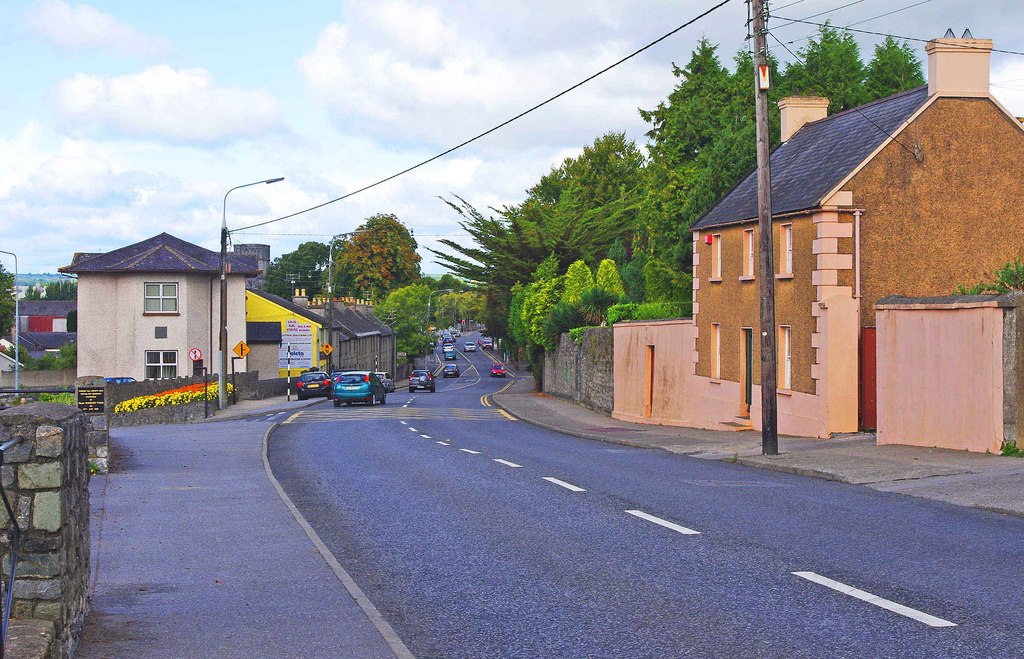
Route surroundings · Dublin Road, Kilkenny - geograph.org.uk - 2587865.jpg — P L Chadwick — CC BY-SA 2.0 (https://creativecommons.org/licenses/by-sa/2.0) — https://commons.wikimedia.org/wiki/File:Dublin_Road,_Kilkenny_-_geograph.org.uk_-_2587865.jpg

P L Chadwick
CC BY-SA 2.0
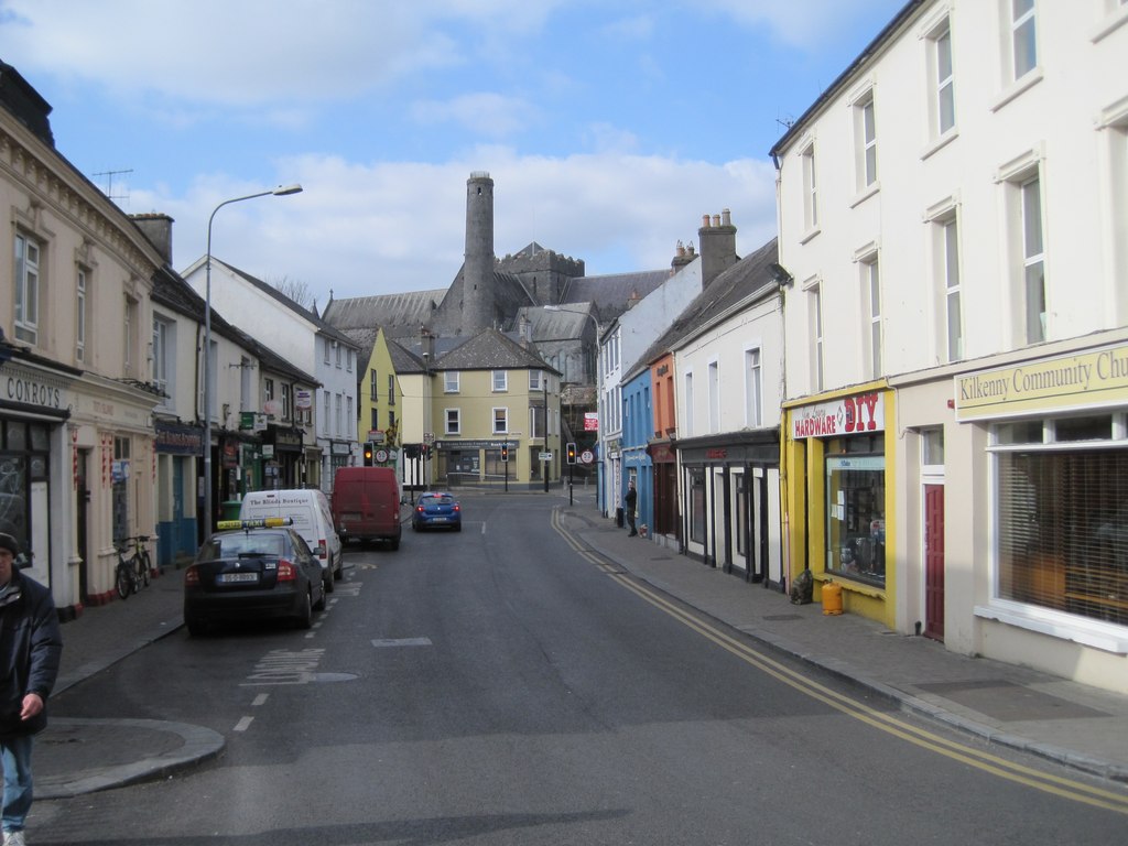
Route surroundings · Irishtown, Kilkenny - geograph.org.uk - 3361096.jpg — Nigel Thompson — CC BY-SA 2.0 (https://creativecommons.org/licenses/by-sa/2.0) — https://commons.wikimedia.org/wiki/File:Irishtown,_Kilkenny_-_geograph.org.uk_-_3361096.jpg

Nigel Thompson
CC BY-SA 2.0
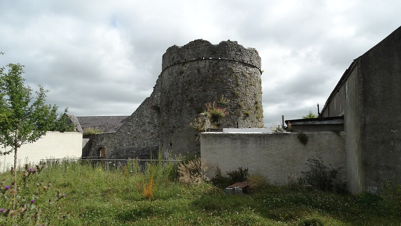
Route surroundings · Kilkenny - Talbot's Tower as seen from Lower New St - geograph.org.uk - 5615158.jpg — Colin Park — CC BY-SA 2.0 (https://creativecommons.org/licenses/by-sa/2.0) — https://commons.wikimedia.org/wiki/File:Kilkenny_-_Talbot%27s_Tower_as_seen_from_Lower_New_St_-_geograph.org.uk_-_5615158.jpg

Colin Park
CC BY-SA 2.0
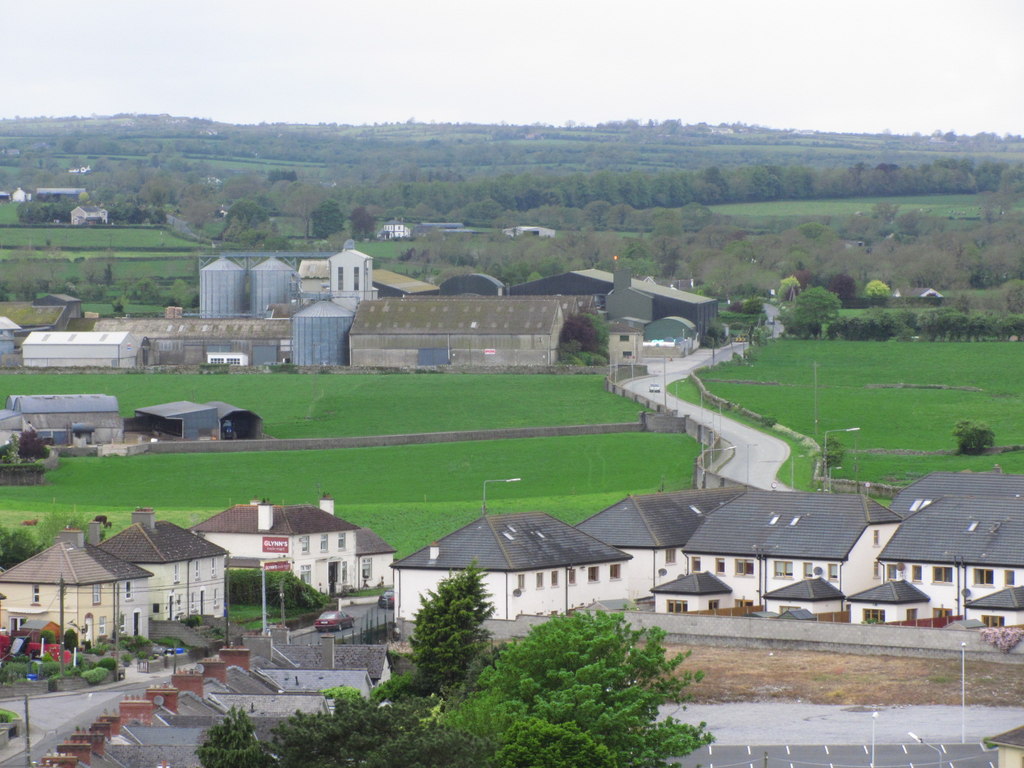
Route surroundings · Kilkenny - View from Round Tower Bonnetstown Rd (close up) - geograph.org.uk - 4275535.jpg — Colin Park — CC BY-SA 2.0 (https://creativecommons.org/licenses/by-sa/2.0) — https://commons.wikimedia.org/wiki/File:Kilkenny_-_View_from_Round_Tower_Bonnetstown_Rd_(close_up)_-_geograph.org.uk_-_4275535.jpg

Colin Park
CC BY-SA 2.0
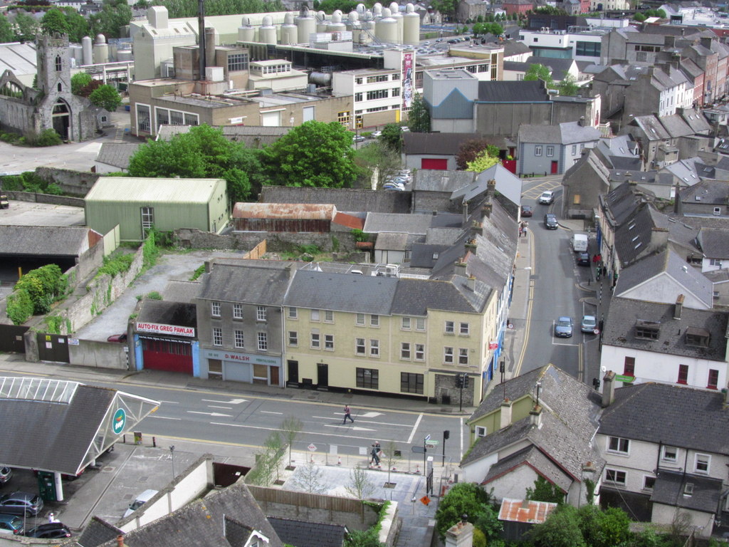
Route surroundings · Kilkenny - View from Round Tower to Irishtown ^ Brewery - geograph.org.uk - 4275523.jpg — Colin Park — CC BY-SA 2.0 (https://creativecommons.org/licenses/by-sa/2.0) — https://commons.wikimedia.org/wiki/File:Kilkenny_-_View_from_Round_Tower_to_Irishtown_%5E_Brewery_-_geograph.org.uk_-_4275523.jpg

Colin Park
CC BY-SA 2.0
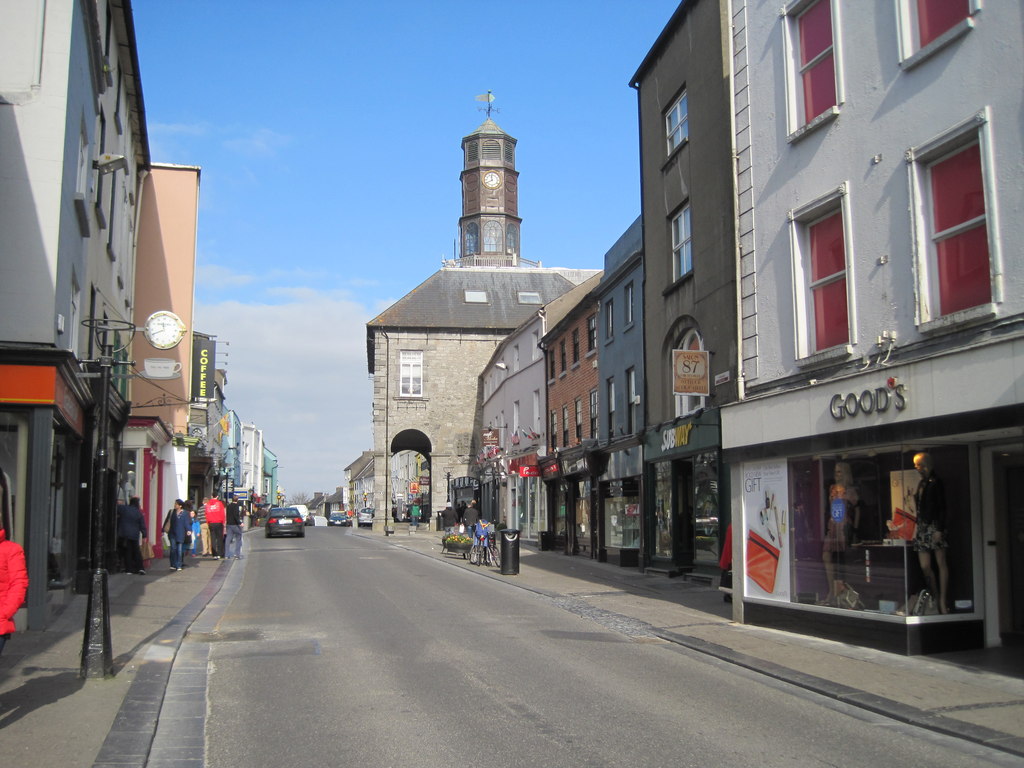
Route surroundings · Kilkenny High Street - geograph.org.uk - 3361079.jpg — Nigel Thompson — CC BY-SA 2.0 (https://creativecommons.org/licenses/by-sa/2.0) — https://commons.wikimedia.org/wiki/File:Kilkenny_High_Street_-_geograph.org.uk_-_3361079.jpg

Nigel Thompson
CC BY-SA 2.0
View original activity in YouVisible
Weather on your route
Loading forecast…
Sources and credits
Sport Ireland · National Trails Register · CC BY 4.0 · https://creativecommons.org/licenses/by/4.0/
Sport Ireland · National Trails Register · CC BY 4.0
Route photograph
Route surroundings · Dublin Road, Kilkenny - geograph.org.uk - 2587865.jpg — P L Chadwick — CC BY-SA 2.0 (https://creativecommons.org/licenses/by-sa/2.0) — https://commons.wikimedia.org/wiki/File:Dublin_Road,_Kilkenny_-_geograph.org.uk_-_2587865.jpg
P L Chadwick · CC BY-SA 2.0 · Media source
Route photograph
Route surroundings · Irishtown, Kilkenny - geograph.org.uk - 3361096.jpg — Nigel Thompson — CC BY-SA 2.0 (https://creativecommons.org/licenses/by-sa/2.0) — https://commons.wikimedia.org/wiki/File:Irishtown,_Kilkenny_-_geograph.org.uk_-_3361096.jpg
Nigel Thompson · CC BY-SA 2.0 · Media source
Route photograph
Route surroundings · Kilkenny - Talbot's Tower as seen from Lower New St - geograph.org.uk - 5615158.jpg — Colin Park — CC BY-SA 2.0 (https://creativecommons.org/licenses/by-sa/2.0) — https://commons.wikimedia.org/wiki/File:Kilkenny_-_Talbot%27s_Tower_as_seen_from_Lower_New_St_-_geograph.org.uk_-_5615158.jpg
Colin Park · CC BY-SA 2.0 · Media source
Route photograph
Route surroundings · Kilkenny - View from Round Tower Bonnetstown Rd (close up) - geograph.org.uk - 4275535.jpg — Colin Park — CC BY-SA 2.0 (https://creativecommons.org/licenses/by-sa/2.0) — https://commons.wikimedia.org/wiki/File:Kilkenny_-_View_from_Round_Tower_Bonnetstown_Rd_(close_up)_-_geograph.org.uk_-_4275535.jpg
Colin Park · CC BY-SA 2.0 · Media source
Route photograph
Route surroundings · Kilkenny - View from Round Tower to Irishtown ^ Brewery - geograph.org.uk - 4275523.jpg — Colin Park — CC BY-SA 2.0 (https://creativecommons.org/licenses/by-sa/2.0) — https://commons.wikimedia.org/wiki/File:Kilkenny_-_View_from_Round_Tower_to_Irishtown_%5E_Brewery_-_geograph.org.uk_-_4275523.jpg
Colin Park · CC BY-SA 2.0 · Media source
Route photograph
Route surroundings · Kilkenny High Street - geograph.org.uk - 3361079.jpg — Nigel Thompson — CC BY-SA 2.0 (https://creativecommons.org/licenses/by-sa/2.0) — https://commons.wikimedia.org/wiki/File:Kilkenny_High_Street_-_geograph.org.uk_-_3361079.jpg
Nigel Thompson · CC BY-SA 2.0 · Media source