Find your next route
Explore hiking, running, trail running and cycling routes that suit your plans.

Community route
Grand Canal Greenway · Sherlockstown and Alasty
Gravel cycling reference itinerary along complete connected Grand Canal Greenway ways around Sherlockstown and Alasty. Every source vertex and segment is retained. The photographs show identified canal locations and nearby surroundings; they do not imply a precise sequence of GPX stops. No elevation profile or travel time is invented. Route geometry: © OpenStreetMap contributors, ODbL 1.0; https://www.openstreetmap.org/copyright; https://opendatacommons.org/licenses/odbl/1-0/.
By YouVisible Sport
Mapa del recorrido
Activity measurements
- distance meters
- 3,864.5074652647
- end · latitude
- 53.2553062
- end · longitude
- -6.6340033
- start · latitude
- 53.2817902
- start · longitude
- -6.5965777
- Sport
- Cycling
- Specialty
- cycling gravel
From start to finish
- Country
- Ireland
- Province / region
- —
- Localities
- —
Before you go
- How to reach the start
- —
- Parking and access
- —
- Advice
- YouVisible Guide only. Garmin export is unavailable: the reference GPX preserves complete source ways as multiple segments and the real validator reports CONTINUITY_UNCONFIRMED. Shared endpoints have identical source node IDs; no joins or elevations are invented to force export. Share the towpath courteously with walkers, slow down at bridge pinch points and road crossings, and follow current signs and local access notices. The gallery includes nearby canal heritage and harbours as route surroundings. This is a linear itinerary: arrange the return journey. No estimated duration is supplied.
- Recommended equipment
- —
- Terrain
- —
- Signage
- —
Characteristics and difficulty
- Estimated duration
- —
- Author perceived effort
- —
- Physical difficulty
- —
- Technical difficulty
- —
About the route
Gravel cycling reference itinerary along complete connected Grand Canal Greenway ways around Sherlockstown and Alasty. Every source vertex and segment is retained. The photographs show identified canal locations and nearby surroundings; they do not imply a precise sequence of GPX stops. No elevation profile or travel time is invented. Route geometry: © OpenStreetMap contributors, ODbL 1.0; https://www.openstreetmap.org/copyright; https://opendatacommons.org/licenses/odbl/1-0/.
- Context
- —
- Specialty
- cycling gravel
- Event type
- —
- Description
- Six real photographs with individual author and licence credits.
- Title
- Route surroundings
- Title
- Sesión
- Description
- Gravel cycling reference itinerary along complete connected Grand Canal Greenway ways around Sherlockstown and Alasty. Every source vertex and segment is retained. The photographs show identified canal locations and nearby surroundings; they do not imply a precise sequence of GPX stops. No elevation profile or travel time is invented. Route geometry: © OpenStreetMap contributors, ODbL 1.0; https://www.openstreetmap.org/copyright; https://opendatacommons.org/licenses/odbl/1-0/.
- Description
- Route surroundings · Grand Canal at Alasty, Co. Kildare - geograph.org.uk - 1365188.jpg. Photograph of the identified place or its documented surroundings; no position on the track is implied.
- Title
- Route surroundings · Grand Canal at Alasty, Co. Kildare - geograph.org.uk - 1365188.jpg
- Description
- Route surroundings · Grand Canal at Keeloges, Co. Kildare - geograph.org.uk - 1366438.jpg. Photograph of the identified place or its documented surroundings; no position on the track is implied.
- Title
- Route surroundings · Grand Canal at Keeloges, Co. Kildare - geograph.org.uk - 1366438.jpg
- Description
- Route surroundings · Henry Bridge on the Grand Canal at Tipperstown, Co. Kildare - geograph.org.uk - 1366465.jpg. Photograph of the identified place or its documented surroundings; no position on the track is implied.
- Title
- Route surroundings · Henry Bridge on the Grand Canal at Tipperstown, Co. Kildare - geograph.org.uk - 1366465.jpg
- Description
- Route surroundings · Grand Canal in Sallins, Co. Kildare - geograph.org.uk - 2479027.jpg. Photograph of the identified place or its documented surroundings; no position on the track is implied.
- Title
- Route surroundings · Grand Canal in Sallins, Co. Kildare - geograph.org.uk - 2479027.jpg
- Description
- Route surroundings · Leinster Aqueduct on the Grand Canal, W of Sallins - geograph.org.uk - 4638049.jpg. Photograph of the identified place or its documented surroundings; no position on the track is implied.
- Title
- Route surroundings · Leinster Aqueduct on the Grand Canal, W of Sallins - geograph.org.uk - 4638049.jpg
- Description
- Route surroundings · Sallins Marina - geograph.org.uk - 536119.jpg. Photograph of the identified place or its documented surroundings; no position on the track is implied.
- Title
- Route surroundings · Sallins Marina - geograph.org.uk - 536119.jpg
- Description
- Route surroundings · Grand Canal at Alasty, Co. Kildare - geograph.org.uk - 1365188.jpg. Photograph of the identified place or its documented surroundings; no position on the track is implied.
- Title
- Route surroundings · Grand Canal at Alasty, Co. Kildare - geograph.org.uk - 1365188.jpg
- Description
- Route surroundings · Grand Canal at Keeloges, Co. Kildare - geograph.org.uk - 1366438.jpg. Photograph of the identified place or its documented surroundings; no position on the track is implied.
- Title
- Route surroundings · Grand Canal at Keeloges, Co. Kildare - geograph.org.uk - 1366438.jpg
- Description
- Route surroundings · Henry Bridge on the Grand Canal at Tipperstown, Co. Kildare - geograph.org.uk - 1366465.jpg. Photograph of the identified place or its documented surroundings; no position on the track is implied.
- Title
- Route surroundings · Henry Bridge on the Grand Canal at Tipperstown, Co. Kildare - geograph.org.uk - 1366465.jpg
- Description
- Route surroundings · Grand Canal in Sallins, Co. Kildare - geograph.org.uk - 2479027.jpg. Photograph of the identified place or its documented surroundings; no position on the track is implied.
- Title
- Route surroundings · Grand Canal in Sallins, Co. Kildare - geograph.org.uk - 2479027.jpg
- Description
- Route surroundings · Leinster Aqueduct on the Grand Canal, W of Sallins - geograph.org.uk - 4638049.jpg. Photograph of the identified place or its documented surroundings; no position on the track is implied.
- Title
- Route surroundings · Leinster Aqueduct on the Grand Canal, W of Sallins - geograph.org.uk - 4638049.jpg
- Description
- Route surroundings · Sallins Marina - geograph.org.uk - 536119.jpg. Photograph of the identified place or its documented surroundings; no position on the track is implied.
- Title
- Route surroundings · Sallins Marina - geograph.org.uk - 536119.jpg
- Advice
- YouVisible Guide only. Garmin export is unavailable: the reference GPX preserves complete source ways as multiple segments and the real validator reports CONTINUITY_UNCONFIRMED. Shared endpoints have identical source node IDs; no joins or elevations are invented to force export. Share the towpath courteously with walkers, slow down at bridge pinch points and road crossings, and follow current signs and local access notices. The gallery includes nearby canal heritage and harbours as route surroundings. This is a linear itinerary: arrange the return journey. No estimated duration is supplied.
- Title
- Grand Canal Greenway · Sherlockstown and Alasty
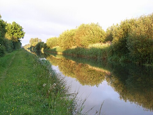
Route surroundings · Grand Canal at Alasty, Co. Kildare - geograph.org.uk - 1365188.jpg — JP — CC BY-SA 2.0 (https://creativecommons.org/licenses/by-sa/2.0) — https://commons.wikimedia.org/wiki/File:Grand_Canal_at_Alasty,_Co._Kildare_-_geograph.org.uk_-_1365188.jpg

JP
CC BY-SA 2.0
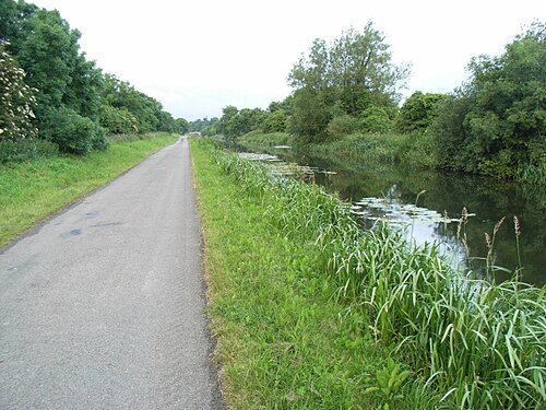
Route surroundings · Grand Canal at Keeloges, Co. Kildare - geograph.org.uk - 1366438.jpg — JP — CC BY-SA 2.0 (https://creativecommons.org/licenses/by-sa/2.0) — https://commons.wikimedia.org/wiki/File:Grand_Canal_at_Keeloges,_Co._Kildare_-_geograph.org.uk_-_1366438.jpg

JP
CC BY-SA 2.0
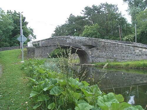
Route surroundings · Henry Bridge on the Grand Canal at Tipperstown, Co. Kildare - geograph.org.uk - 1366465.jpg — JP — CC BY-SA 2.0 (https://creativecommons.org/licenses/by-sa/2.0) — https://commons.wikimedia.org/wiki/File:Henry_Bridge_on_the_Grand_Canal_at_Tipperstown,_Co._Kildare_-_geograph.org.uk_-_1366465.jpg

JP
CC BY-SA 2.0
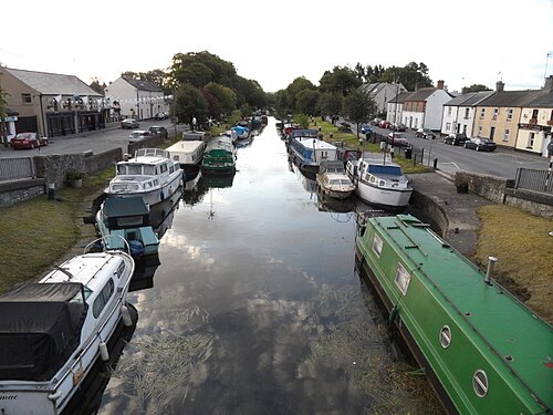
Route surroundings · Grand Canal in Sallins, Co. Kildare - geograph.org.uk - 2479027.jpg — JP — CC BY-SA 2.0 (https://creativecommons.org/licenses/by-sa/2.0) — https://commons.wikimedia.org/wiki/File:Grand_Canal_in_Sallins,_Co._Kildare_-_geograph.org.uk_-_2479027.jpg

JP
CC BY-SA 2.0
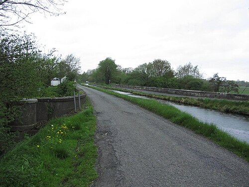
Route surroundings · Leinster Aqueduct on the Grand Canal, W of Sallins - geograph.org.uk - 4638049.jpg — Colin Park — CC BY-SA 2.0 (https://creativecommons.org/licenses/by-sa/2.0) — https://commons.wikimedia.org/wiki/File:Leinster_Aqueduct_on_the_Grand_Canal,_W_of_Sallins_-_geograph.org.uk_-_4638049.jpg

Colin Park
CC BY-SA 2.0
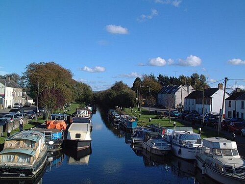
Route surroundings · Sallins Marina - geograph.org.uk - 536119.jpg — toni gaidoni — CC BY-SA 2.0 (https://creativecommons.org/licenses/by-sa/2.0) — https://commons.wikimedia.org/wiki/File:Sallins_Marina_-_geograph.org.uk_-_536119.jpg

toni gaidoni
CC BY-SA 2.0
View original activity in YouVisible
Weather on your route
Loading forecast…
Sources and credits
© OpenStreetMap contributors · ODbL 1.0 · https://www.openstreetmap.org/copyright · https://opendatacommons.org/licenses/odbl/1-0/
OpenStreetMap contributors · Complete mapped route sections · ODbL 1.0
Route photograph
Route surroundings · Grand Canal at Alasty, Co. Kildare - geograph.org.uk - 1365188.jpg — JP — CC BY-SA 2.0 (https://creativecommons.org/licenses/by-sa/2.0) — https://commons.wikimedia.org/wiki/File:Grand_Canal_at_Alasty,_Co._Kildare_-_geograph.org.uk_-_1365188.jpg
JP · CC BY-SA 2.0 · Media source
Route photograph
Route surroundings · Grand Canal at Keeloges, Co. Kildare - geograph.org.uk - 1366438.jpg — JP — CC BY-SA 2.0 (https://creativecommons.org/licenses/by-sa/2.0) — https://commons.wikimedia.org/wiki/File:Grand_Canal_at_Keeloges,_Co._Kildare_-_geograph.org.uk_-_1366438.jpg
JP · CC BY-SA 2.0 · Media source
Route photograph
Route surroundings · Henry Bridge on the Grand Canal at Tipperstown, Co. Kildare - geograph.org.uk - 1366465.jpg — JP — CC BY-SA 2.0 (https://creativecommons.org/licenses/by-sa/2.0) — https://commons.wikimedia.org/wiki/File:Henry_Bridge_on_the_Grand_Canal_at_Tipperstown,_Co._Kildare_-_geograph.org.uk_-_1366465.jpg
JP · CC BY-SA 2.0 · Media source
Route photograph
Route surroundings · Grand Canal in Sallins, Co. Kildare - geograph.org.uk - 2479027.jpg — JP — CC BY-SA 2.0 (https://creativecommons.org/licenses/by-sa/2.0) — https://commons.wikimedia.org/wiki/File:Grand_Canal_in_Sallins,_Co._Kildare_-_geograph.org.uk_-_2479027.jpg
JP · CC BY-SA 2.0 · Media source
Route photograph
Route surroundings · Leinster Aqueduct on the Grand Canal, W of Sallins - geograph.org.uk - 4638049.jpg — Colin Park — CC BY-SA 2.0 (https://creativecommons.org/licenses/by-sa/2.0) — https://commons.wikimedia.org/wiki/File:Leinster_Aqueduct_on_the_Grand_Canal,_W_of_Sallins_-_geograph.org.uk_-_4638049.jpg
Colin Park · CC BY-SA 2.0 · Media source
Route photograph
Route surroundings · Sallins Marina - geograph.org.uk - 536119.jpg — toni gaidoni — CC BY-SA 2.0 (https://creativecommons.org/licenses/by-sa/2.0) — https://commons.wikimedia.org/wiki/File:Sallins_Marina_-_geograph.org.uk_-_536119.jpg
toni gaidoni · CC BY-SA 2.0 · Media source