Find your next route
Explore hiking, running, trail running and cycling routes that suit your plans.

Community route
Cilgerran to Cardigan · Road cycling via Llechryd and Aberporth
Complete published road cycling route from Cilgerran to Aberteifi / Cardigan via Llechryd, Beulah and Aberporth. The photographs show Cilgerran, Cardigan and the Teifi setting as route surroundings rather than locations fixed to the GPX. Canonical track distance: 37.516 km.
By YouVisible Sport
Mapa del recorrido
Perfil de elevación
Activity measurements
- distance meters
- 37,515.6934285035
- elevation gain meters
- 748
- elevation loss meters
- 786.1
- max elevation meters
- 206.3
- min elevation meters
- 2.9
- end · latitude
- 52.080901
- end · longitude
- -4.657322
- start · latitude
- 52.05581
- start · longitude
- -4.636035
- Sport
- Cycling
- Specialty
- cycling road
From start to finish
- Country
- United Kingdom
- Province / region
- —
- Localities
- —
Before you go
- How to reach the start
- —
- Parking and access
- —
- Advice
- Guide + verified export. Follow current traffic directions and local road signs. The gallery does not imply that the cycling route enters the castle grounds. Native GPX elevations are retained; they are not measurements performed by YouVisible. Photographs are labelled “Route surroundings” and do not imply camera locations on the track.
- Recommended equipment
- —
- Terrain
- —
- Signage
- —
Characteristics and difficulty
- Estimated duration
- —
- Author perceived effort
- —
- Physical difficulty
- —
- Technical difficulty
- —
About the route
Complete published road cycling route from Cilgerran to Aberteifi / Cardigan via Llechryd, Beulah and Aberporth. The photographs show Cilgerran, Cardigan and the Teifi setting as route surroundings rather than locations fixed to the GPX. Canonical track distance: 37.516 km.
- Context
- —
- Specialty
- cycling road
- Event type
- —
- Description
- Route surroundings · real photographs with individual author and licence credits.
- Title
- Route highlights
- Title
- Sesión
- Description
- Complete published road cycling route from Cilgerran to Aberteifi / Cardigan via Llechryd, Beulah and Aberporth. The photographs show Cilgerran, Cardigan and the Teifi setting as route surroundings rather than locations fixed to the GPX. Canonical track distance: 37.516 km.
- Description
- Route surroundings · 01 Cilgerran Castle.jpg. Photograph of the identified place or its documented surroundings; no position on the track is implied.
- Title
- Route surroundings · 01 Cilgerran Castle.jpg
- Description
- Route surroundings · Cilgerran Town.jpg. Photograph of the identified place or its documented surroundings; no position on the track is implied.
- Title
- Route surroundings · Cilgerran Town.jpg
- Description
- Route surroundings · A ruined corner of Cilgerran Castle - geograph.org.uk - 5195079.jpg. Photograph of the identified place or its documented surroundings; no position on the track is implied.
- Title
- Route surroundings · A ruined corner of Cilgerran Castle - geograph.org.uk - 5195079.jpg
- Description
- Route surroundings · Cilgerran Castle, The Inner Ward from The East Tower - geograph.org.uk - 6920004.jpg. Photograph of the identified place or its documented surroundings; no position on the track is implied.
- Title
- Route surroundings · Cilgerran Castle, The Inner Ward from The East Tower - geograph.org.uk - 6920004.jpg
- Description
- Route surroundings · Afon Teifi ger Aberteifi o'r awyr - the river teifi near Cardigan, Ceredigion, Wales from the air 22.jpg. Photograph of the identified place or its documented surroundings; no position on the track is implied.
- Title
- Route surroundings · Afon Teifi ger Aberteifi o'r awyr - the river teifi near Cardigan, Ceredigion, Wales from the air 22.jpg
- Description
- Route surroundings · Afon Teifi ger Aberteifi o'r awyr - the river teifi near Cardigan, Ceredigion, Wales from the air 05.jpg. Photograph of the identified place or its documented surroundings; no position on the track is implied.
- Title
- Route surroundings · Afon Teifi ger Aberteifi o'r awyr - the river teifi near Cardigan, Ceredigion, Wales from the air 05.jpg
- Description
- Route surroundings · 01 Cilgerran Castle.jpg. Photograph of the identified place or its documented surroundings; no position on the track is implied.
- Title
- Route surroundings · 01 Cilgerran Castle.jpg
- Description
- Route surroundings · Cilgerran Town.jpg. Photograph of the identified place or its documented surroundings; no position on the track is implied.
- Title
- Route surroundings · Cilgerran Town.jpg
- Description
- Route surroundings · A ruined corner of Cilgerran Castle - geograph.org.uk - 5195079.jpg. Photograph of the identified place or its documented surroundings; no position on the track is implied.
- Title
- Route surroundings · A ruined corner of Cilgerran Castle - geograph.org.uk - 5195079.jpg
- Description
- Route surroundings · Cilgerran Castle, The Inner Ward from The East Tower - geograph.org.uk - 6920004.jpg. Photograph of the identified place or its documented surroundings; no position on the track is implied.
- Title
- Route surroundings · Cilgerran Castle, The Inner Ward from The East Tower - geograph.org.uk - 6920004.jpg
- Description
- Route surroundings · Afon Teifi ger Aberteifi o'r awyr - the river teifi near Cardigan, Ceredigion, Wales from the air 22.jpg. Photograph of the identified place or its documented surroundings; no position on the track is implied.
- Title
- Route surroundings · Afon Teifi ger Aberteifi o'r awyr - the river teifi near Cardigan, Ceredigion, Wales from the air 22.jpg
- Description
- Route surroundings · Afon Teifi ger Aberteifi o'r awyr - the river teifi near Cardigan, Ceredigion, Wales from the air 05.jpg. Photograph of the identified place or its documented surroundings; no position on the track is implied.
- Title
- Route surroundings · Afon Teifi ger Aberteifi o'r awyr - the river teifi near Cardigan, Ceredigion, Wales from the air 05.jpg
- Advice
- Guide + verified export. Follow current traffic directions and local road signs. The gallery does not imply that the cycling route enters the castle grounds. Native GPX elevations are retained; they are not measurements performed by YouVisible. Photographs are labelled “Route surroundings” and do not imply camera locations on the track.
- Title
- Cilgerran to Cardigan · Road cycling via Llechryd and Aberporth
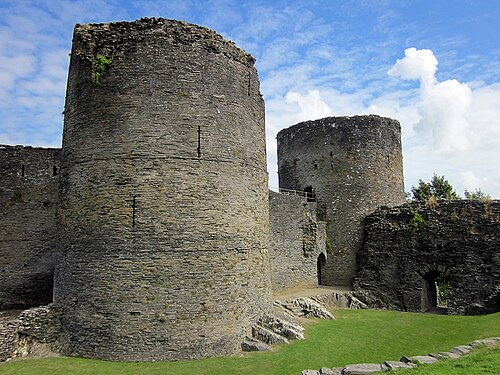
Route surroundings · 01 Cilgerran Castle.jpg — Waterborough — CC BY-SA 3.0 (http://creativecommons.org/licenses/by-sa/3.0/) — https://commons.wikimedia.org/wiki/File:01_Cilgerran_Castle.jpg

Waterborough
CC BY-SA 3.0
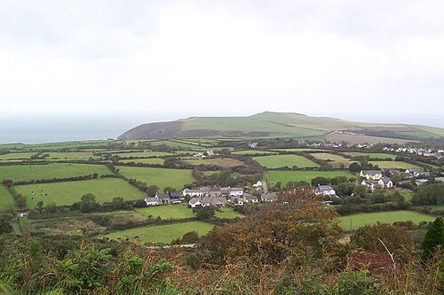
Route surroundings · Cilgerran Town.jpg — Endarrt at English Wikipedia — CC BY 3.0 (https://creativecommons.org/licenses/by/3.0) — https://commons.wikimedia.org/wiki/File:Cilgerran_Town.jpg

Endarrt at English Wikipedia
CC BY 3.0
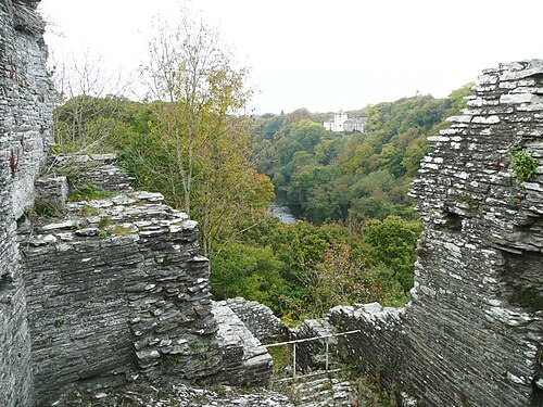
Route surroundings · A ruined corner of Cilgerran Castle - geograph.org.uk - 5195079.jpg — Humphrey Bolton — CC BY-SA 2.0 (https://creativecommons.org/licenses/by-sa/2.0) — https://commons.wikimedia.org/wiki/File:A_ruined_corner_of_Cilgerran_Castle_-_geograph.org.uk_-_5195079.jpg

Humphrey Bolton
CC BY-SA 2.0
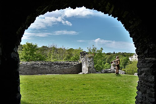
Route surroundings · Cilgerran Castle, The Inner Ward from The East Tower - geograph.org.uk - 6920004.jpg — Michael Garlick — CC BY-SA 2.0 (https://creativecommons.org/licenses/by-sa/2.0) — https://commons.wikimedia.org/wiki/File:Cilgerran_Castle,_The_Inner_Ward_from_The_East_Tower_-_geograph.org.uk_-_6920004.jpg

Michael Garlick
CC BY-SA 2.0
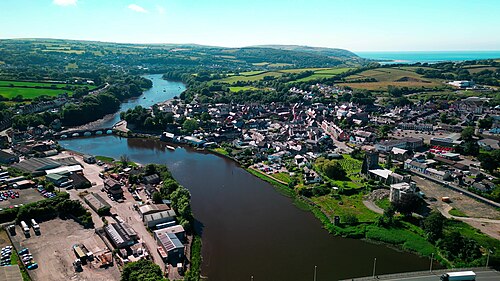
Route surroundings · Afon Teifi ger Aberteifi o'r awyr - the river teifi near Cardigan, Ceredigion, Wales from the air 22.jpg — Llywelyn2000 — CC BY-SA 4.0 (https://creativecommons.org/licenses/by-sa/4.0) — https://commons.wikimedia.org/wiki/File:Afon_Teifi_ger_Aberteifi_o%27r_awyr_-_the_river_teifi_near_Cardigan,_Ceredigion,_Wales_from_the_air_22.jpg

Llywelyn2000
CC BY-SA 4.0
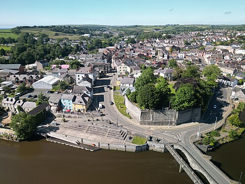
Route surroundings · Afon Teifi ger Aberteifi o'r awyr - the river teifi near Cardigan, Ceredigion, Wales from the air 05.jpg — Llywelyn2000 — CC BY-SA 4.0 (https://creativecommons.org/licenses/by-sa/4.0) — https://commons.wikimedia.org/wiki/File:Afon_Teifi_ger_Aberteifi_o%27r_awyr_-_the_river_teifi_near_Cardigan,_Ceredigion,_Wales_from_the_air_05.jpg

Llywelyn2000
CC BY-SA 4.0
View original activity in YouVisible
Weather on your route
Loading forecast…
Sources and credits
Outdooractive Creative Commons · CC0 1.0 · https://www.outdooractive.com/r/809605486
Outdooractive · Creative Commons Routes · CC0 1.0
Route photograph
Route surroundings · 01 Cilgerran Castle.jpg — Waterborough — CC BY-SA 3.0 (http://creativecommons.org/licenses/by-sa/3.0/) — https://commons.wikimedia.org/wiki/File:01_Cilgerran_Castle.jpg
Waterborough · CC BY-SA 3.0 · Media source
Route photograph
Route surroundings · Cilgerran Town.jpg — Endarrt at English Wikipedia — CC BY 3.0 (https://creativecommons.org/licenses/by/3.0) — https://commons.wikimedia.org/wiki/File:Cilgerran_Town.jpg
Endarrt at English Wikipedia · CC BY 3.0 · Media source
Route photograph
Route surroundings · A ruined corner of Cilgerran Castle - geograph.org.uk - 5195079.jpg — Humphrey Bolton — CC BY-SA 2.0 (https://creativecommons.org/licenses/by-sa/2.0) — https://commons.wikimedia.org/wiki/File:A_ruined_corner_of_Cilgerran_Castle_-_geograph.org.uk_-_5195079.jpg
Humphrey Bolton · CC BY-SA 2.0 · Media source
Route photograph
Route surroundings · Cilgerran Castle, The Inner Ward from The East Tower - geograph.org.uk - 6920004.jpg — Michael Garlick — CC BY-SA 2.0 (https://creativecommons.org/licenses/by-sa/2.0) — https://commons.wikimedia.org/wiki/File:Cilgerran_Castle,_The_Inner_Ward_from_The_East_Tower_-_geograph.org.uk_-_6920004.jpg
Michael Garlick · CC BY-SA 2.0 · Media source
Route photograph
Route surroundings · Afon Teifi ger Aberteifi o'r awyr - the river teifi near Cardigan, Ceredigion, Wales from the air 22.jpg — Llywelyn2000 — CC BY-SA 4.0 (https://creativecommons.org/licenses/by-sa/4.0) — https://commons.wikimedia.org/wiki/File:Afon_Teifi_ger_Aberteifi_o%27r_awyr_-_the_river_teifi_near_Cardigan,_Ceredigion,_Wales_from_the_air_22.jpg
Llywelyn2000 · CC BY-SA 4.0 · Media source
Route photograph
Route surroundings · Afon Teifi ger Aberteifi o'r awyr - the river teifi near Cardigan, Ceredigion, Wales from the air 05.jpg — Llywelyn2000 — CC BY-SA 4.0 (https://creativecommons.org/licenses/by-sa/4.0) — https://commons.wikimedia.org/wiki/File:Afon_Teifi_ger_Aberteifi_o%27r_awyr_-_the_river_teifi_near_Cardigan,_Ceredigion,_Wales_from_the_air_05.jpg
Llywelyn2000 · CC BY-SA 4.0 · Media source