Find your next route
Explore hiking, running, trail running and cycling routes that suit your plans.

Community route
Newport and Parrog · Extended walking circuit
Complete published walking circuit from Newport via Parrog. The gallery shows the Newport and Nevern estuary setting in Pembrokeshire; not every pictured place is claimed as a point on this longer circuit. Canonical track distance: 10.286 km.
By YouVisible Sport
Mapa del recorrido
Perfil de elevación
Activity measurements
- distance meters
- 10,286.4324073577
- elevation gain meters
- 399.5
- elevation loss meters
- 399
- max elevation meters
- 345.3
- min elevation meters
- 1.6
- end · latitude
- 52.019611
- end · longitude
- -4.82569
- start · latitude
- 52.019676
- start · longitude
- -4.825605
- Sport
- hiking mountaineering
- Specialty
- Hiking
From start to finish
- Country
- United Kingdom
- Province / region
- —
- Localities
- —
Before you go
- How to reach the start
- —
- Parking and access
- —
- Advice
- Guide + verified export. Stay on permitted paths and check local conditions before setting out. Native GPX elevations are retained; they are not measurements performed by YouVisible. Photographs are labelled “Route surroundings” and do not imply camera locations on the track.
- Recommended equipment
- —
- Terrain
- —
- Signage
- —
Characteristics and difficulty
- Estimated duration
- —
- Author perceived effort
- —
- Physical difficulty
- —
- Technical difficulty
- —
About the route
Complete published walking circuit from Newport via Parrog. The gallery shows the Newport and Nevern estuary setting in Pembrokeshire; not every pictured place is claimed as a point on this longer circuit. Canonical track distance: 10.286 km.
- Context
- —
- Specialty
- Hiking
- Event type
- —
- Description
- Route surroundings · real photographs with individual author and licence credits.
- Title
- Route highlights
- Title
- Sesión
- Description
- Complete published walking circuit from Newport via Parrog. The gallery shows the Newport and Nevern estuary setting in Pembrokeshire; not every pictured place is claimed as a point on this longer circuit. Canonical track distance: 10.286 km.
- Description
- Route surroundings · Newport, Pembrokeshire - geograph.org.uk - 3560200.jpg. Photograph of the identified place or its documented surroundings; no position on the track is implied.
- Title
- Route surroundings · Newport, Pembrokeshire - geograph.org.uk - 3560200.jpg
- Description
- Route surroundings · River, church, castle, mountain, Newport, Pembrokeshire - geograph.org.uk - 3560211.jpg. Photograph of the identified place or its documented surroundings; no position on the track is implied.
- Title
- Route surroundings · River, church, castle, mountain, Newport, Pembrokeshire - geograph.org.uk - 3560211.jpg
- Description
- Route surroundings · The Pembrokeshire Coast Path near Newport - geograph.org.uk - 5440023.jpg. Photograph of the identified place or its documented surroundings; no position on the track is implied.
- Title
- Route surroundings · The Pembrokeshire Coast Path near Newport - geograph.org.uk - 5440023.jpg
- Description
- Route surroundings · The Pembrokeshire Coast Path near Newport - geograph.org.uk - 5440026.jpg. Photograph of the identified place or its documented surroundings; no position on the track is implied.
- Title
- Route surroundings · The Pembrokeshire Coast Path near Newport - geograph.org.uk - 5440026.jpg
- Description
- Route surroundings · Feidr y Castell, Newport, Pembrokeshire - geograph.org.uk - 1803613.jpg. Photograph of the identified place or its documented surroundings; no position on the track is implied.
- Title
- Route surroundings · Feidr y Castell, Newport, Pembrokeshire - geograph.org.uk - 1803613.jpg
- Description
- Route surroundings · Trefdraeth (English name- Newport), Sir Benfro (Pembrokeshire), Cymru 02.jpg. Photograph of the identified place or its documented surroundings; no position on the track is implied.
- Title
- Route surroundings · Trefdraeth (English name- Newport), Sir Benfro (Pembrokeshire), Cymru 02.jpg
- Description
- Route surroundings · Newport, Pembrokeshire - geograph.org.uk - 3560200.jpg. Photograph of the identified place or its documented surroundings; no position on the track is implied.
- Title
- Route surroundings · Newport, Pembrokeshire - geograph.org.uk - 3560200.jpg
- Description
- Route surroundings · River, church, castle, mountain, Newport, Pembrokeshire - geograph.org.uk - 3560211.jpg. Photograph of the identified place or its documented surroundings; no position on the track is implied.
- Title
- Route surroundings · River, church, castle, mountain, Newport, Pembrokeshire - geograph.org.uk - 3560211.jpg
- Description
- Route surroundings · The Pembrokeshire Coast Path near Newport - geograph.org.uk - 5440023.jpg. Photograph of the identified place or its documented surroundings; no position on the track is implied.
- Title
- Route surroundings · The Pembrokeshire Coast Path near Newport - geograph.org.uk - 5440023.jpg
- Description
- Route surroundings · The Pembrokeshire Coast Path near Newport - geograph.org.uk - 5440026.jpg. Photograph of the identified place or its documented surroundings; no position on the track is implied.
- Title
- Route surroundings · The Pembrokeshire Coast Path near Newport - geograph.org.uk - 5440026.jpg
- Description
- Route surroundings · Feidr y Castell, Newport, Pembrokeshire - geograph.org.uk - 1803613.jpg. Photograph of the identified place or its documented surroundings; no position on the track is implied.
- Title
- Route surroundings · Feidr y Castell, Newport, Pembrokeshire - geograph.org.uk - 1803613.jpg
- Description
- Route surroundings · Trefdraeth (English name- Newport), Sir Benfro (Pembrokeshire), Cymru 02.jpg. Photograph of the identified place or its documented surroundings; no position on the track is implied.
- Title
- Route surroundings · Trefdraeth (English name- Newport), Sir Benfro (Pembrokeshire), Cymru 02.jpg
- Advice
- Guide + verified export. Stay on permitted paths and check local conditions before setting out. Native GPX elevations are retained; they are not measurements performed by YouVisible. Photographs are labelled “Route surroundings” and do not imply camera locations on the track.
- Title
- Newport and Parrog · Extended walking circuit
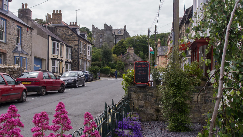
Route surroundings · Newport, Pembrokeshire — Ed Webster — CC BY 2.0 (https://creativecommons.org/licenses/by/2.0/) — https://www.flickr.com/photos/55898913@N04/18803335618/
Ed Webster
CC BY 2.0
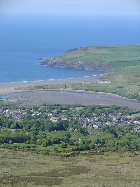
Route surroundings · NewportFrom Carningli.JPG — LinguisticDemographer — CC BY-SA 3.0 (http://creativecommons.org/licenses/by-sa/3.0/) — https://commons.wikimedia.org/wiki/File:NewportFrom_Carningli.JPG

LinguisticDemographer
CC BY-SA 3.0
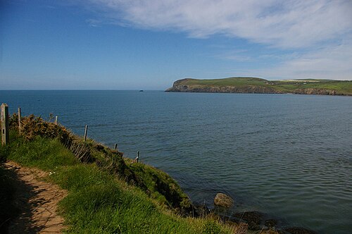
Route surroundings · View out into Newport Bay, from the coast path at Carreg Germain - geograph.org.uk - 5344538.jpg — Christopher Hilton — CC BY-SA 2.0 (https://creativecommons.org/licenses/by-sa/2.0) — https://commons.wikimedia.org/wiki/File:View_out_into_Newport_Bay,_from_the_coast_path_at_Carreg_Germain_-_geograph.org.uk_-_5344538.jpg

Christopher Hilton
CC BY-SA 2.0
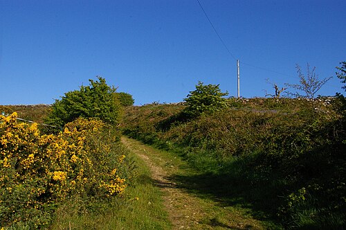
Route surroundings · Path climbing from Trecadifor - geograph.org.uk - 5363821.jpg — Christopher Hilton — CC BY-SA 2.0 (https://creativecommons.org/licenses/by-sa/2.0) — https://commons.wikimedia.org/wiki/File:Path_climbing_from_Trecadifor_-_geograph.org.uk_-_5363821.jpg

Christopher Hilton
CC BY-SA 2.0
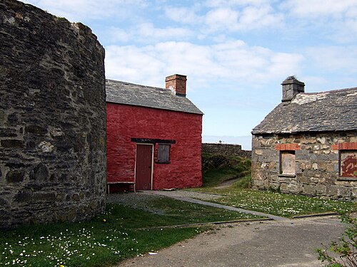
Route surroundings · Old Parrog buildings - geograph.org.uk - 399355.jpg — ceridwen — CC BY-SA 2.0 (https://creativecommons.org/licenses/by-sa/2.0) — https://commons.wikimedia.org/wiki/File:Old_Parrog_buildings_-_geograph.org.uk_-_399355.jpg

ceridwen
CC BY-SA 2.0
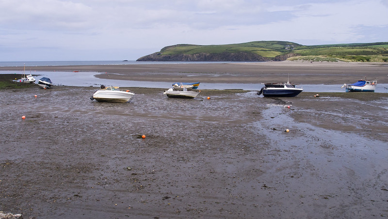
Route surroundings · The Parrog, Newport, Pembrokeshire — Ed Webster — CC BY 2.0 (https://creativecommons.org/licenses/by/2.0/) — https://www.flickr.com/photos/55898913@N04/18804828859/
Ed Webster
CC BY 2.0
View original activity in YouVisible
Weather on your route
Loading forecast…
Sources and credits
Outdooractive Creative Commons · CC0 1.0 · https://www.outdooractive.com/r/809556521
Outdooractive · Creative Commons Routes · CC0 1.0
Route photograph
Route surroundings · Newport, Pembrokeshire — Ed Webster — CC BY 2.0 (https://creativecommons.org/licenses/by/2.0/) — https://www.flickr.com/photos/55898913@N04/18803335618/
Ed Webster · CC BY 2.0 · Media source
Route photograph
Route surroundings · NewportFrom Carningli.JPG — LinguisticDemographer — CC BY-SA 3.0 (http://creativecommons.org/licenses/by-sa/3.0/) — https://commons.wikimedia.org/wiki/File:NewportFrom_Carningli.JPG
LinguisticDemographer · CC BY-SA 3.0 · Media source
Route photograph
Route surroundings · View out into Newport Bay, from the coast path at Carreg Germain - geograph.org.uk - 5344538.jpg — Christopher Hilton — CC BY-SA 2.0 (https://creativecommons.org/licenses/by-sa/2.0) — https://commons.wikimedia.org/wiki/File:View_out_into_Newport_Bay,_from_the_coast_path_at_Carreg_Germain_-_geograph.org.uk_-_5344538.jpg
Christopher Hilton · CC BY-SA 2.0 · Media source
Route photograph
Route surroundings · Path climbing from Trecadifor - geograph.org.uk - 5363821.jpg — Christopher Hilton — CC BY-SA 2.0 (https://creativecommons.org/licenses/by-sa/2.0) — https://commons.wikimedia.org/wiki/File:Path_climbing_from_Trecadifor_-_geograph.org.uk_-_5363821.jpg
Christopher Hilton · CC BY-SA 2.0 · Media source
Route photograph
Route surroundings · Old Parrog buildings - geograph.org.uk - 399355.jpg — ceridwen — CC BY-SA 2.0 (https://creativecommons.org/licenses/by-sa/2.0) — https://commons.wikimedia.org/wiki/File:Old_Parrog_buildings_-_geograph.org.uk_-_399355.jpg
ceridwen · CC BY-SA 2.0 · Media source
Route photograph
Route surroundings · The Parrog, Newport, Pembrokeshire — Ed Webster — CC BY 2.0 (https://creativecommons.org/licenses/by/2.0/) — https://www.flickr.com/photos/55898913@N04/18804828859/
Ed Webster · CC BY 2.0 · Media source