Find your next route
Explore hiking, running, trail running and cycling routes that suit your plans.

Community route
Maynooth · Town and countryside walking circuit
Complete published walking circuit from the Maynooth electoral division via Maynooth. The gallery illustrates Maynooth and the Royal Canal as surroundings and does not assert that every photographed place is on this circuit. Canonical track distance: 15.517 km.
By YouVisible Sport
Mapa del recorrido
Perfil de elevación
Activity measurements
- distance meters
- 15,517.281860198
- elevation gain meters
- 266.3
- elevation loss meters
- 267.5
- max elevation meters
- 90
- min elevation meters
- 45
- end · latitude
- 53.378356
- end · longitude
- -6.557345
- start · latitude
- 53.378348
- start · longitude
- -6.559073
- Sport
- hiking mountaineering
- Specialty
- Hiking
From start to finish
- Country
- Ireland
- Province / region
- —
- Localities
- —
Before you go
- How to reach the start
- —
- Parking and access
- —
- Advice
- Guide + verified export. Follow signed walking access and respect temporary closures and private entrances. Native GPX elevations are retained; they are not measurements performed by YouVisible. Photographs are labelled “Route surroundings” and do not imply camera locations on the track.
- Recommended equipment
- —
- Terrain
- —
- Signage
- —
Characteristics and difficulty
- Estimated duration
- —
- Author perceived effort
- —
- Physical difficulty
- —
- Technical difficulty
- —
About the route
Complete published walking circuit from the Maynooth electoral division via Maynooth. The gallery illustrates Maynooth and the Royal Canal as surroundings and does not assert that every photographed place is on this circuit. Canonical track distance: 15.517 km.
- Context
- —
- Specialty
- Hiking
- Event type
- —
- Description
- Route surroundings · real photographs with individual author and licence credits.
- Title
- Route highlights
- Title
- Sesión
- Description
- Complete published walking circuit from the Maynooth electoral division via Maynooth. The gallery illustrates Maynooth and the Royal Canal as surroundings and does not assert that every photographed place is on this circuit. Canonical track distance: 15.517 km.
- Description
- Route surroundings · Maynooth Library.jpg. Photograph of the identified place or its documented surroundings; no position on the track is implied.
- Title
- Route surroundings · Maynooth Library.jpg
- Description
- Route surroundings · Maynooth, County Kildare.jpg. Photograph of the identified place or its documented surroundings; no position on the track is implied.
- Title
- Route surroundings · Maynooth, County Kildare.jpg
- Description
- Route surroundings · Canals near Maynooth Train Station 005.jpg. Photograph of the identified place or its documented surroundings; no position on the track is implied.
- Title
- Route surroundings · Canals near Maynooth Train Station 005.jpg
- Description
- Route surroundings · Castles of Leinster, Maynooth, Kildare - geograph.org.uk - 2496412.jpg. Photograph of the identified place or its documented surroundings; no position on the track is implied.
- Title
- Route surroundings · Castles of Leinster, Maynooth, Kildare - geograph.org.uk - 2496412.jpg
- Description
- Route surroundings · Leinster Street In Maynooth 237720.jpg. Photograph of the identified place or its documented surroundings; no position on the track is implied.
- Title
- Route surroundings · Leinster Street In Maynooth 237720.jpg
- Description
- Route surroundings · Leinster Street In Maynooth 237728.jpg. Photograph of the identified place or its documented surroundings; no position on the track is implied.
- Title
- Route surroundings · Leinster Street In Maynooth 237728.jpg
- Description
- Route surroundings · Maynooth Library.jpg. Photograph of the identified place or its documented surroundings; no position on the track is implied.
- Title
- Route surroundings · Maynooth Library.jpg
- Description
- Route surroundings · Maynooth, County Kildare.jpg. Photograph of the identified place or its documented surroundings; no position on the track is implied.
- Title
- Route surroundings · Maynooth, County Kildare.jpg
- Description
- Route surroundings · Canals near Maynooth Train Station 005.jpg. Photograph of the identified place or its documented surroundings; no position on the track is implied.
- Title
- Route surroundings · Canals near Maynooth Train Station 005.jpg
- Description
- Route surroundings · Castles of Leinster, Maynooth, Kildare - geograph.org.uk - 2496412.jpg. Photograph of the identified place or its documented surroundings; no position on the track is implied.
- Title
- Route surroundings · Castles of Leinster, Maynooth, Kildare - geograph.org.uk - 2496412.jpg
- Description
- Route surroundings · Leinster Street In Maynooth 237720.jpg. Photograph of the identified place or its documented surroundings; no position on the track is implied.
- Title
- Route surroundings · Leinster Street In Maynooth 237720.jpg
- Description
- Route surroundings · Leinster Street In Maynooth 237728.jpg. Photograph of the identified place or its documented surroundings; no position on the track is implied.
- Title
- Route surroundings · Leinster Street In Maynooth 237728.jpg
- Advice
- Guide + verified export. Follow signed walking access and respect temporary closures and private entrances. Native GPX elevations are retained; they are not measurements performed by YouVisible. Photographs are labelled “Route surroundings” and do not imply camera locations on the track.
- Title
- Maynooth · Town and countryside walking circuit
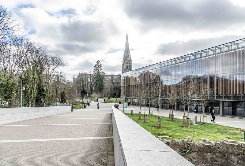
Route surroundings · MAYNOOTH UNIVERSITY LIBRARY [FEBRUARY 2016]-112031 — William Murphy — CC BY-SA 2.0 (https://creativecommons.org/licenses/by-sa/2.0/) — https://www.flickr.com/photos/80824546@N00/24607685754/
William Murphy
CC BY-SA 2.0
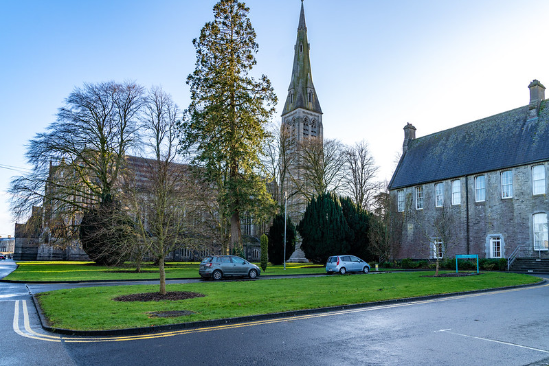
Route surroundings · MAYNOOTH UNIVERSITY [THE SOUTH CAMPUS]-160399 — William Murphy — CC BY-SA 2.0 (https://creativecommons.org/licenses/by-sa/2.0/) — https://www.flickr.com/photos/80824546@N00/49566477687/
William Murphy
CC BY-SA 2.0
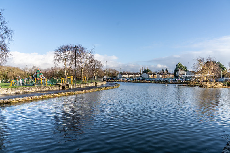
Route surroundings · MAYNOOTH TRAIN STATION [DUKE'S HARBOUR]-160420 — William Murphy — CC BY-SA 2.0 (https://creativecommons.org/licenses/by-sa/2.0/) — https://www.flickr.com/photos/80824546@N00/49567288432/
William Murphy
CC BY-SA 2.0
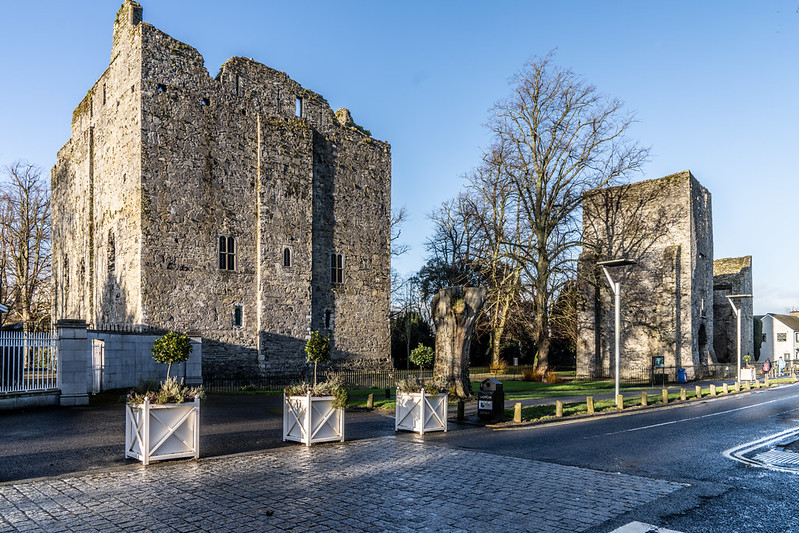
Route surroundings · MAYNOOTH CASTLE [IN MAYNOOTH COUNTY KILDARE]-160372 — William Murphy — CC BY-SA 2.0 (https://creativecommons.org/licenses/by-sa/2.0/) — https://www.flickr.com/photos/80824546@N00/49562109583/
William Murphy
CC BY-SA 2.0
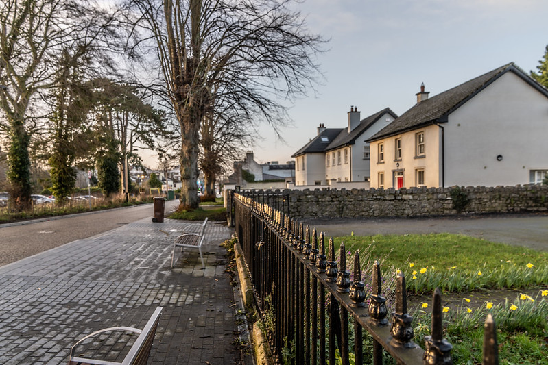
Route surroundings · LEINSTER STREET AND DUKE'S HARBOUR [MAYNOOTH COUNTY KILDARE]-160508 — William Murphy — CC BY-SA 2.0 (https://creativecommons.org/licenses/by-sa/2.0/) — https://www.flickr.com/photos/80824546@N00/49585612917/
William Murphy
CC BY-SA 2.0
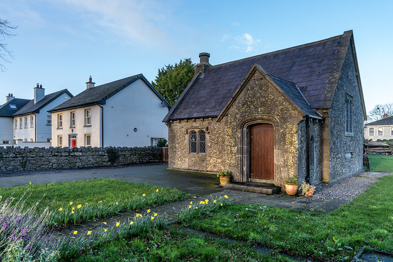
Route surroundings · LEINSTER STREET AND DUKE'S HARBOUR [MAYNOOTH COUNTY KILDARE]-160507 — William Murphy — CC BY-SA 2.0 (https://creativecommons.org/licenses/by-sa/2.0/) — https://www.flickr.com/photos/80824546@N00/49585375546/
William Murphy
CC BY-SA 2.0
View original activity in YouVisible
Weather on your route
Loading forecast…
Sources and credits
Outdooractive Creative Commons · CC0 1.0 · https://www.outdooractive.com/r/809546114
Outdooractive · Creative Commons Routes · CC0 1.0
Route photograph
Route surroundings · MAYNOOTH UNIVERSITY LIBRARY [FEBRUARY 2016]-112031 — William Murphy — CC BY-SA 2.0 (https://creativecommons.org/licenses/by-sa/2.0/) — https://www.flickr.com/photos/80824546@N00/24607685754/
William Murphy · CC BY-SA 2.0 · Media source
Route photograph
Route surroundings · MAYNOOTH UNIVERSITY [THE SOUTH CAMPUS]-160399 — William Murphy — CC BY-SA 2.0 (https://creativecommons.org/licenses/by-sa/2.0/) — https://www.flickr.com/photos/80824546@N00/49566477687/
William Murphy · CC BY-SA 2.0 · Media source
Route photograph
Route surroundings · MAYNOOTH TRAIN STATION [DUKE'S HARBOUR]-160420 — William Murphy — CC BY-SA 2.0 (https://creativecommons.org/licenses/by-sa/2.0/) — https://www.flickr.com/photos/80824546@N00/49567288432/
William Murphy · CC BY-SA 2.0 · Media source
Route photograph
Route surroundings · MAYNOOTH CASTLE [IN MAYNOOTH COUNTY KILDARE]-160372 — William Murphy — CC BY-SA 2.0 (https://creativecommons.org/licenses/by-sa/2.0/) — https://www.flickr.com/photos/80824546@N00/49562109583/
William Murphy · CC BY-SA 2.0 · Media source
Route photograph
Route surroundings · LEINSTER STREET AND DUKE'S HARBOUR [MAYNOOTH COUNTY KILDARE]-160508 — William Murphy — CC BY-SA 2.0 (https://creativecommons.org/licenses/by-sa/2.0/) — https://www.flickr.com/photos/80824546@N00/49585612917/
William Murphy · CC BY-SA 2.0 · Media source
Route photograph
Route surroundings · LEINSTER STREET AND DUKE'S HARBOUR [MAYNOOTH COUNTY KILDARE]-160507 — William Murphy — CC BY-SA 2.0 (https://creativecommons.org/licenses/by-sa/2.0/) — https://www.flickr.com/photos/80824546@N00/49585375546/
William Murphy · CC BY-SA 2.0 · Media source