Find your next route
Explore hiking, running, trail running and cycling routes that suit your plans.

Community route
Parada de Sil · Cañón do Sil and Santa Cristina circuit
Complete hiking circuit published from Parada de Sil, in the Cañón do Sil and Santa Cristina area. The gallery illustrates the canyon and monastery as route surroundings; it does not identify a list of waypoints. Canonical track distance: 3.481 km.
By YouVisible Sport
Mapa del recorrido
Perfil de elevación
Activity measurements
- distance meters
- 3,480.9407244693
- elevation gain meters
- 120.2
- elevation loss meters
- 120.2
- max elevation meters
- 663.3
- min elevation meters
- 605.2
- end · latitude
- 42.382582
- end · longitude
- -7.568468
- start · latitude
- 42.382582
- start · longitude
- -7.568468
- Sport
- hiking mountaineering
- Specialty
- Hiking
From start to finish
- Country
- Spain
- Province / region
- Ourense
- Localities
- —
Before you go
- How to reach the start
- —
- Parking and access
- —
- Advice
- Guide + verified export. Check local paths and access conditions before setting out. Native GPX elevations are retained; they were not measured by YouVisible. Photographs are labelled “Route surroundings”. No claim is made that the camera was on the track.
- Recommended equipment
- —
- Terrain
- —
- Signage
- —
Characteristics and difficulty
- Estimated duration
- —
- Author perceived effort
- —
- Physical difficulty
- —
- Technical difficulty
- —
About the route
Complete hiking circuit published from Parada de Sil, in the Cañón do Sil and Santa Cristina area. The gallery illustrates the canyon and monastery as route surroundings; it does not identify a list of waypoints. Canonical track distance: 3.481 km.
- Context
- —
- Specialty
- Hiking
- Event type
- —
- Description
- Route surroundings · real photographs with individual authorship and licences.
- Title
- Highlights
- Title
- Session
- Description
- Complete hiking circuit published from Parada de Sil, in the Cañón do Sil and Santa Cristina area. The gallery illustrates the canyon and monastery as route surroundings; it does not identify a list of waypoints. Canonical track distance: 3.481 km.
- Description
- Route surroundings · Iglesia dek Monasterio de Santa Cristina de Ribas de Sil.jpg. Photograph of the location or its documented surroundings, without assuming a position on the track.
- Title
- Route surroundings · Iglesia dek Monasterio de Santa Cristina de Ribas de Sil.jpg
- Description
- Route surroundings · Galicia.Canon Sil.jpg. Photograph of the location or its documented surroundings, without assuming a position on the track.
- Title
- Route surroundings · Galicia.Canon Sil.jpg
- Description
- Route surroundings · Ribeira Sacra 2601.JPG. Photograph of the location or its documented surroundings, without assuming a position on the track.
- Title
- Route surroundings · Ribeira Sacra 2601.JPG
- Description
- Route surroundings · Desde o catamarán.013 - Canón do Sil.jpg. Photograph of the location or its documented surroundings, without assuming a position on the track.
- Title
- Route surroundings · Desde o catamarán.013 - Canón do Sil.jpg
- Description
- Route surroundings · Monasterio de Santa Cristina de Ribas de Sil (5926238963).jpg. Photograph of the location or its documented surroundings, without assuming a position on the track.
- Title
- Route surroundings · Monasterio de Santa Cristina de Ribas de Sil (5926238963).jpg
- Description
- Route surroundings · Santa Cristina de Ribas de Sil 453.JPG. Photograph of the location or its documented surroundings, without assuming a position on the track.
- Title
- Route surroundings · Santa Cristina de Ribas de Sil 453.JPG
- Description
- Route surroundings · Iglesia dek Monasterio de Santa Cristina de Ribas de Sil.jpg. Photograph of the location or its documented surroundings, without assuming a position on the track.
- Title
- Route surroundings · Iglesia dek Monasterio de Santa Cristina de Ribas de Sil.jpg
- Description
- Route surroundings · Galicia.Canon Sil.jpg. Photograph of the location or its documented surroundings, without assuming a position on the track.
- Title
- Route surroundings · Galicia.Canon Sil.jpg
- Description
- Route surroundings · Ribeira Sacra 2601.JPG. Photograph of the location or its documented surroundings, without assuming a position on the track.
- Title
- Route surroundings · Ribeira Sacra 2601.JPG
- Description
- Route surroundings · Desde o catamarán.013 - Canón do Sil.jpg. Photograph of the location or its documented surroundings, without assuming a position on the track.
- Title
- Route surroundings · Desde o catamarán.013 - Canón do Sil.jpg
- Description
- Route surroundings · Monasterio de Santa Cristina de Ribas de Sil (5926238963).jpg. Photograph of the location or its documented surroundings, without assuming a position on the track.
- Title
- Route surroundings · Monasterio de Santa Cristina de Ribas de Sil (5926238963).jpg
- Description
- Route surroundings · Santa Cristina de Ribas de Sil 453.JPG. Photograph of the location or its documented surroundings, without assuming a position on the track.
- Title
- Route surroundings · Santa Cristina de Ribas de Sil 453.JPG
- Advice
- Guide + verified export. Check local paths and access conditions before setting out. Native GPX elevations are retained; they were not measured by YouVisible. Photographs are labelled “Route surroundings”. No claim is made that the camera was on the track.
- Title
- Parada de Sil · Cañón do Sil and Santa Cristina circuit
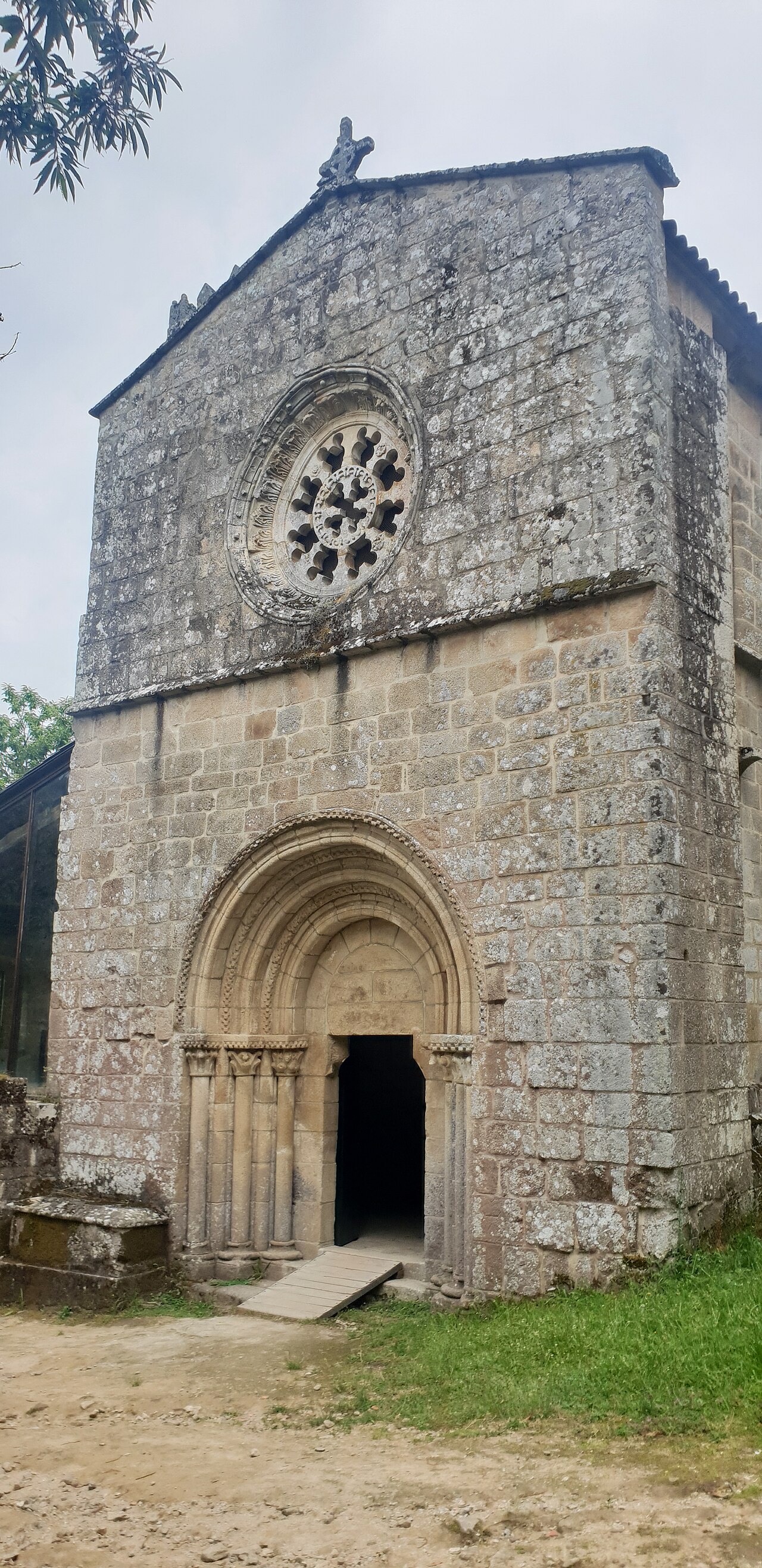
Entorno de la ruta · Iglesia dek Monasterio de Santa Cristina de Ribas de Sil.jpg — Bea.miau — CC0 (http://creativecommons.org/publicdomain/zero/1.0/deed.en) — https://commons.wikimedia.org/wiki/File:Iglesia_dek_Monasterio_de_Santa_Cristina_de_Ribas_de_Sil.jpg

Bea.miau
CC0
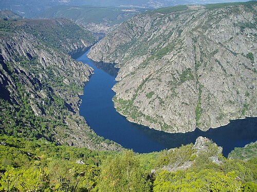
Entorno de la ruta · Galicia.Canon Sil.jpg — luimipi (foto sacada por min, no vrán 2005) — CC BY-SA 3.0 (http://creativecommons.org/licenses/by-sa/3.0/) — https://commons.wikimedia.org/wiki/File:Galicia.Canon_Sil.jpg

luimipi (foto sacada por min, no vrán 2005)
CC BY-SA 3.0
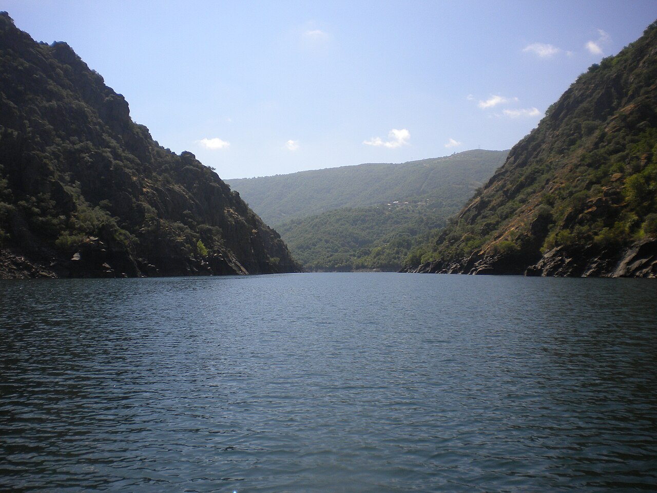
Entorno de la ruta · Ribeira Sacra 2601.JPG — Balles2601 — CC BY-SA 4.0 (https://creativecommons.org/licenses/by-sa/4.0) — https://commons.wikimedia.org/wiki/File:Ribeira_Sacra_2601.JPG

Balles2601
CC BY-SA 4.0
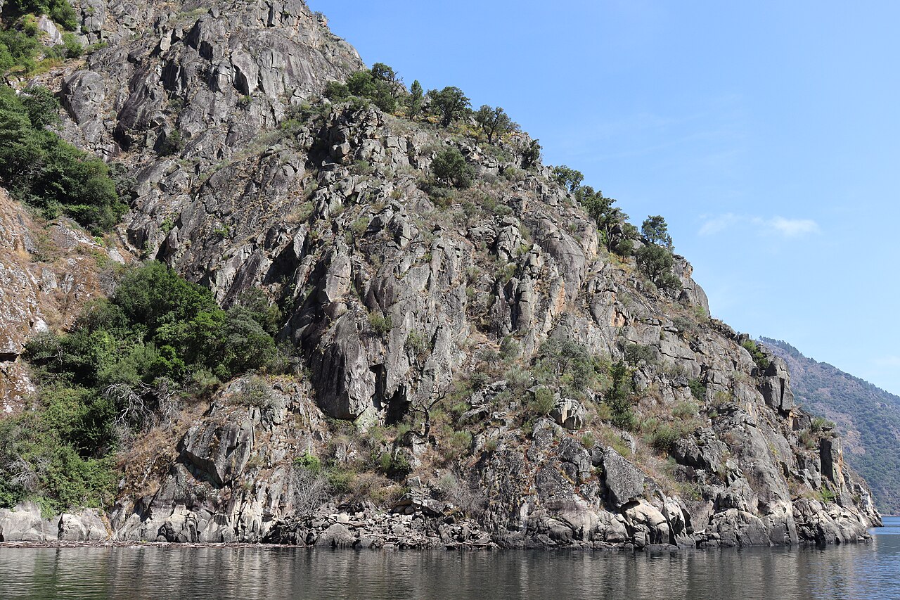
Entorno de la ruta · Desde o catamarán.013 - Canón do Sil.jpg — Fernando Losada Rodríguez — CC BY-SA 4.0 (https://creativecommons.org/licenses/by-sa/4.0) — https://commons.wikimedia.org/wiki/File:Desde_o_catamar%C3%A1n.013_-_Can%C3%B3n_do_Sil.jpg

Fernando Losada Rodríguez
CC BY-SA 4.0
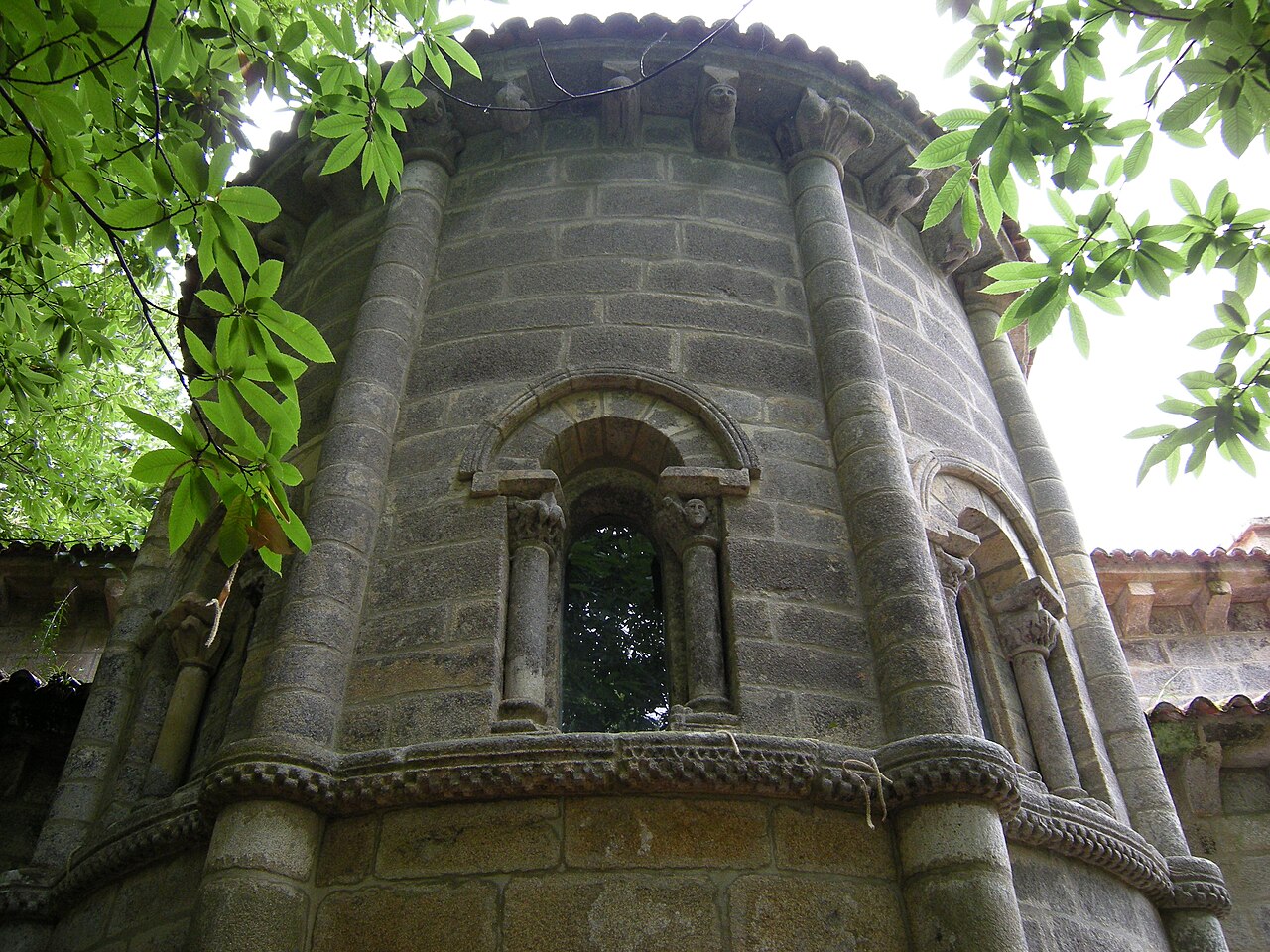
Entorno de la ruta · Monasterio de Santa Cristina de Ribas de Sil (5926238963).jpg — José Antonio Gil Martínez from Vigo, Spain — CC BY 2.0 (https://creativecommons.org/licenses/by/2.0) — https://commons.wikimedia.org/wiki/File:Monasterio_de_Santa_Cristina_de_Ribas_de_Sil_(5926238963).jpg

José Antonio Gil Martínez from Vigo, Spain
CC BY 2.0
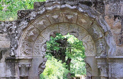
Entorno de la ruta · Santa Cristina de Ribas de Sil 453.JPG — GFreihalter — CC BY-SA 3.0 (https://creativecommons.org/licenses/by-sa/3.0) — https://commons.wikimedia.org/wiki/File:Santa_Cristina_de_Ribas_de_Sil_453.JPG

GFreihalter
CC BY-SA 3.0
View original activity in YouVisible
Weather on your route
Loading forecast…
Sources and credits
Outdooractive Creative Commons · CC0 1.0 · https://www.outdooractive.com/r/806995331
Outdooractive · Creative Commons Routes · CC0 1.0
Route photograph
Entorno de la ruta · Iglesia dek Monasterio de Santa Cristina de Ribas de Sil.jpg — Bea.miau — CC0 (http://creativecommons.org/publicdomain/zero/1.0/deed.en) — https://commons.wikimedia.org/wiki/File:Iglesia_dek_Monasterio_de_Santa_Cristina_de_Ribas_de_Sil.jpg
Bea.miau · CC0 · Media source
Route photograph
Entorno de la ruta · Galicia.Canon Sil.jpg — luimipi (foto sacada por min, no vrán 2005) — CC BY-SA 3.0 (http://creativecommons.org/licenses/by-sa/3.0/) — https://commons.wikimedia.org/wiki/File:Galicia.Canon_Sil.jpg
luimipi (foto sacada por min, no vrán 2005) · CC BY-SA 3.0 · Media source
Route photograph
Entorno de la ruta · Ribeira Sacra 2601.JPG — Balles2601 — CC BY-SA 4.0 (https://creativecommons.org/licenses/by-sa/4.0) — https://commons.wikimedia.org/wiki/File:Ribeira_Sacra_2601.JPG
Balles2601 · CC BY-SA 4.0 · Media source
Route photograph
Entorno de la ruta · Desde o catamarán.013 - Canón do Sil.jpg — Fernando Losada Rodríguez — CC BY-SA 4.0 (https://creativecommons.org/licenses/by-sa/4.0) — https://commons.wikimedia.org/wiki/File:Desde_o_catamar%C3%A1n.013_-_Can%C3%B3n_do_Sil.jpg
Fernando Losada Rodríguez · CC BY-SA 4.0 · Media source
Route photograph
Entorno de la ruta · Monasterio de Santa Cristina de Ribas de Sil (5926238963).jpg — José Antonio Gil Martínez from Vigo, Spain — CC BY 2.0 (https://creativecommons.org/licenses/by/2.0) — https://commons.wikimedia.org/wiki/File:Monasterio_de_Santa_Cristina_de_Ribas_de_Sil_(5926238963).jpg
José Antonio Gil Martínez from Vigo, Spain · CC BY 2.0 · Media source
Route photograph
Entorno de la ruta · Santa Cristina de Ribas de Sil 453.JPG — GFreihalter — CC BY-SA 3.0 (https://creativecommons.org/licenses/by-sa/3.0) — https://commons.wikimedia.org/wiki/File:Santa_Cristina_de_Ribas_de_Sil_453.JPG
GFreihalter · CC BY-SA 3.0 · Media source