Find your next route
Explore hiking, running, trail running and cycling routes that suit your plans.

Community route
Fort Circle · Southern trail section
A complete linear trail section from the National Park Service dataset, running through the southern Fort Circle corridor in Washington, D.C. The full published feature is retained point for point. This itinerary covers the named southern section; the wider Fort Circle network continues beyond it. The gallery shows Fort Dupont signs and historic earthworks as accredited route surroundings. Canonical track distance: 5.603 km.
By YouVisible Sport
Mapa del recorrido
Activity measurements
- distance meters
- 5,602.9134554219
- end · latitude
- 38.8751409
- end · longitude
- -76.9404553
- start · latitude
- 38.8566634
- start · longitude
- -76.975817
- Sport
- hiking mountaineering
- Specialty
- Hiking
From start to finish
- Country
- United States
- Province / region
- —
- Localities
- Washington
Before you go
- How to reach the start
- —
- Parking and access
- —
- Advice
- YouVisible Guide only. Garmin export is unavailable: the source contains no elevations; the real Garmin validator reports ELEVATION_INSUFFICIENT. Plan your return for this linear hike. Follow the signed public trail, use care at road crossings and observe NPS opening hours and temporary closures. The full route has been checked against the official District of Columbia boundary. Gallery photographs show Fort Dupont surroundings and do not assert camera positions on the track. All photographs are labelled “Route surroundings”; no camera position on the track or measured completion time is asserted.
- Recommended equipment
- —
- Terrain
- —
- Signage
- —
Characteristics and difficulty
- Estimated duration
- —
- Author perceived effort
- —
- Physical difficulty
- —
- Technical difficulty
- —
About the route
A complete linear trail section from the National Park Service dataset, running through the southern Fort Circle corridor in Washington, D.C. The full published feature is retained point for point. This itinerary covers the named southern section; the wider Fort Circle network continues beyond it. The gallery shows Fort Dupont signs and historic earthworks as accredited route surroundings. Canonical track distance: 5.603 km.
- Context
- —
- Specialty
- Hiking
- Event type
- —
- Description
- Six real photographs with individual authorship and licences.
- Title
- Route surroundings
- Title
- Sesión
- Description
- A complete linear trail section from the National Park Service dataset, running through the southern Fort Circle corridor in Washington, D.C. The full published feature is retained point for point. This itinerary covers the named southern section; the wider Fort Circle network continues beyond it. The gallery shows Fort Dupont signs and historic earthworks as accredited route surroundings. Canonical track distance: 5.603 km.
- Description
- Route surroundings · Washington, D.C. - Fort Dupont - 20200405144950.jpg. Photograph of the named place or its accredited surroundings; no camera position on the track is asserted.
- Title
- Route surroundings · Washington, D.C. - Fort Dupont - 20200405144950.jpg
- Description
- Route surroundings · Washington, D.C. - Fort Dupont - 20200405144313.jpg. Photograph of the named place or its accredited surroundings; no camera position on the track is asserted.
- Title
- Route surroundings · Washington, D.C. - Fort Dupont - 20200405144313.jpg
- Description
- Route surroundings · Washington, D.C. - Fort Dupont - 20200405145115.jpg. Photograph of the named place or its accredited surroundings; no camera position on the track is asserted.
- Title
- Route surroundings · Washington, D.C. - Fort Dupont - 20200405145115.jpg
- Description
- Route surroundings · Anacostia Community Museum.jpg. Photograph of the named place or its accredited surroundings; no camera position on the track is asserted.
- Title
- Route surroundings · Anacostia Community Museum.jpg
- Description
- Route surroundings · Anacostia Museum Building.jpg. Photograph of the named place or its accredited surroundings; no camera position on the track is asserted.
- Title
- Route surroundings · Anacostia Museum Building.jpg
- Description
- Route surroundings · Fort Circle Hiker-Biker Trail · official NPS trail photograph. Photograph of the named place or its accredited surroundings; no camera position on the track is asserted.
- Title
- Route surroundings · Fort Circle Hiker-Biker Trail · official NPS trail photograph
- Description
- Route surroundings · Washington, D.C. - Fort Dupont - 20200405144950.jpg. Photograph of the named place or its accredited surroundings; no camera position on the track is asserted.
- Title
- Route surroundings · Washington, D.C. - Fort Dupont - 20200405144950.jpg
- Description
- Route surroundings · Washington, D.C. - Fort Dupont - 20200405144313.jpg. Photograph of the named place or its accredited surroundings; no camera position on the track is asserted.
- Title
- Route surroundings · Washington, D.C. - Fort Dupont - 20200405144313.jpg
- Description
- Route surroundings · Washington, D.C. - Fort Dupont - 20200405145115.jpg. Photograph of the named place or its accredited surroundings; no camera position on the track is asserted.
- Title
- Route surroundings · Washington, D.C. - Fort Dupont - 20200405145115.jpg
- Description
- Route surroundings · Anacostia Community Museum.jpg. Photograph of the named place or its accredited surroundings; no camera position on the track is asserted.
- Title
- Route surroundings · Anacostia Community Museum.jpg
- Description
- Route surroundings · Anacostia Museum Building.jpg. Photograph of the named place or its accredited surroundings; no camera position on the track is asserted.
- Title
- Route surroundings · Anacostia Museum Building.jpg
- Description
- Route surroundings · Fort Circle Hiker-Biker Trail · official NPS trail photograph. Photograph of the named place or its accredited surroundings; no camera position on the track is asserted.
- Title
- Route surroundings · Fort Circle Hiker-Biker Trail · official NPS trail photograph
- Advice
- YouVisible Guide only. Garmin export is unavailable: the source contains no elevations; the real Garmin validator reports ELEVATION_INSUFFICIENT. Plan your return for this linear hike. Follow the signed public trail, use care at road crossings and observe NPS opening hours and temporary closures. The full route has been checked against the official District of Columbia boundary. Gallery photographs show Fort Dupont surroundings and do not assert camera positions on the track. All photographs are labelled “Route surroundings”; no camera position on the track or measured completion time is asserted.
- Title
- Fort Circle · Southern trail section
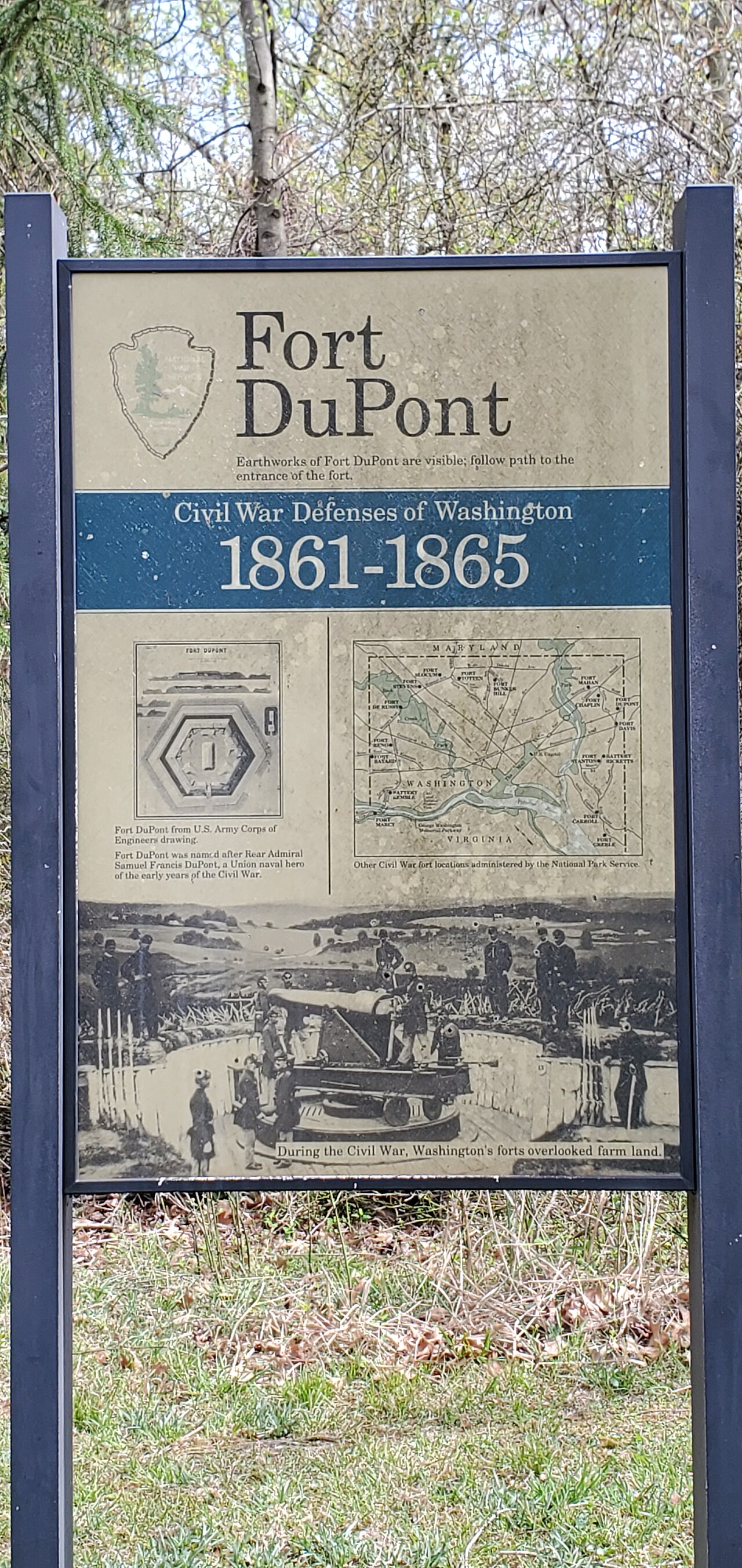
Route surroundings · Washington, D.C. - Fort Dupont - 20200405144950.jpg (File:Washington, D.C. - Fort Dupont - 20200405144950.jpg) — Error9312 — CC BY-SA 4.0 (https://creativecommons.org/licenses/by-sa/4.0) — https://commons.wikimedia.org/wiki/File:Washington,_D.C._-_Fort_Dupont_-_20200405144950.jpg

Error9312
CC BY-SA 4.0
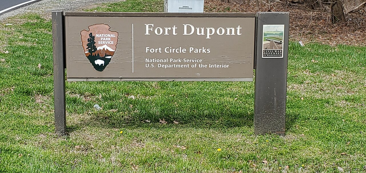
Route surroundings · Washington, D.C. - Fort Dupont - 20200405144313.jpg (File:Washington, D.C. - Fort Dupont - 20200405144313.jpg) — Error9312 — CC BY-SA 4.0 (https://creativecommons.org/licenses/by-sa/4.0) — https://commons.wikimedia.org/wiki/File:Washington,_D.C._-_Fort_Dupont_-_20200405144313.jpg

Error9312
CC BY-SA 4.0
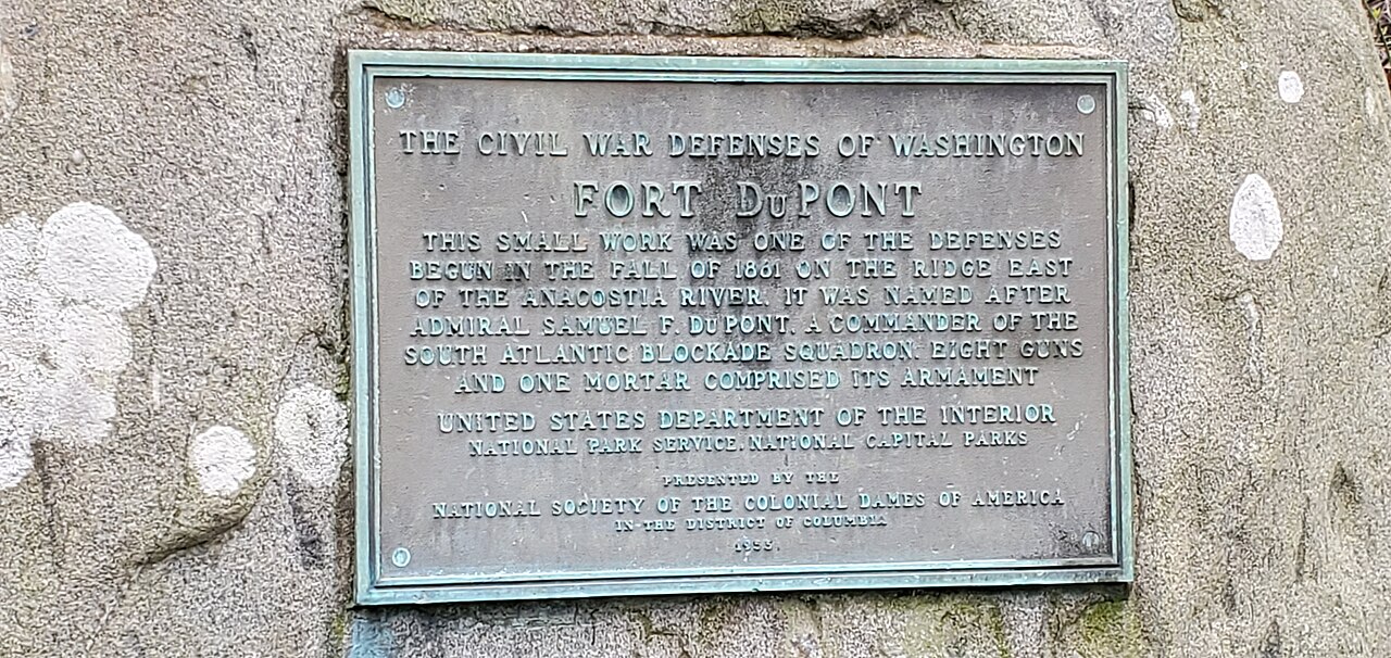
Route surroundings · Washington, D.C. - Fort Dupont - 20200405145115.jpg (File:Washington, D.C. - Fort Dupont - 20200405145115.jpg) — Error9312 — CC BY-SA 4.0 (https://creativecommons.org/licenses/by-sa/4.0) — https://commons.wikimedia.org/wiki/File:Washington,_D.C._-_Fort_Dupont_-_20200405145115.jpg

Error9312
CC BY-SA 4.0
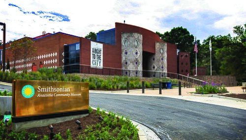
Route surroundings · Anacostia Community Museum.jpg (File:Anacostia Community Museum.jpg) — Smithsonian Institution — Public domain (https://commons.wikimedia.org/wiki/File:Anacostia_Community_Museum.jpg) — https://commons.wikimedia.org/wiki/File:Anacostia_Community_Museum.jpg
)

Smithsonian Institution
Public domain
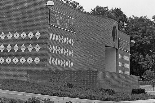
Route surroundings · Anacostia Museum Building.jpg (File:Anacostia Museum Building.jpg) — Charles Philips — Public domain (https://commons.wikimedia.org/wiki/File:Anacostia_Museum_Building.jpg) — https://commons.wikimedia.org/wiki/File:Anacostia_Museum_Building.jpg
)

Charles Philips
Public domain
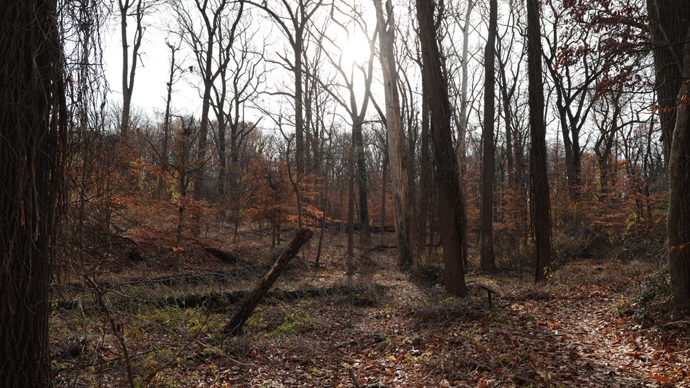
Route surroundings · Fort Circle Hiker-Biker Trail · official NPS trail photograph (Fort Circle Hiker-Biker Trail · official NPS trail photograph) — NPS / Conall Rubin-Thomas — Public domain (https://www.nps.gov/aboutus/disclaimer.htm) — https://www.nps.gov/thingstodo/civil-war-defenses-of-washington-hiker-biker-trail.htm
NPS / Conall Rubin-Thomas
Public domain
View original activity in YouVisible
Weather on your route
Loading forecast…
Sources and credits
National Park Service / DCGIS · CC BY 4.0 · https://maps2.dcgis.dc.gov/dcgis/rest/services/DCGIS_DATA/Transportation_Bikes_Trails_WebMercator/MapServer/75/query?objectIds=114&outFields=%2A&outSR=4326&returnGeometry=true&f=json
National Park Service · DCGIS National Park Service Trails · CC BY 4.0
Route photograph
Route surroundings · Washington, D.C. - Fort Dupont - 20200405144950.jpg (File:Washington, D.C. - Fort Dupont - 20200405144950.jpg) — Error9312 — CC BY-SA 4.0 (https://creativecommons.org/licenses/by-sa/4.0) — https://commons.wikimedia.org/wiki/File:Washington,_D.C._-_Fort_Dupont_-_20200405144950.jpg
Error9312 · CC BY-SA 4.0 · Media source
Route photograph
Route surroundings · Washington, D.C. - Fort Dupont - 20200405144313.jpg (File:Washington, D.C. - Fort Dupont - 20200405144313.jpg) — Error9312 — CC BY-SA 4.0 (https://creativecommons.org/licenses/by-sa/4.0) — https://commons.wikimedia.org/wiki/File:Washington,_D.C._-_Fort_Dupont_-_20200405144313.jpg
Error9312 · CC BY-SA 4.0 · Media source
Route photograph
Route surroundings · Washington, D.C. - Fort Dupont - 20200405145115.jpg (File:Washington, D.C. - Fort Dupont - 20200405145115.jpg) — Error9312 — CC BY-SA 4.0 (https://creativecommons.org/licenses/by-sa/4.0) — https://commons.wikimedia.org/wiki/File:Washington,_D.C._-_Fort_Dupont_-_20200405145115.jpg
Error9312 · CC BY-SA 4.0 · Media source
Route photograph
Route surroundings · Anacostia Community Museum.jpg (File:Anacostia Community Museum.jpg) — Smithsonian Institution — Public domain (https://commons.wikimedia.org/wiki/File:Anacostia_Community_Museum.jpg) — https://commons.wikimedia.org/wiki/File:Anacostia_Community_Museum.jpg
Smithsonian Institution · Public domain · Media source
Route photograph
Route surroundings · Anacostia Museum Building.jpg (File:Anacostia Museum Building.jpg) — Charles Philips — Public domain (https://commons.wikimedia.org/wiki/File:Anacostia_Museum_Building.jpg) — https://commons.wikimedia.org/wiki/File:Anacostia_Museum_Building.jpg
Charles Philips · Public domain · Media source
Route surroundings · Fort Circle Hiker-Biker Trail · official NPS trail photograph
Route surroundings · Fort Circle Hiker-Biker Trail · official NPS trail photograph (Fort Circle Hiker-Biker Trail · official NPS trail photograph) — NPS / Conall Rubin-Thomas — Public domain (https://www.nps.gov/aboutus/disclaimer.htm) — https://www.nps.gov/thingstodo/civil-war-defenses-of-washington-hiker-biker-trail.htm
NPS / Conall Rubin-Thomas · Public domain · Media source