Find your next route
Explore hiking, running, trail running and cycling routes that suit your plans.

Community route
Georgetown · C&O Canal towpath in D.C.
Follow the full mapped District of Columbia section of the Chesapeake & Ohio Canal towpath. Every native point lies within the D.C. boundary; no Maryland or Virginia route is used. The two exactly connected source segments are preserved. Photographs show the canal in Georgetown. Canonical track distance: 7.079 km.
By YouVisible Sport
Mapa del recorrido
Activity measurements
- distance meters
- 7,078.6929663138
- end · latitude
- 38.9040474
- end · longitude
- -77.0567096
- start · latitude
- 38.9363837
- start · longitude
- -77.117193
- Sport
- Cycling
- Specialty
- cycling gravel
From start to finish
- Country
- United States
- Province / region
- —
- Localities
- Washington
Before you go
- How to reach the start
- —
- Parking and access
- —
- Advice
- YouVisible Guide only. Garmin export is unavailable: the original source contains no elevations and preserves multiple native track segments; Garmin cannot confirm export continuity. Ride only where cycling is permitted, yield to walkers and follow canal and trail notices. Expect unsealed towpath surfaces and arrange your return. The route ends at the source’s D.C. section boundary and does not extend into Maryland. All gallery photographs are labelled “Route surroundings”; camera positions on the track are not asserted. No measured completion time is supplied.
- Recommended equipment
- —
- Terrain
- —
- Signage
- —
Characteristics and difficulty
- Estimated duration
- —
- Author perceived effort
- —
- Physical difficulty
- —
- Technical difficulty
- —
About the route
Follow the full mapped District of Columbia section of the Chesapeake & Ohio Canal towpath. Every native point lies within the D.C. boundary; no Maryland or Virginia route is used. The two exactly connected source segments are preserved. Photographs show the canal in Georgetown. Canonical track distance: 7.079 km.
- Context
- —
- Specialty
- cycling gravel
- Event type
- —
- Description
- Six real photographs with individual authorship and licences.
- Title
- Route surroundings
- Title
- Sesión
- Description
- Follow the full mapped District of Columbia section of the Chesapeake & Ohio Canal towpath. Every native point lies within the D.C. boundary; no Maryland or Virginia route is used. The two exactly connected source segments are preserved. Photographs show the canal in Georgetown. Canonical track distance: 7.079 km.
- Description
- Route surroundings · Chesapeake and Ohio Canal National Historical Park - Sarah Stierch 02.jpg. Photograph of the named place or its accredited surroundings; no camera position on the track is asserted.
- Title
- Route surroundings · Chesapeake and Ohio Canal National Historical Park - Sarah Stierch 02.jpg
- Description
- Route surroundings · C&O Canal in Georgetown July 2023.jpg. Photograph of the named place or its accredited surroundings; no camera position on the track is asserted.
- Title
- Route surroundings · C&O Canal in Georgetown July 2023.jpg
- Description
- Route surroundings · C&O (Chesapeake and Ohio) Canal in Georgetown as seen from Key Bridge (March 26, 2004) - panoramio.jpg. Photograph of the named place or its accredited surroundings; no camera position on the track is asserted.
- Title
- Route surroundings · C&O (Chesapeake and Ohio) Canal in Georgetown as seen from Key Bridge (March 26, 2004) - panoramio.jpg
- Description
- Route surroundings · C&O (Chesapeake and Ohio) Canal in the heart of Georgetown (March 26, 2004) - panoramio.jpg. Photograph of the named place or its accredited surroundings; no camera position on the track is asserted.
- Title
- Route surroundings · C&O (Chesapeake and Ohio) Canal in the heart of Georgetown (March 26, 2004) - panoramio.jpg
- Description
- Route surroundings · Chesapeake and Ohio Canal and Key Bridge.jpg. Photograph of the named place or its accredited surroundings; no camera position on the track is asserted.
- Title
- Route surroundings · Chesapeake and Ohio Canal and Key Bridge.jpg
- Description
- Route surroundings · Chesapeake and Ohio Canal facing east.jpg. Photograph of the named place or its accredited surroundings; no camera position on the track is asserted.
- Title
- Route surroundings · Chesapeake and Ohio Canal facing east.jpg
- Description
- Route surroundings · Chesapeake and Ohio Canal National Historical Park - Sarah Stierch 02.jpg. Photograph of the named place or its accredited surroundings; no camera position on the track is asserted.
- Title
- Route surroundings · Chesapeake and Ohio Canal National Historical Park - Sarah Stierch 02.jpg
- Description
- Route surroundings · C&O Canal in Georgetown July 2023.jpg. Photograph of the named place or its accredited surroundings; no camera position on the track is asserted.
- Title
- Route surroundings · C&O Canal in Georgetown July 2023.jpg
- Description
- Route surroundings · C&O (Chesapeake and Ohio) Canal in Georgetown as seen from Key Bridge (March 26, 2004) - panoramio.jpg. Photograph of the named place or its accredited surroundings; no camera position on the track is asserted.
- Title
- Route surroundings · C&O (Chesapeake and Ohio) Canal in Georgetown as seen from Key Bridge (March 26, 2004) - panoramio.jpg
- Description
- Route surroundings · C&O (Chesapeake and Ohio) Canal in the heart of Georgetown (March 26, 2004) - panoramio.jpg. Photograph of the named place or its accredited surroundings; no camera position on the track is asserted.
- Title
- Route surroundings · C&O (Chesapeake and Ohio) Canal in the heart of Georgetown (March 26, 2004) - panoramio.jpg
- Description
- Route surroundings · Chesapeake and Ohio Canal and Key Bridge.jpg. Photograph of the named place or its accredited surroundings; no camera position on the track is asserted.
- Title
- Route surroundings · Chesapeake and Ohio Canal and Key Bridge.jpg
- Description
- Route surroundings · Chesapeake and Ohio Canal facing east.jpg. Photograph of the named place or its accredited surroundings; no camera position on the track is asserted.
- Title
- Route surroundings · Chesapeake and Ohio Canal facing east.jpg
- Advice
- YouVisible Guide only. Garmin export is unavailable: the original source contains no elevations and preserves multiple native track segments; Garmin cannot confirm export continuity. Ride only where cycling is permitted, yield to walkers and follow canal and trail notices. Expect unsealed towpath surfaces and arrange your return. The route ends at the source’s D.C. section boundary and does not extend into Maryland. All gallery photographs are labelled “Route surroundings”; camera positions on the track are not asserted. No measured completion time is supplied.
- Title
- Georgetown · C&O Canal towpath in D.C.
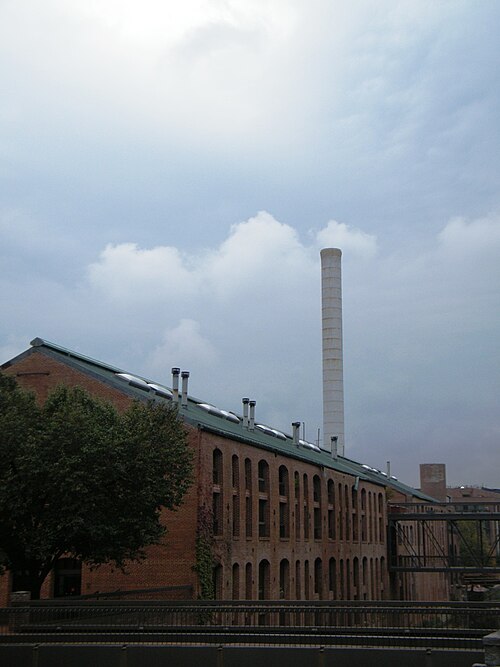
Route surroundings · Chesapeake and Ohio Canal National Historical Park - Sarah Stierch 02.jpg — Sarah Stierch — CC BY 4.0 (https://creativecommons.org/licenses/by/4.0) — https://commons.wikimedia.org/wiki/File:Chesapeake_and_Ohio_Canal_National_Historical_Park_-_Sarah_Stierch_02.jpg

Sarah Stierch
CC BY 4.0
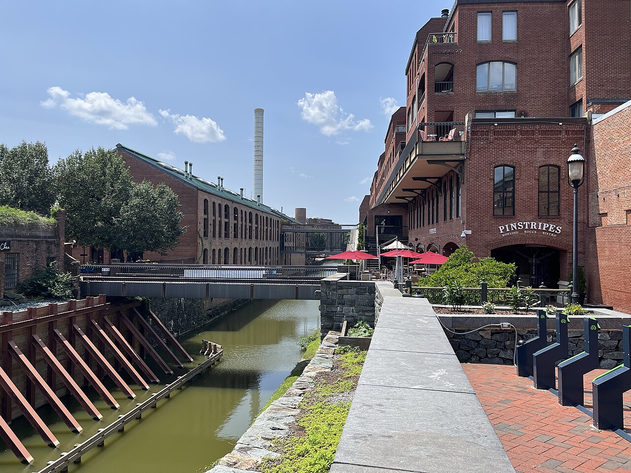
Route surroundings · C&O Canal in Georgetown July 2023.jpg — Cornflower123 — CC0 (http://creativecommons.org/publicdomain/zero/1.0/deed.en) — https://commons.wikimedia.org/wiki/File:C%26O_Canal_in_Georgetown_July_2023.jpg

Cornflower123
CC0
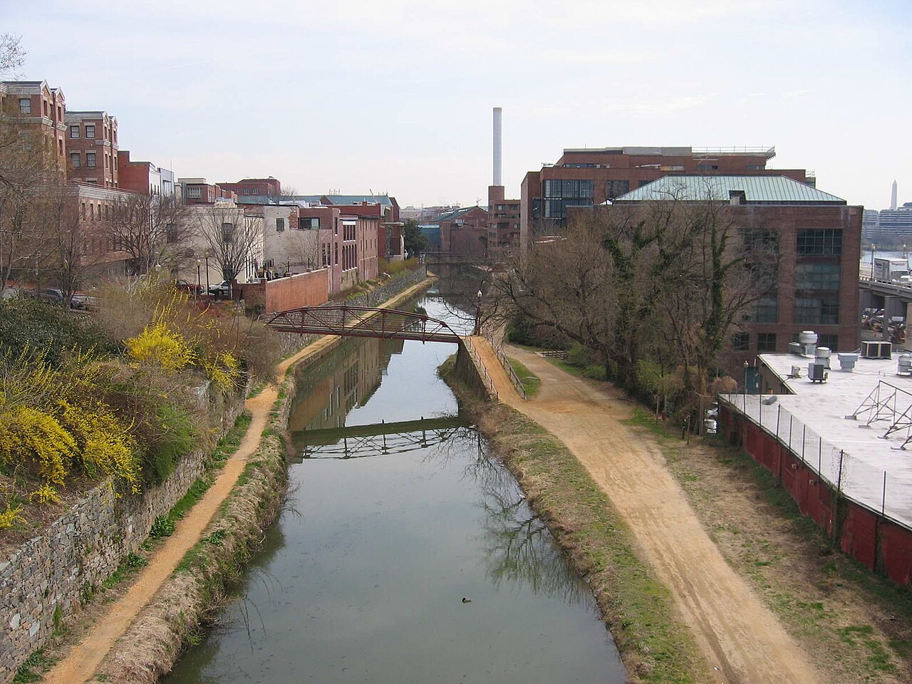
Route surroundings · C&O (Chesapeake and Ohio) Canal in Georgetown as seen from Key Bridge (March 26, 2004) - panoramio.jpg — Jaakko H. — CC BY-SA 3.0 (https://creativecommons.org/licenses/by-sa/3.0) — https://commons.wikimedia.org/wiki/File:C%26O_(Chesapeake_and_Ohio)_Canal_in_Georgetown_as_seen_from_Key_Bridge_(March_26,_2004)_-_panoramio.jpg

Jaakko H.
CC BY-SA 3.0
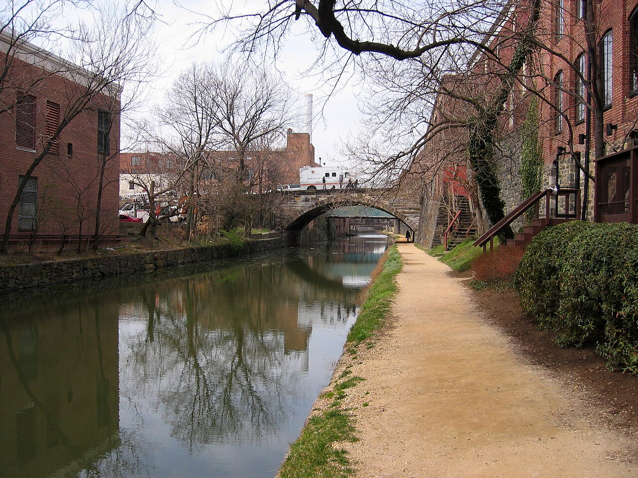
Route surroundings · C&O (Chesapeake and Ohio) Canal in the heart of Georgetown (March 26, 2004) - panoramio.jpg — Jaakko H. — CC BY-SA 3.0 (https://creativecommons.org/licenses/by-sa/3.0) — https://commons.wikimedia.org/wiki/File:C%26O_(Chesapeake_and_Ohio)_Canal_in_the_heart_of_Georgetown_(March_26,_2004)_-_panoramio.jpg

Jaakko H.
CC BY-SA 3.0
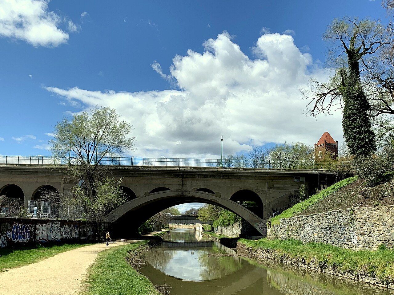
Route surroundings · Chesapeake and Ohio Canal and Key Bridge.jpg — APK — CC BY-SA 4.0 (https://creativecommons.org/licenses/by-sa/4.0) — https://commons.wikimedia.org/wiki/File:Chesapeake_and_Ohio_Canal_and_Key_Bridge.jpg

APK
CC BY-SA 4.0
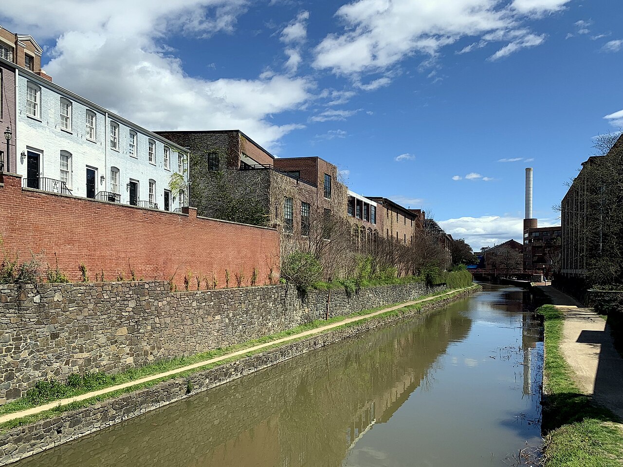
Route surroundings · Chesapeake and Ohio Canal facing east.jpg — APK — CC BY-SA 4.0 (https://creativecommons.org/licenses/by-sa/4.0) — https://commons.wikimedia.org/wiki/File:Chesapeake_and_Ohio_Canal_facing_east.jpg

APK
CC BY-SA 4.0
View original activity in YouVisible
Weather on your route
Loading forecast…
Sources and credits
© OpenStreetMap contributors · ODbL 1.0 · https://cycling.waymarkedtrails.org/#route?id=9773990
OpenStreetMap contributors · Waymarked Trails · ODbL 1.0
Route photograph
Route surroundings · Chesapeake and Ohio Canal National Historical Park - Sarah Stierch 02.jpg — Sarah Stierch — CC BY 4.0 (https://creativecommons.org/licenses/by/4.0) — https://commons.wikimedia.org/wiki/File:Chesapeake_and_Ohio_Canal_National_Historical_Park_-_Sarah_Stierch_02.jpg
Sarah Stierch · CC BY 4.0 · Media source
Route photograph
Route surroundings · C&O Canal in Georgetown July 2023.jpg — Cornflower123 — CC0 (http://creativecommons.org/publicdomain/zero/1.0/deed.en) — https://commons.wikimedia.org/wiki/File:C%26O_Canal_in_Georgetown_July_2023.jpg
Cornflower123 · CC0 · Media source
Route photograph
Route surroundings · C&O (Chesapeake and Ohio) Canal in Georgetown as seen from Key Bridge (March 26, 2004) - panoramio.jpg — Jaakko H. — CC BY-SA 3.0 (https://creativecommons.org/licenses/by-sa/3.0) — https://commons.wikimedia.org/wiki/File:C%26O_(Chesapeake_and_Ohio)_Canal_in_Georgetown_as_seen_from_Key_Bridge_(March_26,_2004)_-_panoramio.jpg
Jaakko H. · CC BY-SA 3.0 · Media source
Route photograph
Route surroundings · C&O (Chesapeake and Ohio) Canal in the heart of Georgetown (March 26, 2004) - panoramio.jpg — Jaakko H. — CC BY-SA 3.0 (https://creativecommons.org/licenses/by-sa/3.0) — https://commons.wikimedia.org/wiki/File:C%26O_(Chesapeake_and_Ohio)_Canal_in_the_heart_of_Georgetown_(March_26,_2004)_-_panoramio.jpg
Jaakko H. · CC BY-SA 3.0 · Media source
Route photograph
Route surroundings · Chesapeake and Ohio Canal and Key Bridge.jpg — APK — CC BY-SA 4.0 (https://creativecommons.org/licenses/by-sa/4.0) — https://commons.wikimedia.org/wiki/File:Chesapeake_and_Ohio_Canal_and_Key_Bridge.jpg
APK · CC BY-SA 4.0 · Media source
Route photograph
Route surroundings · Chesapeake and Ohio Canal facing east.jpg — APK — CC BY-SA 4.0 (https://creativecommons.org/licenses/by-sa/4.0) — https://commons.wikimedia.org/wiki/File:Chesapeake_and_Ohio_Canal_facing_east.jpg
APK · CC BY-SA 4.0 · Media source