Find your next route
Explore hiking, running, trail running and cycling routes that suit your plans.

Community route
Otford · Walking route to Greatness
A complete linear walking itinerary from Otford towards Greatness, following the provider’s original planned track. The gallery shows named Otford paths, village streets and heritage as route surroundings. Canonical track distance: 3.847 km.
By YouVisible Sport
Mapa del recorrido
Perfil de elevación
Activity measurements
- distance meters
- 3,847.3646917995
- elevation gain meters
- 62.1
- elevation loss meters
- 55.2
- max elevation meters
- 95.2
- min elevation meters
- 65.4
- end · latitude
- 51.290723
- end · longitude
- 0.196925
- start · latitude
- 51.312773
- start · longitude
- 0.191074
- Sport
- hiking mountaineering
- Specialty
- Hiking
From start to finish
- Country
- United Kingdom
- Province / region
- —
- Localities
- Otford
Before you go
- How to reach the start
- —
- Parking and access
- —
- Advice
- Guide + verified export. Arrange your return before setting out. Follow public footpaths and local access signs, check conditions and respect property boundaries. Source elevations are retained and are not measurements made by YouVisible. All gallery photographs are labelled “Route surroundings”; camera positions on the track are not asserted. No measured completion time is supplied.
- Recommended equipment
- —
- Terrain
- —
- Signage
- —
Characteristics and difficulty
- Estimated duration
- —
- Author perceived effort
- —
- Physical difficulty
- —
- Technical difficulty
- —
About the route
A complete linear walking itinerary from Otford towards Greatness, following the provider’s original planned track. The gallery shows named Otford paths, village streets and heritage as route surroundings. Canonical track distance: 3.847 km.
- Context
- —
- Specialty
- Hiking
- Event type
- —
- Description
- Six real photographs with individual authorship and licences.
- Title
- Route surroundings
- Title
- Sesión
- Description
- A complete linear walking itinerary from Otford towards Greatness, following the provider’s original planned track. The gallery shows named Otford paths, village streets and heritage as route surroundings. Canonical track distance: 3.847 km.
- Description
- Route surroundings · Footpath to Otford - geograph.org.uk - 6965235.jpg. Photograph of the named place or its accredited surroundings; no camera position on the track is asserted.
- Title
- Route surroundings · Footpath to Otford - geograph.org.uk - 6965235.jpg
- Description
- Route surroundings · Footpath towards Otford - geograph.org.uk - 1978037.jpg. Photograph of the named place or its accredited surroundings; no camera position on the track is asserted.
- Title
- Route surroundings · Footpath towards Otford - geograph.org.uk - 1978037.jpg
- Description
- Route surroundings · Little Oast, High Street, Otford, Kent - geograph.org.uk - 778677.jpg. Photograph of the named place or its accredited surroundings; no camera position on the track is asserted.
- Title
- Route surroundings · Little Oast, High Street, Otford, Kent - geograph.org.uk - 778677.jpg
- Description
- Route surroundings · Otford High Street - geograph.org.uk - 509362.jpg. Photograph of the named place or its accredited surroundings; no camera position on the track is asserted.
- Title
- Route surroundings · Otford High Street - geograph.org.uk - 509362.jpg
- Description
- Route surroundings · St. Bartholomew's Church, Otford, Kent - geograph.org.uk - 1815416.jpg. Photograph of the named place or its accredited surroundings; no camera position on the track is asserted.
- Title
- Route surroundings · St. Bartholomew's Church, Otford, Kent - geograph.org.uk - 1815416.jpg
- Description
- Route surroundings · Public footpath near Otford - geograph.org.uk - 2771071.jpg. Photograph of the named place or its accredited surroundings; no camera position on the track is asserted.
- Title
- Route surroundings · Public footpath near Otford - geograph.org.uk - 2771071.jpg
- Description
- Route surroundings · Footpath to Otford - geograph.org.uk - 6965235.jpg. Photograph of the named place or its accredited surroundings; no camera position on the track is asserted.
- Title
- Route surroundings · Footpath to Otford - geograph.org.uk - 6965235.jpg
- Description
- Route surroundings · Footpath towards Otford - geograph.org.uk - 1978037.jpg. Photograph of the named place or its accredited surroundings; no camera position on the track is asserted.
- Title
- Route surroundings · Footpath towards Otford - geograph.org.uk - 1978037.jpg
- Description
- Route surroundings · Little Oast, High Street, Otford, Kent - geograph.org.uk - 778677.jpg. Photograph of the named place or its accredited surroundings; no camera position on the track is asserted.
- Title
- Route surroundings · Little Oast, High Street, Otford, Kent - geograph.org.uk - 778677.jpg
- Description
- Route surroundings · Otford High Street - geograph.org.uk - 509362.jpg. Photograph of the named place or its accredited surroundings; no camera position on the track is asserted.
- Title
- Route surroundings · Otford High Street - geograph.org.uk - 509362.jpg
- Description
- Route surroundings · St. Bartholomew's Church, Otford, Kent - geograph.org.uk - 1815416.jpg. Photograph of the named place or its accredited surroundings; no camera position on the track is asserted.
- Title
- Route surroundings · St. Bartholomew's Church, Otford, Kent - geograph.org.uk - 1815416.jpg
- Description
- Route surroundings · Public footpath near Otford - geograph.org.uk - 2771071.jpg. Photograph of the named place or its accredited surroundings; no camera position on the track is asserted.
- Title
- Route surroundings · Public footpath near Otford - geograph.org.uk - 2771071.jpg
- Advice
- Guide + verified export. Arrange your return before setting out. Follow public footpaths and local access signs, check conditions and respect property boundaries. Source elevations are retained and are not measurements made by YouVisible. All gallery photographs are labelled “Route surroundings”; camera positions on the track are not asserted. No measured completion time is supplied.
- Title
- Otford · Walking route to Greatness
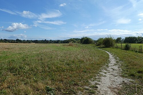
Route surroundings · Footpath to Otford - geograph.org.uk - 6965235.jpg — DS Pugh — CC BY-SA 2.0 (https://creativecommons.org/licenses/by-sa/2.0) — https://commons.wikimedia.org/wiki/File:Footpath_to_Otford_-_geograph.org.uk_-_6965235.jpg

DS Pugh
CC BY-SA 2.0
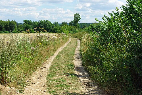
Route surroundings · Footpath towards Otford - geograph.org.uk - 1978037.jpg — Robin Webster — CC BY-SA 2.0 (https://creativecommons.org/licenses/by-sa/2.0) — https://commons.wikimedia.org/wiki/File:Footpath_towards_Otford_-_geograph.org.uk_-_1978037.jpg

Robin Webster
CC BY-SA 2.0
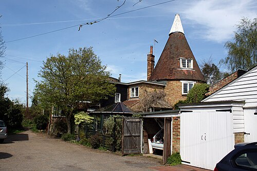
Route surroundings · Little Oast, High Street, Otford, Kent - geograph.org.uk - 778677.jpg — Oast House Archive — CC BY-SA 2.0 (https://creativecommons.org/licenses/by-sa/2.0) — https://commons.wikimedia.org/wiki/File:Little_Oast,_High_Street,_Otford,_Kent_-_geograph.org.uk_-_778677.jpg

Oast House Archive
CC BY-SA 2.0
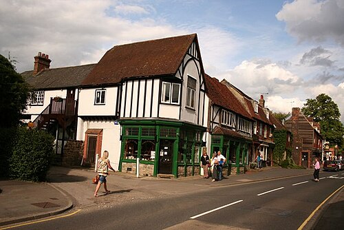
Route surroundings · Otford High Street - geograph.org.uk - 509362.jpg — Richard Croft — CC BY-SA 2.0 (https://creativecommons.org/licenses/by-sa/2.0) — https://commons.wikimedia.org/wiki/File:Otford_High_Street_-_geograph.org.uk_-_509362.jpg

Richard Croft
CC BY-SA 2.0
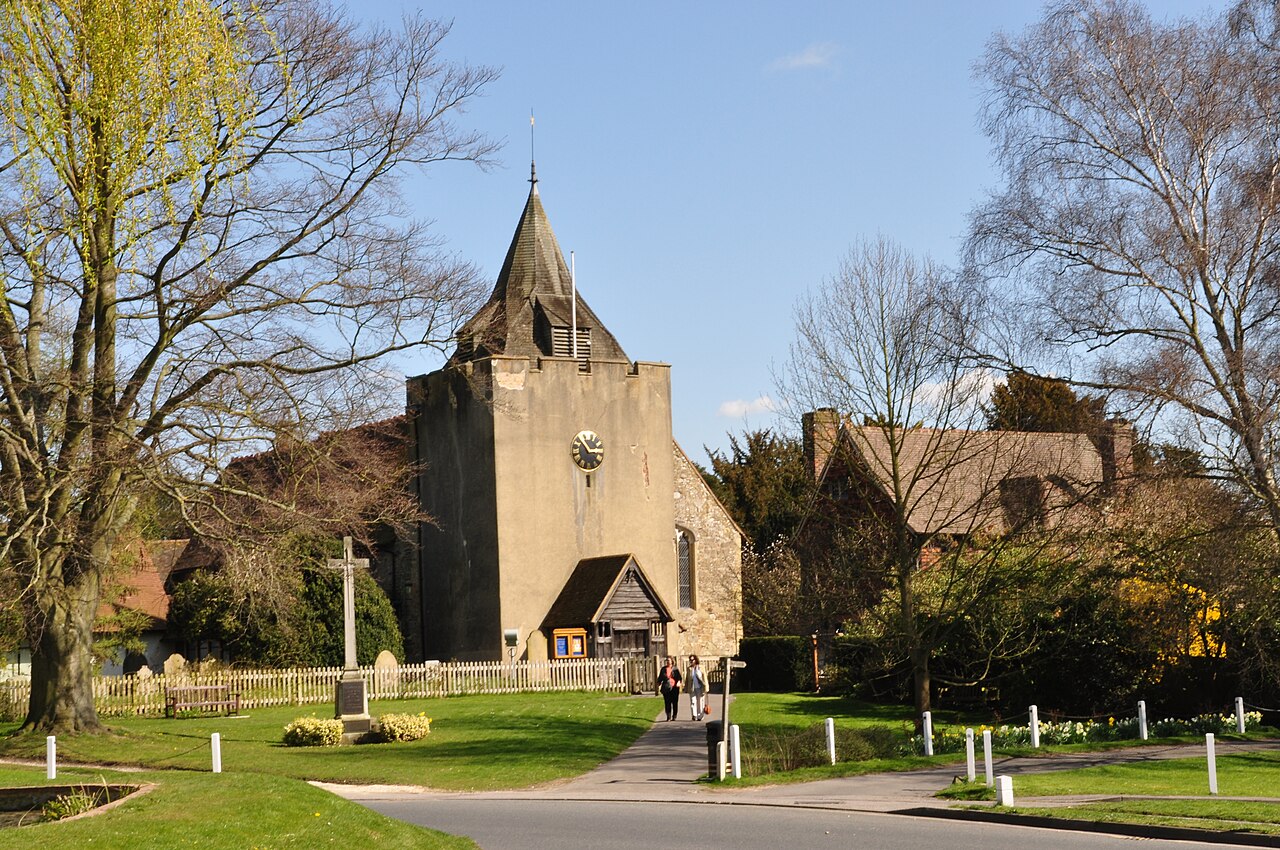
Route surroundings · St. Bartholomew's Church, Otford, Kent - geograph.org.uk - 1815416.jpg — Brian Chadwick — CC BY-SA 2.0 (https://creativecommons.org/licenses/by-sa/2.0) — https://commons.wikimedia.org/wiki/File:St._Bartholomew%27s_Church,_Otford,_Kent_-_geograph.org.uk_-_1815416.jpg

Brian Chadwick
CC BY-SA 2.0
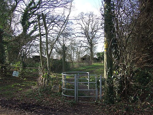
Route surroundings · Public footpath near Otford - geograph.org.uk - 2771071.jpg — Malc McDonald — CC BY-SA 2.0 (https://creativecommons.org/licenses/by-sa/2.0) — https://commons.wikimedia.org/wiki/File:Public_footpath_near_Otford_-_geograph.org.uk_-_2771071.jpg

Malc McDonald
CC BY-SA 2.0
View original activity in YouVisible
Weather on your route
Loading forecast…
Sources and credits
Outdooractive Creative Commons · CC0 1.0 · https://www.outdooractive.com/r/809547665
Outdooractive · Creative Commons Routes · CC0 1.0
Route photograph
Route surroundings · Footpath to Otford - geograph.org.uk - 6965235.jpg — DS Pugh — CC BY-SA 2.0 (https://creativecommons.org/licenses/by-sa/2.0) — https://commons.wikimedia.org/wiki/File:Footpath_to_Otford_-_geograph.org.uk_-_6965235.jpg
DS Pugh · CC BY-SA 2.0 · Media source
Route photograph
Route surroundings · Footpath towards Otford - geograph.org.uk - 1978037.jpg — Robin Webster — CC BY-SA 2.0 (https://creativecommons.org/licenses/by-sa/2.0) — https://commons.wikimedia.org/wiki/File:Footpath_towards_Otford_-_geograph.org.uk_-_1978037.jpg
Robin Webster · CC BY-SA 2.0 · Media source
Route photograph
Route surroundings · Little Oast, High Street, Otford, Kent - geograph.org.uk - 778677.jpg — Oast House Archive — CC BY-SA 2.0 (https://creativecommons.org/licenses/by-sa/2.0) — https://commons.wikimedia.org/wiki/File:Little_Oast,_High_Street,_Otford,_Kent_-_geograph.org.uk_-_778677.jpg
Oast House Archive · CC BY-SA 2.0 · Media source
Route photograph
Route surroundings · Otford High Street - geograph.org.uk - 509362.jpg — Richard Croft — CC BY-SA 2.0 (https://creativecommons.org/licenses/by-sa/2.0) — https://commons.wikimedia.org/wiki/File:Otford_High_Street_-_geograph.org.uk_-_509362.jpg
Richard Croft · CC BY-SA 2.0 · Media source
Route photograph
Route surroundings · St. Bartholomew's Church, Otford, Kent - geograph.org.uk - 1815416.jpg — Brian Chadwick — CC BY-SA 2.0 (https://creativecommons.org/licenses/by-sa/2.0) — https://commons.wikimedia.org/wiki/File:St._Bartholomew%27s_Church,_Otford,_Kent_-_geograph.org.uk_-_1815416.jpg
Brian Chadwick · CC BY-SA 2.0 · Media source
Route photograph
Route surroundings · Public footpath near Otford - geograph.org.uk - 2771071.jpg — Malc McDonald — CC BY-SA 2.0 (https://creativecommons.org/licenses/by-sa/2.0) — https://commons.wikimedia.org/wiki/File:Public_footpath_near_Otford_-_geograph.org.uk_-_2771071.jpg
Malc McDonald · CC BY-SA 2.0 · Media source