Find your next route
Explore hiking, running, trail running and cycling routes that suit your plans.

Community route
Torc · Yellow walking trail
Follow the complete mapped Yellow Trail at Torc in Killarney National Park. All three connected native segments are retained. Photographs show Torc waterfall, woodland and nearby park paths as route surroundings; they are not a list of track waypoints. Canonical track distance: 3.625 km.
By YouVisible Sport
Mapa del recorrido
Activity measurements
- distance meters
- 3,625.0167462716
- end · latitude
- 52.0046185
- end · longitude
- -9.5142586
- start · latitude
- 52.0046185
- start · longitude
- -9.5142586
- Sport
- hiking mountaineering
- Specialty
- Hiking
From start to finish
- Country
- Ireland
- Province / region
- —
- Localities
- —
Before you go
- How to reach the start
- —
- Parking and access
- —
- Advice
- YouVisible Guide only. Garmin export is unavailable: the original source contains no elevations and preserves multiple native track segments; Garmin cannot confirm export continuity. Use marked walking paths, respect park notices and take care on wet steps and uneven ground. The Cardiac Hill photograph illustrates the surrounding park and does not prescribe an extra climb. All gallery photographs are labelled “Route surroundings”; camera positions on the track are not asserted. No measured completion time is supplied.
- Recommended equipment
- —
- Terrain
- —
- Signage
- —
Characteristics and difficulty
- Estimated duration
- —
- Author perceived effort
- —
- Physical difficulty
- —
- Technical difficulty
- —
About the route
Follow the complete mapped Yellow Trail at Torc in Killarney National Park. All three connected native segments are retained. Photographs show Torc waterfall, woodland and nearby park paths as route surroundings; they are not a list of track waypoints. Canonical track distance: 3.625 km.
- Context
- —
- Specialty
- Hiking
- Event type
- —
- Description
- Six real photographs with individual authorship and licences.
- Title
- Route surroundings
- Title
- Sesión
- Description
- Follow the complete mapped Yellow Trail at Torc in Killarney National Park. All three connected native segments are retained. Photographs show Torc waterfall, woodland and nearby park paths as route surroundings; they are not a list of track waypoints. Canonical track distance: 3.625 km.
- Description
- Route surroundings · Autumn at Torc Waterfall, Co. Kerry.jpg. Photograph of the named place or its accredited surroundings; no camera position on the track is asserted.
- Title
- Route surroundings · Autumn at Torc Waterfall, Co. Kerry.jpg
- Description
- Route surroundings · Beech woods near the Torc Waterfall - geograph.org.uk - 450486.jpg. Photograph of the named place or its accredited surroundings; no camera position on the track is asserted.
- Title
- Route surroundings · Beech woods near the Torc Waterfall - geograph.org.uk - 450486.jpg
- Description
- Route surroundings · Steps up Cardiac Hill, Torc Waterfall, Killarney, Ireland.jpg. Photograph of the named place or its accredited surroundings; no camera position on the track is asserted.
- Title
- Route surroundings · Steps up Cardiac Hill, Torc Waterfall, Killarney, Ireland.jpg
- Description
- Route surroundings · Torc Waterfall, Killarney - Ed Fitzgerald.jpg. Photograph of the named place or its accredited surroundings; no camera position on the track is asserted.
- Title
- Route surroundings · Torc Waterfall, Killarney - Ed Fitzgerald.jpg
- Description
- Route surroundings · Torc Waterfall, Killarney National Park - geograph.org.uk - 16108.jpg. Photograph of the named place or its accredited surroundings; no camera position on the track is asserted.
- Title
- Route surroundings · Torc Waterfall, Killarney National Park - geograph.org.uk - 16108.jpg
- Description
- Route surroundings · Jaunting cars for hire at Torc waterfall - geograph.org.uk - 1417350.jpg. Photograph of the named place or its accredited surroundings; no camera position on the track is asserted.
- Title
- Route surroundings · Jaunting cars for hire at Torc waterfall - geograph.org.uk - 1417350.jpg
- Description
- Route surroundings · Autumn at Torc Waterfall, Co. Kerry.jpg. Photograph of the named place or its accredited surroundings; no camera position on the track is asserted.
- Title
- Route surroundings · Autumn at Torc Waterfall, Co. Kerry.jpg
- Description
- Route surroundings · Beech woods near the Torc Waterfall - geograph.org.uk - 450486.jpg. Photograph of the named place or its accredited surroundings; no camera position on the track is asserted.
- Title
- Route surroundings · Beech woods near the Torc Waterfall - geograph.org.uk - 450486.jpg
- Description
- Route surroundings · Steps up Cardiac Hill, Torc Waterfall, Killarney, Ireland.jpg. Photograph of the named place or its accredited surroundings; no camera position on the track is asserted.
- Title
- Route surroundings · Steps up Cardiac Hill, Torc Waterfall, Killarney, Ireland.jpg
- Description
- Route surroundings · Torc Waterfall, Killarney - Ed Fitzgerald.jpg. Photograph of the named place or its accredited surroundings; no camera position on the track is asserted.
- Title
- Route surroundings · Torc Waterfall, Killarney - Ed Fitzgerald.jpg
- Description
- Route surroundings · Torc Waterfall, Killarney National Park - geograph.org.uk - 16108.jpg. Photograph of the named place or its accredited surroundings; no camera position on the track is asserted.
- Title
- Route surroundings · Torc Waterfall, Killarney National Park - geograph.org.uk - 16108.jpg
- Description
- Route surroundings · Jaunting cars for hire at Torc waterfall - geograph.org.uk - 1417350.jpg. Photograph of the named place or its accredited surroundings; no camera position on the track is asserted.
- Title
- Route surroundings · Jaunting cars for hire at Torc waterfall - geograph.org.uk - 1417350.jpg
- Advice
- YouVisible Guide only. Garmin export is unavailable: the original source contains no elevations and preserves multiple native track segments; Garmin cannot confirm export continuity. Use marked walking paths, respect park notices and take care on wet steps and uneven ground. The Cardiac Hill photograph illustrates the surrounding park and does not prescribe an extra climb. All gallery photographs are labelled “Route surroundings”; camera positions on the track are not asserted. No measured completion time is supplied.
- Title
- Torc · Yellow walking trail
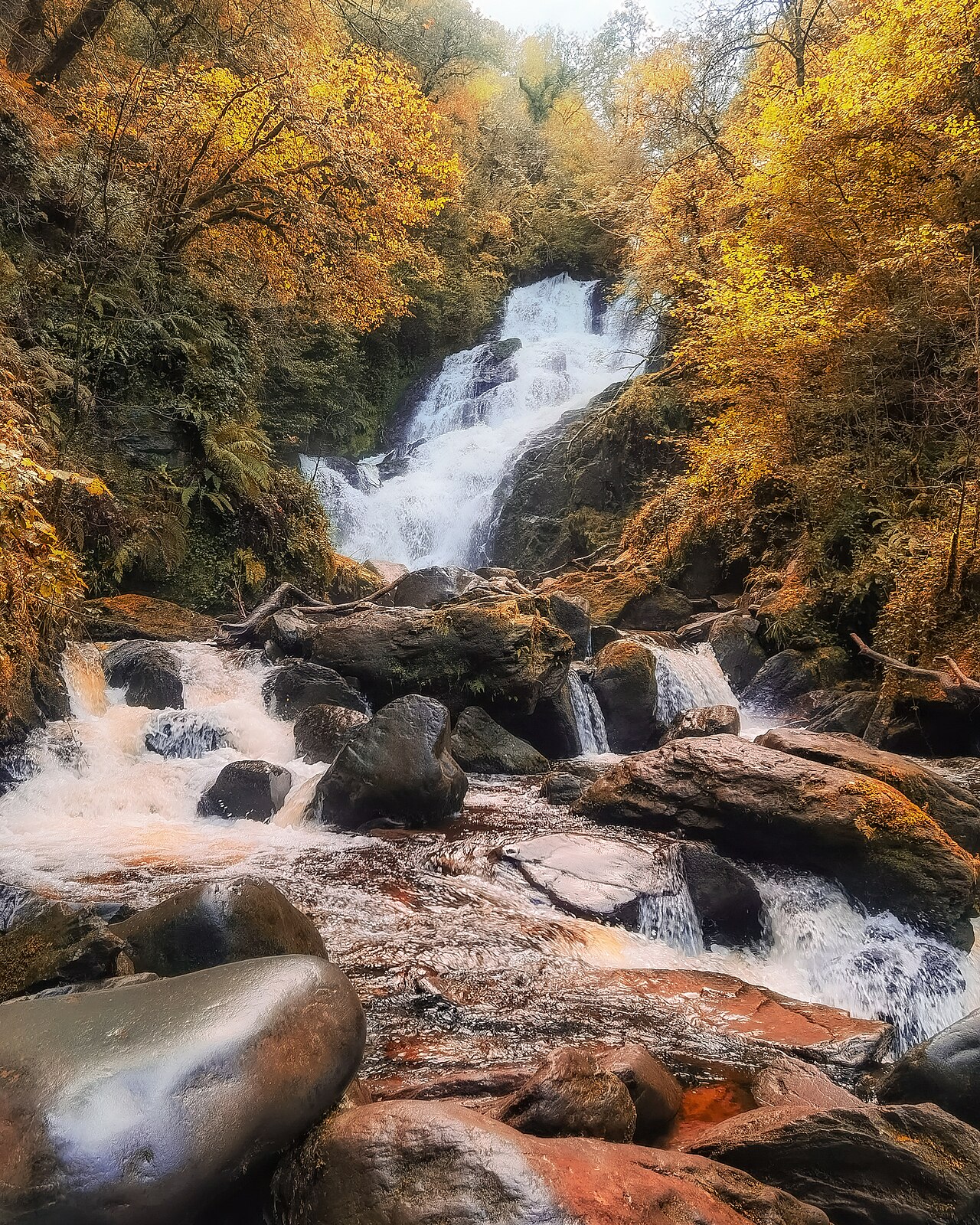
Route surroundings · Autumn at Torc Waterfall, Co. Kerry.jpg — Michael Deligan — CC BY-SA 4.0 (https://creativecommons.org/licenses/by-sa/4.0) — https://commons.wikimedia.org/wiki/File:Autumn_at_Torc_Waterfall,_Co._Kerry.jpg

Michael Deligan
CC BY-SA 4.0
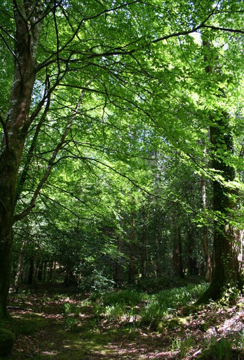
Route surroundings · Beech woods near the Torc Waterfall - geograph.org.uk - 450486.jpg — Espresso Addict — CC BY-SA 2.0 (https://creativecommons.org/licenses/by-sa/2.0) — https://commons.wikimedia.org/wiki/File:Beech_woods_near_the_Torc_Waterfall_-_geograph.org.uk_-_450486.jpg

Espresso Addict
CC BY-SA 2.0
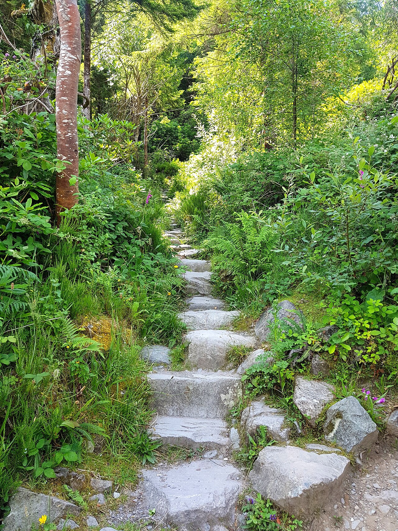
Route surroundings · Steps up Cardiac Hill, Torc Waterfall, Killarney, Ireland.jpg — Britishfinance — CC BY-SA 4.0 (https://creativecommons.org/licenses/by-sa/4.0) — https://commons.wikimedia.org/wiki/File:Steps_up_Cardiac_Hill,_Torc_Waterfall,_Killarney,_Ireland.jpg

Britishfinance
CC BY-SA 4.0
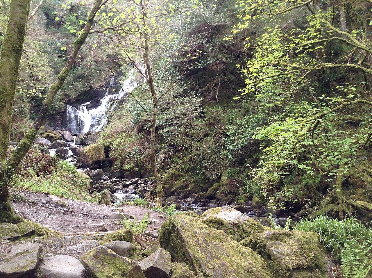
Route surroundings · Torc Waterfall, Killarney - Ed Fitzgerald.jpg — edward982 — CC BY 3.0 (https://creativecommons.org/licenses/by/3.0) — https://commons.wikimedia.org/wiki/File:Torc_Waterfall,_Killarney_-_Ed_Fitzgerald.jpg

edward982
CC BY 3.0
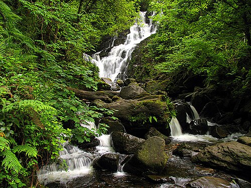
Route surroundings · Torc Waterfall, Killarney National Park - geograph.org.uk - 16108.jpg — Pam Brophy — CC BY-SA 2.0 (https://creativecommons.org/licenses/by-sa/2.0) — https://commons.wikimedia.org/wiki/File:Torc_Waterfall,_Killarney_National_Park_-_geograph.org.uk_-_16108.jpg

Pam Brophy
CC BY-SA 2.0
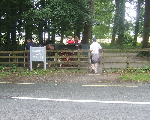
Route surroundings · Jaunting cars for hire at Torc waterfall - geograph.org.uk - 1417350.jpg — John M — CC BY-SA 2.0 (https://creativecommons.org/licenses/by-sa/2.0) — https://commons.wikimedia.org/wiki/File:Jaunting_cars_for_hire_at_Torc_waterfall_-_geograph.org.uk_-_1417350.jpg

John M
CC BY-SA 2.0
View original activity in YouVisible
Weather on your route
Loading forecast…
Sources and credits
© OpenStreetMap contributors · ODbL 1.0 · https://hiking.waymarkedtrails.org/#route?id=538716
OpenStreetMap contributors · Waymarked Trails · ODbL 1.0
Route photograph
Route surroundings · Autumn at Torc Waterfall, Co. Kerry.jpg — Michael Deligan — CC BY-SA 4.0 (https://creativecommons.org/licenses/by-sa/4.0) — https://commons.wikimedia.org/wiki/File:Autumn_at_Torc_Waterfall,_Co._Kerry.jpg
Michael Deligan · CC BY-SA 4.0 · Media source
Route photograph
Route surroundings · Beech woods near the Torc Waterfall - geograph.org.uk - 450486.jpg — Espresso Addict — CC BY-SA 2.0 (https://creativecommons.org/licenses/by-sa/2.0) — https://commons.wikimedia.org/wiki/File:Beech_woods_near_the_Torc_Waterfall_-_geograph.org.uk_-_450486.jpg
Espresso Addict · CC BY-SA 2.0 · Media source
Route photograph
Route surroundings · Steps up Cardiac Hill, Torc Waterfall, Killarney, Ireland.jpg — Britishfinance — CC BY-SA 4.0 (https://creativecommons.org/licenses/by-sa/4.0) — https://commons.wikimedia.org/wiki/File:Steps_up_Cardiac_Hill,_Torc_Waterfall,_Killarney,_Ireland.jpg
Britishfinance · CC BY-SA 4.0 · Media source
Route photograph
Route surroundings · Torc Waterfall, Killarney - Ed Fitzgerald.jpg — edward982 — CC BY 3.0 (https://creativecommons.org/licenses/by/3.0) — https://commons.wikimedia.org/wiki/File:Torc_Waterfall,_Killarney_-_Ed_Fitzgerald.jpg
edward982 · CC BY 3.0 · Media source
Route photograph
Route surroundings · Torc Waterfall, Killarney National Park - geograph.org.uk - 16108.jpg — Pam Brophy — CC BY-SA 2.0 (https://creativecommons.org/licenses/by-sa/2.0) — https://commons.wikimedia.org/wiki/File:Torc_Waterfall,_Killarney_National_Park_-_geograph.org.uk_-_16108.jpg
Pam Brophy · CC BY-SA 2.0 · Media source
Route photograph
Route surroundings · Jaunting cars for hire at Torc waterfall - geograph.org.uk - 1417350.jpg — John M — CC BY-SA 2.0 (https://creativecommons.org/licenses/by-sa/2.0) — https://commons.wikimedia.org/wiki/File:Jaunting_cars_for_hire_at_Torc_waterfall_-_geograph.org.uk_-_1417350.jpg
John M · CC BY-SA 2.0 · Media source