Find your next route
Explore hiking, running, trail running and cycling routes that suit your plans.

Community route
South Kerry Greenway · Glenbeigh–Kilkeehagh
Ride the complete mapped Glenbeigh–Kilkeehagh section of the South Kerry Greenway on its surfaced shared path. This is the single continuous section in the source; separate greenway sections are not joined. Photographs show Glenbeigh and nearby Rossbeigh as route surroundings. Canonical track distance: 6.204 km.
By YouVisible Sport
Mapa del recorrido
Activity measurements
- distance meters
- 6,203.626369799
- end · latitude
- 52.0346685
- end · longitude
- -10.017136
- start · latitude
- 52.0527398
- start · longitude
- -9.9465811
- Sport
- Cycling
- Specialty
- cycling road
From start to finish
- Country
- Ireland
- Province / region
- —
- Localities
- —
Before you go
- How to reach the start
- —
- Parking and access
- —
- Advice
- YouVisible Guide only. Garmin export is unavailable: the original source contains no elevations; the real Garmin validator reports ELEVATION_INSUFFICIENT. Use the signed greenway, yield to pedestrians and check operator notices before riding. Plan your return; the source does not include a connection to other separate South Kerry sections. All gallery photographs are labelled “Route surroundings”; camera positions on the track are not asserted. No measured completion time is supplied.
- Recommended equipment
- —
- Terrain
- —
- Signage
- —
Characteristics and difficulty
- Estimated duration
- —
- Author perceived effort
- —
- Physical difficulty
- —
- Technical difficulty
- —
About the route
Ride the complete mapped Glenbeigh–Kilkeehagh section of the South Kerry Greenway on its surfaced shared path. This is the single continuous section in the source; separate greenway sections are not joined. Photographs show Glenbeigh and nearby Rossbeigh as route surroundings. Canonical track distance: 6.204 km.
- Context
- —
- Specialty
- cycling road
- Event type
- —
- Description
- Six real photographs with individual authorship and licences.
- Title
- Route surroundings
- Title
- Sesión
- Description
- Ride the complete mapped Glenbeigh–Kilkeehagh section of the South Kerry Greenway on its surfaced shared path. This is the single continuous section in the source; separate greenway sections are not joined. Photographs show Glenbeigh and nearby Rossbeigh as route surroundings. Canonical track distance: 6.204 km.
- Description
- Route surroundings · Behr River, near Glenbeigh, Co. Kerry - geograph.org.uk - 5932151.jpg. Photograph of the named place or its accredited surroundings; no camera position on the track is asserted.
- Title
- Route surroundings · Behr River, near Glenbeigh, Co. Kerry - geograph.org.uk - 5932151.jpg
- Description
- Route surroundings · Behy Bridge (1), near Glenbeigh, Co Kerry - geograph.org.uk - 5931874.jpg. Photograph of the named place or its accredited surroundings; no camera position on the track is asserted.
- Title
- Route surroundings · Behy Bridge (1), near Glenbeigh, Co Kerry - geograph.org.uk - 5931874.jpg
- Description
- Route surroundings · Centre of Glenbeigh - geograph.org.uk - 779923.jpg. Photograph of the named place or its accredited surroundings; no camera position on the track is asserted.
- Title
- Route surroundings · Centre of Glenbeigh - geograph.org.uk - 779923.jpg
- Description
- Route surroundings · Glenbeigh church - geograph.org.uk - 774185.jpg. Photograph of the named place or its accredited surroundings; no camera position on the track is asserted.
- Title
- Route surroundings · Glenbeigh church - geograph.org.uk - 774185.jpg
- Description
- Route surroundings · Glenbeigh rossbeigh beach.jpg. Photograph of the named place or its accredited surroundings; no camera position on the track is asserted.
- Title
- Route surroundings · Glenbeigh rossbeigh beach.jpg
- Description
- Route surroundings · The River Behy at Glenbeigh - geograph.org.uk - 5818134.jpg. Photograph of the named place or its accredited surroundings; no camera position on the track is asserted.
- Title
- Route surroundings · The River Behy at Glenbeigh - geograph.org.uk - 5818134.jpg
- Description
- Route surroundings · Behr River, near Glenbeigh, Co. Kerry - geograph.org.uk - 5932151.jpg. Photograph of the named place or its accredited surroundings; no camera position on the track is asserted.
- Title
- Route surroundings · Behr River, near Glenbeigh, Co. Kerry - geograph.org.uk - 5932151.jpg
- Description
- Route surroundings · Behy Bridge (1), near Glenbeigh, Co Kerry - geograph.org.uk - 5931874.jpg. Photograph of the named place or its accredited surroundings; no camera position on the track is asserted.
- Title
- Route surroundings · Behy Bridge (1), near Glenbeigh, Co Kerry - geograph.org.uk - 5931874.jpg
- Description
- Route surroundings · Centre of Glenbeigh - geograph.org.uk - 779923.jpg. Photograph of the named place or its accredited surroundings; no camera position on the track is asserted.
- Title
- Route surroundings · Centre of Glenbeigh - geograph.org.uk - 779923.jpg
- Description
- Route surroundings · Glenbeigh church - geograph.org.uk - 774185.jpg. Photograph of the named place or its accredited surroundings; no camera position on the track is asserted.
- Title
- Route surroundings · Glenbeigh church - geograph.org.uk - 774185.jpg
- Description
- Route surroundings · Glenbeigh rossbeigh beach.jpg. Photograph of the named place or its accredited surroundings; no camera position on the track is asserted.
- Title
- Route surroundings · Glenbeigh rossbeigh beach.jpg
- Description
- Route surroundings · The River Behy at Glenbeigh - geograph.org.uk - 5818134.jpg. Photograph of the named place or its accredited surroundings; no camera position on the track is asserted.
- Title
- Route surroundings · The River Behy at Glenbeigh - geograph.org.uk - 5818134.jpg
- Advice
- YouVisible Guide only. Garmin export is unavailable: the original source contains no elevations; the real Garmin validator reports ELEVATION_INSUFFICIENT. Use the signed greenway, yield to pedestrians and check operator notices before riding. Plan your return; the source does not include a connection to other separate South Kerry sections. All gallery photographs are labelled “Route surroundings”; camera positions on the track are not asserted. No measured completion time is supplied.
- Title
- South Kerry Greenway · Glenbeigh–Kilkeehagh
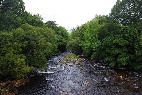
Route surroundings · Behr River, near Glenbeigh, Co. Kerry - geograph.org.uk - 5932151.jpg — P L Chadwick — CC BY-SA 2.0 (https://creativecommons.org/licenses/by-sa/2.0) — https://commons.wikimedia.org/wiki/File:Behr_River,_near_Glenbeigh,_Co._Kerry_-_geograph.org.uk_-_5932151.jpg

P L Chadwick
CC BY-SA 2.0
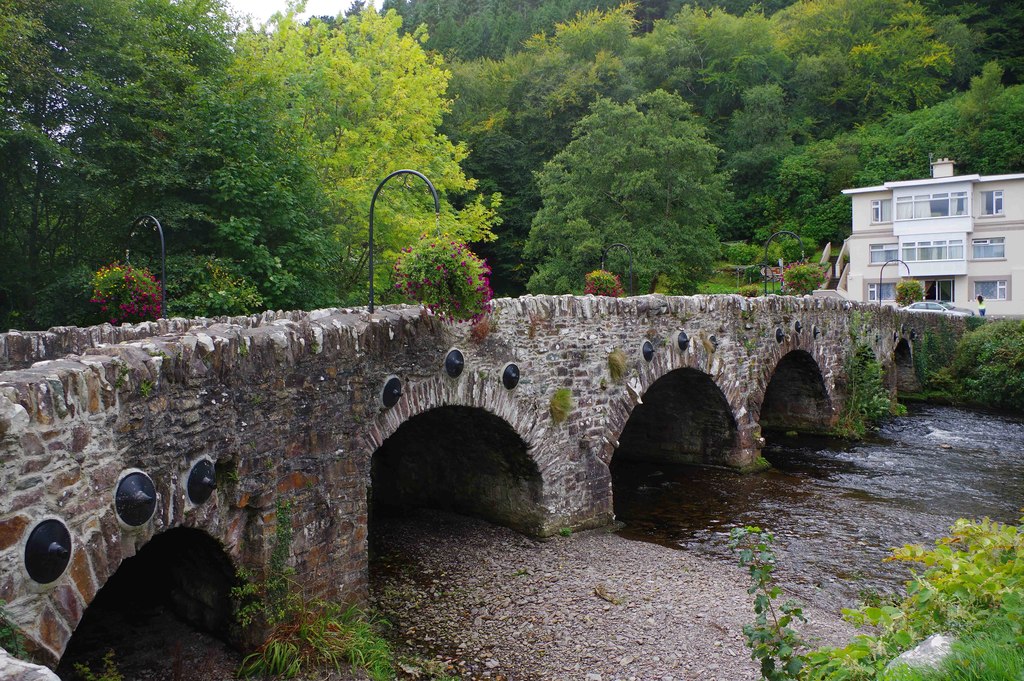
Route surroundings · Behy Bridge (1), near Glenbeigh, Co Kerry - geograph.org.uk - 5931874.jpg — P L Chadwick — CC BY-SA 2.0 (https://creativecommons.org/licenses/by-sa/2.0) — https://commons.wikimedia.org/wiki/File:Behy_Bridge_(1),_near_Glenbeigh,_Co_Kerry_-_geograph.org.uk_-_5931874.jpg

P L Chadwick
CC BY-SA 2.0
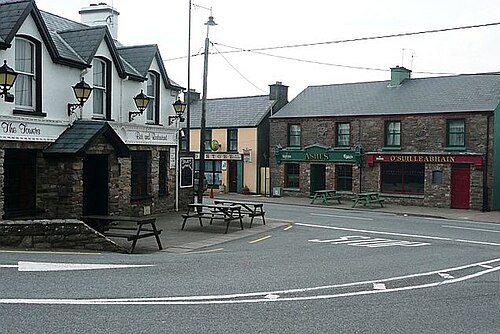
Route surroundings · Centre of Glenbeigh - geograph.org.uk - 779923.jpg — Graham Horn — CC BY-SA 2.0 (https://creativecommons.org/licenses/by-sa/2.0) — https://commons.wikimedia.org/wiki/File:Centre_of_Glenbeigh_-_geograph.org.uk_-_779923.jpg

Graham Horn
CC BY-SA 2.0
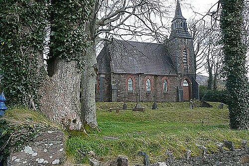
Route surroundings · Glenbeigh church - geograph.org.uk - 774185.jpg — Graham Horn — CC BY-SA 2.0 (https://creativecommons.org/licenses/by-sa/2.0) — https://commons.wikimedia.org/wiki/File:Glenbeigh_church_-_geograph.org.uk_-_774185.jpg

Graham Horn
CC BY-SA 2.0
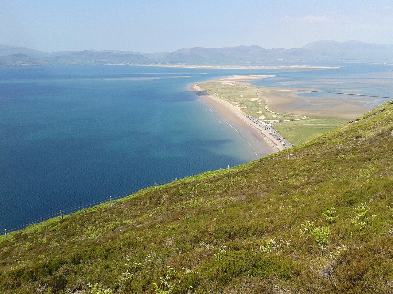
Route surroundings · Glenbeigh rossbeigh beach.jpg — Ostendali — CC BY-SA 3.0 (https://creativecommons.org/licenses/by-sa/3.0) — https://commons.wikimedia.org/wiki/File:Glenbeigh_rossbeigh_beach.jpg

Ostendali
CC BY-SA 3.0
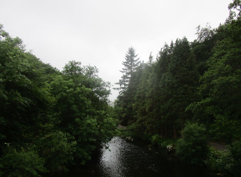
Route surroundings · The River Behy at Glenbeigh - geograph.org.uk - 5818134.jpg — Jonathan Thacker — CC BY-SA 2.0 (https://creativecommons.org/licenses/by-sa/2.0) — https://commons.wikimedia.org/wiki/File:The_River_Behy_at_Glenbeigh_-_geograph.org.uk_-_5818134.jpg

Jonathan Thacker
CC BY-SA 2.0
View original activity in YouVisible
Weather on your route
Loading forecast…
Sources and credits
© OpenStreetMap contributors · ODbL 1.0 · https://cycling.waymarkedtrails.org/#route?id=19980261
OpenStreetMap contributors · Waymarked Trails · ODbL 1.0
Route photograph
Route surroundings · Behr River, near Glenbeigh, Co. Kerry - geograph.org.uk - 5932151.jpg — P L Chadwick — CC BY-SA 2.0 (https://creativecommons.org/licenses/by-sa/2.0) — https://commons.wikimedia.org/wiki/File:Behr_River,_near_Glenbeigh,_Co._Kerry_-_geograph.org.uk_-_5932151.jpg
P L Chadwick · CC BY-SA 2.0 · Media source
Route photograph
Route surroundings · Behy Bridge (1), near Glenbeigh, Co Kerry - geograph.org.uk - 5931874.jpg — P L Chadwick — CC BY-SA 2.0 (https://creativecommons.org/licenses/by-sa/2.0) — https://commons.wikimedia.org/wiki/File:Behy_Bridge_(1),_near_Glenbeigh,_Co_Kerry_-_geograph.org.uk_-_5931874.jpg
P L Chadwick · CC BY-SA 2.0 · Media source
Route photograph
Route surroundings · Centre of Glenbeigh - geograph.org.uk - 779923.jpg — Graham Horn — CC BY-SA 2.0 (https://creativecommons.org/licenses/by-sa/2.0) — https://commons.wikimedia.org/wiki/File:Centre_of_Glenbeigh_-_geograph.org.uk_-_779923.jpg
Graham Horn · CC BY-SA 2.0 · Media source
Route photograph
Route surroundings · Glenbeigh church - geograph.org.uk - 774185.jpg — Graham Horn — CC BY-SA 2.0 (https://creativecommons.org/licenses/by-sa/2.0) — https://commons.wikimedia.org/wiki/File:Glenbeigh_church_-_geograph.org.uk_-_774185.jpg
Graham Horn · CC BY-SA 2.0 · Media source
Route photograph
Route surroundings · Glenbeigh rossbeigh beach.jpg — Ostendali — CC BY-SA 3.0 (https://creativecommons.org/licenses/by-sa/3.0) — https://commons.wikimedia.org/wiki/File:Glenbeigh_rossbeigh_beach.jpg
Ostendali · CC BY-SA 3.0 · Media source
Route photograph
Route surroundings · The River Behy at Glenbeigh - geograph.org.uk - 5818134.jpg — Jonathan Thacker — CC BY-SA 2.0 (https://creativecommons.org/licenses/by-sa/2.0) — https://commons.wikimedia.org/wiki/File:The_River_Behy_at_Glenbeigh_-_geograph.org.uk_-_5818134.jpg
Jonathan Thacker · CC BY-SA 2.0 · Media source