Find your next route
Explore hiking, running, trail running and cycling routes that suit your plans.

Community route
Inishbofin Island · Cloonamore Loop
A walking loop through the eastern part of Inishbofin around Cloonamore. The gallery shows the island coastline and settlement surroundings. Track distance: 7.549 km.
By YouVisible Sport
Mapa del recorrido
Activity measurements
- distance meters
- 7,548.649428145
- end · latitude
- 53.6133999
- end · longitude
- -10.2135665
- start · latitude
- 53.6133999
- start · longitude
- -10.2135665
- Sport
- hiking mountaineering
- Specialty
- Hiking
From start to finish
- Country
- Ireland
- Province / region
- —
- Localities
- —
Before you go
- How to reach the start
- —
- Parking and access
- —
- Advice
- YouVisible Guide only. Check local conditions and access restrictions before setting out. The six photographs identify the route area or its surroundings; no on-track camera position is asserted. The source has no reliable elevations; Garmin export is not verified.
- Recommended equipment
- —
- Terrain
- —
- Signage
- Red arrow on white background
Characteristics and difficulty
- Estimated duration
- —
- Author perceived effort
- —
- Physical difficulty
- —
- Technical difficulty
- —
About the route
A walking loop through the eastern part of Inishbofin around Cloonamore. The gallery shows the island coastline and settlement surroundings. Track distance: 7.549 km.
- Context
- —
- Specialty
- Hiking
- Event type
- —
- Description
- Route surroundings · photographs with individual credits and licences.
- Title
- Route highlights
- Title
- Sesión
- Description
- A walking loop through the eastern part of Inishbofin around Cloonamore. The gallery shows the island coastline and settlement surroundings. Track distance: 7.549 km.
- Description
- Route surroundings · Cloudy landscape panorama - Inishbofin (Galway).jpg. Photograph of the place or its accredited surroundings; no on-route camera position is asserted.
- Title
- Route surroundings · Cloudy landscape panorama - Inishbofin (Galway).jpg
- Description
- Route surroundings · Image-Inishbofin, Galway, Ireland. Old castel and lighthouse 2.JPG. Photograph of the place or its accredited surroundings; no on-route camera position is asserted.
- Title
- Route surroundings · Image-Inishbofin, Galway, Ireland. Old castel and lighthouse 2.JPG
- Description
- Route surroundings · Inishbofin, Galway, Ireland. Harbour 0.JPG. Photograph of the place or its accredited surroundings; no on-route camera position is asserted.
- Title
- Route surroundings · Inishbofin, Galway, Ireland. Harbour 0.JPG
- Description
- Route surroundings · Inishbofin, Galway, Ireland. Harbour 01.JPG. Photograph of the place or its accredited surroundings; no on-route camera position is asserted.
- Title
- Route surroundings · Inishbofin, Galway, Ireland. Harbour 01.JPG
- Description
- Route surroundings · Inishbofin, Galway, Ireland. Landscape 01.JPG. Photograph of the place or its accredited surroundings; no on-route camera position is asserted.
- Title
- Route surroundings · Inishbofin, Galway, Ireland. Landscape 01.JPG
- Description
- Route surroundings · Inishbofin, Galway, Ireland. Landscape 10.JPG. Photograph of the place or its accredited surroundings; no on-route camera position is asserted.
- Title
- Route surroundings · Inishbofin, Galway, Ireland. Landscape 10.JPG
- Description
- Route surroundings · Cloudy landscape panorama - Inishbofin (Galway).jpg. Photograph of the place or its accredited surroundings; no on-route camera position is asserted.
- Title
- Route surroundings · Cloudy landscape panorama - Inishbofin (Galway).jpg
- Description
- Route surroundings · Image-Inishbofin, Galway, Ireland. Old castel and lighthouse 2.JPG. Photograph of the place or its accredited surroundings; no on-route camera position is asserted.
- Title
- Route surroundings · Image-Inishbofin, Galway, Ireland. Old castel and lighthouse 2.JPG
- Description
- Route surroundings · Inishbofin, Galway, Ireland. Harbour 0.JPG. Photograph of the place or its accredited surroundings; no on-route camera position is asserted.
- Title
- Route surroundings · Inishbofin, Galway, Ireland. Harbour 0.JPG
- Description
- Route surroundings · Inishbofin, Galway, Ireland. Harbour 01.JPG. Photograph of the place or its accredited surroundings; no on-route camera position is asserted.
- Title
- Route surroundings · Inishbofin, Galway, Ireland. Harbour 01.JPG
- Description
- Route surroundings · Inishbofin, Galway, Ireland. Landscape 01.JPG. Photograph of the place or its accredited surroundings; no on-route camera position is asserted.
- Title
- Route surroundings · Inishbofin, Galway, Ireland. Landscape 01.JPG
- Description
- Route surroundings · Inishbofin, Galway, Ireland. Landscape 10.JPG. Photograph of the place or its accredited surroundings; no on-route camera position is asserted.
- Title
- Route surroundings · Inishbofin, Galway, Ireland. Landscape 10.JPG
- Advice
- YouVisible Guide only. Check local conditions and access restrictions before setting out. The six photographs identify the route area or its surroundings; no on-track camera position is asserted. The source has no reliable elevations; Garmin export is not verified.
- Signage
- Red arrow on white background
- Title
- Inishbofin Island · Cloonamore Loop
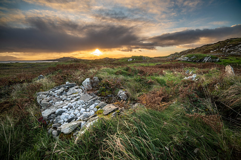
Route surroundings · Grave at St Colmans — Andrew Kearns — CC BY 2.0 (https://creativecommons.org/licenses/by/2.0/) — https://www.flickr.com/photos/51703707@N03/48967632247/
Andrew Kearns
CC BY 2.0
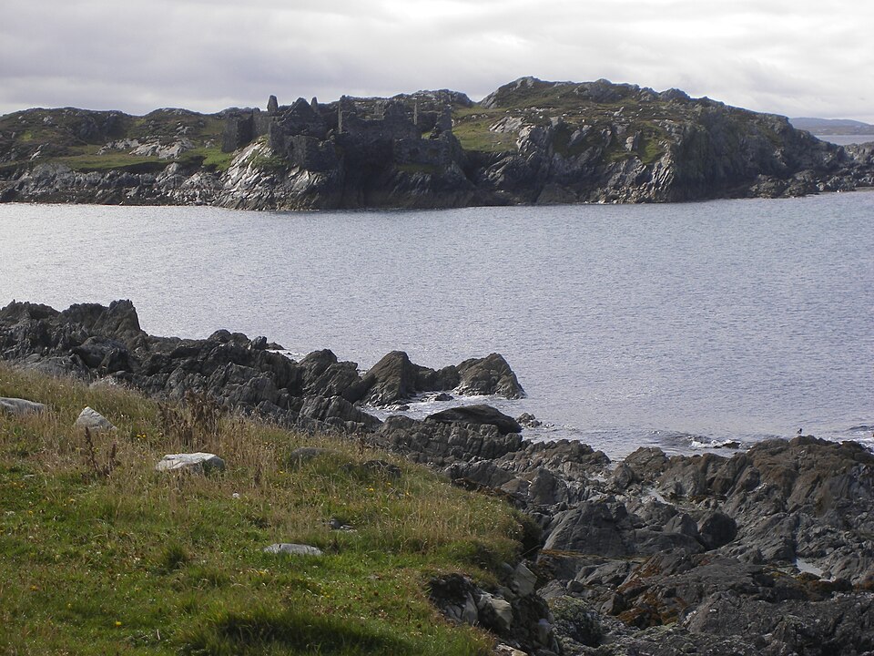
Route surroundings · Inishbofin, Galway, Ireland. Old castle.JPG — Alvaro — CC BY 2.5 (https://creativecommons.org/licenses/by/2.5) — https://commons.wikimedia.org/wiki/File:Inishbofin,_Galway,_Ireland._Old_castle.JPG

Alvaro
CC BY 2.5
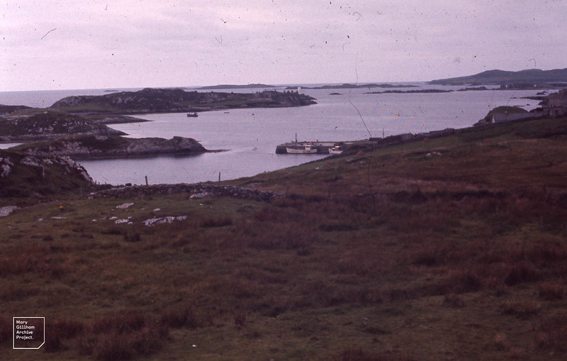
Route surroundings · Inishboffin, wide view of harbour — Dr Mary Gillham Archive Project — CC BY 2.0 (https://creativecommons.org/licenses/by/2.0/) — https://www.flickr.com/photos/139791896@N06/38560154016/
Dr Mary Gillham Archive Project
CC BY 2.0
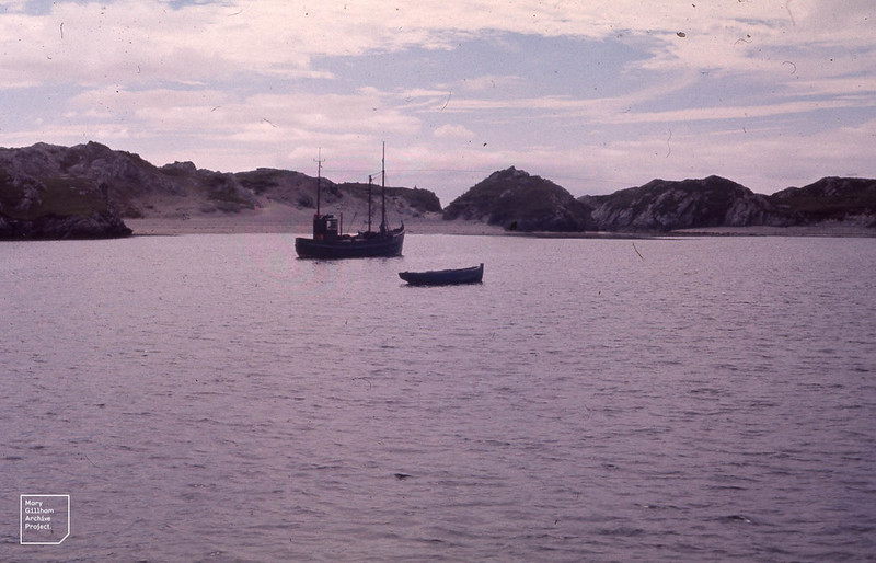
Route surroundings · Boats and dune sand. Inishboffin Harbour — Dr Mary Gillham Archive Project — CC BY 2.0 (https://creativecommons.org/licenses/by/2.0/) — https://www.flickr.com/photos/139791896@N06/37899385084/
Dr Mary Gillham Archive Project
CC BY 2.0
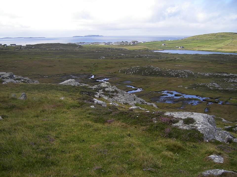
Route surroundings · Inishbofin, Galway, Ireland. Landscape 11.JPG — Alvaro — CC BY 2.5 (https://creativecommons.org/licenses/by/2.5) — https://commons.wikimedia.org/wiki/File:Inishbofin,_Galway,_Ireland._Landscape_11.JPG

Alvaro
CC BY 2.5
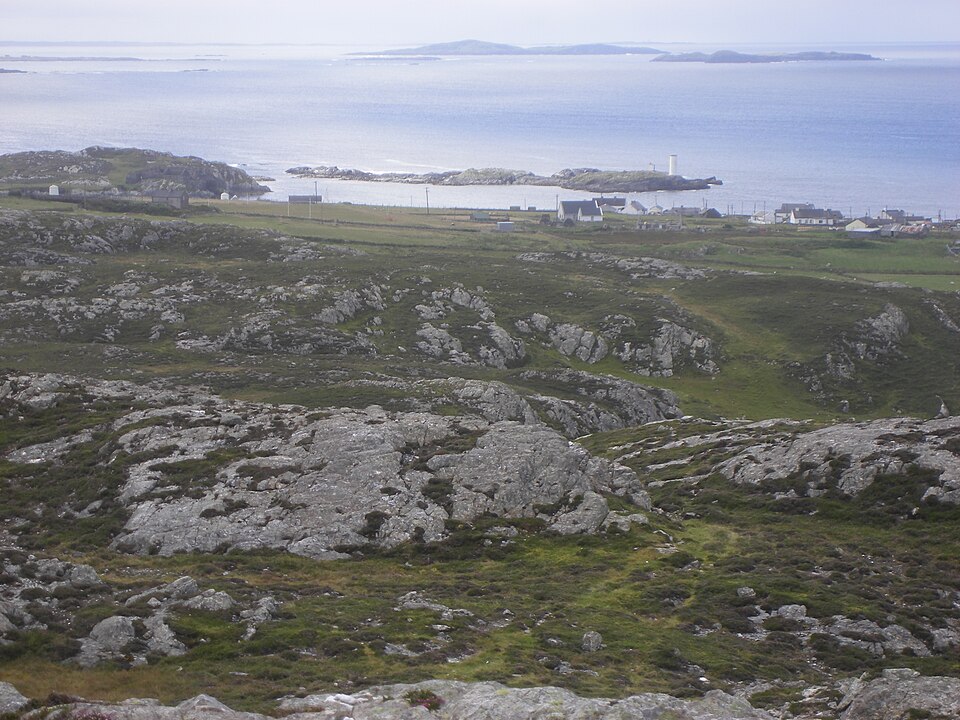
Route surroundings · Inishbofin, Galway, Ireland. Landscape 20.JPG — Alvaro — CC BY 2.5 (https://creativecommons.org/licenses/by/2.5) — https://commons.wikimedia.org/wiki/File:Inishbofin,_Galway,_Ireland._Landscape_20.JPG

Alvaro
CC BY 2.5
View original activity in YouVisible
Weather on your route
Loading forecast…
Sources and credits
Sport Ireland; CC BY 4.0 — https://creativecommons.org/licenses/by/4.0/
Sport Ireland · Get Ireland Active Trail Routes · CC BY 4.0
Route photograph
Route surroundings · Grave at St Colmans — Andrew Kearns — CC BY 2.0 (https://creativecommons.org/licenses/by/2.0/) — https://www.flickr.com/photos/51703707@N03/48967632247/
Andrew Kearns · CC BY 2.0 · Media source
Route photograph
Route surroundings · Inishbofin, Galway, Ireland. Old castle.JPG — Alvaro — CC BY 2.5 (https://creativecommons.org/licenses/by/2.5) — https://commons.wikimedia.org/wiki/File:Inishbofin,_Galway,_Ireland._Old_castle.JPG
Alvaro · CC BY 2.5 · Media source
Route photograph
Route surroundings · Inishboffin, wide view of harbour — Dr Mary Gillham Archive Project — CC BY 2.0 (https://creativecommons.org/licenses/by/2.0/) — https://www.flickr.com/photos/139791896@N06/38560154016/
Dr Mary Gillham Archive Project · CC BY 2.0 · Media source
Route photograph
Route surroundings · Boats and dune sand. Inishboffin Harbour — Dr Mary Gillham Archive Project — CC BY 2.0 (https://creativecommons.org/licenses/by/2.0/) — https://www.flickr.com/photos/139791896@N06/37899385084/
Dr Mary Gillham Archive Project · CC BY 2.0 · Media source
Route photograph
Route surroundings · Inishbofin, Galway, Ireland. Landscape 11.JPG — Alvaro — CC BY 2.5 (https://creativecommons.org/licenses/by/2.5) — https://commons.wikimedia.org/wiki/File:Inishbofin,_Galway,_Ireland._Landscape_11.JPG
Alvaro · CC BY 2.5 · Media source
Route photograph
Route surroundings · Inishbofin, Galway, Ireland. Landscape 20.JPG — Alvaro — CC BY 2.5 (https://creativecommons.org/licenses/by/2.5) — https://commons.wikimedia.org/wiki/File:Inishbofin,_Galway,_Ireland._Landscape_20.JPG
Alvaro · CC BY 2.5 · Media source