Find your next route
Explore hiking, running, trail running and cycling routes that suit your plans.

Community route
Clifden · Sky Road cycling loop
A road cycling loop around the Sky Road peninsula from Clifden. The source route includes the N59. The gallery shows Clifden and its harbour surroundings. Track distance: 15.968 km.
By YouVisible Sport
Mapa del recorrido
Activity measurements
- distance meters
- 15,968.3054903387
- end · latitude
- 53.5103439
- end · longitude
- -10.0406389
- start · latitude
- 53.505738
- start · longitude
- -10.0402303
- Sport
- Cycling
- Specialty
- cycling road
From start to finish
- Country
- Ireland
- Province / region
- —
- Localities
- Clifden
Before you go
- How to reach the start
- —
- Parking and access
- —
- Advice
- YouVisible Guide only. Check local conditions and access restrictions before setting out. The six photographs identify the route area or its surroundings; no on-track camera position is asserted. The source has no reliable elevations; Garmin export is not verified.
- Recommended equipment
- —
- Terrain
- —
- Signage
- —
Characteristics and difficulty
- Estimated duration
- —
- Author perceived effort
- —
- Physical difficulty
- —
- Technical difficulty
- —
About the route
A road cycling loop around the Sky Road peninsula from Clifden. The source route includes the N59. The gallery shows Clifden and its harbour surroundings. Track distance: 15.968 km.
- Context
- —
- Specialty
- cycling road
- Event type
- —
- Description
- Route surroundings · photographs with individual credits and licences.
- Title
- Route highlights
- Title
- Sesión
- Description
- A road cycling loop around the Sky Road peninsula from Clifden. The source route includes the N59. The gallery shows Clifden and its harbour surroundings. Track distance: 15.968 km.
- Description
- Route surroundings · ClifdenOverview.JPG. Photograph of the place or its accredited surroundings; no on-route camera position is asserted.
- Title
- Route surroundings · ClifdenOverview.JPG
- Description
- Route surroundings · Clifden - Entering town via N59 onto Main Street - geograph.org.uk - 1622522.jpg. Photograph of the place or its accredited surroundings; no on-route camera position is asserted.
- Title
- Route surroundings · Clifden - Entering town via N59 onto Main Street - geograph.org.uk - 1622522.jpg
- Description
- Route surroundings · Clifden Harbour - geograph.org.uk - 200103.jpg. Photograph of the place or its accredited surroundings; no on-route camera position is asserted.
- Title
- Route surroundings · Clifden Harbour - geograph.org.uk - 200103.jpg
- Description
- Route surroundings · Clifden center.jpg. Photograph of the place or its accredited surroundings; no on-route camera position is asserted.
- Title
- Route surroundings · Clifden center.jpg
- Description
- Route surroundings · Christ Church, Clifden, Connemara - geograph.org.uk - 2527365.jpg. Photograph of the place or its accredited surroundings; no on-route camera position is asserted.
- Title
- Route surroundings · Christ Church, Clifden, Connemara - geograph.org.uk - 2527365.jpg
- Description
- Route surroundings · Calvary statues - geograph.org.uk - 901672.jpg. Photograph of the place or its accredited surroundings; no on-route camera position is asserted.
- Title
- Route surroundings · Calvary statues - geograph.org.uk - 901672.jpg
- Description
- Route surroundings · ClifdenOverview.JPG. Photograph of the place or its accredited surroundings; no on-route camera position is asserted.
- Title
- Route surroundings · ClifdenOverview.JPG
- Description
- Route surroundings · Clifden - Entering town via N59 onto Main Street - geograph.org.uk - 1622522.jpg. Photograph of the place or its accredited surroundings; no on-route camera position is asserted.
- Title
- Route surroundings · Clifden - Entering town via N59 onto Main Street - geograph.org.uk - 1622522.jpg
- Description
- Route surroundings · Clifden Harbour - geograph.org.uk - 200103.jpg. Photograph of the place or its accredited surroundings; no on-route camera position is asserted.
- Title
- Route surroundings · Clifden Harbour - geograph.org.uk - 200103.jpg
- Description
- Route surroundings · Clifden center.jpg. Photograph of the place or its accredited surroundings; no on-route camera position is asserted.
- Title
- Route surroundings · Clifden center.jpg
- Description
- Route surroundings · Christ Church, Clifden, Connemara - geograph.org.uk - 2527365.jpg. Photograph of the place or its accredited surroundings; no on-route camera position is asserted.
- Title
- Route surroundings · Christ Church, Clifden, Connemara - geograph.org.uk - 2527365.jpg
- Description
- Route surroundings · Calvary statues - geograph.org.uk - 901672.jpg. Photograph of the place or its accredited surroundings; no on-route camera position is asserted.
- Title
- Route surroundings · Calvary statues - geograph.org.uk - 901672.jpg
- Advice
- YouVisible Guide only. Check local conditions and access restrictions before setting out. The six photographs identify the route area or its surroundings; no on-track camera position is asserted. The source has no reliable elevations; Garmin export is not verified.
- Title
- Clifden · Sky Road cycling loop
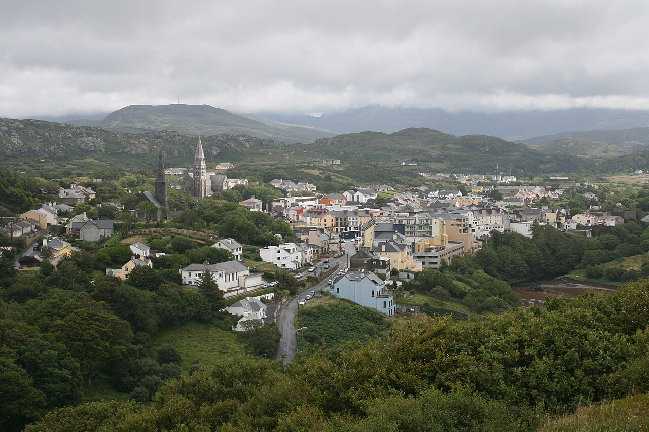
ClifdenOverview.JPG — Bert Kaufmann — Public domain (https://commons.wikimedia.org/wiki/File:ClifdenOverview.JPG) — https://commons.wikimedia.org/wiki/File:ClifdenOverview.JPG
)

Bert Kaufmann
Public domain
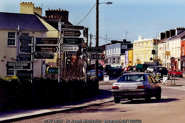
Clifden - Entering town via N59 onto Main Street - geograph.org.uk - 1622522.jpg — Joseph Mischyshyn — CC BY-SA 2.0 (https://creativecommons.org/licenses/by-sa/2.0) — https://commons.wikimedia.org/wiki/File:Clifden_-_Entering_town_via_N59_onto_Main_Street_-_geograph.org.uk_-_1622522.jpg

Joseph Mischyshyn
CC BY-SA 2.0
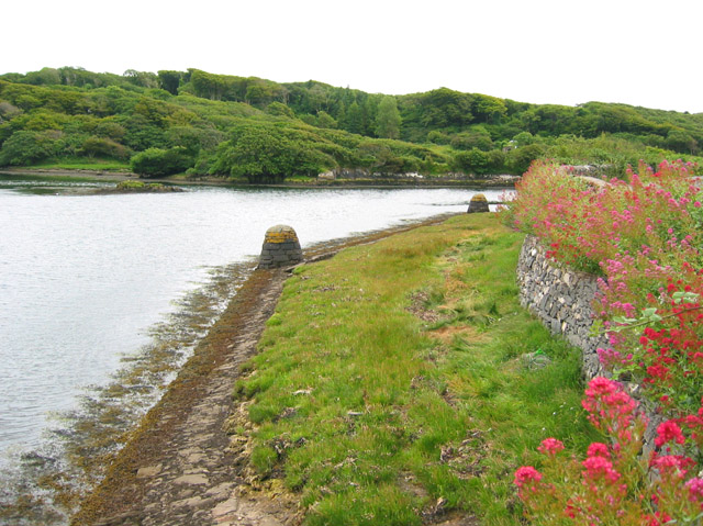
Clifden Harbour - geograph.org.uk - 200103.jpg — Espresso Addict — CC BY-SA 2.0 (https://creativecommons.org/licenses/by-sa/2.0) — https://commons.wikimedia.org/wiki/File:Clifden_Harbour_-_geograph.org.uk_-_200103.jpg

Espresso Addict
CC BY-SA 2.0
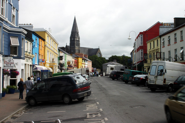
Clifden center.jpg — Kevin Danks — CC BY-SA 2.0 (https://creativecommons.org/licenses/by-sa/2.0) — https://commons.wikimedia.org/wiki/File:Clifden_center.jpg

Kevin Danks
CC BY-SA 2.0
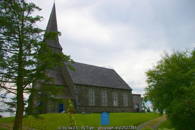
Christ Church, Clifden, Connemara - geograph.org.uk - 2527365.jpg — Tiger — CC BY-SA 2.0 (https://creativecommons.org/licenses/by-sa/2.0) — https://commons.wikimedia.org/wiki/File:Christ_Church,_Clifden,_Connemara_-_geograph.org.uk_-_2527365.jpg

Tiger
CC BY-SA 2.0
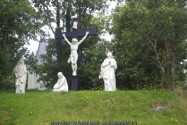
Calvary statues - geograph.org.uk - 901672.jpg — Fractal Angel — CC BY-SA 2.0 (https://creativecommons.org/licenses/by-sa/2.0) — https://commons.wikimedia.org/wiki/File:Calvary_statues_-_geograph.org.uk_-_901672.jpg

Fractal Angel
CC BY-SA 2.0
View original activity in YouVisible
Weather on your route
Loading forecast…
Sources and credits
© OpenStreetMap contributors; ODbL 1.0 — https://www.openstreetmap.org/copyright
OpenStreetMap contributors · OpenStreetMap cycling route relations · ODbL 1.0
Route photograph
ClifdenOverview.JPG — Bert Kaufmann — Public domain (https://commons.wikimedia.org/wiki/File:ClifdenOverview.JPG) — https://commons.wikimedia.org/wiki/File:ClifdenOverview.JPG
Bert Kaufmann · Public domain · Media source
Route photograph
Clifden - Entering town via N59 onto Main Street - geograph.org.uk - 1622522.jpg — Joseph Mischyshyn — CC BY-SA 2.0 (https://creativecommons.org/licenses/by-sa/2.0) — https://commons.wikimedia.org/wiki/File:Clifden_-_Entering_town_via_N59_onto_Main_Street_-_geograph.org.uk_-_1622522.jpg
Joseph Mischyshyn · CC BY-SA 2.0 · Media source
Route photograph
Clifden Harbour - geograph.org.uk - 200103.jpg — Espresso Addict — CC BY-SA 2.0 (https://creativecommons.org/licenses/by-sa/2.0) — https://commons.wikimedia.org/wiki/File:Clifden_Harbour_-_geograph.org.uk_-_200103.jpg
Espresso Addict · CC BY-SA 2.0 · Media source
Route photograph
Clifden center.jpg — Kevin Danks — CC BY-SA 2.0 (https://creativecommons.org/licenses/by-sa/2.0) — https://commons.wikimedia.org/wiki/File:Clifden_center.jpg
Kevin Danks · CC BY-SA 2.0 · Media source
Route photograph
Christ Church, Clifden, Connemara - geograph.org.uk - 2527365.jpg — Tiger — CC BY-SA 2.0 (https://creativecommons.org/licenses/by-sa/2.0) — https://commons.wikimedia.org/wiki/File:Christ_Church,_Clifden,_Connemara_-_geograph.org.uk_-_2527365.jpg
Tiger · CC BY-SA 2.0 · Media source
Route photograph
Calvary statues - geograph.org.uk - 901672.jpg — Fractal Angel — CC BY-SA 2.0 (https://creativecommons.org/licenses/by-sa/2.0) — https://commons.wikimedia.org/wiki/File:Calvary_statues_-_geograph.org.uk_-_901672.jpg
Fractal Angel · CC BY-SA 2.0 · Media source